* compiled by Bob Martin
It has been found that Lavender Peak is higher than Hesperus Mountain,
making it the high point of the La Plata Mountains and the high point of Montezuma County.
Background
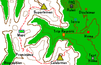
The three highest mountains on the La Plata 7 1/2 minute topo, dated 1963,
and the highest of the La Plata Mountains, are shown as Hesperus Mountain (13,232 ft),
Mount Moss (13,192 ft), and Babcock Peak (east summit - 13,149 ft).
Lavender Peak, between Hesperus and Moss, has no elevation point
and its highest contour is 13,160 ft. This interpolates to 13,180 ft,
with its highest possible elevation being 13,199 ft.
Several years ago, Gerry Roach reported that his leveling showed showed
Lavender Peak to be substantially higher than Mount Moss. This would result in
Lavender being a ranked peak and Moss becoming the unranked peak.
Gerry suggested an elevation of 13,220 ft for Lavender.
Assuming the elevation of Moss is correct, this would mean that Lavender
is missing two contours on the topo.
In 2001, Gerry made a careful survey of the several summits of Babcock Peak.
Besides the east summit with an elevation of 13,149 ft, the middle summit
has 13,120 ft as its highest contour while the highest contour on the west
summit is 13,080 ft. Gerry found that the middle summit is definitely higher
than the east summit or the west summit. He estimated the middle summit to be
13,180 ft and the west summit to be 13,168 ft, all this assuming the map
elevation of the east summit is correct. Thus the middle summit is missing
one contour line and the west summit is missing two contour lines on the topo.
Ken Nolan visited Babcock Peak in 2001 and generally confirmed Gerry's
observations on Babcock. Ken also estimated that the middle summit of Babcock is 20
feet lower than Mount Moss and 50 feet lower than Lavender Peak. This is
consistent with the previous finding that Lavender is substantially higher than Moss.
Several years ago, I began hearing reports that Lavender Peak is higher than
Hesperus Mountain. Ted Brasket reported that he and two friends, leveling
from Hesperus, concluded that Lavender is higher. Ted also reached the same
conclusion sighting back from Lavender. Reportedly, others had reached similar conclusions.
Ted urged me, with my higher-quality level, to visit these two mountains and take observations.
On September 17, 2003 Dave Maceyka and I climbed Hesperus Mountain. Our observations
confirmed that Lavender is higher. Hesperus has a wind break about four feet high.
Lavender has solid rock at the top. Even from the top of this wind break,
Lavender appeared higher. Unfortunately, we were unable to get to Lavender
last summer season. While I felt sure that Lavender is higher, I was not
willing to make a report on it without confirming observations from Lavender Peak.
Ted Brasket invited me to go to Lavender with him to take observations from there.
We made this trip July 20, 2004, along with two of Ted's friends. The level
confirmed that Lavender is higher, even when sighting over the rock pile wind
break build up on Hesperus. It is hard to argue with the level, even though
one of Ted's friends maintained that Hesperus "looked" higher, which it did to
all of us. This is because of the effect we see so many times, when the
background is much lower flat territory.
For the purpose of making a list, it is hard to assign a specific elevation
to Lavender. A good guess would be 13,240 ft. On this basis, the three
highest mountains of the La Platas would be Lavender Peak (13,240 ft),
Hesperus Mountain (13,232 ft), and Babcock Peak (middle summit - 13,180 ft).
From the standpoint of those working on the 13er list, they will want to go
to the three mountains listed in the preceding paragraph. They can skip Moss
and the east summit of Babcock. Those going for the high points of mountain
ranges or the high points of counties, will in the future want to visit Lavender
rather than Hesperus.