Saguache County Highpoint Trip Report

Crestone Peak (14,294 feet) via the Cottonwood Lakes Trailhead

Dates: September 2 and 3, 2006
Author: Adam Helman

This effort was part of a larger journey collecting Colorado county highpoints in August and early September 2006.

I arranged to climb the Crestones, as Crestone Peak and its eastern sister summit, with John Sype of Omaha, Nebraska and his wife Stacy. John climbed Aconcagua with Edward Earl and myself the previous January, and I was anxious to meet him again.

John was recovering from a hand injury on another Colorado fourteener several weeks earlier. This fact, combined with the greater technical difficulty of the north couloir, suggested that we climb the south couloir and, to avoid gains and losses, approach from the west using the Cottonwood Lakes Trail.

Red Tape

The Manitou Foundation is a Buddhist organization which owns a large tract of developed land on the west side of the range. The western, Cottonwood Lakes trailhead is within a public easement on the eastern edge of this land. A heated battle of words (and lawyers?) exists between their desires and that of the Forest Service insofar as public access to this trailhead.

At the trailhead are two posted signs designed to scare you off. One reads, "No trespassing". The other sign reads, "No access to National Forest from this trailhead". Given these negative comments, the Sypes and I met at 7:45 a.m. 0.1 mile west of the trailhead proper at a gravel area, decidedly meant for parking, that forms an extension of the side road which leads to the actual trailhead.

We each place on the inside windshield a signed form, available at the Manitou Foundation website, which states that we are crossing the land on a pilgrimage - and waiving them of liability in event of injury. This was likely overkill - but I for one did not want my truck to be towed!

Approach Hike

I DO NOT RECOMMEND THIS APPROACH TO THE COTTONWOOD LAKES!!

With that stated quite emphatically I proceed to elaborate. The trail begins benignly enough, albeit gaining elevation, unfortunately, quite unevenly with level and steep sections throughout.

After the 3.1 miles mentioned in Dave Covill and John Mitchler's excellent guidebook, one reaches, at 10,600 feet, boilerplate rock slabs with cairns for navigation. Immediately prior to this (0.2 mile?) is a thirty foot tall waterfall. The so-called "trail" passes through the boulders which form the northern (left) buttress of the waterfall, i.e. the trail does not veer left at that point.

The trail is difficult to follow, and the difficulties mount after you reach a critical trail junction at some 11,000 feet. Here, the trail you have walked continues east parallel to the stream; while you want to head northeast on a side-trail (soon to become a mere climber's path) that leads to the Cottonwood Lakes.

This junction is located at GPS-derived NAD27 coordinates (448366 E, 4200146 N), elevation 10,985 feet.

We get off the main "route", not knowing it at the time, and negotiate steep scree and boulders for much of the remaining approach hike to our high camp. We arrive in the tundra basin immediately south of Crestone Peak, and decide to camp at two small ponds instead of walking needlessly 0.2 mile east to Cottonwood Lake proper. This "saves" us 0.4 mile walking the next day as the south couloir is just north of our camp located at GPS-derived NAD27 coordinates (448754 E, 4201098 N), elevation 12,323 feet.

John and Stacy prepare an excellent supper of pasta with shiitake mushrooms, sausage, freshly grated parmesan, and a pesto sauce. Dried tomatoes in olive oil complete the dish. Unfortunately our enjoyment is ruined by a thunderstorm, and we scurry into our two tents and wait it out while booming thunder and snow pummels our little campsite.

This continues for about 1 1/2 hours - whence I exit to inspect the "damage" insofar as how it impacts our summit bid the next day. The rocks are dry, and the grass's snowcover is transient enough that by midnight it is nearly melted. I uncover our single stove, wipe it free of snow, and prepare hot chocolate spiked with coffee for everybody - passing the warm brew into the Sype's tent so they need not exit. I play my shortwave radio for us, even getting an Omaha station (KFAB, 1110 kHz).

Summit Climb

Morning. We wait a while, at my suggestion, for residual snowmelt on the route. However the couloir is in shadow until late morning so there is no point in waiting longer - and we set out at 7:35 a.m.

Most groups hike over Broken Hand Pass from the Colony Lakes trailhead, rather than camping at Cottonwood Lakes. A cairned path leads up the grassy slopes just east (right) of the South Couloir, and, at about 12,800 feet, suddenly traverses west (left) to the couloir's very base for the actual climbing.

The South Couloir is the westernmost of three couloirs visible from our camp, and has a reddish and slightly steeper section on top that, with our foreshortened view, falsely appears to be nearly vertical.

We break about 100 feet above this traverse, mainly to shed clothing, and, for myself, to carry just the top of my overnight backpack as a fanny pack with little more than food, water, and GPS unit (to locate the main pack on descent). During this reconfiguration, Stacy starts uphill on some of the slick rock slabs. She balks, and, despite John's efforts, wishes to abort the effort. That's a shame - this is the first fourteener (among many) that they will not climb together. Stacy returns to high camp as John and I continue.

The couloir is mainly Class 2, with some Class 3 moves on occasion. It is "fun" scrambling with solid holds throughout. The top 500 vertical feet is steeper. We reach the 14,150 foot saddle some two hours after leaving camp; and peer down the north couloir to find it in shadow and with some remnant snow. No party is coming that way today - on this, a busy Labor Day weekend.

We go for Crestone East first, saving the slightly higher western summit for last. After five minutes we enjoy views from the highest and middle of the three bumps that comprise Crestone East's summit. Back at the saddle we go immediately for Crestone Peak's summit. On top we eat, take pictures, and descend after one-half hour at 10:52 a.m. It is my sixtieth Colorado county highpoint - close enough to start counting downwards the number remaining.

We reach camp around 12:30 p.m. - a rapid descent indeed.

After breaking camp we descend what is perceived to be the "correct" trail - only to find sections choked with brush; and two spots where one must jump down about 3 feet to continue. I remove my big pack, handing it to Stacy for these moves. Going uphill on this path would have been even more pitiful.

I truly feel that the Forest Service is allowing the Cottonwood Lakes Trail to "die" by not maintaining it in the least. In five or ten years Nature will claim it completely.

top of south coloir
John Sype (at left) and Adam at top of the south couloir
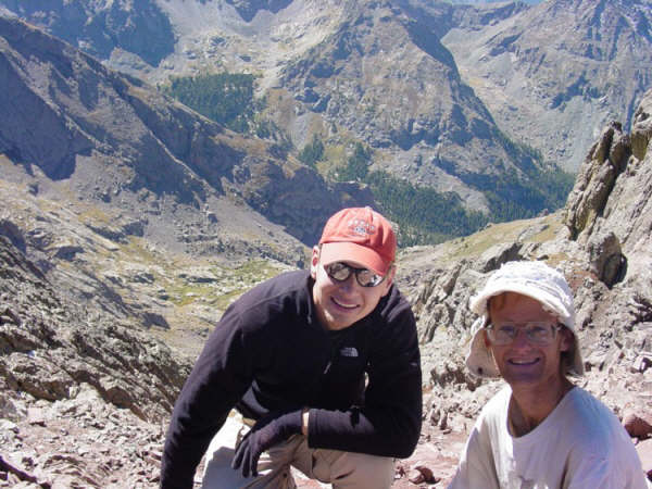
just after reaching both summits.
View is straight down the couloir (hidden behind John).