|
|
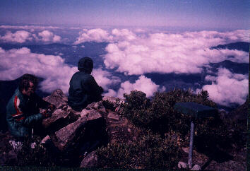
Monday is summit day. We first climb the second highest summit in Costa Rica - Cerro Ventisqueros (12,510 ft) from the high altitude hut. Descending to a trail junction we then reascend a different trail to a saddle in-between Cerro Chirripó and the nation's third highest. The final 400 vertical feet above the saddle is class 2 with handholds required. We spend an hour on top. |
|
| View northeast from top | summit of Cerro Chirripó | |
| of Cerro Ventisqueros |
|
|
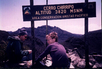
Tuesday saw a tedious descent the full seven thousand vertical feet to the town of San Gerardo de Rivas where we had slept Saturday night. I fill up on a liter of ice cream at the only restaurant. We took a public bus to sleep in the city of San Isidro de el General. Again, this was nearly the most vertical feet I have descended in one day - and this regardless of how much was carried. *1 |
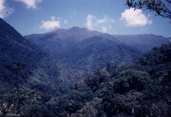
| Looking back at Cerro | |
| Chirripó from the trail |
|
|
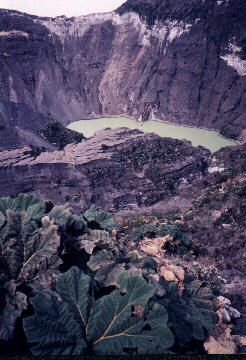
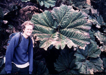
On Wednesday morning we again traveled by bus to Cartago at the base of Volcan Irazú. A taxi ride to within one thousand vertical feet of the summit was mandatory so that we could Earlize Irazú (the driver though this most strange behavior!). Views of the caldera were spectacular. Some of the foliage had leaves that were individually as broad as writing desks and kitchen tables! |
|
| toxic green lake | huge foliage on Irazú | |
| of Volcan Irazú |
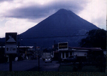
| On Thursday yet another bus ride (this time of five hours duration) brought us to Fortuna near Parque Nacional Arenal. Very touristy. I temporarily lost my passport and yet found it at the local police station. That evening we went on private tour to the base of Arenal - and waited in vain a full hour for the clouds to clear and reveal glowing lava as it flows down the slope. |
|
| Volcan Arenal from Fortuna |
|
|
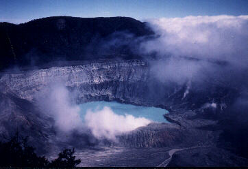
On Saturday we taxied to Parque Nacional Póas. A short walk brought us to a lookout over a spectacular pair of calderas. The summit was ill-defined as we had no good topographic maps of the park. Nevertheless we all made a "good faith" effort and, in a most ludicrous display of highpointing madness, ended up spending perhaps 30 minutes trudging, crawling and climbing some 100 horizontal feet off-trail to what appeared as the local highpoint. The foliage was so thick that we had to wave at each other from just thirty feet to assess who was the higher! |
| Caldera and lake near | |
| summit of Volcan Póas |
|
|
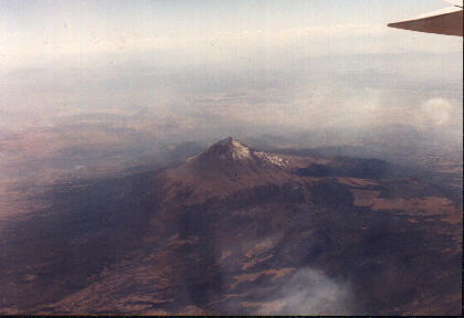
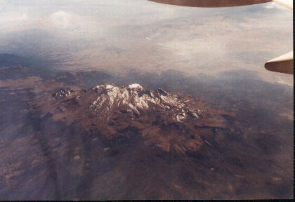
On Sunday March 3 we returned home on United Airlines. One highlight was passing directly over the giant Mexico volcanoes of Popocatépetl and Ixtacchíhuatl. I jumped out of my seat and searched in vain through the east windows for Orizaba. The peaks were disappointingly short on snowcover - with Popocatépetl nearly devoid of snow owing to its recent volcanic activity, and Ixtacchíhuatl displaying little snow compared to my experience there several years previously around Thanksgiving. Perhaps the snow amount was lower than my expectation simply because of the season ... or was it an ominous result of global warming? |
|
| Popocatépetl (17,887 feet) | Ixtacchíhuatl (17,343 feet) | |
| from our jet over Mexico | from our jet over Mexico |