| Google Earth Images * |
|
Statewide Files
All fifty states have coordinates available for their county highpoints. Google Earth kmz files were provided by Tom Dunigan through a set of PERL scripts which extracted coordinates from state trip report index pages. After conversion to text format, Adam Helman hand-edited these files to make the county and contour names more understandble and user-friendly in general, i.e. "DenverCityandCounty01" becomes "Denver City and County". Mouse-click any colored state for its Google Earth county highpoint file. |
Regional and Contiguous USA Files
Mouse-click either map or text to obtain the corresponding Google Earth file.
|
Northeastern states (New England plus New York) |
|
mid Atlantic states (Pennsylvania through North Carolina; D.C.) |
|
Upper Midwest states |
|
Eastern states (Mississippi River to the Atlantic Ocean) |
|
Four Corners states (Arizona, Colorado, New Mexico, and Utah) |
|
northern Rockies (Idaho, Montana, and Wyoming) |
|
far southwest (Arizona, California, and Nevada) |
|
Pacific Northwest (Idaho, Oregon, and Washington) |
|
Western states (Rocky Mountains to the Pacific ocean) |
|
Contiguous states |
State Highpoint File
Mouse-click here to obtain a Google Earth file showing all fifty state highpoints. All possible contenders are displayed for the relevant states - Indiana, Michigan, Missouri, Nebraska and Wisconsin.Links to More Google Earth Files
Sample Images for Climbing and Peakbagging
These screen captures are available my mouse-clicking the small embedded images; and demonstrate the utility of Google Earth for trip planning and climbing.
|
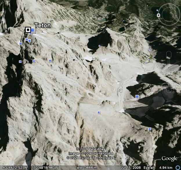
Grand Teton looking east. The lower Saddle is at lower right; the Owens-Spalding Route climbing from there to the upper left. |
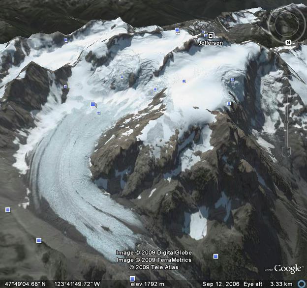
| General view of Mount Olympus with the Blue Glacier at lower left, the Snow Dome at center, and the summit area at upper right. |
|
|
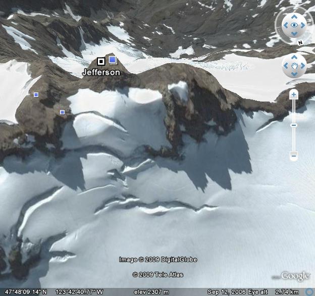
The Mount Olympus summit seen from the north. The steep, final rock pitch is made quite evident in this image. |
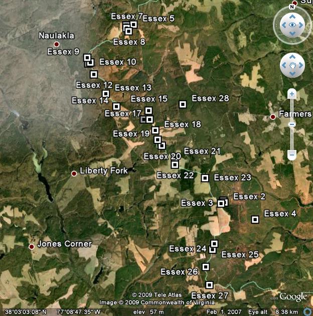
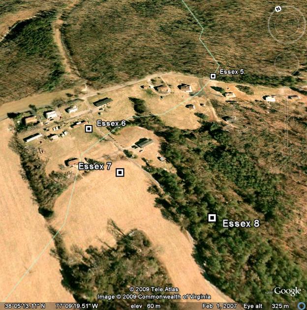
| The relative locations for all 28 Essex County, Virginia contours. |
|
|
Close-up of four Essex County, Virginia contours looking southeast. At high magnification contour locations relative to artificial structures provides quite useful and significant information. |
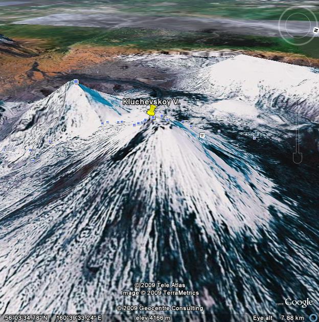
| Klyuchevskaya Volcano, an Earth Fifty Finest prominence located in the Kamchatka Peninsula of eastern Siberia. |
|
|
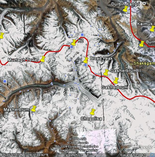
Heart of the Karakoram Range as seen from space. Note the Baltoro Glacier at center, flowing south from K2. Additional 8,000 meter peaks are seen in this view; with "pins" marking ultra prominence summits. |
| back to information maps page |