Arizona Prominences April 2011 Trip Report
© April 2011 Adam Helman
(Click on any image for enlargement.)

Note 1: All coordinates use the WGS84 datum.
Note 2: Scott Surgent's photographs are indicated by "(SS)".

Background

Scott Surgent and I initially conceive a trip to the Arizona "Strip" for a bunch of peaks with prominence as the main motivation. However we soon realize that melting snow (and consequent muddy roads) could devastate our plans in this, a somewhat remote part of the lower 48 United States with hundreds of miles of only dirt roads and no communities whatsoever.

We switch plans, and concoct a trip to northwestern Arizona wherein I climb desert peaks with at least 2,000 feet of prominence (henceforth, "P2K"). Scott joins me for the two efforts falling on a Saturday and Sunday.

Four mountains are scheduled (all values are in feet; E = "elevation"; P = "prominence") -

Lake Mead
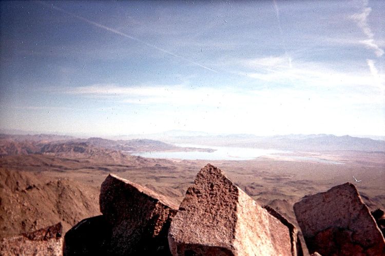
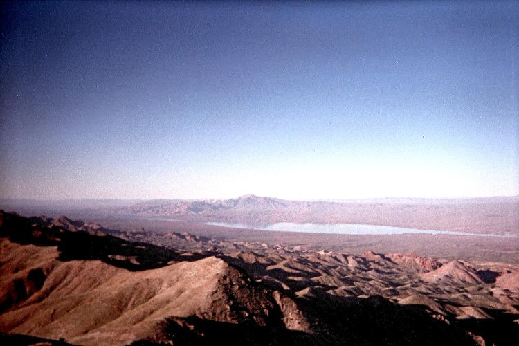
The highest summit rock of Mount Wilson points to Lake Mead.

Trip Details

Wednesday, March 30 - approach drive

I select a route taking me through the southern outskirts of Las Vegas, Nevada - thence south on US Route 93 across the Arizona state line at Boulder Dam.

At logical mile marker 19.1 along US-93 turn east onto the paved Temple Bar Road which heads north to Lake Mead. Drive for 10.6 miles to this junction (elevation 1,634 feet) with a dirt track heading west directly towards Mount Wilson.

trailhead
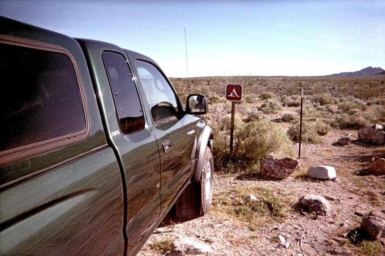
The trailhead "no camping" logo.

It is now 3.1 road miles along this track (4WD is not needed in dry conditions despite the sign) to the wilderness boundary and your trailhead at (35.98425° N, 114.54912° W). There is a "no camping" sign but nobody will be there to enforce it. I obtain 2,339 feet. A heavy metal register lies alongside the trailhead kiosk.

I arrive about 4 p.m., and have plenty of time to enjoy the views before having a supper of stuffed cabbage with oriental-style noodles.

This evening I read more from "Peakbagging Montana", a guidebook received from the publishers in-return for my consideration describing it at the cohp.org website.

I set the alarm for 5:40 a.m. - which allows for a 5:45 awakening and a 6:30 departure barely after sunrise. Unseasonably warm temperatures are forecast; and it is wise to start quite soon; in fact, the earlier the better.

Thursday, March 31 - Mount Wilson

I don't like the route conditions described by John Hamann in his summitpost.org trip report. His group remained inside a gully that soon became choked with brush. Therefore when I get to this point at (35.99131° N, 114.59067° W) after about one hour's hiking (elevation 3,399 feet), I head steeply uphill northwest to begin a ridge-based route leading ultimately to the main north-south ridge.

To reach that point simply walk the road heading west until it ends at (35.99118° N, 114.57373° W), elevation 2,873 feet, converging there with a broad gully descending from the range. At that point, hike the gully going west until it becomes narrower and with rougher vegetation - until the exit point cited above.

summit ridge
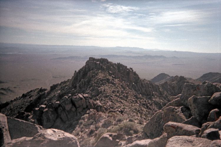
Looking back from Wilson's summit
to the 5,400+ foot rock pinnacle.

The ridge route has much better views and, today, provides some wind-relief from the heat when descending by late morning. I aim for the top of spot elevation 4,346 some 950 feet above; and find that a good place to get my bearings is at a small saddle immediately northwest of a small 3,920+ foot "bump" shown on the topographic chart.

I reach this broad saddle just west of peak 4,346 by sidehilling its south slope, so avoiding a needless ascent. There is a rocky rib descending south from the summit with refrigerator-sized boulders that must be crossed during this section. However it is never more than Class 2 when the route is well-chosen.

Now I set my sights on this ridgeline saddle immediately north of the enclosed 5,200 foot contour containing a major obstacle. I recommend traveling directly towards that rocky obstacle, and then sidehilling northwest about 100 or 150 feet beneath it. This avoids some dicey rock scrambling at its base.

Charleston Peak
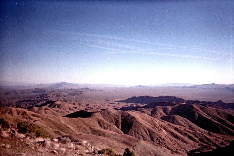
Wilson summit view northwest
into Nevada with distant,
snow-capped Charleston Peak.

Now the summit is enticingly close - yet there remains a sizeable 5,400+ foot rock pinnacle in-between that must be either surmounted or somehow avoided. I remain just east of the ridge and head on easy slopes towards the pinnacle. One must climb through this vertiginous mass of rock yet not actually top-out on it. A route with a few cairns is available - and judicious micronavigation allows for a Class 2+ route with nothing more difficult.

The final 30 or so vertical feet is again on steeper terrain. I reach the summit around 9:30 a.m. a tad over three hours after my 6:26 start. Atop the highest rock I obtain GPS-derived coordinates (35.99660° N, 114.61188° W), elevation 5,427 feet.

Views are wonderful. To the northeast is Lake Mead. To the west is a blue strip of the Colorado River demarcating California. To the northwest are, by increasing distance, Route 93 crossing over Boulder Dam; the "summit towers" of downtown Las Vegas; and Mount Charleston capped in snow.

The turkey pastrami onion roll is yet another reward.

I descend the ascent route, feeling ever-more the day's heat. The final road-walk is uncomfortably hot as I near my vehicle. It is now about 12:40 p.m., and I am uncommonly tired - surely a result of heat stress - until I both rest and have some more food (a pint of fruit cocktail).

summit ridge
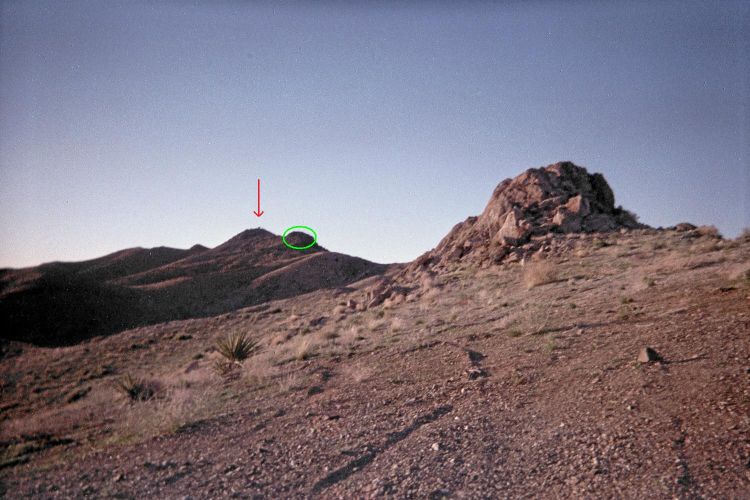
View southeast to Perkins' summit (arrow)
and the final rock obstacle (ellipse).

There's plenty of time seeing as my next peak entails only about 34 miles of driving - total. After reaching US-93 I head south all of about one dozen miles, and visit a Chevron station positioned one mile north of the Mount Perkins approach road.

Their prices are ludicrous - such as $3.99 for a single slice of pizza. I refuse to pay it; yet find that the frozen fudge bar is irresistible at 99 cents. I also buy two packages of gum since somehow I forgot to take them even though they are listed in my cheat-sheet of what to bring that I use for packing on a road journey.

The 8 mile drive to my trailhead is described in the next section. I park in a grassy area about 900 horizontal feet short of a 4,400 foot high road-bend used by Scott Surgent as his trailhead.

I enjoy plenty of cold food for supper - the day's heat suggesting that plan. Later I read another few dozen pages from Mike Kelsey's "World's Mountains & Volcanos".

Friday, April 1 - Mount Perkins

This one is quite easy, taking only about one hour from my carpark to summit. The northwest ridge is taken, just as described in Scott Surgent's posted trip report.

More tedious is the driving approach. Here are some exact junction coordinates and what to do at each one. Zero your odometer at the highway. Mileages are in ATM (Adam Truck Miles) which are about 1% longer than standard, statute miles.

In dry weather a high clearance vehicle can certainly drive to the radio facility at some 4,860 feet. I started from the cited car-camp around dawn, and left the road quite conveniently at a major bend about 150 feet below the radio gear, elevation 4,716 feet. This avoids needless road-walking, and takes one to the northwest ridge by hiking roughly southeast up the obvious slope.

California
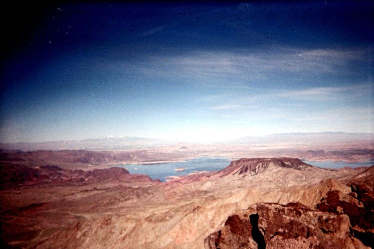
Mount Perkins summit view
into California beyond
the Colorado River.

In good weather the summit is always obvious, with a communications facility beyond several ridgeline rock outcrops. The final outcrop is avoided by finding a minor path to its east paralleling the ridge perhaps 20 feet under the rock's eastern base. It climbs to the saddle just south of the outcrop ... and then the summit is basically yours.

The views are quite good today, and I try to identify certain peaks across the Colorado River, and thus inside California, that I've likely already visited.

After returning the ascent route I'm back around 9 a.m. to take a nap in the camper shell before it becomes enveloped by sunlight and so far too toasty.

It's a lazy afternoon as I attempt to occupy the time while waiting for Scott to meet me at 5 p.m. near the community of Dolan Springs. I buy food at a market in town, and then find shade for the truck on the east side of the Mount Tipton Church about 3 miles along Pierce Ferry Road from US-93.

desert
cheap real estate

Here I have a lazy lunch seated on the tailgate. Then I spend 1 1/2 hours reading from "World's Mountains & Volcanos". Around 4:20 p.m. I call Scott who is around Kingman, Arizona. Somehow he takes longer than I expected, and after phoning him we agree to just meet at the desired trailhead.

In getting there these posted instructions are adequate. However the 45° turn right at Mojave Rancho Lumber is 1.2 miles from US-93 (not 1 mile). From that turn it is then 4.3 ATM to a slight (30°) left turn onto a side road at (35.54619° N, 114.26030° W). It is then a further 1.4 miles to the wilderness boundary and trailhead at (35.55546° N, 114.23848° W), elevation 3,780 feet. The final one-half mile is seriously rough with plenty of rocks that demand caution.

Scott arrives while I prepare a self-heating spaghetti and meatballs meal. There's a lot to talk about; and we agree to start before dawn owing to heat concerns. We continue until about 9 p.m. whence we retire to get 8 hours of rest.

Saturday, April 2 - Mount Tipton

We consume 7 3/4 hours for this effort - from 5:37 a.m. until roughly 1:25 p.m. That includes 4 hours for the ascent, one-half hour on the summit, and about 3 1/4 hours for the descent.

sunset glow
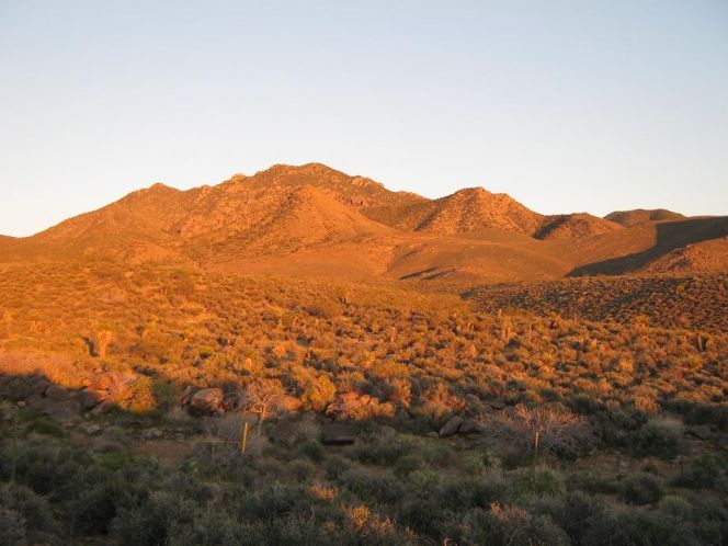
Mount Tipton at sunset. (SS)

The route and our experience in particular are admirably described in Scott's posted trip report.

After our climb we caravan to Kingman for refreshments. Eventually we are eating at McDonald's - which is rare for myself. The "quarter pounder" with "double cheese" is a ripoff at $3.99; and the iced coffee is served completely unsweetened. However a strawberry sundae for all of 99 cents is luscious - and served with grated peanuts for what I call "textural contrast".

triangular peak
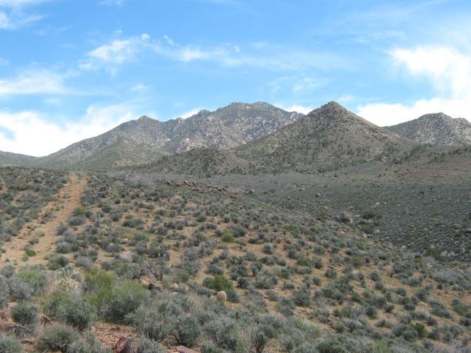
View near trailhead with
"triangular peak" at right. (SS)

The drive to our next trailhead is reasonably short. It is a western approach to Peacock Peak, which is somewhat novel as the majority of climbs have come from the eastern side and entail far more effort. I describe our approach drive in the next section.

We eat some cold food around suppertime (including a pint of Spaghettios) even though it's quite windy and a bit chilly at our parked vehicles - now, at some 4,700 feet elevation. A weather front is passing through. Not being hungry, I don't particularly care for hot food.

Scott presents to me a free copy of his new book on the Arizona county highpoints - and it's autographed. I had reviewed the book prior to its publication and find it to be a nice addition for my home collection of mountain-oriented literature.

The wind blows, sometimes strongly, for much of the night. Together with the air's chill and the short duration of today's venue there is now no sane reason for arising before dawn - yet we plan to do that anyway.

Tomorrow is going to be a fairly easy hike lasting only 3 or 4 hours.

summit ahead! Scott summit vista
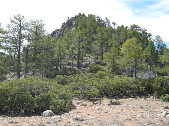
Mount Tipton summit from the
saddle immediately north. (SS)
Scott at Tipton's tippy-top. (SS) 
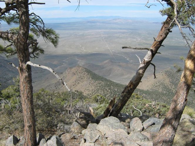
Trees framing the view of
distant Dolan Springs. (SS)

Sunday, April 3 - Peacock Peak

Here's how to reach our trailhead for this mountain. At Exit-53 along Interstate-40 head north on old US Route 66 for exactly 4.7 miles to Mohave Airport Drive. Turn right (east) and drive 0.5 mile to Shipping Lane. Zero your odometer here and turn left (north) onto Shipping Lane. (Note these very original street names.)

truck
Adam heads toward Peacock
in "DENALY". (SS)

Drive 0.9 mile on Shipping Lane whence it turns to dirt and makes a slight bend to the left (northwest). Drive another 0.8 mile whence the road (no longer named?) bends to the right and then parallels railroad tracks for 2.3 miles. Here, at 4.0 miles on the odometer you find Jan Road.

route
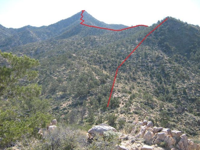
Peacock Peak route seen
from point 4928. (SS)

Turn right (east) onto Jan Road and take it 6.5 miles to a T-junction not shown on the topographic chart at (35.31206° N, 113.79969° W), elevation 4,397 feet. (This junction is shown using Google Earth.)

Note the abandoned structures just a few hundred yards north. Turn right (south) and steeply drive another 0.6 mile to our suggested carpark and trailhead at (35.30741° N, 114.79307° W), elevation 4,700 feet. On the descent you will want to use low gear.

The route and our experience in particular are well described in Scott's posted trip report.

Drive Home

When I return to Kingman it's about 10:45 a.m. and there's 380 miles to home via a route Scott recommended. So after hot coffee with a Butterfinger ice cream bar I begin the thankless task. My route includes Interstate-40, US-95 (within California), CA-78, CA-111, and Interstate-8. I arrive around sunset, the truck odometer reading 903.7 ATM for the entire journey.

After reading and replying to some E-mail, I sleep 12 hours from 8:30 p.m. to 8:30 the next morning.

Scott cactus summit vista
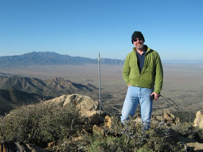
Scott at Peacock's summit. (SS) 
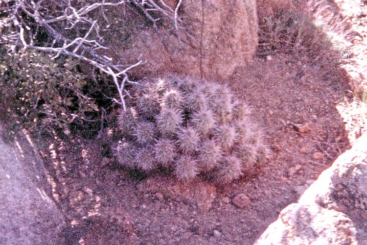
Spherical cactus shape keeps
it nice and warm at the summit.
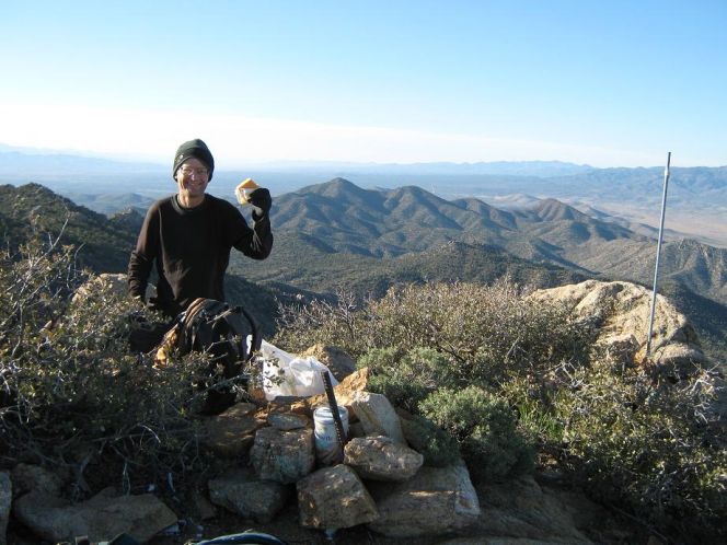
I am confused when Scott
says, "Cheese!". (SS)

Summary

I thank Scott for his role in ensuring success on this journey and so look forward to our next joint adventure - likely next Fall after temperatures moderate in the Arizona backcountry. I now have 424 P2Ks worldwide.

sand dunes     crops
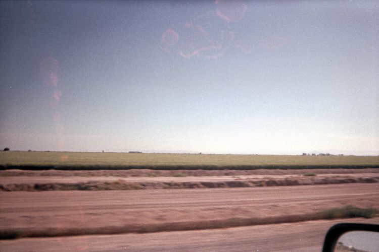
From sand dunes to irrigated crops -
demonstrating the difference water can make
as seen along California Route 78.