Arizona Prominences November 2009 Trip Report
© November 2009 Adam Helman

Note 1: All GPS-derived coordinates use the WGS84 datum.
Note 2: Most photographs are courtesy of Chris Gilsdorf.
              Click on any image for enlargement.

Introduction

Amongst the many desert peakbagging trips I've enjoyed this one stands out with its mix of unanticipated events. Some are unfortunate - yet not irretrievably so. Some are nice. However most comprise the "price of admission" for climbing in the remoteness of Arizona's Sonoran Desert.

My goal is to enjoy what remains of the 2,000+ foot prominences accessible in the colder months within a day's drive of San Diego. One target is the Sierra Estrella Range highpoint located immediately southwest of Phoenix. The previous February I was stymied on the approach drive, unable to drive close enough for a summit attempt the next day. Then too Scott Surgent of Chandler, Arizona has coveted this summit for three years. He twice scouted the approach drive, and is now most eager for a reattempt seeing as he had failed previously owing to an unexpected vertical cliff band. A "vengeance peak".

John Klein of Tucson wants to join me, having also waited nearly a year for the opportunity after we met at Weaver Peak last winter. John is also eager to climb Gu Achi Peak, a mountain on the Tohono-O'odham Indian Reservation. John is an orthopedic surgeon, and only has free time on weekends. Hence the overall trip is timed with Saturday for the first peak climb.

Chris Gilsdorf is a recently transplanted highpointer from New England (and originally from Ohio). In-between work and yet applying to medical school, Chris has ample free time - and so we plan on his attendance at all five peaks of my journey. The remaining three are, in order, the Coyote Mountains highpoint, Kitt Peak, and South Mountain. The Coyote Mountains highpoint is notorious for rough terrain and difficult navigation. Kitt Peak is a near drive-up, being famous for summit astronomical facilities and hence a paved summit road. South Mountain is also on "the rez", and, as with the Coyote Mountains highpoint, requires a four wheel drive ("4WD") vehicle for the sandy approach.

Trip Details

Friday, November 20 - to Arizona

Scott and I meet in nearly nonexistent Mobile, Arizona at the pre-arranged 3:45 p.m. Chris is his passenger as they live at most ten miles apart. I provide exact driving instructions here for future efforts.

From the junction of AZ-238 and 99th Avenue we caravan northwest along a six mile stretch of gas pipeline access road with power transmission lines. It is bermed in several locations along the first few tenths of a mile - likely an attempt to discourage access. The berms are bypassed. You will want 4WD for these portions.

We drive west for two miles and then north six miles, reaching east-west Chandler Heights Road. We drive west for one mile to a gate on the road's north side, and flag it with orange surveying tape so John Klein, arriving later, can identify it after sunset.

tower
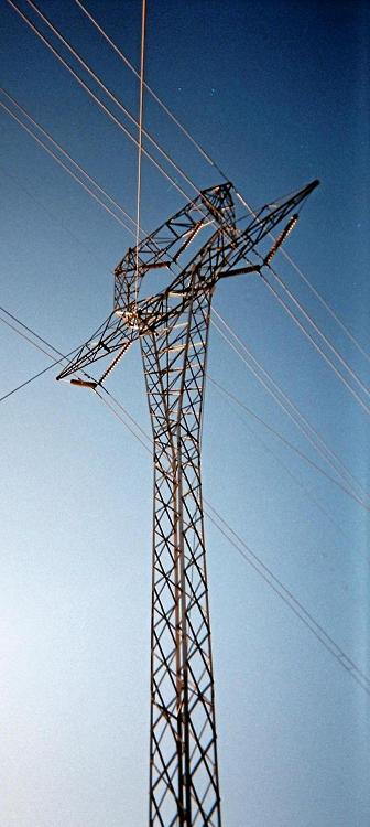
The power line beneath
which we make camp.

Now northbound we drive 1.0 mile, passing an eastbound road noted at 0.7 mile, so reaching the unsigned extension of Ocotillo Road. Finally we drive east on Ocotillo Road 5.4 miles, passing a Y-junction at 2.2 miles. On the return one takes the left (south) fork. We park right under an electric power transmission line tower, the electromagnetic fields making us glow green soon after arrival. We are roughly at this spot with 1,386 feet elevation indicated on my GPS unit.

Before sunset we inspect our route options. Scott's proposed ridge looks good; and we will take it the next morning as it ascends smartly to point 3795. I am excited for Scott since I know how much this particular summit means to him.

Scott enjoys a meatloaf dinner, now cold - yet revivified with my Cholula hot sauce and a Caribbean-style marinade. I've purchased Campbell's Chunky Steak and Potato soup for Chris, after which he eats macaroni and cheese from my nearly endless food store. I eat gefilte fish with an assortment of sauces. It's not much for supper but fresh and full of protein.

We all enjoy mathematics, the conversation focusing on assorted problems with unusual and fascinating answers. After this interlude I open a bottle of sweet port wine and share it with chocolate almond biscotti for dunking. Chris and Scott have a bit while I get the lion's portion. Here, my aim is to sleep on-time for a pre-dawn awakening.

John Klein arrives around 8 p.m., having located the gate, with orange tape, and having negotiated the approach drive in complete darkness. We chat about the coming event and soon realize that an early bedtime is most appropriate. To that goal the wine allows me to lose consciousness essentially instantly when I hit the pillow around 9:30 p.m.

I arise one hour later with an insane urge to eat more food, suspicious that without more in my stomach I will be too drunk for climbing safely! I have overdone it. The only item immediately available is a jar of peanut butter - and I start eating it with my bare fingers right out of the jar. Then too I locate leftover Frosted Mini Wheats as "bread" for the peanut butter. After digging a fist-sized cavity in the unctuous stuff I call it quits and fall back to sleep.

Saturday, November 21 - Sierra Estrella Range Highpoint

My watch's alarm feature started malfunctioning a few days ago. It no longer can be relied upon for a pre-dawn awakening. Yet, somehow, I arise naturally 15 minutes before the agreed upon 5:30 a.m. The extra time is welcome as I still feel somewhat groggy. After Raisin Bran with added pecans and prunes I'm ready by 6:20 - 15 minutes before our departure time scheduled for one half hour before the 7:05 a.m. sunrise.

The first one-half mile is along an extension of the approach road and can be walked in the dark. We depart, reaching this point near the road's terminus in short order.

shadows
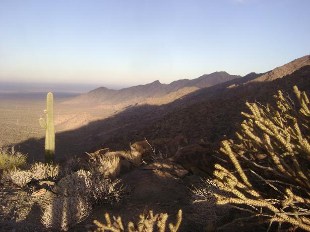
Morning shadows on the
Sierra Estrella Range.

Still somewhat dark, we aim for a notch at the base of the skyline ridge to our east southeast. Scott leads, setting a decent pace for the 600 foot of gained elevation. We take a water break at this 2,000 foot level and turn left (east), proceeding directly up the ridge to a prominent-appearing rock formation with cliffs on its north and west slopes.

We separate yet maintain voice contact - John is most eager while Scott lags behind. The disparity in our speeds becomes a problem, and will become a major issue later in the day. The rock formation is bypassed as we head instead to its right (east-northeast), reaching more level terrain along the ridge yet perhaps one-quarter mile southwest of point 3795.

John and I speed ahead, and we wait for Chris and Scott with a good view of our final goal. After being joined, we two sidehill northeast to an obvious saddle north of point 3795; and again, wait for Chris and Scott who have remained on the ridge - by agreement, the preferred route.

ridge
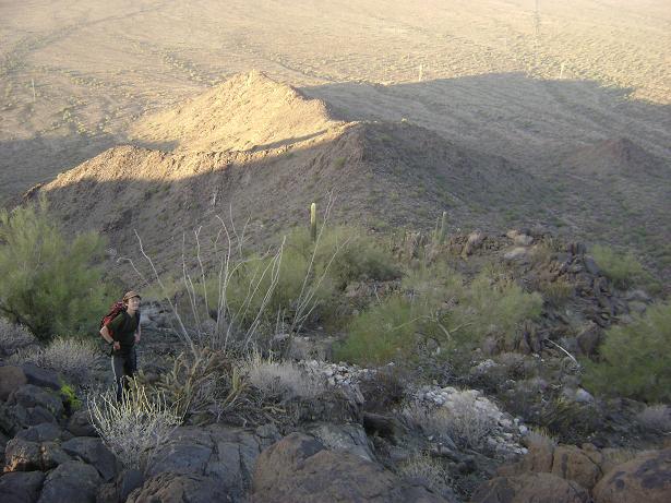
The ridge taken east
with Adam in foreground.
Transmission towers are
at shadow's edge.

John and I calculate that at Scott's pace there is a significant chance he will not summit and then return to the trailhead by nightfall. We are also anxious to proceed, the current pace being simply too slow. After everybody gathers at the saddle we agree that John and I will continue at our own pace while Chris stays with Scott so that everybody can both summit and have a good time doing it.

The route is now obvious as it follows the main ridge north-northwest, going over point 3873 before descending to a second saddle immediately south of our goal.

We water-break before climbing the steep ridge leading to a 4,240 foot contour. Now the terrain eases as we contour around the right (east) side of some dicey terrain; and finally reach the summit antennae complex - a mere 28 minutes after leaving the saddle.

All of Phoenix lies beneath us. It is remarkable to be so detached from civilization and yet so relatively near a major metropolitan center.

I enjoy half of a mini-sized challah (Jewish egg bread) with a chunk of kosher salami and Italian marinaded vegetables. The other half is saved for Chris ...

flora
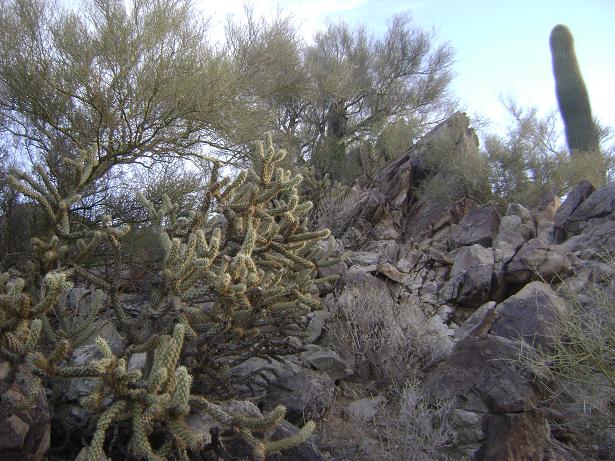
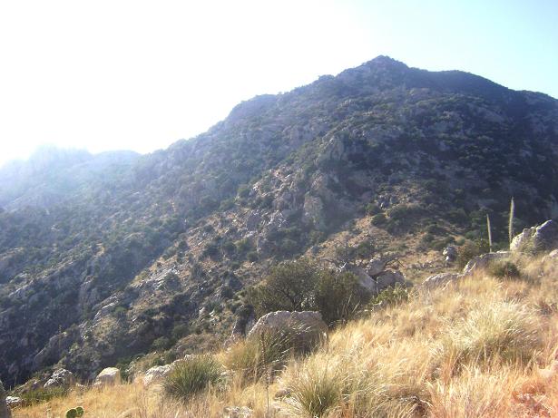
Standard flora and terrain
encountered at Sierra Estrella.

John and I conclude that waiting for Scott HERE is foolish since there's a chance that Scott will decide to turn-back. We descend to nearly the saddle before meeting Chris and Scott, and learn they will continue to the summit. I am pleased with Scott's decision. However everybody is aware of the time crunch: with such a plan it is uncertain whether Scott will return before dark. Nevertheless I am willing to descend in the darkness, if needed, so that Scott can realize his important goal.

I suggest that John and I return to the saddle north of point 3795. There I will wait for Chris and Scott, while John returns to his vehicle. The plan is sound because if Scott must descend in the dark, and thus Chris and I with him, an injury (far more probable without light) could be addressed with one climber waiting with the injured person while another climber, presumbly the strongest, descends quickly to alert John and arrange for external assistance if needed.

John and I reach the cited saddle by 12:45 p.m. I then remain, taking a long break, even lying down, with a green apple in the shade of one xerophyte (a drought-adapted plant).

Much later I learned that Chris ate his salami and challah sandwich while in-motion on the final ridge, scrambling mostly with one hand. Further, Chris reports that Scott was suffering unusual "charley horses" for unknown reasons - and these slowed him more than usual.

*
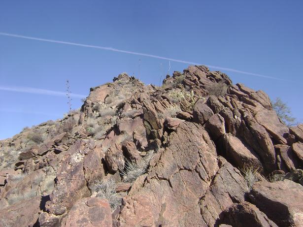
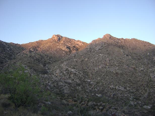
A rocky portion along
the final summit ridge.

Scott and Chris arrive just shy of 2 o'clock. We return by ascending 300 feet to point 3795, Chris and I forging ahead and then waiting for Scott's arrival. This process is repeated. After passing the 3,600 foot contour I continue alone while Chris descends slowly to again keep Scott company.

It IS getting late. Nevertheless I reach the ridge's base in gathering shade around 4:30 p.m., entertaining myself by watching the others descend at half-pace for the next twenty minutes or so.

We collectively descend the gulley, and sunset is upon us before reaching the road. The final ten minutes are walked in gathering dusk, meeting John at 5:45 p.m. to my slight amazement that complete darkness was indeed avoided.

Scott thanks us for our patience - and yet will not be joining us for Gu Achi Peak. The good news is that we ALL summited; and I am certain that Scott would agree with me that this outcome overwhelms any regrets.

We caravan out just after six, returning to the gate on Chandler Heights Road. Unwilling to drive the gas pipeline road at night (getting around the berms will be impossible in the dark), we drive west two miles to Rainbow Valley Road and then head north for an exit via Buckeye and Route 85. Reversing these directions will prove useful for those attempting Sierra Estrella from greater Phoenix.

It is a long drive to our next venue, a drive that should have been in daylight. Drowsy, I let Chris drive my vehicle after snacks in Buckeye. We caravan, now without Scott, south on Route 85 to Gila Bend and then east on Interstate-8 to just shy of Casa Grande. Here we all get gasoline and drive south on Arizona Route 15 into the Indian reservation, looking for a lonely side road to camp. We locate one and stop at a mere broadening in the road - likely not a legal parking situation.

John falls asleep soon enough, having purchased a pair of submarine sandwiches in Buckeye. I prepare supper for Chris and myself, consisting of two large cans of Campbell's Chunky Potato and Cheddar soup, with two added tins of canned chicken, and sharp Irish Dubliner cheese shaved on top for more taste. Basil, hot sauce, and even (very spicy) Indian curry paste are added condiments. I don't lie down until 10:30 p.m. - a long day indeed.

Sunday, November 23 - Gu Achi Peak

Coffee-infused milk with chocolate almond biscotti provides alterness as I drive at 6 a.m., an hour before sunrise, bound for our next summit. We hit Route 86, drive east, and then north on Routes 35 and 34 through Sil Nakya community to the dirt road grid for a southern approach and climb.

We park 0.3 mile west of this junction in an unvegetated area just north of the east-west track. The southeast ridge's base lies 2 air miles northwest, and we hike the distance in 40 minutes.

The fun begins on ascending the ridge. John leads a blistering pace which I maintain but then have misgivings about as I am sweating so profusely that my eyeglasses are getting wet. He slows down slightly, and I stay back with Chris so he can follow the route.

cactus
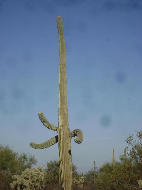
Three "arm" cactus
along the approach drive.

After gaining several hundred vertical feet we hear helicopters. Looking about, they are hovering over our distant, parked vehicles. These Border Patrol aircraft have somehow found them in the trackless desert, and are likely right now radioing-in their position so that ground vehicles can come and apprehend us on our return. As there is nothing gained in giving up on account of this information, we simply continue on our way.

The ridge levels for a bit, and we find the route ahead is a series of subpeaks with very dicey rock formations along much of its length. We start contouring south of the ridge proper, and eventually agree to abandon the route altogether by descending about 150 or 200 vertical feet into a much more promising gulley leading south from the summit ridge.

The descending traverse into the gulley is quite tricky with numerous opportunities for slipping on scree while trying to avoid being impaled by any of several succulent types. Eventually we reach the gulley and resume upward progress.

The gulley steepens, Chris slows, and is having a bit of difficulty climbing some nearly smooth rocks (yet still Class 3) akin to dry waterfalls. Time passes. We had started the climb at 9:37 a.m., fully three hours later than desired - and all on account of having returned from Sierra Estrella unexpectedly late. It is already 12:30 p.m.

Chris later reports that upclimbing the class 3 waterfalls was not terribly difficult; but was feeling sluggish and low on energy on the general ascent once we had reached the gulley. However Chris was a bit concerned about the downclimb - fears which were ultimately unfounded.

cactus
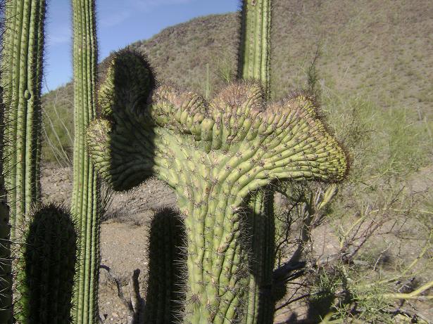
A rare and unusual shape tops
this desert floor succulent.

I suggest to Chris that he wait while John and I summit and return to his location. Chris agrees - and it's a good thing as right afterwards the route steepens ever more, and remains that way until reaching the summit ridge. An idea of the steepness is gathered by examining the contour spacing on this topographic chart right around the mouse cursor.

The final 300 or even 500 vertical feet are easy as we walk along the summit ridge. After a disappointing false summit we reach the highest point around 1:12 p.m. There's not much time to spend, and after I eat my sandwich we descend after only about 12 or 13 minutes. It's not enough time to rest given our blistering pace since leaving Chris.

Chris waits patiently for us; and we descend the gulley, now all together, starting about two o'clock. We descend nearly the gulley's entire length rather than retrace our inadvisable ascent route. Near the bottom we head more southeast to leave the boulders behind in favor of scree on the adjacent slope. This bearing also sets us in the correct direction for our parking location.

Our 2.6 miles along the valley floor are walked most briskly, and we return around 4:30 p.m. to a pair of vehicles - ours - and nobody else's. No questions to avoid answering, let alone arrest, this time around.

We return in waning light to Sil Nakya; and then drive the 18 miles of pavement back to Route 86. We give our final "goodbyes" to John K, and then head a dozen or so miles east to Coleman Road as John's recommended approach for "Coyote". It is now completely dark, and we drive this most sandy road, requiring 4WD, exactly 2.0 miles south to signed Dill Road.

At about the one-mile mark Coleman Road is bermed, and one gets around it by backtracking maybe 150 feet, turning sharp left (northeast), and then following that side-road south and finally west to its junction with Coleman Road mere yards south of the berm.

The Coleman Road / Dill Road junction has WGS84 coordinates (32.01113° N, 111.45342° W).

We drive along Dill Road due west (i.e. it does not meander as shown on the 25,000:1 scale topographic chart); taking it for exactly 1.4 miles to our chosen trailhead for "Coyote" at measured 2,978 feet.

The trailhead is at a junction where Dill Road meets a north-south road paralleling the north-south wilderness boundary. We turn left (south) and park just off the road atop tufts of grass. Remarkably we have parked within 100 feet of a house - yet did not learn of it until returning at dusk the next day!

I had planned on a group dinner for everybody the night after climbing Sierra Estrella. However Scott had departed, and we arrived too late, around 9:15 p.m., to start preparing a relatively elaborate dish. I am also tired.

However this evening at least Chris and I would partake - and so I cook a somewhat large pot of elbow macaroni noodles to which is added a 12 ounce can of Brazilian roast beef, salt, two entire sticks of butter (!), and enough Cajun-spices to make the entire affair both spicy and appetizing. Irish Dubliner cheddar is made available for throwing on top. We each have something like six bowls of this noodle dish, amounting to 1,600 Calories each without even counting the extra cheese. I figure this energy will be important to have for the next days's effort...

Monday, November 23 - Coyote Mountains highpoint

Notes on Navigation

I provide a considerable amount of detail by special request. Several routes were available by personal correspondence. I select that route taken by John Klein for one simple reason - it is a trail.

That written, this "trail" is over 50 years old and so most difficult to follow. Henceforth I refer to this pathway as POOR: "Pitiful Object of Our Regret".

To assist, John forwarded to me a file containing 500 GPS-derived waypoints automatically collected along the POOR by a friend on a climb earlier still than his own efforts. The file is designed for uploading into one's GPS unit, allowing for automated navigation which allows one to remain on POOR without fail.

My unit does not enjoy such capability. All I can do is carry a hard-copy version, and correlate the latitude, longitude pairs with the current location. This waypoint file uses the NAD27 datum. To obtain WGS84 coordinates add 12 x 10-5 degree and 70 x 10-5 degree to the latitudes and longitudes - about 44 feet and 216 feet, respectively. Stated bluntly, if the datum assumed is incorrect you will not find the POOR once it has been accidently lost.

This mental exercise is challenging (see the example below); and I highly recommend that for the POOR to work in your favor, one should have a fancy-shmancy GPS device with all 500 coordinate pairs stored therein.

It is important to remain on POOR because the implied off-POOR bushwhacking is two or three times slower. One will run out of daylight - and as we nearly did by having lost the POOR at least seven times.

Chris Gilsdorf has prepared an annotated route map portraying POOR from a key 4,850 foot saddle to the summit. It is a most valuable item to have along - I claim of equal importance to the 500 coordinate pairs.

route map

Route Description

We time our start for 30 minutes before sunrise, departing at 6:36 a.m. The first half hour is along an old roadbed. Initially traveling due west, it then meanders a bit before coming to a point which I label as the true place where one would want natural light. In other words, to allow for a longer round-trip duration time, start hiking so as to be HERE 30 minutes before sunrise. As this point is reached after a half-hour's effort, a trailhead departure one hour before sunrise is recommended. Starting sooner than that is counterproductive since shortly thereafter the old road deteriorates into POOR and so more than a headlamp's light is highly desired.

The old road continues mere yards southwest and appears to end. The POOR is not a simple continuation threof - it heads northwest, possibly even descending a bit, before continuing uphill.

Try as best you can to remain on POOR. Sometimes POOR is recognized by a rock wall along its lower or upper edge. These rocks will not have deteriorated noticeably since POOR's construction, and are thus good indicators of POOR's location. In contrast, POOR often has sharp succulents growing right atop - and, when so, one diverts briefly to bypass these rather "thorny issues".

saddle
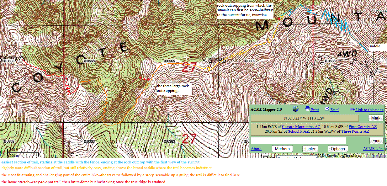
The key 4,850 foot saddle is at
left in this early morning view.

A milestone is reached as a 4,850 foot saddle with fenceline. This saddle is approached through a series of switchbacks to its northwest, the final switchback heading east-southeast before "topping-out" at the saddle.

Chris and I get there roughly two hours from the trailhead. I manage to squeeze-out a cell phone signal to my mother, expressing in heavy tones my unhappiness with how the navigation is going. In-truth losing the trail is wasting a lot of time since every instance requires stopping to examine the hard-copy waypoint list; and the mathematical exercise of answering "Which way is the trail?".

Please try this exercise as a demonstration. Your present location is (32.00466° N, 111.51009° W) in the WGS84 datum at the aforementioned saddle. Using this snippet of 30 coordinate pairs in the NAD27 datum, determine which direction the trail proceeds from your current location.

32.00582855     111.50994578
32.00593994     111.50994377
32.00591120     111.51001091
32.00572076     111.51017435
32.00556838     111.51012373

32.00519999     111.51008056
32.00508172     111.51005173
32.00506731     111.51007277
32.00502523     111.51001493
32.00482674     111.50984956

32.00465735     111.50964537
32.00461519     111.50956532
32.00433816     111.50945619
32.00436666     111.50958301
32.00446439     111.50965283

32.00447588     111.50972190
32.00458576     111.50986800
32.00461544     111.50991762
32.00468610     111.51008869
32.00489698     111.51033302

32.00494736     111.51043780
32.00511408     111.51070895
32.00541893     111.51090383
32.00534240     111.51091741
32.00529906     111.51097918

32.00540929     111.51109167
32.00534190     111.51106963
32.00560961     111.51132980
32.00556452     111.51138772
32.00545304     111.51130817

The reward for "getting it right" is an opportunity to summit. The punishment for failure is a wasted day and the admission that you could not even follow a simple trail to success.

Mind you, the POOR refuses to visually reveal its current location and direction of travel. Thus your sole recourse is to solve the above math problem - an exercise made more difficult still by the ridiculous number of significant figures in the dataset (corresponding to about 1 millimeter horizontal precision!); and by the need for mentally compensating for the difference in datums.

Answer: Remain on the north (same side) of the fence, and find the POOR as it parallels the fence west, thence performing a clockwise traverse of the slope to your northwest.

USE A GPS DEVICE WHICH CAN AUTOMATICALLY UPLOAD AND TRACK 500 WAYPOINTS.

Heeding this admonition will save you much mental energy and wasted time, while dramatically raising your success chances.

The POOR makes a series of switchbacks, then traverses southwest, eventually gaining a 5,400 foot saddle where, again, its ongoing location is completely baffling. To the immediate southwest is a boulder outcrop; while west is an unpromising tangle of brush and lower terrain. Here the POOR heads south, actually loosing elevation as it contours around the left side of the boulders.

Chris notes that a short scramble to atop the boulder outcropping provides the first view of the summit and much of the ridge ahead.

The POOR continues southwest, soon ascending to a flat location at 5,700 feet just southwest of point 5796. Your goal is finally visible.

The obvious saddle connecting you to higher ground west is NOT on the POOR. Instead, POOR descends to the left (south) of the saddle, in order to eventually traverse under a series of three prominent, nearly vertical rock slabs that should be quite evident in your viewshed. These slabs sit one atop the other, and presumably are the reason why POOR looses elevation rather than simply crossing the saddle.

As you continue west the most terrifically annoying succulent plant variety will bar progress.1 It is roughly eight inches tall, and consists of multiple thin leaves radiating upward and outward from a central core at ground level. Each leaf terminates in an extremely sharp tip, and these tips will try their level best to gouge and impale you whenever trampled upon. To Chris I refer to them as simply the "horrible plant"; while he calls them "Devil weed". Do your best to skirt around them whenever possible. Again, this is a darned good reason for keeping on the POOR.

1 Andy Martin informs me this is Agave lechuguilla - the "shin dagger".

After contouring under the three huge slabs, POOR continues west through heavy brush and boulders. It is likely that you will lose POOR here - and as we did. Remarkably, POOR now goes south, traveling away from the summit for several dozen yards before turning back north.

pinnacles
One heads under (left, south)
of the three rock pinnacles
just right of photo's center.

Chris notes that after passing the "rocky fin" of a ridge leading due north, one should "hug" the ridge, at the base of its western side to best follow the trail.

We fail to do that on-ascent, and, having thereby given up on the POOR, simply head willy-nilly uphill in the general summit direction - north. This works fine until reaching a large and steep series of rock slabs, generally smooth, and barring further progress without rope.

The coordinate list suggests POOR is 300 feet due east, and we head there in circuitous fashion. With POOR at-hand Chris now caches my ski poles which he has been using as trekking poles. He later reports they are used because of a minor knee hyperflexion injury on Gu Achi.

The poles are now a hindrance since our hands are used with nearly every footstep. We are here with 600 vertical feet still remaining.

The POOR continues by generally hugging the main summit ridge to the west-northwest. However the terrain is very rough and convoluted - losing the POOR here is guaranteed to get you either "cliffed-out" or in heavy foliage (which at this elevaton are thankfully trees rather than cacti). Small cairns are of great assistance in locating the POOR from traversing below the triple rock slabs noted above to the summit. Cairns are also present lower down, but as the navigation is roughest in the final thousand vertical feet their availability is more recognized and appreciated there.

We pass over a false summit about one-eighth mile from the true summit, having mistakenly taken a side trail. Backtracking all of a dozen feet we locate the main POOR, descending to the intervening saddle before the final summit push.

The summit area supports two boulders competing for title of "tippy-top". One boulder is perhaps a half dozen feet south of the benchmark and nearby summit register; the other (and likely higher) boulder is just to the benchmark's north (or northeast). A taller person can simply hand-slap the latter boulder while standing at its base. I have to actually climb it, using a foothold maybe 18 inches above ground on its south side. On reaching the top I find myself hugging the boulder in a prone position.

Adam
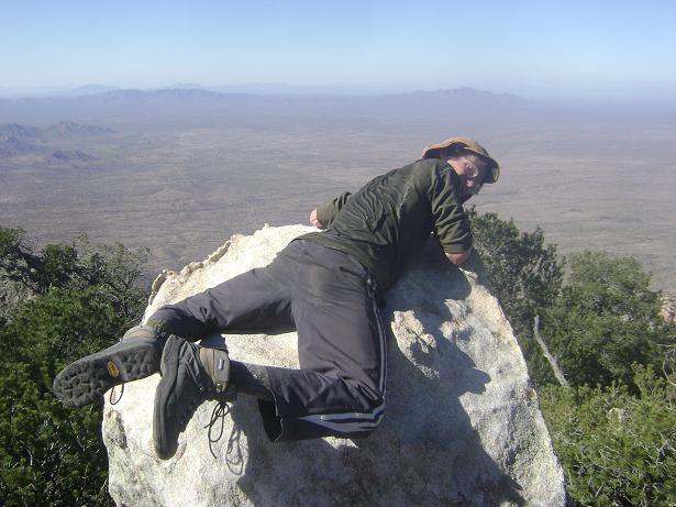
Adam atop the highest boulder.

The benchmark is roughly three feet lower than the highest natural ground. Hence the published summit elevation (and corresponding prominence) should be amended to reflect a slightly higher value of 6,532 feet.

It is about 1 p.m, having taken over six hours to get here. At that rate we will be returning in the dark - a daunting proposition given that finding the POOR with only headlamps is likely impossible.

Salami and rye bread provide some reward for our efforts, and I try hard to forget about the progression of time while eating. The mustard is spread with fingers, and I consume a large amount of potassium salt to aid water retention. Even though I have brought 4 quarts of water, I am rationing it to make it last for the entire day.

The summit observatories atop Kitt Peak beckon us for tomorrow morning when we can simply drive to visit them. Then too the technical Baboquivari taunts Chris to our south as he has not yet scaled it. He says it looks unclimbable - and, indeed, from our unique perch it appears to be completely sheer all-about without any weakness.

The summit register reveals that we are the first people to sign-in this season, the last group of climbers having come last winter in February 2009. Given the difficulties of getting here I can appreciate this ...

We descend. I soon get us off-route, too far east from the ridge; and so we bushwhack through rough terrain, upclimbing back to the POOR for whatever it's worth. At the cached ski poles we descend through new territory since we had gone cross-country on the ascent to reach that point. Again, cairns are quite helpful.

Back at the level spot near point 5796 we are slightly relieved to note that the hardest of our navigation is now past. Yet another granola bar is consumed, and we continue, with one break, to the 4,850 foot saddle with fenceline.

It is now 4 p.m., and sunset is around 5:20. Nevertheless we have a good 15 minute stop; and each enjoy a juicy green apple - saved for this occasion as a partial reward for having gotten back this far before dark.

There is a vertical mine pit located mere feet north from the saddle where it is joined by the POOR. Although it is obvious by daylight, in darkness it could become one's grave.

We descend the POOR at a most rapid pace, incredibly so, and reach the old road around 5 p.m. with plenty of daylight remaining. As this is the point beyond which darkness no longer poses a navigational threat I am somewhat relieved - and drink nearly my last water without any attempt to save it for later. One cup remains.

We return to "DENALY" around 5:30 p.m., after sunset yet still with plenty of useful daylight. It has taken 10.9 hours for the round trip.

I had been planning to share an Indian rice dish with hot curry sauce. However my desire for eclectic food is not necessarily transferrable to Chris. Instead we share a first course of creamy mushroom soup served with pesto/mozzarella potato chips. I add highly spiced tomato/cumin sauce to some of my portion, and dried basil to another part.

We follow with six snack-size packages of macaroni and cheese and two cans of tuna fish thrown-in. Available condiments include Cholula, that spicy Indian sauce/paste, and extra crumbled romano cheese. It's clearly enough for both of us.

We both performed well today. Attempting to remain with the POOR has made for one of the most difficult ascents in my experience from a purely navigational aspect.

I sleep by 8:30.

Tuesday, November 24 - Kitt Peak and Wasson Peak

I time our awakening such that we're at Kitt Peak's summit around sunrise. The hour, 5:15 a.m., seems almost normal by now. After my milk/coffee/biscotti and Chris' deconstruction of my tent we drive just after six.

The Kitt Peak summit road is about seven miles east of Coleman Road. Shortly after entry, a sign advises that the road is open from only 9 a.m. to 4 p.m. - rather short visiting hours - and perhaps suggested by the need to avoid extraneous headlights during astronomical activity. The road is gated only on the uphill lane. I simply drive through on the opposite lane, and we enjoy increasingly inspiring dawn views, with many pictures taken, as we drive exactly 12.0 miles to the summit area.

observatories
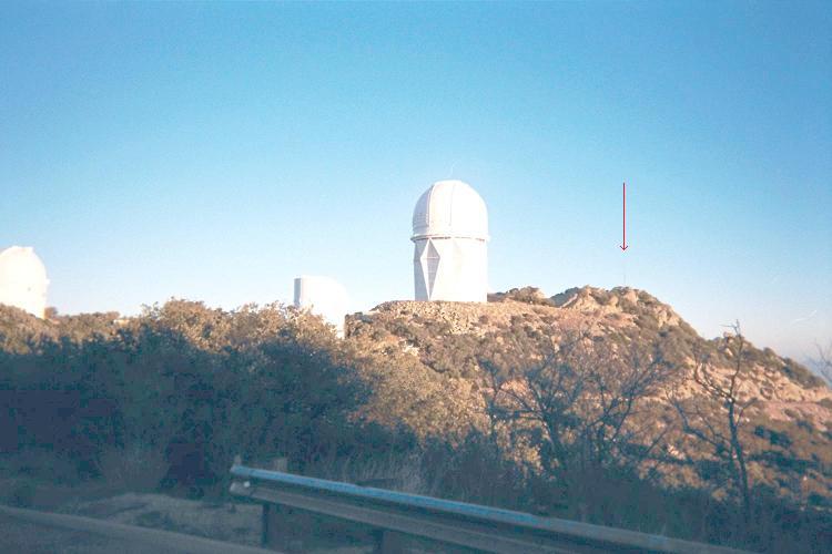
View northwest to the
highest ground - marked
here with a red arrow.

We park 0.1 mile south of the large, Mayall telescope dome at a pullout on the road's north side rather than 0.3 north of the 'scope at a pullout on the northernmost bend of the approach road. We then walk the road north, turning left (west) onto a service road for the telescope; and take it clockwise around to the observatory's north side where one finds the highest summit rocks.

Ascend the rocks on their east side, ducking through some trees before climbing on and around smooth boulders to the highest point - maybe 40 feet of vertical gain from pavement.

Views are wonderful in the gathering light. It is balmier than I had guessed, my parka being superfluous. We return to the pickup truck and continue to our next venue.

Chris
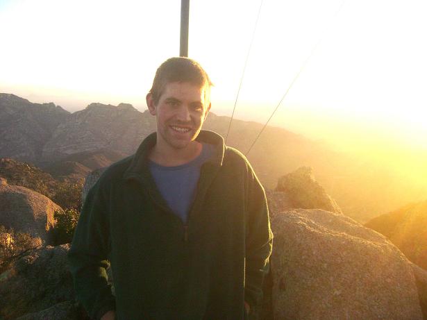
Chris atop Kitt Peak.

Chris was spooked by our near encounter with officialdom on the Indian reservation, and does not want a repeat performance at South Mountain. He suggested Wasson Peak as alternative, located in a unit of Saguaro National Park and most definitely on public land. Thereby we drive east on Route 86, get gasoline and snack food, and head for the appropriate trailhead as recommended via cell phone message by Scott Surgent that morning.

The trailhead is located by traveling west from the Arizona-Sonoran Desert Museum along its paved access road until the first dirt road on the right (north) side and no more than 30 seconds drive from the museum turnoff. There is a parking lot; the trailhead itself accessed from its western end. Follow maps at the trailhead information kiosk: 0.9 + 1.4 = 2.3 miles to a saddle; then northwest 0.9 + 0.3 mile to the summit.

map
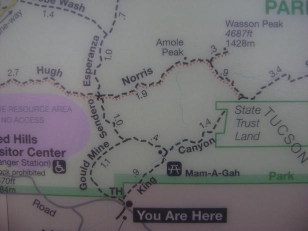
Trailhead map for
Wasson Peak.

Our route is completely on-trail, and is 7 miles round-trip with some 1,900 feet of total elevation gain - "piece of cake", if you will. On the summit, thankfully ours alone for the moment, we take-in the views of Tucson and of assorted mountains in the distance - including Coyote, Kitt, and Baboquivari in close proximity.

We enjoy a whole grapefruit each, followed by kosher salami ad libitum with cheese crackers and some piquante romano cheese. It is a beautiful day.

We descend rapidly, the round-trip taking 3 hours 25 minutes despite over one-half hour at the summit.

summit
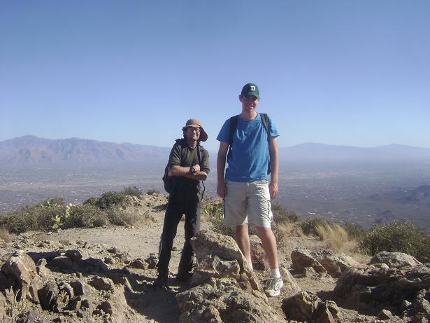
Atop Wasson Peak
with Chris and Adam.

We drive northwest only to discover that a national park entrance fee is required. Evidently we had started the hike within a Tucson city park with free entry - and then entered the national park on-foot while enroute to Wasson's summit.

Driving back, we instead head east into greater Tucson. There I find a pint of Starbuck's Java Chip Frappuccino ice cream; and proceed to enjoy its creamy goodness while Chris drives us northwest to Phoenix along Interstate-10. The best mix-in is sesame candy with drizzled honey atop. The honey congeals instantly on reaching the ice cream! Then again the chocolate almonds are another good addition...

train at sunset
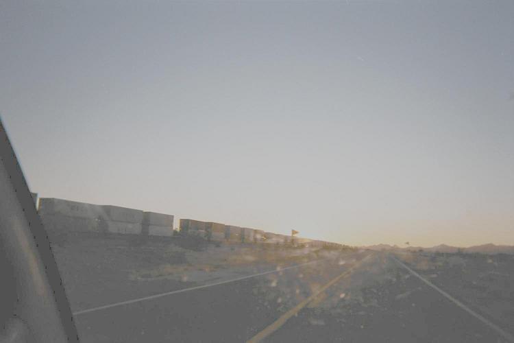
This westbound train forms
an effective sunblock.

We reach Chris' home around 3:45 p.m. in Chandler. His personal items are removed and we say goodbye. It's been fun yet at times challenging.

I decide to end today's homebound efforts at a Gila Bend motel. On the drive west into the setting sun I find the going dangerous in being forced to head almost right at the glowing orb - and even with glacier glasses the glare is almost unbearable.

A "miracle" then occurs: a long freight train blots out the sun as it heads west at just about highway speed. I match its rate, about 50 m.p.h., remaining in its very long shadow just long enough for the sun to set behind distant mountains.

The National Geographic Channel provides ample entertainment this evening after a long and much appreciated hot shower.

Wednesday, November 25 - Chance Encounter and Drive Home

The Love's gasoline station has what I want. After pumping gas and ready to buy coffee I am greeted by Richard Carey and Mark Adrian, friends and peakbaggers from San Diego! Then too I meet Gail Hanna and Shelley Rogers, also from my home city.

They all meet in Gila Bend to climb Arizona 1,000+ foot prominences over the long Thanksgiving weekend. I knew about their trip, yet declined to join them because it would mean three consecutive journeys for as many weeks - without any time at home to pay bills and perform other essential tasks.

Gail reminds me about a climb of Mount Hood next summer, and Mark indicates interest. I confirm my willingness to reclimb Oregon's highpoint for her sake.

I drive home the 295+ miles, stopping in Yuma to top-off the tank at pre-California prices.
chance meeting Gail and Adam
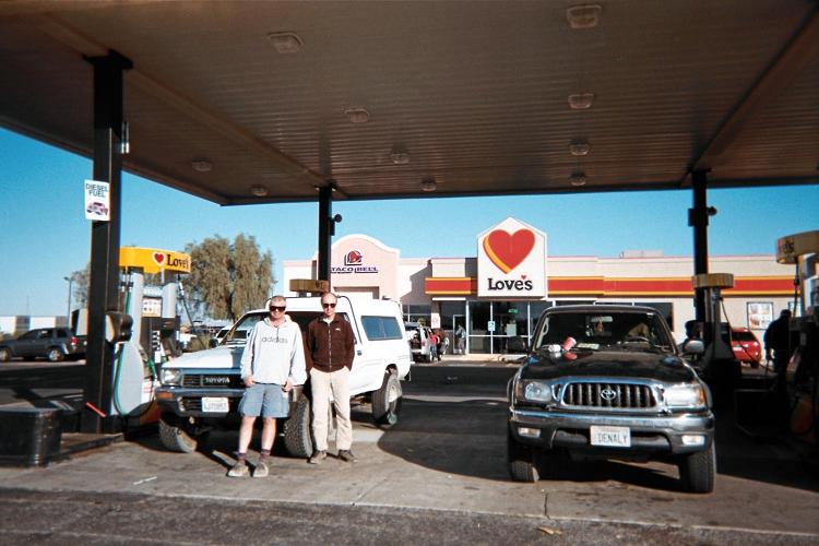
Mark Adrian (far left),
Richard Carey (center),
"DENALY" at Gila Bend.
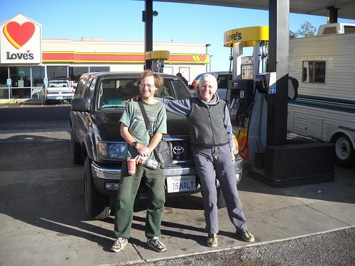
Gail Hanna and Adam
in Gila Bend.

Summary

The truck odometer reads 1185.0 miles on returning home. These "Adam truck miles" are typically one-hundredth more than standard statute miles.

I recommend to Chris Gilsdorf and Scott Surgent an eastern route for their future Gu Achi Peak climb. Such a route would be shorter and entail a bit less elevation gain. I also look forward to climbing again with John Klein whenever desire, timing, and finances converge into suggesting an Arizona peakbagging journey.

Hawk
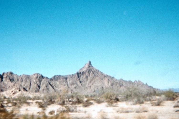
A future goal is benchmark Hawk, seen here looking north
from Interstate-8 near mile marker 54.