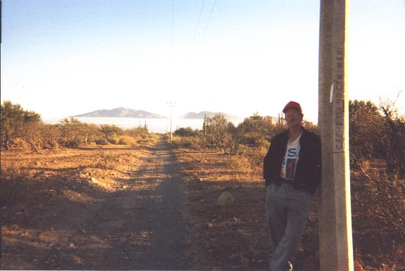
with Bob at our carcamp
on day one of the Giganta climb.
| Summit | Prominence (feet) | Elevation (feet) |
| ****** | *************** | ************* |
| Sierra La Giganta highpoint | ||
| Cerro Las Palmas | ||
| Sierra La Asamblea highpoint | ||
| Cerro Santa Isabela |
Note 1: Click on any photograph for a larger version.
Note 2: All GPS-derived coordinates for Cerro Giganta use the WGS84 datum in zone 12R.
Bob Packard drove south and west from his Flagstaff home, camping at the Walmart
parking lot
in El Centro, California a mere two hours from my home in San Diego.
Monday February 5
Bob greets me in Del Mar Highlands, the community in North San Diego County where I live.
His new camper's refridgerator was acting stranglely, and, to hedge our bet, we purchased an
ice chest at Target.
We drive to Chula Vista and buy Mexican automobile insurance good for nine days. We get lost in central Tijuana trying to locate the entrance to Highway 1D, having initially failed to take the relevant connecting ramp. After an eternity we eventually drive south, through Ensenada, and then east on Highway 3 for our first venue - Cerro Santa Isabela.
We camp inside a local cattle ranch (a $20 gratuity being paid);
and look forward to an easy, 4 or 5 hour hike the following morning.
When in Mexico navigating the backcountry dirt roads is a challenge in itself.
I had purchased two bottles of tequila so as to make the locals friendlier to our presence and hiking desires - some of which surely would be on private land. One bottle is 100% pure blue agave tequila; the other a cheaper blend. The tequila would prove valuable on several occasions. That said, I generally saved the finer bottle for myself.
The amount of tequila I enjoy this evening is both entirely unreasonable and quite delicious -
especially with strawberry-infused white chocolate. In contrast, Bob eats a normal meal.
Tuesday February 6 - Cerro Santa Isabela
This is a very nasty hike, with thick brush (mainly dead manzanita that must be broken by hand), and everything from refrigerator to room-sized boulders. We give up just 1 kilometer from the summit, sensing an inadqueate water supply.
On the descent through a gulley the boulders are so large that each poses a climbing "problem". In two cases we crawled under a room-sized boulder in order to make progress. At about this point I locate a small pool of water hiding under a boulder, and accessed via a narrow passage. The two new quarts allowed me to complete our unsuccessful climb without becoming severely dehydrated.
Bob explores another approach route from due south by car, and might very well be determined enough for a return attempt some year.
We camp near Highway 3, having taken about 1 1/2 hours to drive out the roughly twenty miles of dirt road from near our objective.
|
|
|
Morning fog in the distance, with Bob at our carcamp on day one of the Giganta climb. |
Wednesday February 7
This is a driving day, as we wend our way, first west back to Ensenada on Highway 3;
and then south on Highway 1 to within some 20 miles of the junction leading to Bahia de Los Angeles.
My limbs are quite sore from yesterday, having not done any hiking or climbing for two months;
and then being subjected to a severe physical test lasting eight hours.
A dirt approach road leads 7.2 miles to a camp abeam the base of the Sierra La Asamblea Range highpoint.
We camp atop a minor rise and anticipate a twelve hour climb the following morning.
Thursday February 8 - Sierra La Asamblea
I set the alarm as to depart before sunrise - each of us with a full gallon of water.
We reach the range's western base after ninety minutes; breaking at the point of maximum curvature
where the alluvial plain meets the mountain per-se.
Upon resuming our effort my right lower limb has a shooting pain down the right side whenever I place weight on it. The pain disappears, only to be replaced by a feeling that some muscle in my right thigh compartment refuses to support my weight. Too risky to continue with a sprain or torn ligament, I return to the camper some 2 1/2 miles away as Bob proceeds to the summit.
Returning after nearly two hours (longer than the ascent and due to my bad leg),
I change clothes and shoes to get comfortable; and enjoy the bulk of today both reading and
eating food in the camper.
It was a fun day yet certainly not why I had come to Baja.
Bob returns one hour after sundown, having taken 13 hours 20 minutes for the round-trip.
Clearly tired and short of breath, he confirms that only the three southwesternmost bumps need be visited;
the fourth and farthest bump being obviously lower. A ridge route is preferred,
Bob having encountered climbing obstacles upon descending the wash.
We return the seven road miles and camp near the main highway.
Friday February 9
We drive into Baja Sur and, by mid-afternoon, arrive at kilometer 30 along Highway 1 north of Loreto. There, at San Juan Bautista, Señor Romera and his wife provide route information for how one drives to the base of La Giganta; as well as the name of a man in Loreto who might we willing to guide us on the mountain. La Giganta is a complicated mountain, with vertical cliffs surrounding nearly every approach angle. Together with the prospect of heavy brush and bushwhacking, it seems like a very good idea to find a man who knows his way around this beast.
The driving instructions proving inadequately detailed, we proceed to the Loreto police station where the attending officers contact the recommended man by telephone. Evidently this is one means of finding somebody in Mexico - summon him through the police department.
The guide appears within twenty minutes, only to say that he is not available to assist us for the weekend. However his brother José might be willing to assist us; and is presently working at a water pump station located 4.6 miles along the dirt road approach for La Giganta, one that leaves Highway 1 near kilometer marker 27. We caravan back north to greet José.
|
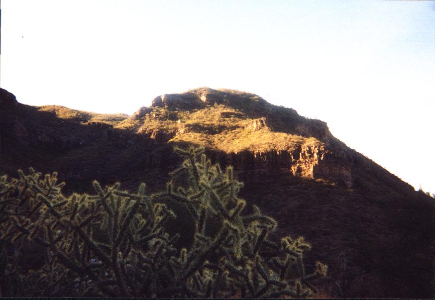
|
View northwest from our backcountry camp on Giganta. Cholla cactus in foreground. |
After some dubious impressions that lead Bob and I to suspect that José is simply trying to make a quick profit (he obviously could not read our topographic map); we decide to take our chances and entrust this man with our success on La Giganta.
After bargaining we agree to a price of $135 and a two-day climb of La Giganta spanning Saturday and Sunday. José could not meet us until after he gets off work at 8 a.m. Saturday; and we agree to an 8:30 a.m. meeting at the pump station where we camp for the night.
Saturday February 10 - Sierra La Giganta Day One
José knows of a permanent water source, and this fixes the location of our overnight, backcountry camp. The hike lasts some 3 hours 50 minutes, and shaves 1,400 feet of gain off the following day. We arrive with plenty of time before sundown, and enjoy many hours of relaxation prior to supper and finally turning-in for the night.
Sunday February 11 - Sierra La Giganta Day Two
José must work by 8 a.m. Monday morning, creating two scenarios both of which entail hiking at night in order to meet that schedule. Either we climb to the summit, descend, break camp, and return to Bob's camper late evening; or we camp a second night on the mountain and hike out starting at 4 a.m. on Monday. Regardless, it is to be a long day.
We start by headlamp at 6 a.m., and negotiate the first of two class 3+ sections while yet dark. Remarkably, José wanted us to camp beyond these steep sections at a point where no water exists (!!!). I refused to consider that concept as it would have us hauling already heavy packs with enough water for two days to a dry camp - and along a route that was very steep at times - and all to reduce the effort of summit day by a rather minor fraction. Our actual campsite was far preferable. Had we too only a daypack, as José, then it would have been reasonable to camp farther up the route.
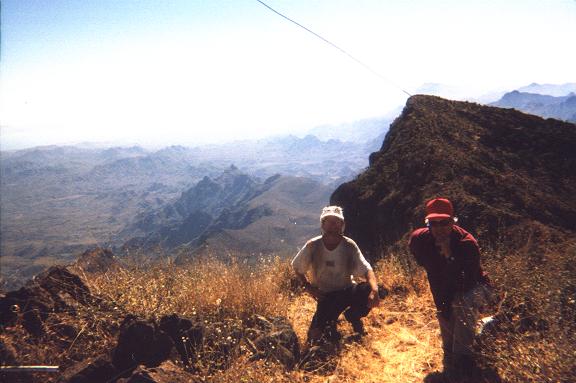
|
|
View southeast with Adam and Bob atop Cerro de la Giganta. |
The route is complicated, and José earned every bit of his commission by locating a narrow path that goes clear to the summit. The path is at times quite rocky; and is annoying inconsiderate in a combination of nearly level sections mixed with very steep ones; but it is a path nonetheless. Bob and I would never have found this path on our own; and, having then to bushwhack, would have taken twice the time and effort to scale the mountain.
I rush ahead the final section to the summit, topping-out at 10:08 a.m. Bob and José follow within ten minutes, and we enjoy the remarkable views - especially east and northeast to the Gulf of California. The tall summit antenna is visible from way below (I saw it at our camp); and is used as a relay for the Loreto police to communicate with other municipal police departments. There is also a shorter antenna used by the military.
We return to camp at 2:45 p.m. and depart forty-five minutes later, having a nice snack to partly revive myself for the remaining descent. The backpack is not really heavy, perhaps only forty pounds. Nonetheless the only thing I want is to stop and sit down - it was 8 3/4 hours from camp to summit and back again. Our toils conclude at 6:48 p.m. just as darkness is nearly complete. A celebratory sample of tequila for José and myself is followed by Bob driving us back to the water pump station where José will sleep with fellow workers prior to assuming his chores the next day.
It is a linguistic and tactical tour de force that we manage to have climbed La Giganta. The net elevation gain is 4,800 feet; the total gain perhaps 400 feet more still.
Some coordinates for the approach drive and climb follow.
| (Easting, Northing) | elevation (meters) | description |
| **************** | *************** | ********* |
| (450220 E, 2896110 N) | 69 | car camp at water pumping station |
| (443951 E, 2891951 N) | 226 | trailhead |
| (442813 E, 2890277 N) | 353 | 1 to 1 1/2 hours along trail |
| (442105 E, 2890669 N) | 597 | topping-out on ridge |
| (440545 E, 2889430 N) | 662 | backcountry camp |
| (439949 E, 2889312 N) | 967 | water cache at ridge |
| (440090 E, 2888423 N) | 1257 | under cliffs along route |
| (441622 E, 2887389 N) | 1693 | summit Cerro Giganta |
Monday February 12
From Mulegé, Bob and I investigate the long and bumpy approach road for Cerro Las Palmas. After some ten miles of rather nasty going, we decide it is not worth the pain on this trip seeing as we had only driven about one-fourth of the needed distance. Bob may return for this mountain on his own, now that some of the exploratory ground research has been performed.
We return to Baja Norte, and camp about 30 miles north of the border just off the main highway. My dinner of home fries with three eggs and kosher pastrami is likely the tastiest meal I enjoyed in Bob's camper. It mirrors Bob's favorite evening meal (in his camper), which generally is a combination of hash browns, sausage links, and a fried egg; all served with a canned vegetable such as green beans or peas with butter. A small dessert completes the repast - chocolate chip cookie or fruit cup.
Tuesday February 13
Today's highlight is doubtless the midday restaurant meal in Ensenada. This seaside city brings tourists by the thousands; and, with an ample supply of fresh fish and seafood, it has always been my desire to take "time out" and smell the roses.
I choose El Cid, a moderately fancy establishment that serves traditional fare rather than the Americanized stuff we all see at places like Taco Bell.
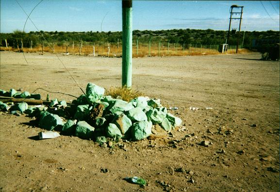
|
|
Green rocks at the pump station where we camped before and after Giganta. |
The requisite tortillas with salsa are first to make their appearance. The appetizer is "on the house" (yeah, right!) as tuna paté with toast wedges. A green salad with lettuce, tomatoes, and cucumbers is refreshingly tasty after over a week of canned food - served with blue cheese dressing. I enjoy a "margarita grande" - served in a large, hemispherical goblet with the standard salted edge. Suddenly I am tipsy and quite happy indeed!
A guitarist walks by, and plays a song about mountains and the countryside as per my request. Heck, for three dollars I can claim for all-time that Bob and I were "serenaded" at tableside.
The entreé is whitefish - breaded for Bob, and topped in a Monterey Jack cheese sauce for myself. A rice timbale and assorted cooked vegetables complete the dish. Again, there is a variety of menu items, ranging from standard burrito/enchilada/rice/bean combination plates to steak. However it just made sense to order fish while in Ensenada. The Chile en Nogada was tempting, however - a classic Mexican dish.
For dessert I enjoy apple tart with caramel sauce, accompanied by a scoop of vanilla ice cream. With tip the entire bill comes to $48 USD.
Bob and I return north on the toll highway 1D, and then wait at the border crossing one hour before entering California. Once home I pack my gear, and then Bob departs for El Centro.
Wednesday February 14
Bob returns home today and begins planning the next south-of-the-border adventure.
The major objective of the trip was acheived as the Sierra La Giganta Range highpoint. It is likely that no other person (and certainly no other foreigner) has climbed Baja's five largest prominence peaks besides Bob Packard.
Although I climbed no mountain besides La Giganta, I still find the entire journey satisfying.