Cuyamaca Peak October 2012 Trip Report
© October 2012 Adam Helman

Note 1: All coordinates use the WGS84 datum.
Note 2: Mouse-click any image for enlargement.

Introduction

summit vista south
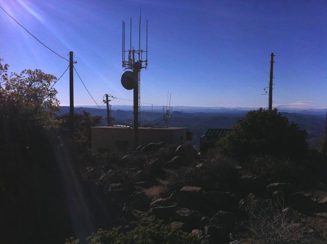
View south from Cuyamaca summit
with new communications building.

It's been fully one month since returning home from Japan - and I have not climbed a single peak since!

I am quite anxious to make good use of the gorgeous weather. Plus, last time I was there, in August 2011, the general summit area of Cuyamaca Peak was undergoing some construction project - and I want to learn first-hand if it might prevent future efforts from succeeding.

I shall return to Denali in June 2013. Not wishing to spend gasoline on another 1,000 mile journey to and from Flagstaff (for colder overnight temperatures), I consider multiple trips to Cuyamaca Peak for both a review of winter camping methods and to snowshoe with sled and a full-size pack. For all of these desirables the peak's 6,512 foot summit and an area surrounding the campground parking lot, some 1,650 feet below, are deficient substitutes for colder venues - venues that sadly cost a lot more to reach. A tradeoff.

So it is that I drive at first light the 60.0 miles from home early on Saturday, October 27. I've already done my evening exercise at home, on the elliptical trainer with a 50 pound pack - so it's not physical training this time which I seek. Rather, I simply want to "get OUT there", and so long as I have a valid reason for visiting Cuyamaca Rancho State Park yet again that is excuse enough for spending the $25+ in gasoline and $8 daily use fee.

Trip Details

vista north
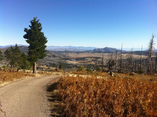
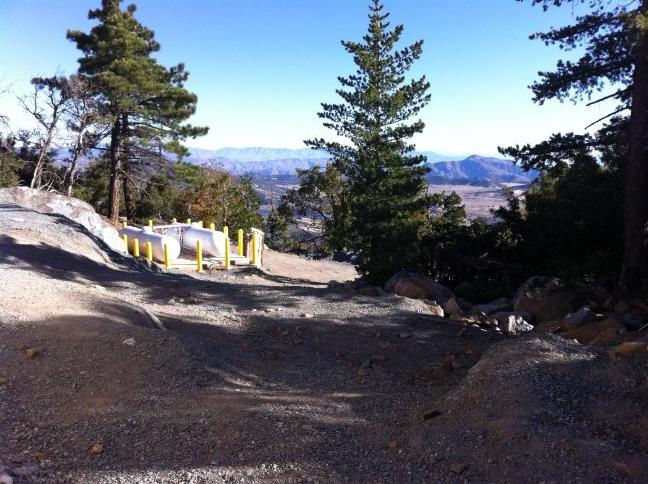
One-quarter way from the top
is this view looking north.

I walk from the car at 7:42 a.m., the day most promising with blue skies and nary a hint of wind. Being a Saturday there are many people camping - and they are going about their trivial concepts of outdoor activities replete with giant-size tents, tables with chairs, satellite dishes and just about all the trappings of having never left home. How pitiful.

After some initial difficulty navigating the campground's dense road grid the paved fire service road leading uphill is located - but not before wasting a few minutes backtracking from a wrong "lead".

burnt trees
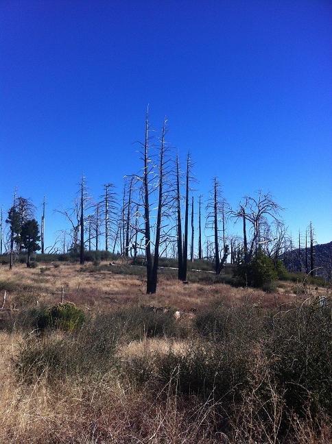
Lightning-struck trees -
were they split that way?

Soon enough I top-out at 8:48 just 1.1 hours later, having had a break at 6,027 feet at a prominent log that's quite obviously been positioned as a resting spot for hikers.

The good news is that the summit rocky outcrop is still accessible despite the recent construction of two concrete buildings with corresponding antenna masts. One seems to be a commercial communications facility; the other labeled "U.S. Forest Service" on one door. There is still a good amount of construction equipment all-about, and also some large white propane tanks along the approach road perhaps 20 feet below the new buildings.

In addition to reaching the true top I also visit a second rock outcrop located to the southeast and immediately (15-20 yards) southeast of the new communications building. With perhaps 10 feet of prominence it's not going to be listed at peakbagger! Its coordinates are (32.94644° N, 116.60635° W) at a GPS-measured 6,502 foot elevation.

rock outcrop
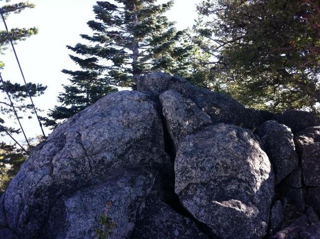
Rocky outcrop southeast of
the true summit

There's plenty of wind blowing from the north as I sit to eat "lunch" on the lee (south) side of the new communications structure - tuna fish salad inside pumpernickel bread, some sharp asiago cheese, a few Good and Plenty licorice pieces and a red apple of the "Golden Delicious" variety.

I locate potential flat spaces to erect a two-person tent, and as I plan to do this coming winter provided that it's allowed by the Park authorities rather than using a standard campsite.

A newly acquired iPhone4, my first so-called "smartphone", is leveraged by contacting my mother at the top and by taking numerous photographs without worrying that real film is being wasted. In so doing my descent consumes more than the 45 minutes it would have otherwise taken without this distraction.

I am home just before noon and am unproductive for the day's balance given that I only had about three hours of sleep.

The following coordinates will allow myself, and others, to navigate past the campground road grid even at night.

description (latitude, longitude) Topo chart (waypoint at cursor)
********* **************** *********
PARK (4,827 feet) (32.96014° N, 116.58028° W) click here
RIGHT 1 (32.95885° N, 116.58040° W) click here
RIGHT 2 (32.95874° N, 116.58063° W) click here
LEFT 3 (32.95881° N, 116.58120° W) click here
STRAIGHT 4 (32.95872° N, 116.58159° W) click here
STRAIGHT 5 (32.95786° N, 116.58224° W) click here
LEFT 6 (32.95745° N, 116.58294° W) click here
LEFT 7 (32.95697° N, 116.58349° W) click here
FIRE ROAD -
bear right (4,900 feet)
(32.95660° N, 116.58369° W) click here

vista north vista northwest
View north from just east of
the new near-summit facility.
Note the propane tanks.
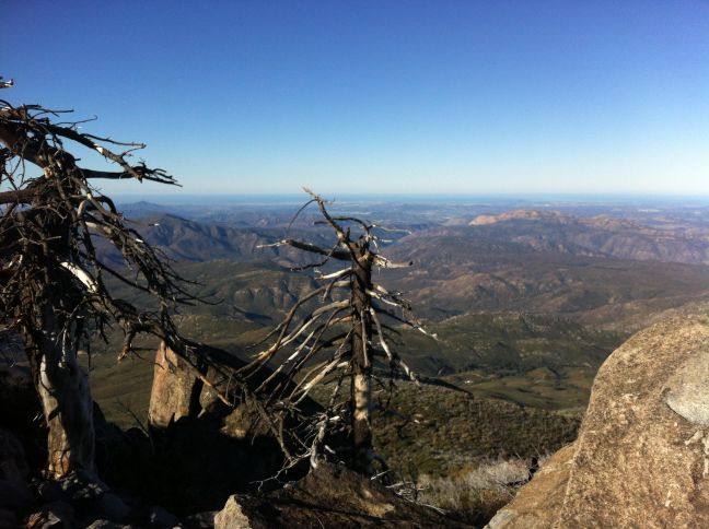
Summit view northwest
clear to the Pacific Ocean.