
|
|
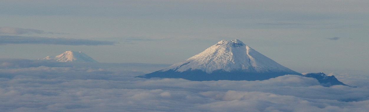
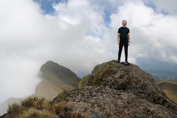
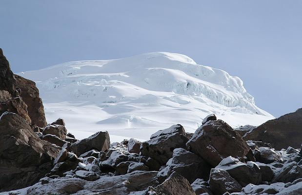
begin at the end because the view is simply too magnificent.
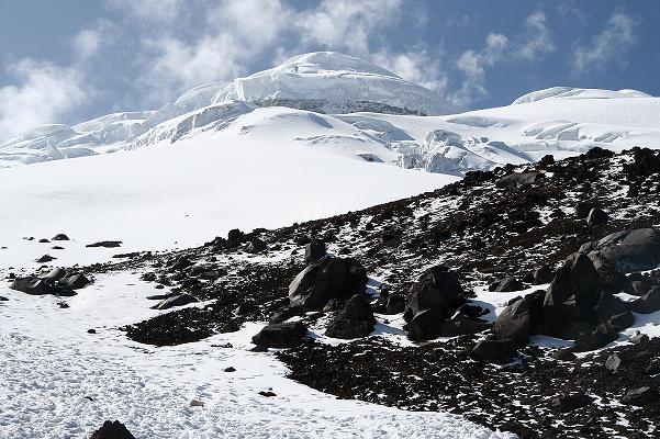
Atop an octant highpoint, Nevado Cayambe, the distant peaks rise above morning clouds like antarctic nunataks floating on ice.4
|
| Distant Chimborazo and Cotopaxi from Cayambe's summit. |
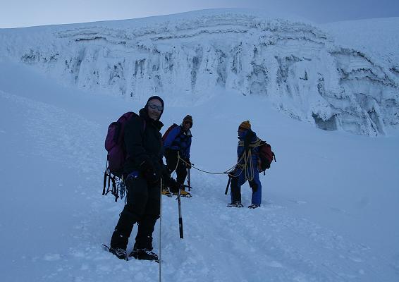
We three, and our local guide are privileged to have the entire mountain, all nineteen thousand feet of it, completely to ourselves.
After one-half hour the morning chill suggests retreat - but not until a round of handshakes, plus many photographs, document our visual feast atop this, the third of three successful efforts on Ecuador's big, snowy volcanoes.
|
1
Mouse-click on any photograph for enlargement. Receive permission directly from Petter Bjørstad prior to using any image. 2 I reserve the right to emphasize any aspect of the journey deemed important to myself or of potential interest to the reader. Food is the easiest means to experience another culture - including Ecuador. However if through a closed mind you do not wish to learn about other's habits, culinary or otherwise, then please skip to the next section. It is your loss. 3 This is a general accounting of our journey. For more details about climbing specific mountains consult the detailed reports by Petter Bjørstad; and the concise reports by Robert Woodall. 4 The Earth's surface contains eight octants bounded by the Equator, poles, and four meridians separated by 90° in longitude. Cayambe is the highest point of the octant bounded by the Equator, North Pole, Prime Meridian, and 90° W. Lying just one arcminute north of the Equator, it supports the highest ground, at some 16,000 feet, along that gigantic, red line. |
 Click on any mountain name or icon for the corresponding story. |

|
e travel as three - Petter Bjørstad of Bergen, Norway; Robert Woodall of the United Kingdom; and myself from San Diego, California.
Our journey is motivated by topographic prominence - a mountain metric rewarding vertical relief as distinct from sheer elevation. That written, Robert wishes to test his mettle on peaks higher than what the European Alps offer - and, with the likes of Chimborazo, plus others, this goal is realizable.
|
|
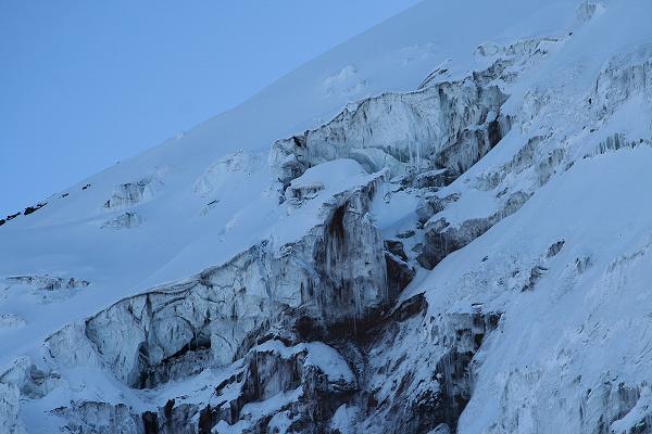
Icefalls provide daunting terrain high on Chimborazo. |
Chimborazo was once believed Earth's highest. Despite Mount Everest, the superlative yet applies in that, owing to Earth's equatorial bulge, its summit is farther from Earth's center than any other point.
Chimborazo is the main goal - at well over 20,000 feet, the journey's highpoint in both a physical and emotional sense. It is the seventeenth most prominent peak on Earth.
Reaching such heights demands rigorous attention to proper acclimatization. A series of ever-higher peaks are planned for the first week in Ecuador. Then, the three highest (and most prominent) glaciated volcanoes are attempted - Cotopaxi (with its beautiful, symmetrical form), Chimborazo, and, if time permits, the often difficult Nevado Cayambe.
|
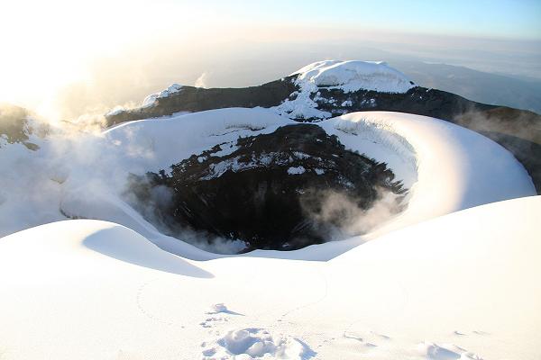
| Cotopaxi summit crater |
We wish to maximize the number of large prominence peaks climbed - so-called ultra summits. Thereby we shun a standard itinerary as practiced by commerical guiding agencies because such a concept is foreign to them. Rather, we solicit a local, Quito-based company that is willing to accomodate our peculiar, prominence-based desires; and accepts on-faith that we have enough experience so as to obviate any training or practice sessions.
Compania de Guias de Montaña is selected. Our driver and guide is Diego Zurita, his four wheel drive vehicle proving essential on many occasions. Diego will know each route in detail impossible to secure by scouring the Internet. We rely on his local knowledge despite the fact that, on nearly all the climbs, Petter with his extensive snow-savvy could have led us without incident.
In review, then, Ecuador "happens" because of Chimborazo's prominence. The journey's bulk is spent building to that event, all-the-while earning ultra prominence summits and experiencing yet another Latin culture.
|
|
have a good sendoff. After driving to Los Angeles, I am treated to lunch by my parents at our favorite Italian restaurant, the California Pizza Kitchen - where the fettuccini Alfredo with mushrooms is good as-ever.
My flight is on the COPA, the Panama national carrier - twelve hours later. I come early to avoid Friday rush hour traffic. To avoid high airport rates, I park in the San Fernando Valley and, by 8 p.m., take a shuttle bus to LAX - the well-known acronym for Los Angeles International Airport.
The flight to Panama arrives after sunrise. After a one-hour layover the far shorter flight to Ecuador has me in Quito around 2 p.m.
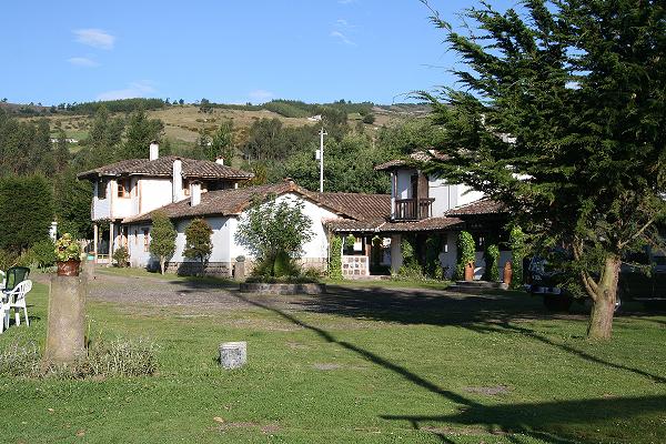
We have reservations at Casa Helbling, a moderately low-key affair that, unbeknownst on selecting it, caters largely to the outdoors-oriented traveler.
The guide company has failed to retrieve me. I shout "Compañia de Guias!", TWICE, and dozens of heads turn - alas, none answering my call.
The taxi ride costs $6 and drops me unceremoniously at the doorstep in a very heavy rainstorm. My travel clothing, of cotton, takes more than a day to dry out. Eventually I wear them to speed the process. Ecuador uses the American dollar as currency.
I sleep much of the day, having lost much of the night. By evening I meet three Americans in the upstairs combination dining area / reading room. They intend to gain, for the first time, experience at very high altitude. None of them have an extensive climbing resumé; and, indeed, one person has hardly climbed at all. I sense they are pushing too hard what they should attempt based on their collective experience. Nonetheless their obvious enthusiasm is noteworthy.
Robert arrives around 10 p.m., and we soon sleep until past sunrise in anticipation of a good breakfast in the hostel lobby. Robert surely has traveled more than I, and yet I clearly cannot write of his experience jumping the pond from Europe.
Having arrived at altitude today, I denote Saturday the 6th as "Day 0" of an "acclimatization clock" that determines when we may reach certain elevation milestones. Our hostel is at 9,200 feet - high but not "high enough" for my sake.
Sunday, December 7 - Petter Arrives; Mama Clorinda
|
|
don't like eating the same food on successive days. Unfortunately the breakfast at our hostel is by far the most convenient calorie source each morning - and we spend many of them at Casa Helbling.
However this first morning should be a treat. In addition to the continental-style items set before us, Robert and I order eggs with bacon and cheese. The entire spread provides two kinds of bread with jam, coffee, tea, possibly hot chocolate, and always a glass of squeezed fruit juice - served, unfortunately, at room temperature to render it thoroughly unrefreshing. However I always can enjoy a cheesy omelet on soft bread.
|
|
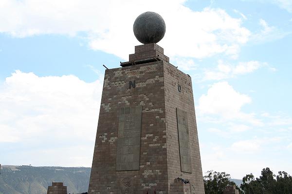
Centerpiece of the Mitad del Mundo Park. |
On subsequent mornings I eat only because Robert and Petter wish to; and because the energy is needed for subsequent climbs. After their departure the final day, my breakfast consists of little other than coffee - there being no need for eating more simply to fly home later that day.
Petter arrives mid-morning, having worn double plastic mountaineering boots for eighteen hours on the inbound flights. Our first collective task is taking GPS-based readings at the nearest street intersection - Seis de Diciembre and Avenida Veintemilla. This calibrates our units, providing an offset, in meters, between what the SRTM3 database claims for that intersection (2800 m); and what our units read (2807 m). This is important because later we must in part rely on SRTM3 elevations for determining the prominence of Cerro Imbabura (see below).
|
|
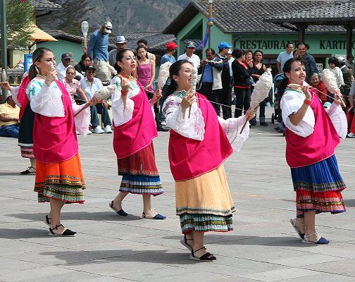
Folk-dancing at the Mitad del Mundo Park. |
This somewhat lazy day is actually important because, merely in being here, we are acclimatizing to the modest altitude. We taxi to La Mitad del Mundo, a park with central, ceremonial obelisk; plus many stores, located near the Equator. Our GPS units indicate we are roughly 0.1 arcminute south of the true line - some 600 feet.
We have lunch, beginning with cheesy, gooey empanadas - a savory pastry turnover enjoyed througout Latin America. My main dish features several kinds of sausage, and comes with avocado and llapingachos - cakes of potato with cheese and quite delicious indeed. Petter treats us all!
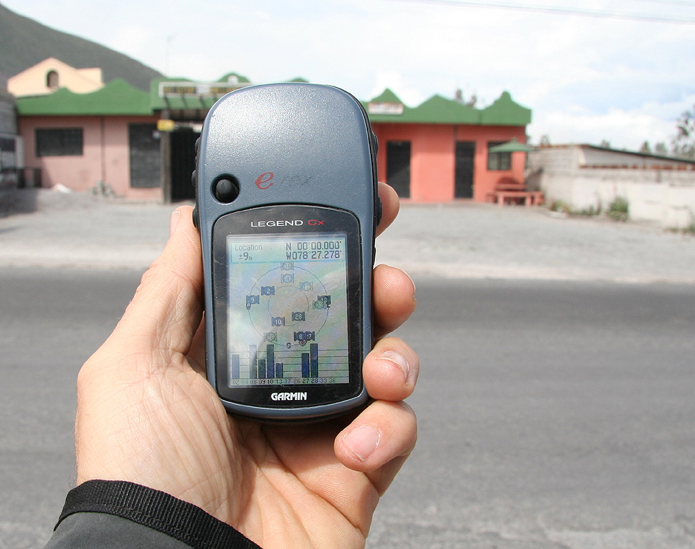
After this filling lunch we exit the park, walking north and then west, to locate the true Equator alongside a small, roadside museum to that end. A few cell phone calls are made on my unit, both to California and Norway, whilst standing nearest as determinable to the actual line.
|
|
The true equator as confirmed by GPS technology (click to view seven zeroes). |
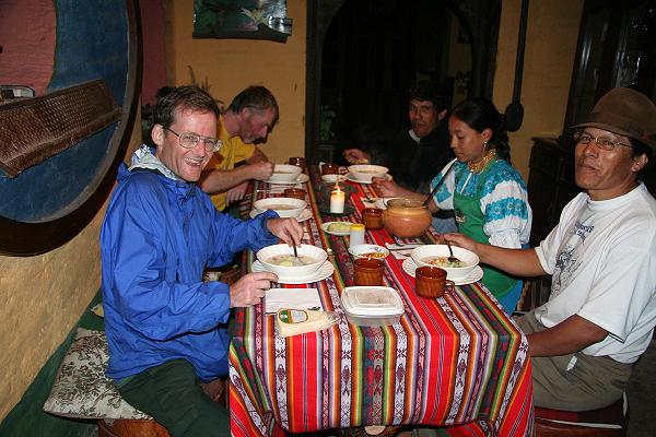
This evening we invite the three Americans to dinner at Mama Clorinda which, at 1144 Reina Victoria, serves traditional Ecuador cuisine. The chief draw is cuy - guinea pig that, at least at this establishment, is served battered and fried much like American-style fried chicken. I fail to locate the wonderful cheese empanada appetizer of lunch; but do manage to enjoy a very sweet cocktail with Ecuador fruit liqueur. My entrée is ribs in a barbecue sauce served with llapingachos; and on request I get a piece of cuy from Robert.
The three New Englanders order spaghetti and are disappointed in the flavor. Petter orders red wine, and we three share in it - so making for a slighly precarious walk back to the hostel.
Petter treats us again to dinner: this expense does not go on the itemized sheets that I distributed before the journey to track our purchases (and thus settle finances at trip's end). Of course we had a great time together, six people with the common goal of climbing big, high altitude Andean mountains.
| Monday, December 8 - Cerro Pasochoa | Petter's Pasochoa report |
| Robert's Pasochoa report |

|
ur first hike is today, Cerro Pasochoa at 4,200 meters (about 13,800 feet). Having been two days at altitude, I should be ready for this one. Diego, our driver and guide, retrieves us at 7:30 a.m. from the hostel; and we reach the muddy trailhead roughly 1 1/2 hours later at just over 3,300 meters (10,900 feet). We three estimate a five-hour round-trip, and so Diego will return around 2 p.m. I have no idea how his time is spent.
Pasochoa has 794 meters (2,605 feet) of prominence - and the notion of nabbing a P610m (P2000 foot) peak provided the rationale for including it on the itinerary.
|
|
Pasochoa's subpeak from along the summit ridge. |
It is strange - after reaching the road's high end, you enter a cultivated area where the obvious route is south towards higher ground. A local farmer's son, on horseback, recommends that we veer left (east) into a ploughed field. We follow his directions, only to be charged ten dollars each for permission to pass through their private land. We deny him (and the father) the money. At the field's top end a road appears; and the boy says it is "impossible" to climb by turning right (west) up the road. We disregard his instructions, figuring (by now) that he is only trying to mislead us.
The path is often muddy from recent rains. Eventually we enter a grassy zone, devoid of trees, and negotiate the first of two possible summits on the near side of the trail system. Atop, both our GPS readings and views support the notion that the other summit is higher. We descend to the intervening saddle, some 50 meters below, and climb the higher summit via a somewhat "interesting" route with much heavy vegetation and a pair of hard, Class 3 moves. The twin summits are perhaps one-quarter mile distant.
Petter brings an oximeter, and we dutifully take both oxygen saturation and pulse reading every morning before arising. I am shocked by a saturation of just 80% - and a pulse of roughly 100 beats per minute. At sea level such a low saturation would shock a physician - it is "near death" and with little recourse except perhaps to inform the morgue of a new arrival. Interestingly, Petter reports the (truly alarming) value of 67% saturation when atop Aconcagua - at 6,962 meters (22,841 feet) the highest peak of the Americas.
|
| Robert atop Pasochoa's main summit. |
The GPS units read roughly 13-15 meters higher than summit elevations of both map and book. Later we find the same offset on several peaks - which is most gratifying as, among other conclusions, it confirms the precision of our units. The difference arises from discrepancies in the assumed vertical datum between map and GPS unit; and as discussed at-length below.
After many pictures and some lunch food we descend by a far easier brushy slope to the south; thence regaining our original path in short order. A long break halfway down the hike is welcomed for its good views prior to much cloud and poor visibility. Indeed, the weather pattern is identical every day - clear until 9 or 10 a.m., followed by gathering clouds with rain sprinkles by mid-afternoon. Climbing in the morning, or later, literally at night, is essential to our plans.
I return to the trailhead at 1:50 p.m. (1:45 for Petter and Robert), Diego having just arrived. The timing was nearly perfect. I was delayed by choosing a bushwhack to avoid a certain steeper, muddy section of the road that reminds me of descending a most slippery trail on Gunung Lawu of Indonesia in summer 2007.
Near the hostel we learn from the three Americans they had climbed the slightly lower subpeak, having either little inclination for reaching the true summit; or having simply run out of fair weather. They recommend a Colombian restaurant literally across the street, and we eat heartily for just five dollars each. Remarkably, we all ordered the same plato fuerte ("main dish") - the comida typica ("standard plate") with meat, plantain, avocado, a mound of rice ... and a large crock of beans on the side. Quite a bit for the price. However lacking desserts or appetizers on the menu, I decide to not return there.
| Tuesday, December 9 - Guagua Pichincha and Homestay | Petter's Pichincha report |
| Robert's Pichincha report |

|
Yesterday we purchased all ten remaining slices of a chocolate cake from one nearby store; and now one-half the cake is enjoyed as breakfast since we leave for the peak too early for the standard, hostel-prepared breakfast. Petter calls it a "calorie bomb" as I tend to preparing "milk" for myself using, mistakenly, a bottle of carbonated water. The dry milk powder / fluid concoction is the farthest cry from real milk I've ever fashioned. Yuck!
|
|
Robert jubilant atop Guagua Pichincha |
Diego wishes to leave us at 3,700 meters (12,150 feet) on the approach road. We wish to spend a longer, slower ascent at a higher altitude; and so convince him to continue until 4,050 meters where we park and begin the ascent. Diego will then meet us upon our return.
The first hour gets us to a yellow, concrete refuge at 4,550 meters (14,900 feet). The road continues, now to the left (west), reaching the main, summit ridge at 15,200 feet and near a small subpeak with cross and antenna.
The ridge is very windy. I don all available layers; and proceed with Robert and Petter past a false summit, down the intervening saddle, and then to the true summit. A 5 meter tall, Class 4 section is surmounted immediately prior to gaining the true summit - yet can be bypassed to the right (south) without difficulty.
|
|
Adam downclimbs the Class 4 crux just below Pichincha's summit. |
Collective GPS readings provide 4,799 and 4,800 meter summit elevations. The offset from 4,784 meters is identical to that at Cerro Pasochoa - good news. We hunker down, sheltered by boulders from the wind, and enjoy more chocolate cake. That cake is an essential "partner" this morning!
Petter downclimbs the technical crux and stops to photograph myself on said portion. The wind dies down; and the return hike bound for the yellow structure is quite enjoyable in gathering sun. Robert briefly visits the subpeak; while Petter and I meet the three New Englanders taking a rest outside the building. One has diarrhea and so will not go higher today.
|
|
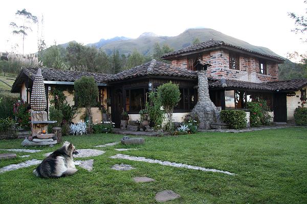
San Clemente homestay under Cerro Imbabura. |
We meet Diego after a rapid road descent; and, without reason for remaining in Quito, drive all afternoon to near next day's climbing goal.
After leaving Quito behind us we break at an ice cream parlor ("Mickey's") where Robert, Diego and especially myself enjoy a bunch of interesting tropical fruit flavors. We then stop at Lago de San Pablo to again calibrate our GPS units. SRTM3 indicates a lake elevation of 2,662 meters. Our units read slightly higher - and the exact difference becomes essential knowledge as described below.
We enter the populated valley with Otovalo as largest community - and famous for its outdoor market. Cerro Imbabura and Cotacachi sit in splendor at opposite ends. Both peaks, appropriately, appear bulky enough, and with much vertical relief, to indeed be ultra prominence summits.
A tale of two volcanoes. The locals refer to Taita ("Daddy") Imbabura and Mama Cotacachi. Legend has it that when it is raining in Otavalo, Taita Imbabura is urinating in the valley. Another legend suggests that when Mama Cotacachi awakes with a fresh covering of snow, she has been visited by Taita Imbabura during the night.
Diego knows where to get lodging, and we find ourselves by sundown at San Clemente - an attractive homestay located at 2,800 meters and just south of Cayambe the city. We have a triple room, and dinner is served at 7:30 p.m. - with no choice in either the time or the menu.
I complain about eating so late only to sleep right afterwards - this is most unhealthy. I am hungry and want to eat NOW ... not go unsatisfied for hours only to eat, somewhat needlessly, merely to sleep.
|
|
Dinner at the San Clemente homestay. |
The meal is a vegetarian delight. We start with an (!) oatmeal soup served with toasted corn kernels for texture. Sliced avocados add some variety. There are potatoes in a cream sauce, cooked carrots with broccoli, and, almost as an afterthought, fried chicken (one piece per person). I request and obtain "aji" - the generic hot condiment to enliven many a dish. Throughout Ecuador it manifests as a red, slightly creamy sauce with much onions and spices.
The rice tamales in corn husks are supposed to be dessert yet are not sweet at all. I bet they are great with honey. The brown sugar tea is extra sweet, and I enjoy multiple glasses of it at the meal's conclusion.
I fear that lodging and meals will cost more than originally estimated. However our homestay is likely more appealing and peaceful than staying at a motel in nearby Ibarra (which is also 1,000 feet lower).
We agree to a 5:00 a.m. departure, with breakfast at 4:30 and my alarm set at 4.
| Wednesday, December 10 - Cerro Imbabura | Petter's Imbabura report |
| Robert's Imbabura report |
|
|
e start in near darkness at 5:40 a.m. from a parking area just over 3,450 meters - so making for a 1,150 meter (3,750 foot) net elevation gain. The initial pace is far faster than needed: we hike 550 vertical meters (1,800 feet) the first hour. Although such a pace is normal near sea level, it is VERY rapid given our elevation. WHY SO FAST? What is the POINT?
One-half hour later and we leave the tusocky grass along a rocky ridge. Wind again. Many hikers stop at the first subpeak and call it good enough. After all, it IS nearly 4,600 meters and hence nearly the same elevation as the true summit. Furthermore, the route beyond is somewhat more dicey. Clearly, though, turning back HERE does NOT satisfy us.
|
|
At a tiny meadow prior to Imbabura's false summit. |
The ridge route appears to be a technical affair. Somehow a set of arrows leads one on a Class 3 scramble that must surely have been difficult to discover by the original climbers. After descending about 100 feet one regains the summit ridge as it travels, counterclockwise, first west and then south to the main summit.
After nearly an hour we reach the main summit and rejoice in a series of GPS readings. Imbabura is noteworthy because of its questionable status as an ultra prominence summit. To wit, various sources claim summit elevations ranging from 4,609 to 4,630 meters. Which is correct? The key saddle elevation is 3,116 meters according to SRTM3 data. Thus in the absence of our measurements, Cerro Imbabura's prominence, as the difference between summit and saddle heights, may be anywhere from 1,493 to 1,514 meters. Ultra status only applies to peaks with at least 1,500 meters of prominence. Hence the need for accurate GPS-derived elevations.
|
|
Diego (front), Robert, and Adam (rear) approach Imbabura's false summit. |
We place faith in the aforementioned saddle elevation because the terrain is very flat - SRTM3 is highly accurate in such a case. Owing to the absence of a valid SRTM3 summit elevation GPS readings are made in its place - and then adjusted by the offset noted, relative to SRTM3, at the completely flat Laguna de San Pablo for which SRTM3 data is available.
The detailed calculations are provided here. Our GPS units read an average of 13 meters higher than the 2,662 meter SRTM3 elevation for Laguna San Pablo. 13 meters is also consistent with the measured discrepancies between map and GPS-derived summit elevations at both Cerro Pasochoa and Guagua Pichincha.
Thereby, had our GPS units been located at Imbabura's key saddle they would read 3,129 meters, as the 3,116 meter SRTM3 value plus the 13 meter offset. By extension, a GPS reading of at least 3,129 + 1,500 = 4,629 meters is required at the summit of Imbabura for it to be an ultra prominence summit.
The following readings (in meters) are obtained for our respective GPS units -
Each value above for Petter and Robert's units represents an averaging for at least 100 data points.
Using a mean value of 4,645 meters, the measured prominence of Cerro Imbabura is 4,645 - 3,129 = 1,516 meters, comfortably above the 1,500 meter ultra prominence cutoff as 16 meters is far greater than our error range.
I enjoy some pita bread with tangy, Greek Kasseri cheese and a granola bar or two. We view Cotacachi to the northwest, and, in fleeting moments, even Nevado Cayambe to the southeast.
The descent, at least after reaching the false summit, is quite rapid; and we are back at the vehicle 6.9 hours after departing.
|
|
The final ridge to Imbabura's summit as seen from below the false summit. |
We return to the homestay for the bulk of our belongings; and drive the relatively short distance, through the community of Cotacachi to El Mirador - a motel located above Lago Cuicocha ("Cuy Lake") and within view of our next goal - Cotacachi itself. At 3,130 meters (10,270 feet) our motel might barely satisfy our desire to sleep high for acclimatization. I remain skeptical, yet understand that to sleep higher means staying in a tent and sacrificing casual and filling hot meals.
Robert's stomach is not all well. He joins us for dinner anyway; and I enjoy as main dish this fish (possibly trout?) in a curry sauce. Petter also has fish as it is a welcome break from the meat eaten on most nights. There is fried pineapple for dessert while others enjoy fried banana.
Petter and Robert generally drink Pilsner beer with their evening meal. As I don't enjoy beer I am usually left with nothing to drink except when noted at various points in this account.
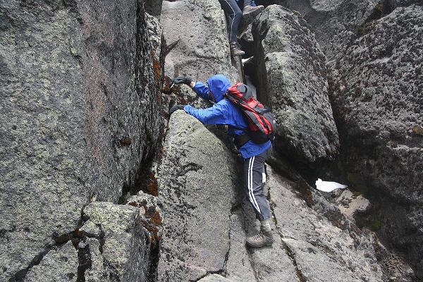
We agree to a 4 a.m. start, and everybody readies his pack with the usual stuff plus seat harness and even ice axe with crampons in case snow or ice greets us beneath the summit of this, our first goal requiring skills beyond hiking and rock scrambling.
| Thursday, December 11 - Cotacachi | Petter's Cotacachi report |

|
obert will not climb with us due to severe gastrointestinal upset. He lies in bed as Petter and I, with Diego, eat a continental breakfast in the motel restaurant. This is quite a setback since Cotacachi is one of our climbing goals - and an ultra prominence summit.
By now I am sick of eating nearly the same fare every morning - and yet, as the only calorie source, I am "stuck" in this mode without recourse. Perhaps this is better than my normal habit: at home, where I arise typically at 9 a.m. I don't eat anything at all until at least high noon.
|
|
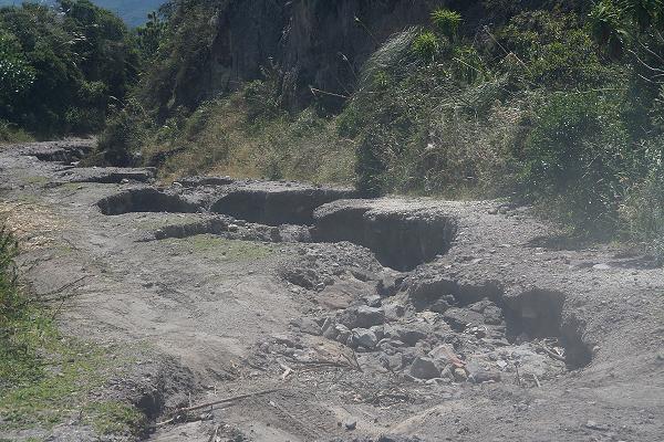
The Cotacachi approach road features terribly bad sections. |
The approach road is in very poor condition. Some sections are tolerable as they have been obviously graded recently. Other sections seem more like stream beds for flowing water than a route of passage. Diego does an admirable job negotiating the tougher sections, all-the-while playing music on Quito radio.
Eventually we near the mass of military antennae and communications facilities at some 4,000 meters elevation, visible from far below in the valley. We park at 4,030 meters (13,220 feet) and shoulder our packs at six a.m. The summit area is cloaked in cloud.
Even though clouds prevent a view, I know the sun is set to appear since, at the Equator, sunrise occurs the same time of day all year long. Given our longitude of roughly 79° W, as four degrees west of the 75th meridian (i.e. the center of our time zone), sunrise is always about 6:15 a.m. in Ecuador's "Avenue of the Volcanoes".
|
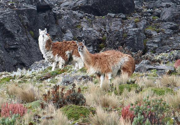
| Llamas at 15,000 feet. |
The first hour is a hike along this narrow path with lichens of this most gorgeous, brilliant green shade - we are in the paramo, a largely treeless zone that is akin to lush alpine tundra with tall grasses.
After a break we continue in a clockwise pattern on steeper terrain, the paramo behind us with only rocks and scree as company. I breath heavily - as usual, my partners have not accounted for steepness in setting the pace. Here the limiting factor is oxygen; and so a constant heart rate (as a surrogate measure of oxygen consumption rate) should be sought independent of slope angle. Sometimes, however that desire is not possible to realize.
A small herd of llamas are passed at around 15,000 feet elevation. Diego notes they are domesticated - somebody master can claim them.
We don helmets as the rockfall hazard increases. Passing a snowfield to the left, we scramble atop loose rock immediately underneath an obvious rockfall zone. Finally we reach a sheltered alcove at the base of a vertical rock wall. Snow lies beyond, and we emplace crampons for the first time in our journey.
My crampons slip off the leather boots - and this despite the fact that I tested them for a tight fit earlier in the trip. I am surprised - yet note that the toe bail has eroded significantly and irrevocably through months of boot use. We all agree that I should wait, HERE, as Petter and Diego continue.
What's HAPPENED is that I have worn these boots for over 18 months - including Indonesia (!) The estimated hiking distance is some 300 miles (480 kilometers) over that timespan. As noted, in that time the toe bail (for fitting the crampon) has eroded away through overuse .... and I never realized this because in that entire 18 months I never needed crampons - even in Montana last summer on several snow slopes.
Thus, and most sadly, had I encountered hard snow in Montana last summer I would have been able to continue with Diego and Petter, as then I would have realized that my leather boots need replacement. Furthermore, had we encountered soft snow at Cotacachi I could also have continued. It is the coincidence of hard Cotacachi snow and soft Montana snow that brought my "downfall" - ANY OTHER PERMUTATION would have seen me continue: {(hard, hard), (soft, hard), (soft, soft)}.
The remaining climbs are on snow in the cold - suggesting plastic mountaineering boots. My crampons fit them well upon adjustment of their length for the larger boot size.
Petter and Diego encounter loose, unconsolidated rock. Their efforts are hampered by these poor conditions; and, on his return to my location, Petter describes much of these hazards to my amusement. The summit is theirs - for all of ten minutes.
|
|
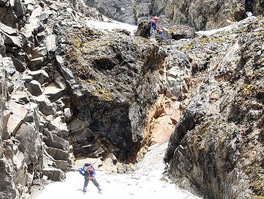
The saddle where Adam waits. Note the tall, angulated rock (mid-ground) and the foreground boulder used as a rappel anchor. |
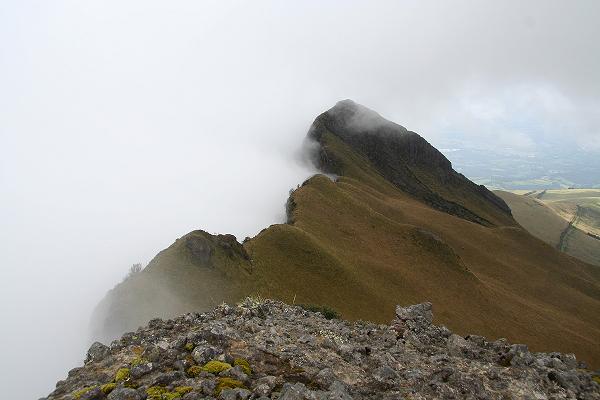
The elevation is 4,725 meters (15,500 feet), and, apart from a few brief moments, I am shaded the entire time. A prominent and most vertiginous subpeak taunts me across the saddle in my immediate vicinity - it is perhaps 50 meters higher and 150 meters distant. That subpeak was visible from our lodge as we awaited dinner the previous day.
I spend the 2 1/2 hours alternating between running in-place (to stay warm); eating my lunch (to the same end); and simply reclining on the muddy dirt/rock that forms my living space for the duration, with hands folded and legs bunched together to retain heat.
Far below I spot what appear to be red/orange brick structures along the general direction of our descent path. Given their size they must be 2,000 feet below me! Suddenly one of them moves - and I realize these are the llamas we passed a mere 500 feet below me.
Becoming bored, I explore the snow and peer around a corner. Just then Petter and Diego return mere meters away. Using a very secure boulder as rappel point, we descend a snowfield rather than scramble down the rock slope. A second rappel gets us onto level snow, and we continue unabated on the scree trail until back at the campsite area well into the paramo.
|
| Adam completes the final rappel. |
Petter and I race each other to the automobile, traveling the distance in what seems like hardly any time at all. It is silly!
We descend the egregious road, surmising that it could become completely impassible (by vehicle) with the next heavy rainstorm. It is possible that Diego and Petter are the last to climb Cotacachi for a long, long time.
Being only about 2 p.m. Diego decides there is plenty of time for returning to Quito and spending the night there. This shaves-off driving time the next day as we continue south to our next goal. We depart at 3, and stay at a nice hotel quite close to our favorite eatery.
Only Petter and I eat dinner at Mama Clorinda, Robert electing to clear his internal plumbing as he slowly recovers. I order the half-plate of cuy, and yet find that it is both tough and stringy - so contrasting with the delectable piece Robert gave me on our first visit. However the Ecuador liqueur cocktail remains wonderful.
Friday, December 12 - Drive to Tambopaxi Lodge
|
|
enjoy breakfast at our hotel because it is different. The staff member charged with breakfast preparation brings some set menu to Petter and myself - and I wave it off in disgust as something I never ordered. Instead, we select a la carte items from the general menu, satisfying us both. Robert is still sick and does not join us. After tea I enjoy this wonderful, cheesy omelet (a special request); while Petter has a sausage omelet actually on the menu. The dessert is best of all - marinated figs in an extremely sweet syrup and served with bland, white cheese ("higueras con queso").
|
|
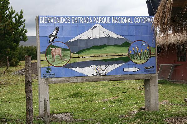
At the northern entrance to Cotopaxi National Park. |
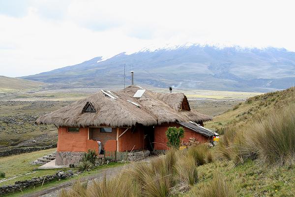
Diego arrives, I believe at nine a.m., and ultimately we enter Cotopaxi National Park from the north. Later, the mountain is shrouded in cloud as we check into Tambopaxi Lodge - at 3,760 meters (12,350 feet) an ideal place to acclimatize for the big, glaciated volcanoes.
I have a mild headache and lie in bed as Petter and Robert eat lunch downstairs. After one hour I improve, and repack gear for leaving much of it in a storage locker, taking only what is needed for the Cotopaxi climb.
|
|
Tambopaxi lodge near the base of Cotopaxi. |
It is a lazy afternoon as we read and talk. Robert enjoys the changing patterns of sunset; and, just around then, dinner is served at the normal hour of 6 p.m.
The menu has but one selection - a creamy vegetable soup for starters, and a pork cutlet entrée with rice and vegetables. Although I don't enjoy eating from a menu without choice (and fear for the price since it is not listed anywhere), there is, again, little option aside from going hungry or eating snack food. In compensation the soup is adorned with my parmesan cheese (from the well-recognized green shaker bottle); the pork and rice is flavored with ají (which Petter and Robert largely ignore); and my dessert is to-die-for delicious: two scoops of chocolate ice cream with a raspberry syrup - plus a granola bar from my food stash for textural contrast.
I luxuriate in a good, long sleep - at this, a decent altitude for acclimatizing. This is all well and good seeing as our next peak is fully one thousand meters higher than anything previously attempted on the trip - indeed, the biggest "jump" in elevation apart from flying into Quito itself.
Now Petter is not well, appearing to suffer from stomach and intestinal upset just as Robert's issue has improved. He visits the bathroom five times tonight. He feels weak and the prospects for his Cotopaxi bid seem poor.
Saturday, December 13 - Cotopaxi Refuge
|
|
e enjoy a full breakfast at Tambopaxi, and I am yet again wary of the final bill for our stay. One delicious combination is the granola topped with yogurt and sweetened with honey.
The Cotopaxi refuge is our goal. Driving there, you stop at a large parking area at 4,600 meters (15,100 feet); and then hike on one of two trails (gentle and winding or direct) to the refuge itself.
Petter and Robert carry a single pack. I carry two packs, one for the overnight stay and the other, smaller daypack for the summit climb. I planned this system, realizing that my daypack is too small for carrying sleeping bag, pot, food, and other items used at the refuge. Further, to carry just my overnight pack makes for seven pounds of useless, empty pack weight on the summit climb. No - the best compromise is to carry both packs a mere 200-or-so vertical meters so that I can use the lighter daypack for the fully 1,000 vertical meter summit climb.
Petter is amused, possibly even concerned, that my pack weight is nearly twice what he carries. I review the items taken, and conclude that I require everything. How could this be? Here are some answers, the totality of which explains the large discrepancy in our pack weights.
Petter and I choose the gentle, serpentine path; Robert and Diego the more direct route. I take roughly 45 minutes for the hut-bound hike, and learn shortly upon arrival the GPS-derived elevation of 4,880 meters (16,000 feet). I feel fine - yet the interior is cold enough for wearing light gloves and at least two layers: an estimated 10° C (50° F).
|
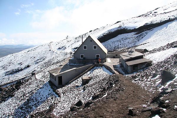
| Cotopaxi refuge |
The Cotopaxi refuge is a large structure with multiple floors. There are bunk-style beds, and storage bins to hide extra gear while on the mountain. The latrine is outdoors in a separate building.
The kitchen provides free, boiling, hot water - with hot chocolate, plus other beverages, for one dollar. You may cook atop any free stove. The hut fee is (I believe) $18 per person - which in my opinion seems like a lot given the overall quality of the experience.
Petter, still not well, took even longer than myself for the short ascent. That written, he recovers "miraculously" this coming afternoon, and into the evening, just in-time for making his Cotopaxi bid. I bring him hot chocolate in bed.
It is the weekend and a lot of climbing groups are here - nearly, in fact, filling all available beds. I carry a headphone to deaden the ambient noise, and this is most useful as one tries to sleep, or at least nap, both before and after supper in anticipation of a midnight awakening. I estimate somewhere between 50 and 75 people will climb tonight. Many are from Quito, including lots of teenagers. Many go outside by afternoon for practicing skills on the nearby snow.
My supper is vermicelli noodles with a parmesan cream sauce, and to which I add a can of tuna fish for protein. This is supplemented by hot chocolate (which I treat Robert and Petter to), and some dessert of tea with crackers. Unfortunately the noodles don't cook well, and the dish tastes like congealed mush. I force-feed myself to get over with it. Had it been tasty I would have prepared the second box of noodles. My hypothesis is that I failed to drain the starch-laden water from the pot - an operation that would surely have been performed at home 16,000 feet below.
I set my alarm for midnight.
|
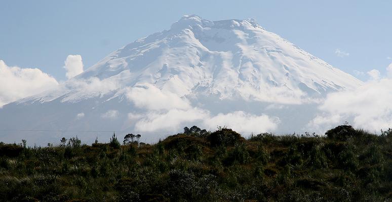
| Cotopaxi is glorious in her white dress. |
| Sunday, December 14 - Cotopaxi Climb and Hacienda | Petter's Cotopaxi report |
| Robert's Cotopaxi report |

|
earby climbers arise early and force my own preparations at just 11:35 p.m. It is ridiculous to even think that our state of awareness, and ability to make sound, rational judgements, is uneffected by this early hour.
Imagine, if you will, our "predicament" -
I apologize to those familiar with such a regimen - yet it runs contrary to every stitch of comfort, and perhaps sanity, that our species has sought since the dawn of time. Else, you would have (heaven forbid!) millions of people flock to the heights rather than sun themselves at a Mexican resort for their winter vacation.
Think about it. Nothing in this plan smacks of "normalcy" as most might define it. Transform one of the variables to a standard value and the effort is at-once both made easier and lessened (for a mountaineer) in many ways. But, nooooooo - we have to shun daylight, a decent and dry path, a standard oxygen supply, plus more ... and for what???
To wit, if one were to be deposited, summarily, atop Cotopaxi without acclimatization the period of useful consciousness would typically be fifteen minutes. Add the cold (for all but the hardened Norwegians among us), plus lack of sleep (yet coffee grounds in one's oatmeal does wonders), and you have the makings of a "perfect storm" guaranteed to generate misery for the uninitiated.
Rejoice in the comfort of your living room - one realization, after thousands of generations, of our species' effort to make life liveable. Yet we three religiously, if not altogether gladly, abandon this all for a moment of brief one-ness with Nature, and sense of accomplishment, atop yet another high altar of montane geology!
This description should give you some appreciation of what even a simple snow climb is like when all the variables are, to use financial market parlance, in "southern territory". Returning from this subroutine, I now continue with our story.
The twin packets of hot oatmeal are my only consolation at this ungodly hour - this time the "cinnamon roll" flavor; and with milk powder for creaminess and taste. The raisins and hazelnuts are for all three of us.
|
|
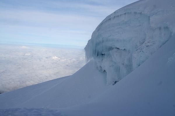
High on Cotopaxi the team admires equatorial ice. |
We depart at 1:05 a.m. after every other climbing party. Within 500 vertical feet the snow is thick and crusty enough for crampons. Here we break and rope-up because a glacier is our imminent venue with the potential for crevasse fall.
Many groups are slower, and the effort is made to pass them by breaking trail on one side or the other. I resent this since the pace is already too fast for myself, yet say nothing. In fact, I am breathing about as heavily as I can ever recall. I am making a lot of noise!
It is too late for changing the situation, and I consider two possible culprits. One is that Petter and Robert are known to be very fast hikers. This contention is demonstrated in that we are passing every other climbing party. Then again, I do not think we should have slept so low until now. We had little choice, though, since to have slept higher means foregoing good, restful nights and filling, restaurant-style meals: a trade-off.
|
| Diego (left) and Adam near the rounded summit. |
Another factor operates here - the smaller you are, the larger is the fraction of your body weight carried as clothing, climbing gear, and food. This results because clothing and food mass are correlated with body surface area instead of mass (which is proportional to volume). A small object loses heat faster, per unit mass, than a larger object - and thus requires more insulation (as clothing) and food. I am at a considerable disadvantage here as I only weigh 50 kg (110 pounds).
I seem to eat as much as my friends with the sole exception of not having beer at meals since I detest it. So I can blame a rather high metabolism (which demands more food) and small size for carrying more than others relative to my weight. It is hard for me to gain weight and retain it: I have to eat at least 4,000 Calories a day and yet do no exercise. As that is an unacceptably unhealthy lifestyle, I have largely given up trying to gain weight. Besides, both animal laboratory and human ethnographic studies have demonstrated that I will likely live longer by being chronically underweight.
|
|
Robert at the summit in morning's earliest light. Note the extremely long shadow of Cotopaxi itself. |
Taking this concept to an extreme, a small child would have one horrible time scaling a big mountain (i.e. one requiring climbing gear and much clothing) provided they were technically qualified in the first place. In particular, there is no such thing as climbing gear for smaller people (ice axe, carabiners, etc...).
In contrast, a very large man often has problems for the opposite reason - his bulk is large independent of "add-ons" such as clothing and gear.
I digress. Near the top our slope steepens, and there is a crux section along a narrow path perhaps only 100 meters below the rounded summit dome. Dawn has come, and with it, a better sense of depth since my field of vision is no longer limited to a cone of light.
The final steps, even though nearly level, are painfully slow from altitude and fatigue. Once on-top everybody rejoices except myself: I am exhausted with dizziness lurking in the background. I listlessly eat my sandwich as others take photographs and congratulate one another.
|
| Surreal ice formations high on Cotopaxi. |
Diego says that on using 100% of one's energy for the summit there is none left for getting down, an effort he describes as 50% of the total. He seems disappointed in my physical ability, and I must agree. However, as noted, had we slept higher, and had I been climbing with people of "average" speed this would not have been an issue. Period.
We descend in just two hours, arriving before any other group. An enormous headache envelops me, the most powerful ever. It is absolutely debilitating. I take two Motrin pills and begin repacking for the short downhill hike. For some reason I could not fathom, Diego wants to leave soon - and this even though it is only nine in the morning!
Later I learn Diego's plan of enjoying a big Sunday lunch with his family in Quito, so explaining his rush to depart the area. In Ecuador, as with all of Latin America, the mid-day meal is largest and most elaborate.
|
|
Another view of Cotopaxi's higher slopes. |
Somehow I carry my (twin) packs downhill, by the steeper route, and, as passenger and after descending just 2,000 feet from the refuge I feel relieved of headache. However a hacking cough begins, and does not abate for much of the day. It is still with me, albeit greatly reduced, even after returning to California.
We check into a country lodge, Cuello de Luna ("Neck of the Moon"), near the west entrance to Cotopaxi National Park and on the opposite, western side of the Pan American Highway. The elevation, 3,160 meters (10,350 feet), is roughly that of Leadville, Colorado - highest incorporated town in North America. However for our purposes I feel it is not high enough.
Lunch is from a somewhat limited menu. A mixed drink appeals to me - some combination of five or six liquors plus pineapple juice for a whopping $6. Petter and Robert order the "grande" - sized Pilsner beers, and we have a great conversation now that the first of our three main goals has been acheived. I enjoy a ham and cheese sandwich; yet forget (alcohol?) what Petter and Robert ate. What I do recall is that the wall menu lists nachos (see photograph in the next section); which as Petter notes would go great with their beer. However it is unavailable.
I sleep from about 3 p.m. to about 6:30 the next morning - a combination of one half-night lost and the alcohol promoting this record-duration rest. I wear a scarf found by Diego just lying on the paramo near Tambopaxi. I like it, yet cannot decide if the light brown is dirt or the natural color. However given the consistent shade of brown throughout I suspect the latter.
| Monday, December 15 - Rest Day and Loma Santa Cruz Chica | Petter's Loma Santa Cruz Chica report |
| Robert's Loma Santa Cruz Chica report |
|
|
|
|
Our lodging for two nights between Cotopaxi and Chimborazo. |
This is a rest day on the itinerary. However Petter and Robert are energetic enough to go hike a small hill just to our west. I nurse my chill and cold by lying in bed for half the morning. Later I am awakened by door knock - a German tourist wishes my wisdom about several climbing issues. We had met his group of three at breakfast, and they want to attempt Cotopaxi after just four or five days in Ecuador. I don't feel that's a sufficient acclimatization period. Nonetheless I am courteous in reply, even when he asks, naively indeed, whether bottled oxygen is available for Cotopaxi!
Petter and Robert have been gone four hours. I am concerned they have met some landowner and have been arrested for trespassing. Just as I ask a lodge staff member how to proceed, along they stroll into the area. They have hiked to the summit of a significant local hill (one that Petter estimates as having 200 meters of prominence) over an estimated 15 kilometers (9 miles) and 800 meters (2,650 feet) of elevation gain.
The peak's name remains a mystery until a visit to the national map agency in Quito. There we learn that Loma Santa Cruz Chica matches both the location and recorded summit elevation readings.
|
|
Enjoying lunch at Cuello de Luna. Note the wall menus (photo by Adam). |
They've had nothing to drink and it's getting to be one hot day. So we immediately head for lunch. The spaghetti is with either a mushroom sauce (Petter) or bolognese-style with meat (Robert, myself). I want to order a beverage, yet tomorrow we again return to high altitude - and I don't want even the slightest concern about ethanol when it comes to climbing.
|
|
Petter on a swing at Cuello de Luna (photo by Adam). |
Our room has a fireplace burning real wood. Petter prepares a fire; and I lie down next to it, my head closest to the flames, adding wood on Petter's recommendation. As kindling a Quito newspaper's sports section serves well - a most unexpected benefit of having "taken" it from the hotel eating area as incontrovertable proof that I was indeed in Ecuador: for you cannot buy a foreign newspaper in some curio shop!
Despite the warm air and scarf my cough persists.
Last night we missed eating dinner because it was falsely believed that the dining area closes at 7:30 p.m. and we slept through it. However tonight we indeed enjoy an evening meal. Unfortunately, again, there is only one entrée - and I flavor the beef with whatever spices I can muster to that end.
The sole computer is "down" - it would have occupied our time quite handily.
Tuesday, December 16 - Whymper Refuge at Chimborazo

|
The drive to Chimborazo consumes some three hours, and takes us through some beautiful, ever-rising countryside inhabited by native Indians with their ploughed fields. The mountain, although invisible in cloud, is clearly enormous by noting its horizontal extent below the cloud layer.
Above about 4,000 meters the grass turns to rock; and, at perhaps 4,300 meters (14,000 feet) we turn from pavement onto the side road leading to our goal. It is snowing lightly as we drive, ever-higher, to a parking area with refuge at over 4,800 meters (15,750 feet). Just 1 p.m., Diego wishes we retire within and eat some lunch while waiting for the snowfall to subside.
|
|
The Whymper Refuge is starting point for most Chimborazo ascents. |
I have some vegetable soup with pieces of bland queso blanco ("white cheese") floated within. Savory crackers are purchased, and in general I feel "good to go". We do this at 3 p.m. - and, 26 minutes later, I am at the well-known Whymper Refuge at 5,050 meters (16,550 feet). That is the highest I have ever slept in a permanent structure. Mr. Whymper was the first westerner to scale Chimborazo in 1880; and is infamous for the first (and fatal) ascent of the Matterhorn in 1865.
We eat dinner around 5:30 p.m, and, again, my noodles are bland and tasteless. The garlic salt helps, as does extra cheese, but, as with before Cotopaxi I am not inclined to cook and eat the second package.
Petter meets a group of Norwegian climbers, and a lively conversation ensues. One of them wears heavy mittens even inside the eating hall. I inquire, and learn that he, as with myself, gets unusually cold hands.
Not being on the weekend, there are fewer climbers than at Cotopaxi. Petter, Robert, and I have an entire room for ourselves; and I sleep fitfully from about 7 p.m. onwards.
At 9 p.m. a slight headache appears, and I am concerned that, upon arising at 9:45 p.m. (for an 11 p.m. departure), that my headache will soon be more serious still. Petter and Robert will leave an hour later, hopefully catching up with Diego and myself. This is the "main event" of our journey - and yet, somehow, I just don't "feel right".
|
|
Sunset between a pair of cloud layers as seen from the 16,550 foot Whymper Refuge. |
| Wednesday, December 17 - Chimborazo Summit "Day" | Petter's Chimborazo report |
| Robert's Chimborazo report |

|
n excruciating, heart-wrenching decision. On arising my headache worsens - one that is clearly altitude-induced. I walk up-and-down the stairwell to assess my sensations. HOW can I in good conscience consider climbing a really high mountain feeling like this? Such a concept runs counter to every tenet of high-altitude medicine. Yet, how can I simply give up climbing, or at least attempting this most important goal of our journey?
It is a horrible choice - yet choose I must. I go to the dining room where Diego has slept, describing my headache. He does not want me to go; and, with that, I suggest that he sleep another hour and go with Petter and Robert on a single rope.
|
|
The lower route proceeds through rocky terrain to the central skyline. |
Robert suggests that I at least start. Thinking this to be a reasonable concept, I offer the idea to Diego - and he thinks it to be a poor one. I am not going to countermand his wishes.
"Breakfast" consists of hot water with a Motrin tablet swimming atop as I watch the others eat hot oatmeal with raisins and hazelnuts. I fall asleep, or at least try to. I cannot from headache; and the entire night is spent in a half-conscious state as I listen to various climbing parties return, well before sunrise, presumably having failed to make the summit.
My headache suddenly disappears at 6:30 a.m. with the sunrise - too late for myself yet a sign that perhaps I had finally acclimatized to this altitude.
|
| First light while nearing the grand goal. |
Petter and Robert return with tales of great hardship along the final, long summit ridge from about 5,800 meters (19,000 feet) onwards. The snow conditions are horrible, an ice axe sinking down to the shaft and providing little or no support.
Breaking trail was Diego's responsibility, a most arduous task in soft, unconsolidated snow. Petter was second, and Robert last. They pushed into the lead, and, it is claimed, that no other party would have succeeded were it not for their efforts.
At the summit Petter meets some of the Norwegian party. Thus three Norwegians, an Englishman, and two local guides made the summit this morning .... among some 50 climbers who started from the refuge.
|
|
Diego (right) and Robert at the farthest point from Earth's center. |
I congratulate Petter and Robert for their hard-won prize, and yet inside I am unhappy that my own trip is now, by some measure, a failure. WHY is it that MY illness had to be so poorly timed?
I am presented the option of remaining behind, hiring a new guide (who? where? how much?) for my own Chimborazo attempt. I also consider the option of doing such AFTER Cayambe - so requiring backshifting my return flight as well as finding a new guide. All of this takes money, of course.
The various options are considered. I decide that the snow conditions will still likely be quite detestable the next morning. Cayambe currently has favorable crevasse conditions. In contrast, most seasons it is hard to climb on account of this issue. Given these two observations, I decide to remain with Petter and Robert for Cayambe; and return to Chimborazo at another time as part of a lengthier journey with Bolivia's Nevado Sajama (21,436 feet) as the main venue.
|
|
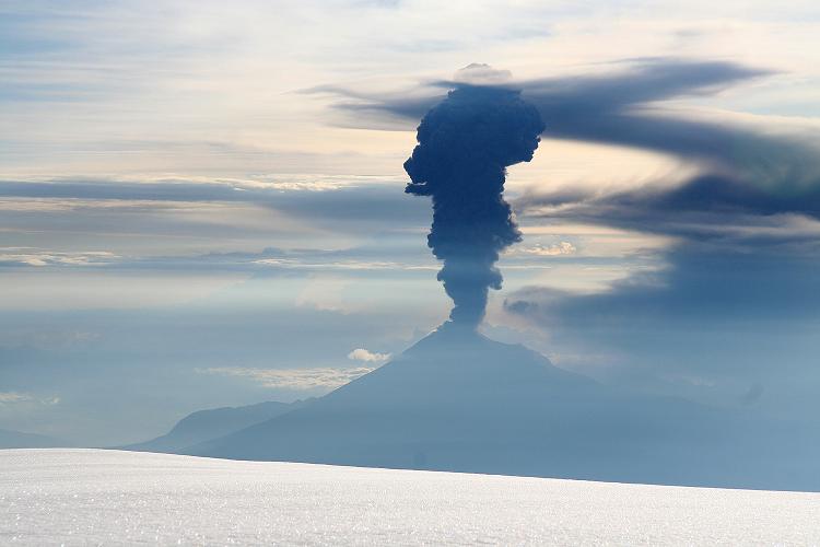
Tungurahua erupts to celebrate the successful ascent. |
Anyhow, we pack our gear and hike to the lower refuge. By mid-afternoon we are in Quito, having secured reservations for the night at Casa Helbling. With the heavy exercise done by 9 a.m., today is considered a "rest day" insofar as the itinerary. That leaves us two possible summit days for Nevado Cayambe rather than one: both Friday and Saturday morning. It would appear that the dream of securing all our summit climbs is within reach!
This evening we eat, somewhat expectedly, at Mama Clorinda. I enjoy a gigantic, plate-sized shrimp omelet for a change-of-pace; and the Ecuador liqueur cocktail yet again is my appetizer. I treat Petter and Robert, as they have earned the privilege - and this even though I frankly cannot afford to be so free with my funds. However, Chimborazo is worth it - especially under such offensive snow conditions.
We meet the three Americans from New England at the hostel, learning that they climbed Cotopaxi yet failed at Chimborazo. Mushy snow was a factor. The man who had cramponed for but the second time (in their words) "freaked out" high on a ridge. Hence the following morning did see poor conditions - and I feel partially vindicated in my decision to simply continue with Cayambe as per the intended itinerary.
Thursday, December 18 - Lazy Morning and Cayambe Refuge
|
|
Breakfast, although again boring, enjoys some comic relief as somehow Petter gets three glasses of fruit juice with his food.
This morning we walk to the IGM (Instituto Geografico Militar) with the chief aim of learning about that summit Petter and Robert hiked to after Cotopaxi. The experience is far more revealing.
Mapping in Latin nations appears to be run by the military. This is my personal observation in Bolivia (IGM), Mexico (INEGI), and now Ecuador. As expected, one of us surrenders his passport at a military check point; so providing ingress to the building complex. I shall not forget to retrieve it!!
We enter a large, indoor public space with impressive dioramas and several counters atop of which gigantic books of topographic charts lay open for review. One of the displays has a map, with scientific description, portraying the evacuation zone for Tungurahua - an active, 5,000+ meter volcano that we saw enroute to Chimborazo. Even though it is Spanish, I am impressed with the map's technical details and point it out to Robert at the odd moment.
A most helpful man assists in locating the relevant topographic maps; and we learn that Loma Santa Cruz Chica boasts 199 meters of prominence - remarkably near Petter's original 200 meter estimate.
A 250,000:1 chart of the region extending from Quito to well south of Cotopaxi portrays the majority of peaks we climbed. It is pleasing enough that we purchase one for each of us at $3.50 apiece. Then, by coincidence, we are given a copy of the Tungurahua geological map. As only I understand the Spanish text it's clear who takes it home.
|
|
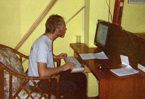
Robert uses the computer at Casa Helbling (photo by Adam). |
Now comes the interesting part. I (and hence we) learn that the 13 meter offset observed arises because of a difference in the vertical datum assumed on the reference maps and inside the GPS units. Map legends indicate that the South American 1956 datum is employed for assigning latitude and longitude. The vertical datum is sea level along the Ecuador coast - and clearly differs from the WGS84 plus geoid deviation model presumably applied by our GPS units.
I explain that for all summits except Chimborazo our GPS readings are higher than the map elevations by a consistent 13 to 15 meters. For Chimborazo the "official" elevation is 6,310 meters - and yet our units read 6,280 meters on the summit snowfield. Subtraction of 13 meters yields 6,267 meters in agreement with previous, accurate (and precise) GPS measurements made several years ago by other concerned climbers.
I ask the assistant for an explanation - and he brings a manager, clad in jacket and tie, from the back office. The manager claims that our GPS units have an accuracy of only ± 50 meters, so voiding the validity of our Chimborazo summit elevation readings. I protest that for six other peaks our readings are consistently in a tight range of exactly 13-15 meters higher than the printed values - so confirming an accuracy of ± 2 meters. Further, I claim to big boss, what is the probability that, of all peaks, that only the Chimborazo readings are miraculously inaccurate to such an extent as he claims them to be?
Mind you, this argumentation is entirely in Spanish. The manager does not back down in his claim that our GPS units are grossly in error.
|
|
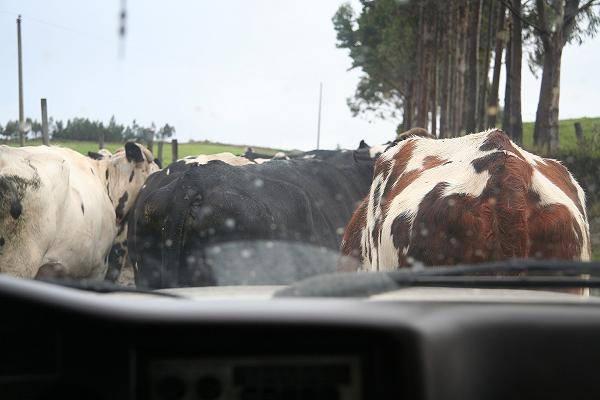
Cows block the road leading to our mountain refuge. |
Based on the weight of evidence, Petter, Robert, and I conclude that "6,310 meters" is an official lie maintained by the mapping agency; and thus by extension of the entire Ecuador government. This is odd since in-between the true elevation of some 6,267 meters, and 6,310 meters, lies no national highpoint elevation that Ecuador's highest peak could surpass through such a misrepresentation of reality.
Venezuela's Pico Bolivar is also a national highpoint. It is commonly noted as 5,007 meters even though recent, satellite-based measurements indicate 4,980 meters. In this case the high-water mark of 5,000 meters provides incentive for an official lie. In contrast, is "6,300 meters" considered a landmark elevation? Here, do recall, that the metric system is used - equivalent, English unit elevations are not relevant to Latin American nations, be it to their climbers or to their mapping agencies.
Purchased maps in-hand, we briefly visit an astronomical museum with planetarium, at the IGM building complex, prior to passport retrieval.
Petter wants lunch. We try a new place, and enjoy bowls of fresh ceviche as prepared along the coast. Ecuador and Peru are famous for this seafood stew, one "cooked" in the acid of its lime juice and served cold with cilantro and innumerable other spices. Banana chips provide carbohydate and textural contrast. Petter and Robert enjoy Pilsner beer, as always; and I have a guayaba fruit smoothie. It is great to have a "change of pace" and eat something beyond meat with rice (as at dinner) or bread with jam (as at breakfast).
|
|
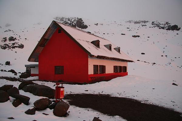
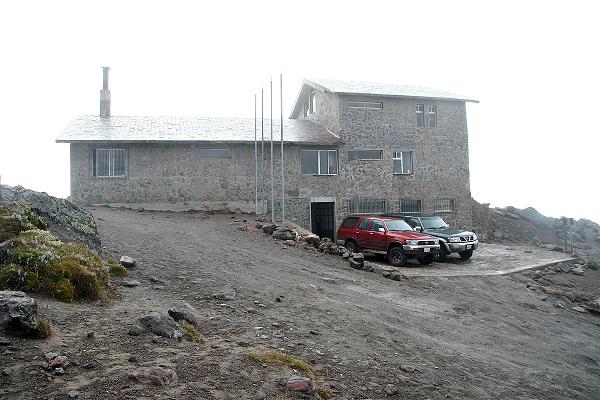
Brick construction distinguishes the Cayambe Refuge from sister structures on the other glaciated volcanoes. |
Diego arrives at 3 p.m. and we drive to the Cayambe refuge. By 4:30 p.m. we leave the paved road grid, and begin a protracted and bumpy 30 kilometer (19 mile) drive. It starts poorly enough with a short section where the road is under repair. It is extremely muddy, and all available traction is brought to bear as we cautiously reach the far side. We wish an alternative return route; and yet learn from locals that there is no other option.
A hilarious episode ensues, at roughly 3,500 meters, where a herd of cows stand astride the road and will not budge. I have never seen such recalcitrance from cows. Finally Robert gets out and slaps the offending animals to set them into action - while everybody laughs aloud inside.
We pass into the cloud layer as the sun arcs ever lower. Finally at 4,600 meters (15,250 feet) we park near the refuge - at roughly 6 p.m. It is warmer inside than the refuges at Cotopaxi and Chimborazo; and I surmise that its brick construction may be responsible.
The routine is now standard practice - find a bunk bed and organize climbing gear, plus clothing, for our little morning stroll to the summit.
We eat shortly afer arrival, and, again, my pasta with added canned tuna fish is too mushy and flavorless for words. (Darned - where is my tastier, canned salmon?) It's Monday, January 5 (two weeks later). Tonight or tomorrow I'll cook the same dish here at home, all of 160 feet above the sea, and make it a most delicious meal just to enjoy what I simply could not in the hustle-and-bustle of preparing for a peak climb.
I feel just fine, despite the altitude; and set the alarm for 11:45 p.m. I put on more clothing than others, and fasten my climbing harness right afterwards (rather than during the climb). These chores suggest an additional fifteen minutes relative to when others arise at midnight.
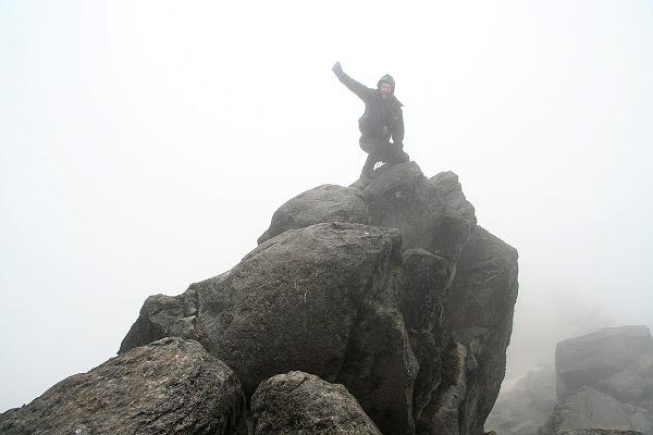
| Friday, December 19 - Nevado Cayambe | Petter's Cayambe report |
| Robert's Cayambe report |
|
|
he pint+ of oatmeal with maple/brown sugar flavor and milk powder is most welcome - again, the only thing I actually want to do at this unfortunate hour.
We start at one o'clock as planned. The first 500 vertical feet is on rock along a rudimentary path. I am overheating from too many layers, the hot food, and unusually warm conditions. My glasses fog and nobody is waiting for me to resolve this. Instead, I am told by Diego to continue without wearing them.
|
|
Is this view high on Cayambe worth the effort? |
Huh? Does he realize how blind I am without glasses? Of course not. I try this tactic, stashing them inside a jacket pocket. I follow behind the lead person, Diego, closely enough to see where his feet are placed. It's really a bit dangerous because I can barely see where my boots should go on this mixed terrain. Furthermore, my vision is also limited by my headlamp's cone of light. This nightmarish affair continues until we reach the glacier's toe, breaking for rope, ice axe and crampons.
It is a relatively simple glacier climb that is rendered trickier through darkness and more arduous with altitude. I suspect that Diego, and the others, are going slower for my sake than they otherwise might. However the difference in our desired, "comfortable" paces is never made complete - and so I am, as with Cotopaxi, nearly out of breath the entire time. Much later Robert notes that he would not have wanted to go faster.
It is a repeat affair, with my only thought that of "four hours more" - then "three hours more" - and then "only two more hours". It is really really hard to maintain what must be over 80% of your maximum heart rate for such an extended period.
|
|
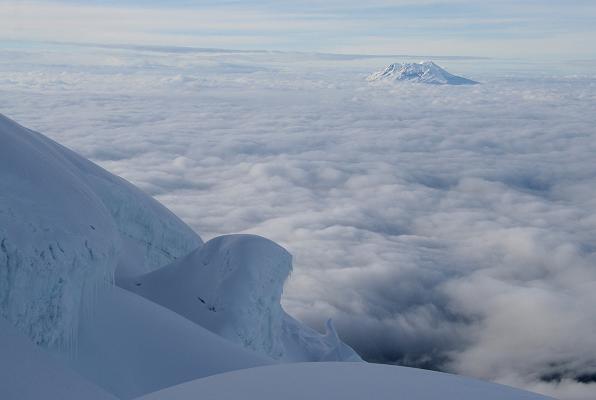
How about THIS view of a snow landscape with distant Antisana poking above the clouds? |
Every hour we have a break. First I plunge ice axe into the snow, set my pack resting on its upslope side (so it won't roll downhill), and then spend a full minute gasping to catch my breath while slumped over the combination. Meanwhile the others talk, joke, and ask me "what's wrong?".
By the time I drink some water it is already time to go - and a granola bar is eaten in three enormous bites that leave my mouth stuffed because it is simply too dry for swallowing it way up here.
As you can imagine I did not enjoy being so unbelievably aerobically challenged for a solid four hours - right from the glacier's toe to the very summit.
However the summit views are grand even as I begin to shiver from the cold and wind. And Petter does not even wear gloves while taking photos! I really am not of the right body type for this....
|
|
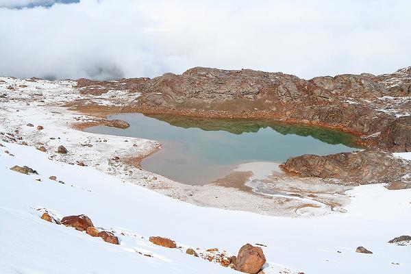
A pond hints at milder conditions at the end of our snow descent. Note the green color typical of glacial meltwater. |
Our descent is quite rapid. The day warms so fast that, even as we head down the glacier, first at 18 and then at 17,000 feet, I am beginning to "bake" in my multiple clothing layers! I cannot wait until we stop as a "clothing break". We continue, unabated, roped, and quickly mind you, all-the-while enjoying horizon-to-horizon views of distant peaks done and imagined.
Inexplicably we continue five minutes beyond the glacier's base before resting. I remove superfluous layers and we set out - only to be sideswiped by some breathtaking views of Cayambe before the clouds settle-in for the day.
We drive to Quito, our trip basically over apart from some good meals, some shopping, and, most importantly, getting home.
|
|
Cayambe rewards us with this spectacular view near the end of our descent. |
For an early dinner we attend an Argentine steakhouse, beginning the repast with steaming soup bowls. I order the classic French onion variety, with croutons and melted cheese atop a bowl of brown nearly too hot for consumption.
My cut of filet mignon in a Spanish mushroom sauce is just nine dollars. I had asked the waiter for his recommendation - and yet I could not resist enjoying what in the states would cost at least thirty dollars. I claim it is the tastiest, juiciest, most perfectly cooked cut of meat in memory.
Petter and Robert have tenderloin steak - and they are enormous. Eating a pound of butter would be no less healthy in terms of calories and cholesterol. To go with our meals Petter orders a bottle of appropriate red wine.
I request the acclaimed, Argentine chimchurri sauce - with crushed garlic, spices, and virgin olive oil. It is wonderful atop my mashed potatoes - and, frankly, the meat is so perfectly cooked, and adorned with sauce, that the chimchurri is superfluous.
I am keenly aware of people walking down the sidewalk and seeing us, examining our sumptuous food, as we sit sunken three or four feet below street level. It is thus with a sense of guilt that I eat, as I know they cannot afford such a meal except but rarely. Further, many passers-by are young people that tend to be appallingly skinny. Indeed, I did not see one truly fat person the entire time in Ecuador - except, of course, for the occasional foreign tourist.
I try to avoid this distraction, simultaneously enjoying food and company; all-the-while tasked with my Spanish for the odd utensil, extra drink, and, ultimately, the food bill.
Saturday, December 20 - Free Day!

|
I discover a new item on the hostel's breakfast menu. The heaping-high plate of mixed fruit is covered in yogurt; and both Robert and I order it instead of the usual fare.
|
| Diego Zurita at Cayambe. |
Anyhow, by late morning we walk to a textile store where Petter buys three bolts of cloth, with Ecuador-style motifs, for his wife to fashion into as many dresses. My Spanish comes handy - although I suspect that Petter could "get along" if needed in many circumstances had I been unavailable.
It is mid-day. What to do? Lunch, of course. Ambling down Avenida Reina Victoria, known for its eateries (at least by us), I request that we briefly visit a gourmet grocery store specializing in foreign comestibles. The assortment of cheeses and sausages for sale is broad and varied.
We notice that a menu is offered with prepared sandwiches, beverages, and a dessert case of assorted speciality cheesecakes plus lighter items. I assent to staying here for our meal upon verifying that I can have a sandwich prepared, special, using whatever ingredients I please.
|
|
Robert after unroping from Cayambe's descent. |
I choose a delectable Italian sausage and Spanish manchego - a tangy, hard, sheep milk cheese that is to Spain what cheddar is to the United States. (In my opinion the manchego is superior in every respect.) The bread is a rustic, crusty loaf; and I specify toppings of lettuce and oil-cured tomatoes. Robert and I share these down-the-middle as a pair of sandwiches while Petter enjoys the prepared sandwhich. Beer for both - not I.
For dessert Petter has a fruit salad while Robert and I split a slice of decadent raspberry cheesecake. I order a chilled mocha cappuccino but there is no ice for preparing it. A hot chocolate spiked with coffee is enjoyed instead.
|
|
Adam after removing layers at the toe of Cayambe's glacier. |
We retire to the hostel and basically do little much other than surf the Internet. On the computer, Petter shows me his "doctoral ancestry" clear back to the likes of Carl Gauss and Leibniz. Evidently one's thesis advisor is considered a "parent" - and he (or she) also had an advisor. This lineage proceeds backward in time for hundreds of years ... until the epoch when "science" (i.e. apart from philosophy) was a new concept. I am highly amused - and ponder what my own doctoral ancestry could look like. With my degree in physical chemistry rather than mathematics it would be quite different - yet could be structurally similar in many ways.
Our final dinner together is at Mama Clorinda - our fourth time there. After my Ecuador liqueur cocktail my main dish is seco de chivo - goat meat - and served (my request) with llapingachos instead of rice and potato. Petter treats us, including the red wine. A harpist plays to assorted patrons, and I uncharacteristically reward him.
Petter and Robert leave early next morning and have already packed in that idiotic fashion required by airline regulations - you know, with no liquid (or empty containers), forks, or knives in carry-on luggage. It is crazy since car keys are allowed - and these are easily used as hand weapons much as a fork might. Why not ban everything yellow from the flight? After all, that makes about as much sense as banning all liquids!
So with not much of anything to do I fall asleep only an hour after dinner.
Sunday, December 21 - Flights Home
|
|
arise early to see Petter and Robert out the door - and then crawl into bed for another hour.
This is going to be a long, thankless travel day; one that I really don't "want to" do at all. It begins anew with a breakfast of three coffee cups and a large marshmallow chocolate cookie. This is followed by careful and methodical packing for what must have been nearly two hours.
My flight is at 4:11 p.m. and my taxi ride is set for 1:45 p.m. - well after check-out time. So around 11:30 a.m. I transfer my load downstairs to lie near the computer; have some leftovers for lunch heated in the microwave oven; and impatiently await my ride.
The flight to Panama City is uneventful. While waiting there I learn that one person is needed to sacrifice his seat as COPA has overbooked. You stay overnight in Panama City, take the next evening's flight to Los Angeles, and get a voucher good for $400 on a future COPA flight in the next twelve months.
This interests me enough to inquire further. Could I get a discount by simply staying at a less-than-shining hotel? No. Could I simply sleep in the airport terminal so as to avoid going through security? Stares of disbelief. Could the voucher be applied to a flight beyond the twelve month limit? Likely.
When would I have a need for COPA again? Noting a future Bolivia trip, they fly to Santa Cruz, Bolivia - yet not to La Paz. As Santa Cruz is only 500 feet above sea level, my plan for staying high and thus acclimatized, traveling from Bolivia to Ecuador, would be ruined. I lose interest in taking the offer.
The flight to Los Angeles is alongside a retired, unmarried gentleman who enjoys working crossword puzzles. We do some of them together and have a nice conversation - even trading favorite foods when our meals arrive.
We land around midnight; and I sleep in the truck's camper shell around 2:30 a.m. Here, I consider myself too dangerously tired for driving home to San Diego. Instead, I wait until Los Angeles rush hour has largely subsided the next morning, so beginning the drive at 9:30.
|
|
ur journey is generally successful, having realized all the original goals and then some when considered as a group. Of course I failed to climb Chimborazo - and this will haunt me until I make good on some future trip.
Everybody contributed to this outcome as a team effort. Diego Zurita's competent vehicle and his local knowledge was essential.
Petter secured the 2nd, 4th, and 6th highest peaks on his list of successful ascents. I got the 3rd and 5th highest; and, having never been higher previously, Robert earned numbers 1 through 5. I find this even - odd - all numbers result amusing.
There was not one time when my Spanish was instrumental to success. That written, it was most handy on many occasions from restaurants to shops, taxi rides - even with one intractable map agency manager.
I remain amazed at Petter's excellent oximeter readings and concomitant aerobic performance. He could have led the various snow climbs - but, again, Diego's route knowledge was certainly noteworthy and appreciated.
Robert performed very well at the high altitudes he had never previously encountered. Motivated by these successes, he is considering a combination trip to Aconcagua and Ojos del Salado. Regardless, Robert - you are now an official andinista - the regional term signifying "alpinist" (of the Andean cordillera).
I did not perform satisfactorily at Cayambe and Cotopaxi even though I did summit both. The reasons (excuses?) for this are described above. As I train for Denali next June the implied exercise routine, which is quite rigorous, should go far to address this issue.
My door-to-door trip cost was $1,850. This includes $485 airfare from Los Angeles; roughly $100 in gasoline and parking fees in driving from San Diego to Los Angeles; the $750 fee to Compania de Guias de Montaña; and perhaps $500 in food and lodging.
This total cost compares favorably with hiring an American-based guide company. With them, the ground costs alone (i.e. without airfare) amount to well over $3,000 - and without any choice of which mountains to climb. We could have made the trip a very low budget affair by taking public buses everywhere. However Diego Zurita's local knowledge was essential to locate both lodging and the preferred means of accessing each trailhead. Using public transportation with all of our gear presents a major security issue.
I thank Petter and Robert for allowing me free choice of where to eat on every occasion when a choice was possible. More broadly, I thank them for a memorable journey.
|
|
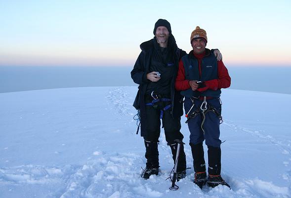
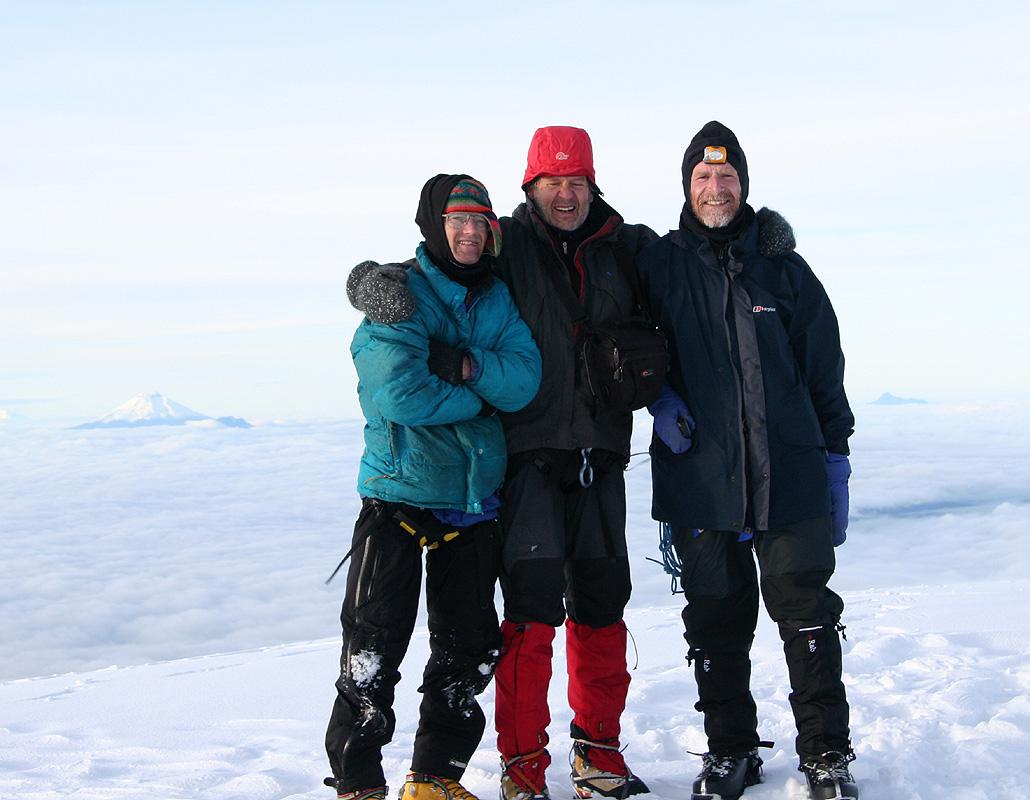
Atop Cayambe with Petter at center, Adam with Cotopaxi off his right side, and Robert at right. |