Liebre Mountain Survey and Reyes Peak Trip Report

Liebre Mountain (5,783 ft) and Reyes Peak (7,517 ft)

Dates: June 16 to June 18, 2006
Participants: Richard Carey, Edward Earl, Gail Hanna, and Adam Helman
Author: Adam Helman

Note: All NAD27 UTM coordinates are in zone 11S.

The chief goals of this trip were to assess whether Liebre Mountain is higher than nearby Burnt Peak; and to climb Reyes Peak. Either Burnt Peak or Liebre Mountain belongs on the California 2,000+ foot prominence list - and an accurate survey of both summits is required to this end.

The elevation of Burnt Peak was determined on a previous trip by Edward Earl and myself, using a hose-level of Edward's design. We learned that the highest point is five feet higher than the summit benchmark (5,788 feet), making for a 5,793 foot summit elevation.

In addition, Bear Mountain was scouted for a future attempt - one that is best performed after additional examination of satellite photographs and in the cooler months.

Burnt Peak Survey

On Saturday morning we assembled at Liebre Mountain, Edward and myself having driven from San Diego the previous evening. Richard Carey owns an accurate leveling instrument and an appropriate sturdy tripod. After an hour of calibration measurments the survey commenced. Details of the survey are provided in this Microsoft Excel spreadsheet available for downloading.

Liebre Mountain supports three summits - eastern, middle, and western. Located near a dirt road, all summits are easily accessible, and lie within a circle of 3/4 mile diameter. Unfortunately heavy brush and trees prevent the summits from being directly visible from each other. The survey thus proceeded in stepwise fashion, with the survey path taking the road from closely separated points that are directly visible. "Tedious" is the word.

After a short lunch break at the middle summit area we sighted the road about one-third mile west and quite near the western summit. Using handheld radios, Richard and I drove to that point while Edward reported when he could see us through the surveying scope. By this means hours of tedious, stepwise surveying was avoided by use of a single, long sighting. In order for Edward to see the surveying rod through brush in the sight path, I swayed the surveying rod back-and-forth while Richard relayed Edward's instructions on how to allow for the rod's visibility. Ultimately the measurement was made, and we met at the survey rod in preparation for the final measurements at the western summit area.

The western summit includes an eastern and western sub-summit. Both were surveyed as it was initially uncertain which was the higher. The detailed measurements indicate the western sub-summit to be higher - and, indeed, it is the highest summit on Liebre Mountain.

Measurement readings were scrawled into a notepad as they were made. We did the math and ascertained that the western summit is higher than Burnt Peak. We left a new register at the western summit, duly noting that Liebre Mountain is the higher.

However upon re-examination of the data back in San Diego an error was found in the calculations. The corrected results, as seen in the spreadsheet, indicate that Burnt Peak is the higher summit.

It would be well for a future hiker to correct our summit register's statements, properly indicating that nearby Burnt Peak is higher (5,793 feet) and hence belongs on the California 2,000+ foot prominence list. Liebre Mountain is a three to four hour drive from San Diego, and I for one (nor any reasonable person) have no desire at today's gasoline prices to make the summit register correction myself.

UTM coordinates of the various summits on Liebre Mountain are provided here so future hikers may easily locate the mountain's highpoint. Pursuers of the HPS Hundred Peaks List should note that the eastern summit, with HPS register, is definitely not the highpoint of Liebre Mountain.

Easting, Northing, elevation (feet) Topographic chart Description
**************************** *************** **********
(348610 E, 3842219 N, 5774) click here eastern summit (300 feet north of road - DPS "summit" register)
(348173 E, 3842554 N, 5772) click here middle summit (immediately south of road)
(347640 E, 3842671 N, 5783) click here western summit (eastern sub-summit 500 feet east)

Bear Mountain

Edward and I did a reconnaisance of Bear Mountain for a future effort. This scouting consumed much of the afternoon, and we arrived in camp for Reyes Peak no sooner than 9 p.m. Gail and Richard were already asleep or preparing to do so.

Reyes Peak

On Sunday morning all four of us hiked to the summit of Reyes Peak near Ventura County - another mountain on the California 2,000+ foot prominence list. The summit benchmark indicates 7,514 feet but is three feet below the highest boulder's top. Hence we quote an elevation of 7,517 feet for this mountain.

We split a small watermelon into four quadrants and enjoyed the views of various coastal mountains to the south and west.

Richard Carey will eventually provide photographs of both the surveying effort and of our summit break atop Reyes Peak.

Edward and I drove home, with gingersnap cookies and a quart of milk providing ample refreshment as we departed Ojai on Route 33 bound for San Diego.

On the drive home we determined that taking Interstate 5 north from its bifurcation with Interstate 405 just south of Irvine is 5-6 miles shorter for getting to the junction of the Ventury Freeway (Route 101) and Interstate 405 in Encino at the southern end of the San Fernando Valley. Road maps would have one guess that taking the '405 is shorter ... but evidently this is not the case.

Richard and Gail continue north on an extended peakbagging trip through northern California.
watermelon
Gail Hanna and Adam cut the juicy, little watermelon
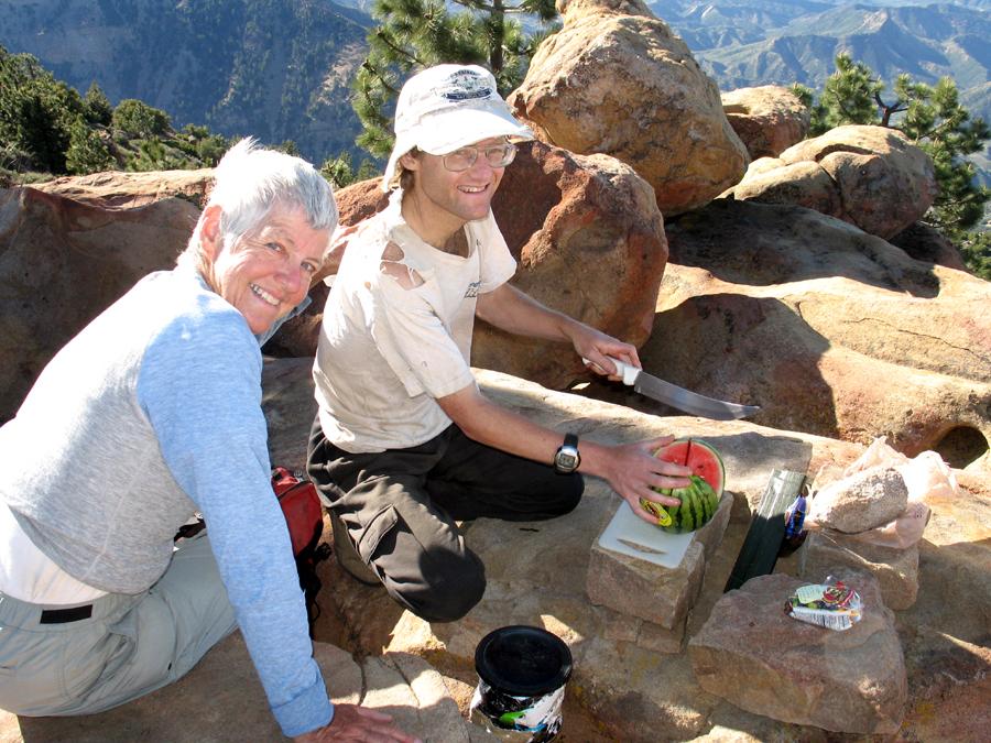
atop Reyes Peak. Refreshing!
Richard Carey photograph (click for enlargement).