
|
|
ob Packard proposed two climbing-oriented trips to northern Mexico, and asked me to select which would be realized now - the other itinerary reserved for another winter season. Our efforts are driven by the following considerations.
|
|
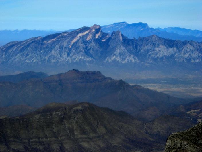
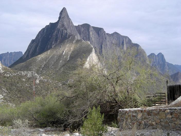
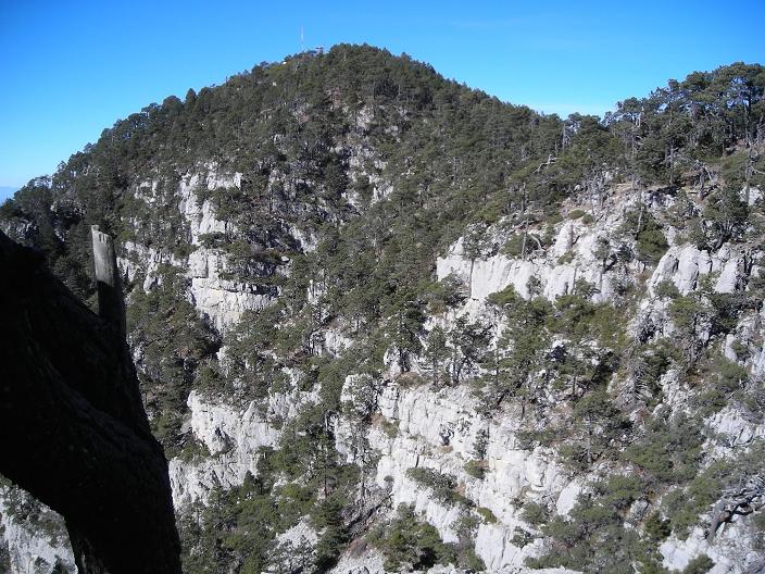
Picachos el Fraile ("F") and Tia Chena ("T"). Both are ultra prominence summits. |
We pursue mountains on objective peak lists, with two measures of principal interest - summit elevation and topographic prominence. The former measure places Mexican state highpoints on the itinerary. The latter measure, unfamiliar to many, has a rigorous technical definition. For lay purposes, however, think of prominence as the mountain's vertical relief: a measure of it's "presence" on the land. We seek mountains that have at least 1,500 meters (4,921 feet) of prominence - the "ultra" summits - and Mexico has 26 of them. In the United States a cutoff value is 5,000 feet is used (1,524 meters).
This list-oriented emphasis has many proponents in the climbing arena. However such a philosophy, and mindset, runs counter to the desires and goals of most climbers who simply choose mountains for the rigor and technical challenges of specific routes to the summit. In effect, for us the chief goal is overwhelmingly the summit - and, as such, the "simplest" route to it is sought as the means of maximizing success probability.
This includes seizing any opportunity to drive-up the mountain. Although this option would not appeal to most climbers, please note that we are willing to accept the rigors and challenges posed by any mountain on our fully objective peak lists - regardless of what is required to reach the very top. Often this entails major physical effort since prominent peaks generally have a large elevation gain on-foot due to their imposing stature. Our journeys thus include a combination of sizeable efforts, simple hikes, and, on occasion, even a drive-up.
For this journey five mountains form the "core" itinerary.
| Summit (state) | Prominence meters (feet) | Elevation meters (feet) | Comments |
| Picachos el Fraile (Nuevo Leon) | 1,600 ± 20 (5,249 ± 66) | 2,390± 10 (7,841 ± 33) | ultra prominence |
| Cerro Tia Chena (Nuevo Leon) | 1,885 ± 15 (6,184 ± 49) | 2,630± 10 (8,629 ± 33) | most prominent in Nuevo Leon - an ultra summit |
| Cerro el Potosi (Nuevo Leon) | 1,876 ± 12 (6,155 ± 39) | 3,721± 7 (12,209 ± 23) | Nuevo Leon state highpoint and ultra summit1 |
| Cerro San Rafael (Coahuila) | 1,405 ± 13 (4,610 ± 43)2 | 3,715± 3 (12,188 ± 10) | possible Coahuila state highpoint1 |
| Sierra la Martha highpoint (Coahuila3) | 1,005 ± 13 (3,297 ± 43)2 | 3,715± 3 (12,188 ± 10) | possible Coahuila state highpoint1 |
We add two mountains with additional time owing to fair weather.
| Summit (state) | Prominence meters (feet) | Elevation meters (feet) | Comments |
| Sierra la Madera highpoint (Coahuila) | 1,895 ± 5 (6,217 ± 16) | 3,020 (9,908) | most prominent in Coahuila - an ultra summit |
| Sierra El Borrado (Tamaulipas) | 320 ± 20 (1,050 ± 66) | 3,430± 10 (11,253 ± 33) | Tamaulipas state highpoint |
An eighth mountain, the Sierra las Mitras highpoint in Monterrey, is planned.
The effort is cancelled due to rain. I would far rather climb it under fair skies
on a future journey.
Bob provides the transportation as his 3/4 ton pickup truck with over-the-cab camper; and drives it to Laredo, Texas immediately after a holiday family reunion in Las Vegas, New Mexico. I fly to Laredo where he retrieves me, and we sleep in the Walmart parking lot as the clock strikes midnight on New Year's Eve.
I provide the Spanish language expertise and largely plan the journey with the assistance of several Mexican acquaintances on the Internet - some of whom would eventually become our friends.
Note: All GPS-derived coordinates, be they latitude and longitude or UTM grid, use the NAD27 datum.
|
|
|
|
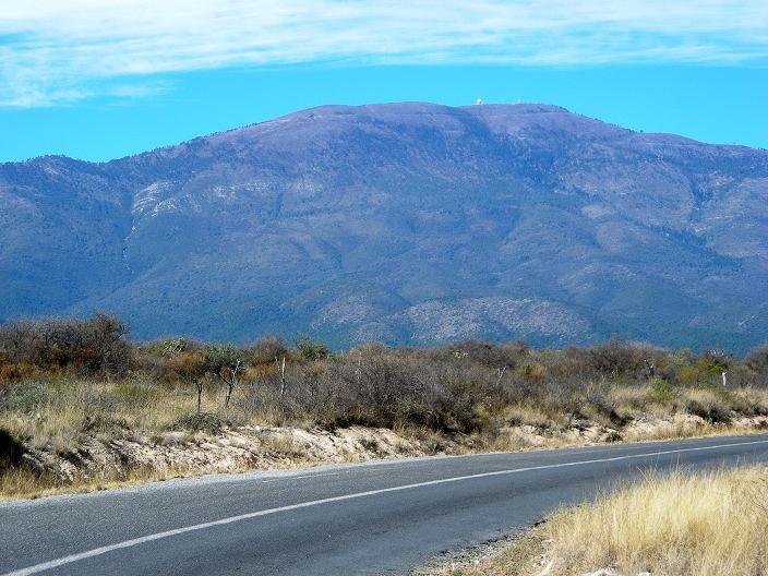
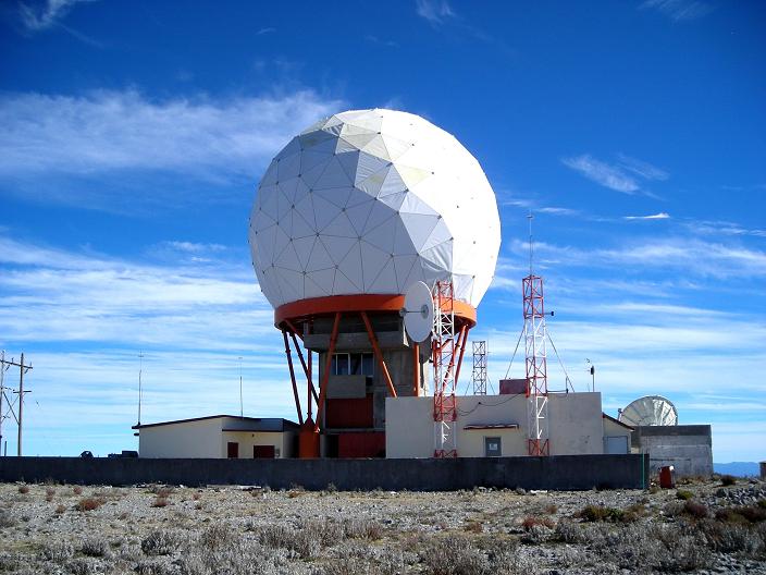
Cerro el Potosi from the east. Note the summit radome. |
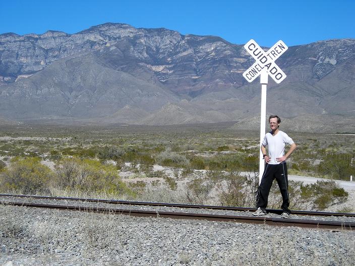
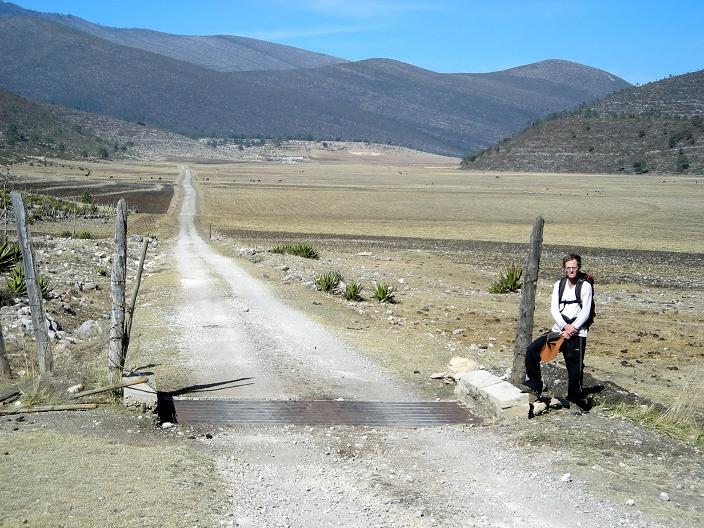
Sierra la Madera highpoint from the south. Adam at rail crossing. |
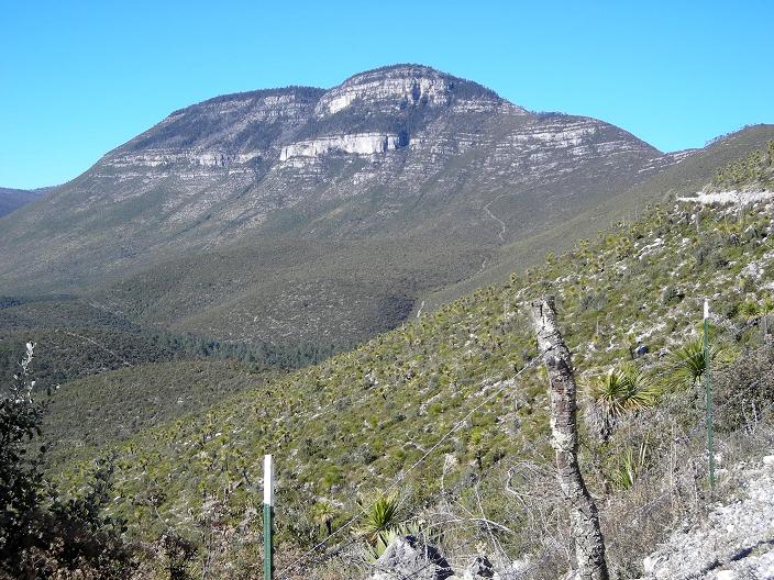
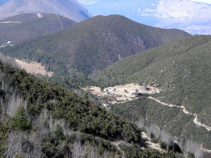
View north to Sierra el Borrado. Hike the southeast ridge above saddle "S". |
|
|
ob and I enter Mexico at Nuevo Laredo, acquiring vehicle permit and traveler visas in addition to our passports. We meet Felipe Nacher at a 7-Eleven store on the northern edge of Monterrey. I find Felipe on the Internet after becoming a member of trepacerros, a Yahoo! newsgroup of outdoors-oriented Monterrey residents.
We and Felipe then caravan to a Carl's Junior for meeting Rogelio Stille - a rock climber who knows the routes for our first two mountains. Carl's Junior is a good meeting place since there are plenty of open seats even at meal hour, and the staff does not mind us just sitting to talk.
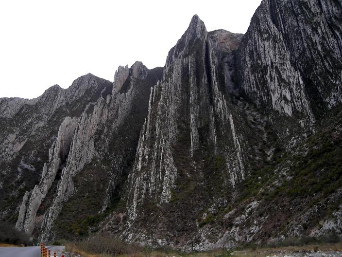
That afternoon Rogelio treats Bob and myself to a driving tour of his favorite rock climbing venue. The entire area is filled with limestone layers upended to a vertical orientation - kind of like giant mica slices set on-edge. It is a rock climber's paradise.
One peak, "El Negro", is extremely appealing to me. It has a knife-edge ridge that is rated Class 5.5, and a sheer vertical face rated 5.10. Rogelio has done both routes - and I consider this peak for a future ascent with Rogelio as lead.
Bob parks his camper on level ground one block from Rogelio's apartment, and sleeps inside. I sleep on the apartment floor, with pad and blanket, near the washer and dryer.
|
|
| Vertical sedimentary folding |
El Negro's ridge progressively steepens to the summit. |
Wednesday January 2 - Picachos el Fraile and El Sapo ("The Toad")

|
e drive with Rogelio well before dawn. Access to the keys of a pig ranch's entrance gate provides a shorter approach hike on the valley floor; and so we begin walking at first light with wind and perhaps 5° C (41° F). We summit by early afternoon after a thrilling ridgewalk followed by a diagonally ascending traverse of the final peak - El Sapo. A single Class 4 move requires downclimbing from one ramp to another; and as this poses little problem Rogelio brought a handline for naught.
Darkness falls while still over 1,000 feet above the valley. Bob is visibly exhausted, the steep, rubble-strewn path on ascent having tired him for the remaining effort. We return to the vehicle after 12 1/2 hours and drive to Rogelio's home.
To Climb Picachos El Fraile
Location: 25�51'45" N, 100�36'42" W
250,000:1 chart "Monterrey" G14-7
50,000:1 chart "Hidalgo" G14C15
Contact Rogelio Stille (cell 01-81-1513-6154; home 01-81-8059-0748 - no E-mail). He knows the rancher who can provide passage through his farm to the trailhead. Apart from this access issue the mountain can be climbed without his assistance. That said, Rogelio knows the route well enough to have climbed it by dark. We thus recommend his services.
The standard route accesses the main, east-west ridge by traversing the south face along a steep, rubble-strewn path which eventually lessens in grade after passing an obvious rock pinnacle. An airy ridgewalk follows, and the route concludes with an ascending traverse of the summit block, on its north side, along a series of Class 2 ledges. There is a recognizable path for the entire route.
Allow 10-12 hours for the round-trip. Bob Packard estimates 7 miles distance; and we obtain 5,250 feet net elevation gain with 5,400 feet of total gain.
Key GPS-derived waypoints follow (zone 14R).
| waypoint description | elevation (feet) | (Easting, Northing) |
| carpark | 2,627 | (335138 E, 2859063 N) |
| base of mountain | 3,370 | (335279 E, 2860537 N) |
| on rubble path | 4,361 | (335845 E, 2861030 N) |
| under pinnacle | 5,605 | (336349 E, 2861351 N) |
| reach main ridge | 6,320 | (336699 E, 2861660 N) |
| along main ridge | 6,773 | (337271 E, 2861625 N) |
| summit | 7,881 | (338701 E, 2861590 N) |
|

|
|
View west down the main ridge from near the summit - El Sapo. |
Summit block and Rogelio. Violet indicates the Class 4 move. |
Thursday January 3 - Monterrey and Lunch

|
his is an intentional rest day in light of the next venue which promises to be even more physically demanding than El Fraile. We are treated by Felipe to lunch at his parent's home.
Italian by ancestry, we expect the spaghetti with tomato sauce to completely define the meal. Suddenly the main course arrives - pork with apples and prunes; plus potatoes in a lively cilantro cream sauce. I do my best to please his mother, who prepared all food from scratch, with a hearty appetite. Further, I need the calories for tomorrow anyway: a win-win excuse to indulge. With an appropriate red wine and a dessert course, I am definitely energized for the next day's ascent of Cerro Tia Chena.
The Nacher's hospitality is well recognized by us with a multitude of gifts, culminating in a book with aerial photographs of Latin America - a perfect choice for Felipe as he climbs mainly to photograph the mountain scenery. I inscribe the inside front cover with a Spanish note.
The same sleeping arrangement obtains as the previous two nights with Bob in his camper (mainly to guard it); and myself at Rogelio's apartment.
|
|
|
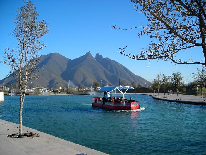
La Silla, Monterrey's landmark peak. Downtown tourist canal in foreground. |
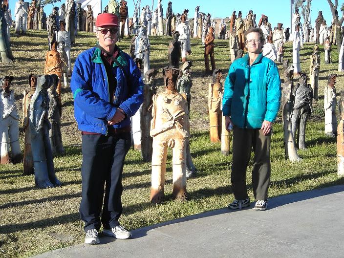
"City" of 2,501 sculptures representing the migration of an entire town. Here Bob and Adam join them. |
Friday January 4 - Tia Chena and La Calle
|
|
ob is wary of another 12 hour day. Instead, he elects to join Felipe on a climb of Urbano with a broad path leading to excellent summit views after some 3 3/4 hours on-ascent. Urbano has an elevation of 9,770 feet and a prominence of 3,700 feet - not shabby at all. Bob signs a register at La Calle ("The Street"), a flat area a couple of hundred feet below the summit. Bob estimates 5 miles round-trip and 4,000 feet of total elevation gain. Urbano is on 50,000:1 chart G14C25.
I awaken with Rogelio earlier still than for El Fraile - I believe at 4:40 a.m. At the ubiquitous OXXO market we enjoy hot chocolate/coffee while continuing through the town of Mina to the gated ranch road for our start. For such an early effort Rogelio had acquired keys the previous day.
With considerably warmer conditions than the other day, the wind is absent as dawn appears at 6:45 a.m. The climb is rapid, and we near the main summit ridge in the excellent time of just over three hours. I carry four liters of water yet consume only three by day's end.
Rogelio is misled by us into believing that he, and others, have always gone to the wrong summit - one that is east of and slightly lower than the mountain's true highest point. We thus leave the standard route and bushwhack through heavy brush in the effort of reaching the western, higher summit. This consumes much time until suddently we transect the standard path! In short order we reach the true highpoint, and, noting the summit register, conclude that the correct summit has been climbed, once annually for ten years, all-along.
I enjoy a large, round onion roll filled with smoked turkey and Roka blue cheese. Rogelio never seems to get hungry or thirsty - choosing to eat heartily and hydrate the previous evening. We descend the large northern exposure, this time in full sun, and reach the car around 5 p.m. some 10 hours 10 minutes after departing. Without the needless bushwhacking our time would have been roughly 9 1/2 hours - very slick indeed.
We meet Felipe and Bob that evening at Rogelio's home, and I prepare supper for him before his wife comes home too late for our appetites to remain unsatisfied any longer.
To Climb Cerro Tia Chena
Location: 26�07'12" N, 100�33'24" W
250,000:1 chart "Monclova" G14-4
50,000:1 chart "Mina" G14A85
Tia Chena is located north of Mina which is along Mexico Route 53 northwest of Monterrey.
Contact Rogelio Stille (cell 01-81-1513-6154; home 01-81-8059-0748 - no E-mail). He knows the rancher who can provide passage through his farm to the trailhead. The key is preferably obtained the previous day. Apart from this access issue the mountain can be climbed without his assistance. That said, Rogelio knows the route well enough to have climbed it by dark. We thus recommend his services.
Within ten minutes from the carpark, enter a canyon and then negotiate a steep scree path, to the right (east) leading to an obvious saddle after 1,100 feet of elevation gain. This saddle lies at bottom of a large, moderately steep south face. Climb this steep face, with well over 3,000 feet of elevation gain - one that is festooned with brush and cacti. I was "stuck" several times.
The route is shallow once atop the ridge. Many turn-back on reaching the ridge, which is unfortunate since most of the difficulty is overwith at that point. Follow the ridge east as it passes north of the forested summit area, turning south towards it for the final 300 vertical feet.
Allow 10-12 hours for the round-trip. There is 5,750 feet of total elevation gain.
Key GPS-derived waypoints follow (zone 14R).
| waypoint description | elevation (feet) | (latitude, longitude) |
| carpark | 2,864 | (26�06'35.1" 100�36'27.2") |
| saddle below north face | 3,957 | (26�07'05.0" 100�35'37.9") |
| just below main ridge | 7,171 | (26�07'35.5" 100�34'26.1") |
| summit | 8,679 | (26�07'08.4" 100�33'22.0") |
|
|
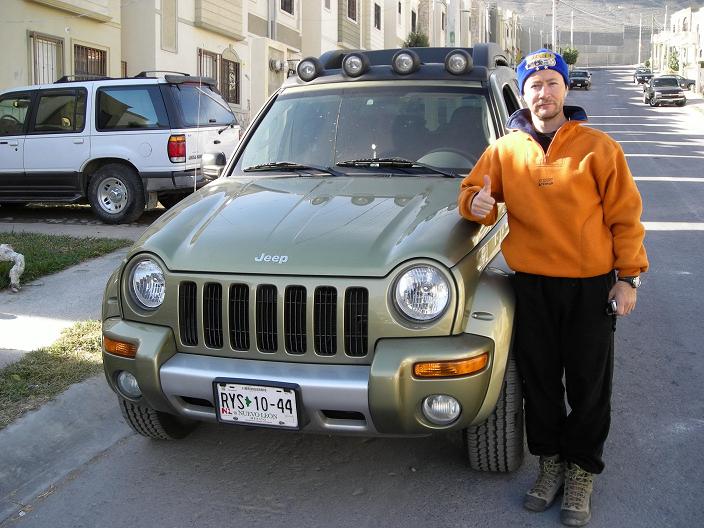
| Felipe Nacher and his vehicle. |
Tia Chena's climbing route shallows markedly at the summit ridge ("R"). |
Saturday January 5 - Cerro el Potosi
|
|
he trio of mountains {San Rafael, El Morro, and Cerro el Potosi} form a set of peaks that must all be climbed to realize our objectively defined goals. These include reaching the highest point of Coahuila, the highest point of Nuevo Leon, and climbing one ultra prominence summit.
The problem is that all three of these mountains appear to have identical elevations on the Mexican 50,000:1 topographic charts - 3,700 to 3,720 meters. We have good evidence supporting the hypothesis that the Sierra la Martha ridge, containing El Morro, defines the Coahuila/Nuevo Leon state boundary. Collectively these facts yield several corrolaries -
Our handheld GPS units should allow for a relative ranking of their summit elevations.
We alter the original itinerary, which calls for climbing this trio at the end of our travels, in order to take advantage of fair weather that has brought snow-free conditions for these 12,000+ foot peaks. A single weather event could easily dump snow on these mountains, and, with it, a far more arduous task set before us. We thus travel south from Monterrey to attempt these mountains before any others, of lower elevation, are visited.
|
| The summit radome of Cerro el Potosi. |
Various information sources suggest Cerro el Potosi can be driven to its summit. If this is not possible we are prepared to climb it. We travel there first of the three peaks to most effectively use our day: if Potosi is indeed completely driveable then it can be done today instead of waiting for sunrise to actually climb it.
After reaching the village of Dieciocho de Marzo ("March 18") we locate the mountain approach road and begin the mechanically-assisted ascent. Cobblestones prevent Bob from driving faster than an average 8 m.p.h. - and the fully 18 mile road consumes just over 2 hours on-ascent.
We wander about the summit area, taking GPS readings at three different "bumps" within the dumbbell-shaped 3,700 meter contour. Bob and I independently conclude that the northernmost bump, at forest's edge, is highest. The middle bump, with a radome facility, has an east-west limestone ridge that is higher than adjacent ground. The southermost bump is clearly lower than these two as seen by our readings and by backsighting to the radome.
The descent consumes a bit under two hours, making a four hour round-trip for the mountain road. We camp at a pullout just a few miles south of Galeana.
To Drive Cerro el Potosi
Location: 24�52'18" N, 100�13'57" W
250,000:1 chart "Conception del Oro" G14-10
50,000:1 chart "Hidalgo" G14C56
From Monterrey travel west on Mexico 40 to just east of Saltillo. Drive south on Mexico 57 to San Roberto; thence east and north on state roads to Galeana. Drive northwest to Dieciocho de Marzo community.
At the south end of this town locate the start of the 18 mile cobblestone summit road (c.f. coordinates below). After 1 kilometer encounter a manned gate. Pay 20 pesos.
Approximately 1,500 feet below the summit a radio antenna marks the road's end prior to its completion. The 50,000:1 chart shows the road ending here - it is obsolete. Continue driving to the summit contour.
Allow four hours round-trip for return to Dieciocho de Marzo - plus any time at the summit. There are hiking routes to the summit. We do not explore them.
Key GPS-derived waypoints follow (zone 14R).
| waypoint description | elevation (feet) | (Easting, Northing) |
| 100 meters south of mountain road's base | 6,586 | (381141 E, 2752813 N) |
| north summit bump | 12,215 (Adam); 12,204 (Bob) | (375597 E, 2751272 N) |
| middle summit bump atop limestone ledge | 12,208 (Adam); 12,201 (Bob) | (375532 E, 2751167 N) |
| south summit bump (with a metal cross) | 12,210 (Adam); 12,191 (Bob) | (375453 E, 2750760 N) |
Sunday January 6 - San Rafael (La Viga)
|
|
efore dawn we drive west to Mexico 57 and then north to just beyond the highway's highest point at a mountain saddle. We continue to gain elevation throughout, eventually passing through the village of Jame on the San Rafael's south side by mid-morning.
|
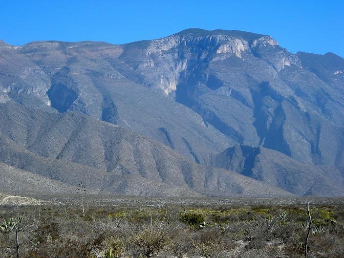
| San Rafael's summit from the northwest |
After negotiating a steep mountain road to about 10,500 feet we encounter a manned gate. An extended conversation results in passage through this community of summer retreats, and we continue east, past a hairpin turn back west, and eventually stop along the perfectly good dirt road, heading right for the summit, on account of tree branches that threaten to damage the top of Bob's camper.
The resulting hike consumes just over one hour to the summit, with 1,000 feet of elevation gain. We pass by the highest summer cottage about 500 feet vertical and one mile shy of the summit, the road deteriorating to an ATV track at that point.
We take GPS readings at both the nearer, eastern bump, with several antenna masts; and at a farther, western bump with one antenna tower. The eastern bump is highest, and we enjoy our snack food there prior to descent.
After a silly argument about whether the trees are limber pine or another species we renegotiate the road, eventually returning to Jame before having some lunch at a pullout.
We find a shortcut that bypasses a complete return to Highway 57; and proceed south, then west, in the direction of El Morro for the next day. By 3:30 p.m. we are parked alongside a summer cabin rental office, and at the base of a former road that is now restricted to foot traffic that we'll walk by daybreak. El Morro and its sister summit, just west of it, lie roughly south and some 3,000 feet above.
To Drive/Climb San Rafael
Location: 25�21'51" N, 100�33'27" W
250,000:1 chart "Monterrey" G14-7
50,000:1 chart "San Antonio de las Alazanas" G14C35
There are hiking trails on both the north and south sides of San Rafael which get one to the summit. We choose a southern approach.
From Monterrey travel west on Mexico 40 to just east of Saltillo. Drive south on Mexico 57 to just north of an obvious pass, and exit east at a road signed for "Chupaderos de Abajo" and/or "San Andres" and/or "Los Lirios". Bear right for Los Lirios, then bear right for the town of Jame, then bear left for the town of Jame.
From Jame take a dirt road east 4.3 miles to Puerto Maravillas, elevation 9,000 feet, at a sharp bend in the road as it suddenly turns right (south). Take this steep dirt road (initially paved) uphill for 5.5 miles. A gate is located roughly halfway along this distance. If you cannot receive permission to drive past the gate a better option might be to locate either of two hiking trails beginning 1.4 and 1.5 miles along the road as measured from its base at Puerto Maravillas. After the gate continue east until a hairpin turn taking you west back towards the summit.
One can drive an additional mile beyond the 5.5 miles cited (again, we stopped short because of low branches - a normal car will have no problem with this). This additional mile takes you to within 500 vertical feet and one mile of the summit. Park here and walk the ATV track west to the summit areas. The closer, eastern area with multiple antennae is highest.
Key GPS-derived waypoints follow (zone 14R).
| waypoint description | elevation (feet) | (Easting, Northing) |
| east summit bump (multiple antennae) | 12,208 (Adam); 12,190 (Bob) | (343382 E, 2805927 N) |
| 12,203 | ||
| 12,197 | ||
| 12,192 | ||
| 12,187 - after unit has "settled down" | ||
| west summit bump (one antenna) | 12,178 (Adam) | (342982 E, 2806023 N) |
Monday January 7 - Sierra la Martha highpoint and El Morro
|
|
hinking the weather could be nippy we begin no sooner than sunrise - about 7:30 a.m. In fact the coldest time was already past at Picachos el Fraile. We initially take the broad, abandoned road east to a "T"-junction at 10,201 feet. Not knowing which direction to proceed, we instead climb straight up the slope, heading generally southwest for the summit of El Morro's sister peak, topping-out after about three hours.
We descend 250 feet east to the saddle and climb El Morro - finding it to be lower than the first summit by a considerable thirty feet. Thus El Morro is not Sierra la Martha's highest summit - the peak 800 meters west of it is.
Our GPS readings confirm that Cerro el Potosi is the highest peak of the trio, having accounted for the inherent error in the readings in conjunction with the difference in mean elevations, for each mountain, as taken over several readings for each.
However our readings are insufficiently accurate for deciding if San Rafael is higher than the Sierra la Martha highpoint - or vice versa. Hence both mountains must still be climbed to claim the Coahuila state highpoint.
In contrast we conclude that Cerro el Potosi is both the Nuevo Leon state highpoint and an ultra prominence.
We eat lunch and then take a direct line down from the saddle. The route is steep and filled with loose rocks - a mistake. Eventually we meet the abandoned road and proceed downhill with a combination of bushwhacking and road walking to the camper.
By nightfall we are well north on Mexico 57, camped only 30 miles south of Monclova. With cell phone I call Andy Martin, prominence-oriented list compiler and peakbagger from Tucson. Andy is surprised to learn of our findings regarding the relative elevations of these mountains - and the obvious implications for their prominences.
To Climb El Morro and the Sierra la Martha highpoint
Location: 25�12'03" N, 100�22'42" W
250,000:1 chart "Monterrey" G14-7
50,000:1 chart "San Rafael" G14C45
From Monterrey travel west on Mexico 40 to just east of Saltillo. Drive south on Mexico 57 to an exit at a high pass in the road signed for "San Antonio de las Alazanas".
Continue on pavement east-southeast to a switchback heading northwest, the last few miles being dirt/gravel. At the switchback (see the 50,000:1 chart) continue straight (east) roughly one kilometer to a cabin rental area where the road drops steeply. Park here, i.e. before the road descends.
Hike the abandoned road that begins to the southwest of your vehicle until reaching 10,201 feet at a "T" junction. You are now roughly north of named "El Morro" and northeast of its sister summit - the true range highpoint.
Choose your route - possibly a combination of cross-country travel and road walking. The former is quite direct while the latter, though simpler, involves far greater distances.
Allow six hours round-trip with 3,100 feet of total elevation gain for reaching both summits.
GPS-derived summit elevations follow (zone 14R).
| waypoint description | elevation (feet) |
| west summit (Sierra la Martha highpoint) | 12,186 (Adam); 12,190 (Bob) |
| 12,185 | |
| 12,187 | |
| 12,186 | |
| east summit (El Morro) | 12,153 (Adam); 12,165 (Bob) |
| 12,155 | |
| 12,157 |
|
|
|
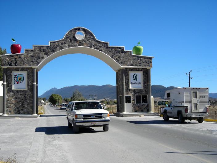
Ornate gateway at the Coahuila state border. Note the apples. |
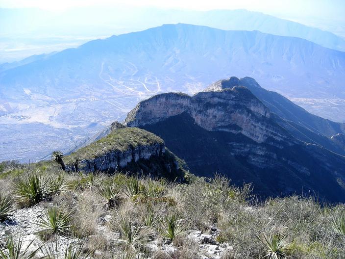
View northwest from the Sierra la Martha. |
Tuesday January 8 - Sierra la Madera southern approach
|
|
e drive into Monclova and locate Mexico 30 for driving west to Cuatrocienegas. At a police station on the Cuatrocienegas outskirts we enquire about our contact, Arturo Contreras, who runs a herpetology exhibit and organizes eco-tours of the nearby desert for tourists. Arturo arrives and we drive to his museum/agency in the center of town.
I met Arturo on the Internet, referred by others who had an interest in the area due to its ecological importance with some 70 endemic desert species. Arturo was to have obtained some form of access permission on our behalf to climb the Sierra la Madera highpoint.
Arturo instructs us to take a gravel road that passes the sierra on its southern flank, eventually meeting the rancher's son at Ejido Juncal who is waiting for us with mules for a trek into the range. This sounds too grood to be true - and it is.
The road is bad, jarring the camper and our nerves a full 42 miles before finding the ranch - over two hours from Cuatrocienegas. The ranch owner, no English at all, does not know what we are talking about upon our mentioning Arturo and his own son's availability. Finally, the ranch is way too far west of our mountain to consider walking from it.
We borrow his 50,000:1 chart of the mountain range, promising its return whenever he can visit Arturo in Cuatrocienegas. Map in-hand, the rancher points to the northern side of the range, noting that the most direct approaches are owned by one Raul Flores of Monclova. One canyon, Cañon el Agua, climbs directly to the summit.
Driving back east we sight some obvious routes to the summit. We stop to offer another rancher a goodly sum of cash for permission to cross his land, and that of a neighbor, to climb the mountain. He wants nothing less than $200 cash - which Bob and I consider an outlandish sum - and then camp nearby. The entire day has been wasted, apart from having acquired a good map for the Sierra la Madera highpoint and learning of Señor Flores.
Wednesday January 9 - Sierra la Madera northern approach
|
|
ob and I arrive in Cuatrocienegas around 9 a.m. and locate Arturo Contreras. Explaining that Raul Flores is a hopeful contact, Arturo eventually calls him and describes our intentions. Raul is most pleased to assist, providing the name and location of his partner - a rancher in the town of Ocampo who can arrange for our climb.
The drive to Ocampo is short, only 30 miles northwest. We arrive around noon, eating lunch in the camper while waiting for Juan Regino to return on his tractor for the mid-day meal with his family. A older man of few words, Juan confirms that his son can climb with us - and asks for 200 pesos, about 20 dollars, for driving his truck into the backcountry to meet him.
|
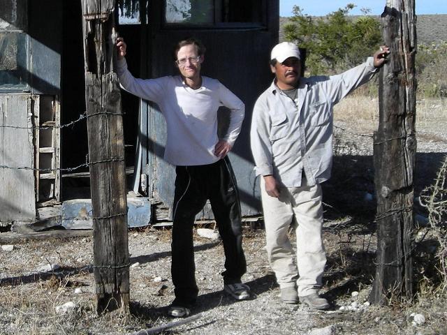
| Romero and Adam at the trailhead shack. |
We backtrack some 12.6 miles towards Cuatrocienegas and locate a ranch road that is gated 0.5 mile from the highway - the first of five gates. The 8.7 miles consume one hour. Eventually we meet Romero de la Cruz - our companion for the mountain. He lives with eight children in a small dwelling, completely isolated and without electricity. We never see his wife.
We are quite close to canyon entrances on the range's north side; and, after learning that we can drive Bob's camper closer still, note that what we thought would be an overnight backpack, with much water to carry, is reduced to a single day's effort due to proximity.
I squeeze between Bob and Romero in the front cab. After 2.9 miles and 20 minutes we arrive around 4 p.m. at a small shack where Romero will sleep. I shave and then cook supper. The oldest son, age eighteen, arrives on horseback with Romero's supper.
Noting the nearly 6,000 feet of elevation gain, Bob suggests that Romero carry his daypack the next day. As Romero has no pack at all, and could certainly use more money, this is a win-win scenario - and Romero accepts this plan. As Romero speaks only Spanish, my translation duties are most essential.
We agree to a 6 a.m. departure well before sunrise.
Thursday January 10 - Sierra la Madera

|
reasonable pace gets us to a set of concrete water basins in two hours, there being a path to follow the entire way. From the basins a plastic pipe leads all the way to Romero's home in the valley. This permanent water source explains our canyon's name.
We continue on rougher terrain as the canyon trends naturally counterclockwise to the left. After another hour, perhaps around 7,000 feet, the ground is littered with leaves to such an extent that our feet at times disappear. It is similar to walking in snow since it too has a soft consistency. Bob is surprised to identify maple trees.
The flora changes from desert-adapted plants to deciduous bushes to a pine forest as we enter the final 1,000 vertical feet. Here the canyon's steep side walls are replaced by open terrain; and we proceed up the gradient to summit.
Views on-top are limited by the trees. I enjoy a large onion roll with smoked turkey and pineapple cream cheese, sharing some with Romero who in-turn gives me some cold, bean-filled flour tortillas. The ascent has consumed six hours.
The long descent begins after 30 minutes on top - and ends within daylight because we had started so early. Bob's round-trip consumes 11 3/4 hours as I wait in the camper after having dashed the final part.
We three drive back to Romero's home and pay him the promised 600 pesos and a "tip" for carrying Bob's pack - in American cash an $80 sum.
We camp near Romero's home on a flat, cleared area far enough away to not be disturbed by his family. Two bean tortillas are fried on the stovetop with sharp cheddar cheese, leftover canned salmon, and Cholula hot sauce - a more fitting way of enjoying them than simply plain and cold.
Bob and I consider climbing the Sierra la Madera highpoint a significant accomplishment because to our knowledge no American had climbed this mountain - one without an Internet presence. Romero states that when the rare ascent does occur, the locals prefer to camp on the summit. Thus he thinks we are the first people to climb this mountain in one day - the most prominent peak in Coahuila state.
To Climb the Sierra la Madera highpoint
Location: 27�02'03" N, 102�23'30" W
250,000:1 chart "Ocampo" G13-3
50,000:1 chart "Cerro de la Madera" G13B48
Contact Raul Flores in Monclova by E-mail (ctconsorcio@prodigy.net.mx) or by telephone (cell 86-6638-0243; office 86-6636-4044). His permission is required for accessing the entrance to Cañada el Agua.
From Monterrey drive Mexico Route 53 northwest to Monclova; then drive Mexico 30 for 50 miles to Cuatrocienegas. Drive northwest on Coahuila B-2 for 30 miles to Ocampo. Meet Juan Regino at his ranch, Rancho el Alazán, by turning east (right) just north of the obvious propane tank on the south side of town on your right side.
Señor Regino can take you to his son's home as described above - 12.6 miles southeast on Coahuila B-2 to a dirt road with five gates, some locked, for a total of 8.7 additional miles to the home. Drive with son Romero 2.9 miles towards the canyon entrance. Park and camp.
Hike the bladed track. After 30 minutes veer-off to the left (east) to enter Cañon el Agua. Climb up the canyon its entire length as it trends left (counterclockwise), aiming straight for the range highpoint.
About two hours uptrail is the permanent water source. Bring a purifying agent if you plan to use it - there were leaves adorning the basin's entire surface on our visit.
About halfway up the cayon (an hour after the water), encounter a major fork in the canyon. Take the left fork.
Allow 10-12 hours for the round-trip. Bob Packard estimates 13 miles distance; and we obtain 5,700 feet net elevation gain with 5,900 feet of total gain.
Key GPS-derived waypoints follow (zone 13R).
| waypoint description | elevation (meters) | (Easting, Northing) |
| home of Romero | 1,147 | (760002, 3004163) |
| trailhead near canyon entrance | 1,292 | (758323, 3001221) |
| summit | 3,027 | (758790, 2992700) |
|
|
|
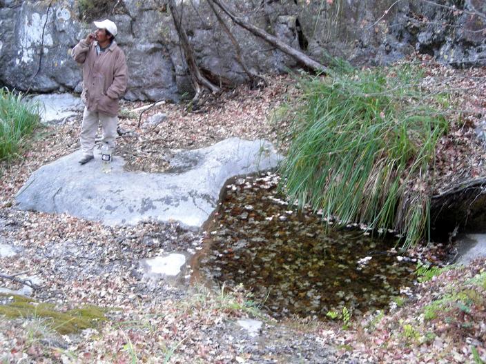
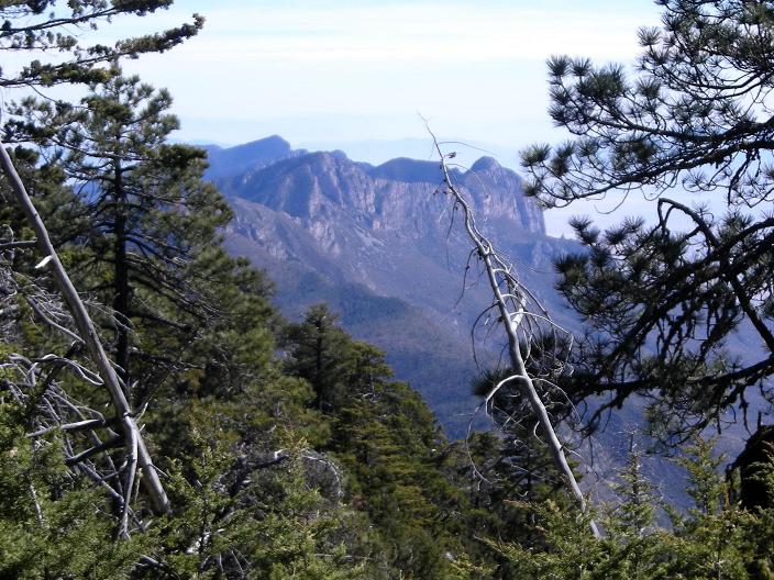
| Leaf-topped water pool two hours above trailhead. | View east from the Sierra la Madera highpoint. |
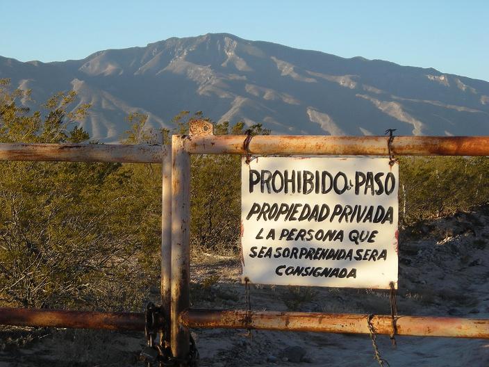
Private property / no trespassing sign with the Sierra la Madera as background. |
Friday January 11 - Monterrey and INEGI
|
|
cappuccino ice cream cake is ample reward for reaching the Sierra la Madera summit - and I enjoy it with gusto as Bob drives us to Monclova.
Prior to flying down I noted that the Tamaulipas state highpoint is about two to three degrees south of Monterrey - within a reasonable distance - and yet was never placed on the itinerary. However it is amusing to consider having reached the highpoints of all six Mexican states bordering the U.S.A. - including Tamaulipas.
I described these concepts to Bob, and he eventually is convinced that we should alter plans by nixing Centinela, yet another ultra summit; returning instead to Monterrey for information gathering, and head for Tamaulipas. Centinela is easily combinable based on the road grid with a future trip to the Chihuahua, Durango, and Sinaloa state highpoints - but Sierra el Borrado, the Tamaulipas highpoint, is not. As his only forseeable opportunity to nab it, we head for Monterrey's downtown INEGI office to obtain the relevant maps.
INEGI is the Instituto Nacional de Estadistica, Geografia, e Informacion - and the service rendered to us is impeccable. We obtain maps for Sierra el Borrado in both the 250,000:1 and 50,000:1 series, opting for photocopies at $2 apiece instead of actual maps for $5 each.
Books with hundreds of statistical tables, one per state, indicate highest elevation points - yet unfortunately there is disagreement between these lists and the highest contours for the mountains of interest. Cerro Pedregoso at 3,260 meters is listed as the highest elevation in Tamaulipas. However the more recent 50,000:1 chart indicates a 3,420+ meter elevation for Sierra el Borrado which is presumably on the Nuevo Leon/Tamaulipas border. Then at Felipe's home we check Google Earth's boundary and find that it either passes directly over Sierra el Borrado's summit or immediately to the south - whence the Tamaulipas state highpoint could be a liner along the corresponding summit ridge.
Given this information, Bob and I will climb and/or descend Sierra el Borrado via this ridge above the summit elevation of Cerro Pedregoso. Below that height ridgewalking is obviated since Pedregoso, entirely within Tamaulipas, is higher than the ridge at such points anyway.
We sleep in Bob's camper parked near Felipe's home overlooking the city of Monterrey. It is a beautiful night vista.
Saturday January 12 - south to Tamaulipas

|
t is four hours to Ciudad Victoria, the capital of Tamaulipas and a city in its own right. Four additional hours bring us to a 2,810 meter saddle along a dirt road some 27 miles beyond Miquihuana where the pavement ends. The odometer indicates 110 miles since Ciudad Victoria, and we arrive with enough daylight, at 4 p.m., for Bob to effect repairs on the camper door which has started falling off the hinges.
While enjoying supper, and after sunset, a pickup truck approaches and the driver, a most handsome man, stops with the single utterance, "PERMISO!. I advise Bob, who is outside, to pretend no knowledge of Spanish so he will leave. This plan failing, the man gets out and I am left to deal with him.
Again, "PERMISO! - and I can only assume he is some landowner, or represents one, and that a simple exchange of funds will settle the matter as bribery sets the standard in Mexico. Explaining that we only wish to camp and climb the mountain by daylight, he disregards my offer of $20, and then even of $50 - asking instead if we have a means for letting him smoke.
His wife, still in the truck cab, is most upset at his behavior and pleads that he leave us be.
I offer him tequila - and he enters the camper for a shot of the edible fire. Instantly he is friendly, forsaking any thoughts of access in favor of shaking hands and bidding us farewell. Is offering a drink the local sign of friendship?
Bob later tells me that the man had driven into a ditch and that he smelled of alcohol. This would certainly explain his strange behavior - including the neglect of $50.
We sleep undisturbed for yet another ten hour night.
|

|
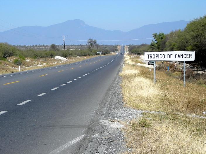
| The Tropic of Cancer bisects Mexico 101. | Miquihuana's cemetery |
Sunday January 13 - Sierra el Borrado
|
|
he route is obvious - or so it seemed. Bob and I skirt a hill north of our carpark, descending to the saddle between it and the main peak. In so doing we have a taste of what's to come, and it is quite repulsive: a bushwhack through heavy brush, similar to manzanita, that makes for very slow progress.
It is quite troublesome to force yourself through thick brush with the only end in sight the conifer forest higher still. Our efforts are rewarded on spotting a broad path, intended for pack animals, that drops down from an obvious saddle along the main ridge at 3,100 meters. We head to this minor saddle, and are gratified to locate a foot path which zigzags up the ridge from there. We have wasted over an hour, needlessly, bushwhacking to this point.
We enter the conifer zone for the last 500 vertical feet, with succulents here-and-there, adapted to the desert conditions, even as we near 11,000 feet (about 3,350 meters). The summit is quite broad, and, arriving well before Bob, I obtain a GPS-derived elevation of 3,430 meters which confirms the map's highest contour of 3,420+ meters.
On descent Bob notes his glasses are missing. They must have been left on a log at the flat summit area. Bob will now drive either without glasses (which provide minor correction anyway), or wear his prescription sunglasses.
At 3,100 meters we descend the broad track east instead of entering the brush, even though we know it will deposit us on the road a full 2 miles horizontally and 900 feet below the camper. The additional implied uphill travel is preferable to going through the brush a second time.
The afternoon's balance is spent returning to pavement, via Miquihuana; and we camp very near the Tropic of Cancer close to Highway 101.
To Climb Sierra el Borrado
Location: 23�44'00" N, 99�50'26" W
250,000:1 chart "Ciudad Victoria" F14-2
50,000:1 chart "Miquihuana" F14A27
From Monterrey drive Mexico 85 south to Ciudad Victoria. Take Mexico 101 or Mexico 126 followed the Mexico 101 to Jaumave. Route 126 is multilane, and avoids the elevation gain and loss of taking exclusively Mexico 101. Continue south-southwest (SSW), then west, to just north of Palmillas. Leave Mexico 101 bound for Miquihuana where the pavement ends - 83 miles (on Route 101 alone) from Ciudad Victoria.
From Miquihuana drive southwest past Estanque de los Walle and Servando Canales to a 2,810 meter saddle south of Sierra el Borrado. Continue downhill east towards Marcela, another 2 miles, to a cattle guard at 2,500 meters and park here - 29 miles of gravel and dirt driving from Miquihuana. Allow 4 hours to reach Ciudad Victoria and another 3 1/2 hours for reaching this point.
Hike the broad path, intended for animal traffic, west to the main, northwest-southeast ridge at 3,100 meters with 2,000 feet of elevation gain. Continue northwest on this ridge, following a foot path to the summit. You may wish to remain on the true ridge from 3,260 meters to the summit in case the Tamaulipas state highpoint is a liner southeast of the summit.
Allow 6 hours round-trip with 3,000 feet of total elevation gain.
Key GPS-derived waypoints follow (zone 14Q).
| waypoint description | elevation (meters) | (Easting, Northing) |
| camp/trailhead at cattle guard | 2,507 | (416734, 2623831) |
| access main ridge | 3,100 | (415121, 2623774) |
| broad summit1 | 3,430 | (414380, 2624599) |
1Higher ground (by a few feet) might be 200 feet south.
|
|
|
One should start an ascent of Sierra el Borrado at this cattle guard. |
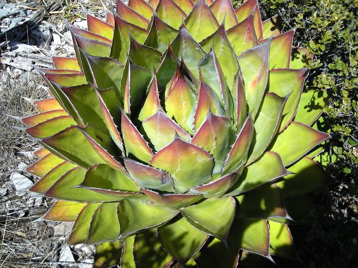
A typical succulent - beautiful yet dangerous. |
Monday January 14 - Monterrey and INEGI
|
|
here is time to climb one more mountain - and we set sights on the highpoint of the Sierra las Mitras, Cuauhtemoc, literally at Monterrey. With the afternoon at our disposal we visit INEGI a second time. However parking downtown is an enormous headache for Bob and his camper. We stop at a Walmart, have lunch in Bob's camper, and taxi downtown for roughly five dollars.
|
|
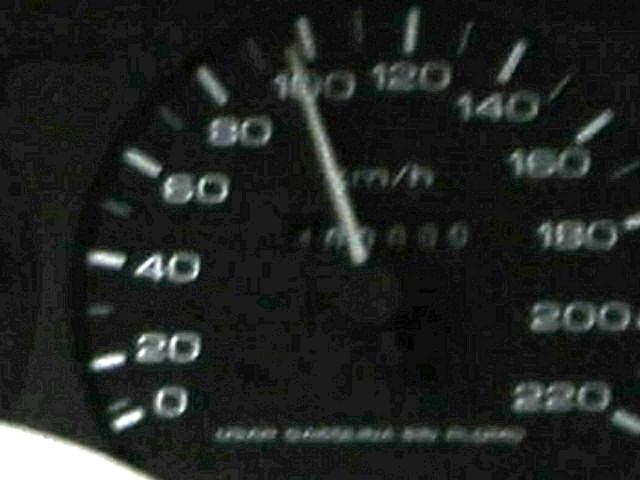
Our Monterrey taxi passes 400,000 kilometers. Mouse-click to view the number more clearly. |
At INEGI we acquire a topographic chart copy for the Sierra las Mitras, and research a longstanding question about the Sonora state highpoint along the Chihuahua border.
The weather worsens. I saw clouds while atop Sierra el Borrado far to my west; and now it is completely overcast with a light drizzle at times. A tropical system is bringing moisture as it proceeds northeast across Mexico and the Gulf.
This evening, using Felipe's home computer, we verify an 80-90% chance of rain for next morning. Given that I want to climb Cuauhtemoc largely for the view, I defer climbing it until a later journey. The compact range has roughly 4,300 feet of prominence, placing its highpoint on Mexico's Fifty Finest list of most prominent peaks.
Our trip is now basically finished since there will be no more peakbagging.
Tuesday January 15 - return to Laredo

|
elipe directs us out of the city's road network at 6:15 a.m., in the rain and dark, before going to work. To expedite this plan Bob foregoes his routine of eating breakfast on arising - yet stops halfway back to Laredo, mid-morning, for sustenance and a break in the driving.
We are most upset with the American border agent summarily tossing fully cooked smoked turkey, and other obviously safe items, into the trash can. Then dogs sniff the camper for drugs. Finally the entire vehicle is X-rayed as we watch patiently nearby. I swear - crossing into America it seems like one is "guilty until proven innocent".
My flights are not until tomorrow evening. Bob and I don't like just sitting around for a day doing "nothing". At the airport my flights are moved forward one day for $100 - one-half of which Bob pays since we are both beneficiaries of this action.
I "shower" in Bob's camper using a wash basin with water heated on the stove.
By late afternoon we are eating in this Italian restaurant with a waitress who speaks only Spanish even though we are back stateside. The menu is very complete with "Mexican" food, "Italian" food, and fish dinners. I start with a lime margarita and enjoy seafood-stuffed enchiladas with cheese and an assortment of side dishes. Bob has whole fish in a cheese sauce with rice and baked potato.
My flights that evening are uneventful; and I arrive home just after midnight. Bob takes two days for returning to Flagstaff, citing 1,198 road miles after Laredo.

|
ur journey is completely successful, having realized all the original goals and then some.
Significantly, I've made acquaintances with several Mexicans who are both helpful and knowledgeable in climbing their mountains:
To these people I heartily say, "Hasta la vista".