Nevada Prominences December 2009 Trip Report
© December 2009 Adam Helman

Note: Click on any image for enlargement.

I am pleased that Courtney has joined us: climbing the friction pitch unprotected is a bit too rich for my blood. In short order he's above the smooth boulder and prepared to "top rope" myself and the others.

It's at-once chilly and sunny; and it would be a perfect day but for that wind chill factor. Bob takes his time after I join Courtney; followed by his friend Matthew who scampers up flawlessly.

To Courtney it's the second time atop Jumbo Peak, one of several goals for Bob Packard and myself. I digress ...

Introduction

It's fortunate that Bob Packard had not (yet) starting "working" seriously on the Nevada 2,000+ foot prominence list before I too became interested. Concentrating on south Nevada, a number of peaks are targeted for a joint effort in early December.

Jumbo Peak
Jumbo Peak summit
(Courtney P. photo)

The journey highlight is Jumbo Peak with P = 3,317 feet. Remarkably, despite this hefty value, Jumbo is not on the Nevada Fifty Finest prominence list; in turn because Nevada has fully 178 2,000+ foot prominence mountains - more than any other contiguous state.

Jumbo is "technical", meaning that a rope is generally required - low Class 5. We locate and join forces with a Las Vegas man, Courtney Purcell, who knows several routes to its summit. Then too his girlfriend, "Db" comes along - plus Courtney's climbing buddy Matthew Holliman from the Bay area.

Six mountains are planned, of which four are guaranteed to have that arbitrarily chosen yet significant 2,000+ foot prominence cutoff value.

Close to the starting date most weather forecasts call for a frontal system on our final day. Hedging, we alter the itinerary so that the highest (and thus most weather-sensitive) peak is attempted first - while leaving the lowest mountain for the tentative rain/snow date.

Trip Details

Wednesday, December 2 - to Nevada

Bob and I meet along Nevada Route 164 at Powerline Road. We zero our odometers there. At 0.4 mile is a junction - bear right (the left track is difficult), continue to 1.0 mile, and turn right (east) onto the "main" track under the lines. We continue to 5.1 miles paralleling the transmission lines.

Zero the odometer and then turn left (west), eventually turning right at 1.4 miles. At 4.6 miles park alongside a corral some 0.1 mile shy of the "trailhead". The road is sandy from about mile 2 to mile 4 - and four wheel drive is required.

Tonight we enjoy chicken livers with mushrooms and onions, sauteed in olive oil and served atop a bed of noodles. Delicious.

Bob displays Mexican maps for a January climbing trip, and we quickly find that many of them are very poor xeroxes. We do our best to figure out which maps must be ordered fresh to round-out our information set.

There is a full moon.

Thursday, December 3 - McCullough Mountain

It's cold, perhaps 20° F in the pre-sunrise chill. The hot oatmeal in Bob's propane-heated camper is just what I need; and we start at 6 a.m. a half hour before sunrise.

We botch the navigation on this one by heading west up the first gulley encountered after hiking northwest from the trailhead. We should have continued northwest, leaving the first gulley, and then head west up a second gulley.

sandy road
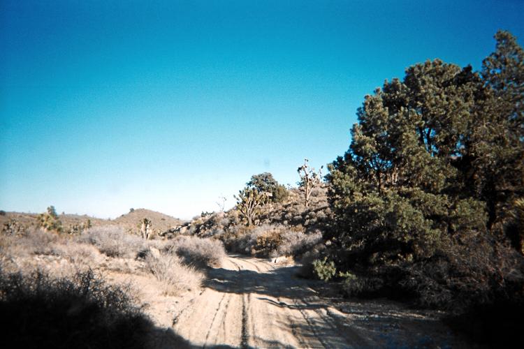
Sandy approach road -
four wheel drive is essential.

We needlessly climb a significant hill, gaining about 500 vertical feet before learning that we are 2,000 feet south of various waypoints that we should be following from a posted trip report.

This wastes perhaps an hour, and we get on-track to the desired route. Thereafter the navigation is easier. That written, the terrain is convoluted, and we don't actually see our mountaintop until nearly upon it.

It is fully 4 1/2 hours before we summit. Wind makes the temperature feel a lot colder. An avocado and Irish cheddar sandwich is eaten.

On descent we fair better navigation-wise, and we return around 1:30 p.m. some 7 1/2 hours after leaving.

Gasoline and snacks are found in Searchlight, Nevada. We caravan north on Route 95, through greater Las Vegas, and nightfall comes before reaching our turnoff for Gass Peak. After some searching we locate the exit, drive four miles to the Corn Creek Station, and camp in a gravel lot.

McCullough Mountain was not particularly enjoyable.

summit view Bob at summit
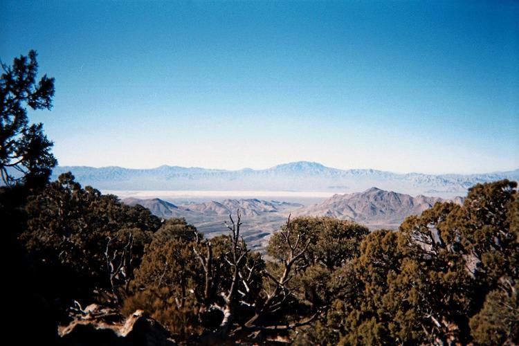
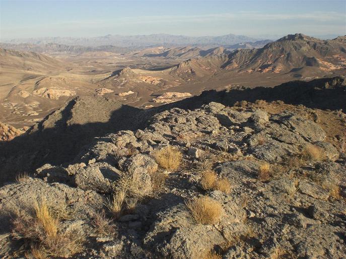
View southwest from
McCullough's summit.
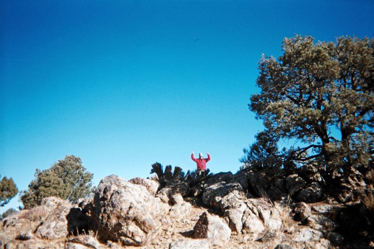
Bob triumphant at the summit.

Friday, December 4 - Gass Peak

There's no need for taking both vehicles. We use Bob's truck, driving some 12 1/2 miles to our chosen trailhead. Now we eat breakfast, a nice concession on Bob's part to my desire for having carbohydrate before exercise rather than before driving.

Gass Peak is easy. The summit is always in view, and one simply takes a series of ridges for getting there. Taking 2 1/2 hours to summit, views of Las Vegas are washed out from haze. A unique gefilte fish sandwich is enjoyed, one-half with ketchup and the other half with honey.

Descent is faster still, and, back at my vehicle, Bob prepares hot dogs as we have a lot of time: we've decided that attempting Frenchman Mountain today is not in the cards.

By about 2 p.m. we drive through Las Vegas, stopping for more gasoline at the Flying J off Exit 46 on Interstate-15. We continue to Exit 75 and head south 3.1 miles to camp at a designated junction where Courtney and his entourage will meet us at 6 a.m.

I recommend Gass Peak for anybody wanting an "introduction" to bagging desert peaks.

Yucca Bob, yucca, summit
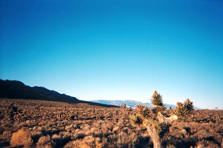
Charleston Peak with
yucca as foreground.
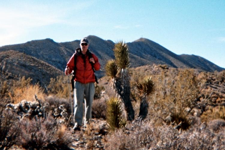
Bob with Gass Peak's summit
above the yucca plant.

Saturday, December 5 - Muddy Mountains highpoint

Everybody is ready at the appointed hour. We caravan as three (of originally four) vehicles south on good gravel. After 5.2 miles Bob stops, citing the poor road conditions. I've been leading, and don't realize this. Finally I turn around at 5.8 miles, return to the others, and have breakfast in Bob's camper.

The propane tank is empty! No hot coffee with my "honey bun" pastry... I improvise and make cold coffee with milk - prefaced by a whole grapefruit. How did the tank empty? Bob and I still are uncertain...

Courtney is now my passenger, while Bob goes with Matthew and Db. After several bone-jarring miles (this is a bad road in sections) we find our turnoff, bearing right (west) and driving 0.7 mile to park.

After an unwelcome 250 foot ascent to a saddle we descend about 100 feet into Hidden Valley with the Muddy Range to our immediate south. We continue generally south southwest along a gradually fading jeep track; and enter a prominent gulley after over an hour.

The gulley is taken southeast until a roughly 1,450 meter saddle where the wind chill must have been close to zero degrees Fahrenheit. Some 700 vertical feet remain as we turn right (southwest), aiming for yet another saddle at 1,550 meters. (I provide metric units since the topographic chart is annoyingly in metric.)

Adam
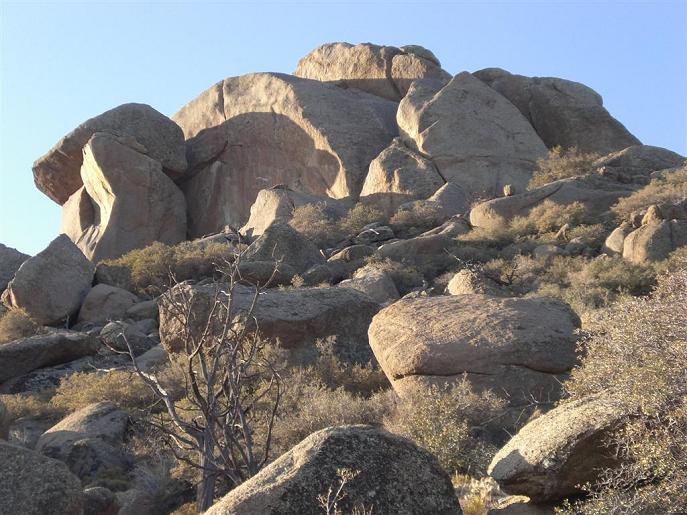
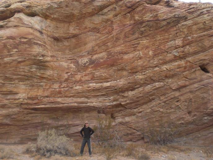
An overhanging rock formation
at Hidden Valley, with Adam.
(Courtney P. photo)

A prominent rock buttress is contoured around its right (north) side. Here, I get slightly ahead only to find that my route is higher than the easier way. I downclimb this Class 4 chute, and wait for Bob to locate me. Courtney, Db, and Matthew remain high.

Bob and I now guess which steep, narrow gulley will provide access to the next saddle. We climb our chosen route (why is this essential detail not documented anywhere?), and top-out in plain view of both the saddle and our summit goal. From here it is easy.

After a handful of jelly beans (thanks!) at the saddle I continue to the summit just 300 or 400 feet higher. Soon everybody is accounted for, and the register is signed by the majority.

It is windy again. We hunker under a rock outcrop while eating. I enjoy a smoked salmon and Irish cheddar cheese sandwhich.

Bob and I descend independently of the other people, and yet we agree to rendezvous at the 1,450 meter saddle - rather, just below it to avoid the wind. Courtney enjoys this strange, chili-crusted dried pineapple I provide, and I am surprised he (or anybody) enjoys it so much.

The gulley's bottom is reached soon enough, and Courtney with Matthew head quickly to another climbing venue while Bob, DB and I return to the vehicles. We drive around 3 p.m, having started our ascent at about a quarter of eight.

After a series of guessed turns at assorted junctions along the unsigned road, we return to Bob's camper around 4 p.m. with just enough daylight to reach the Interstate before sunset. We are glad to have not gotten lost.

Bob finds propane for sale at the gasoline station (what luck!); and I have my standard hot chocolate / coffee drink ("mocha") despite the relatively late hour - for alertness: we will navigate by darkness the approach road for our next venue.

New Gold Butte Road is taken 44.0 miles from Exit 112 before arriving at the Gold Butte "town" - in truth, just an open patch of bare ground by the roadside. I am cranky because the day began at 5:30 a.m. and we have traveled 14 hours without respite. People work eight hours, right?

I seriously consider not going to Jumbo Peak: we've agreed to leaving at six, before sunrise, and yet it is already 8 p.m. and I have not prepared my daypack for tomorrow - let alone eaten supper. I cannot function well on just six hours sleep, and yet Bob seems perfectly happy on such a schedule.

My attitude improves on eating supper - Indian-style with cooked rice, tinned roast beef, peas/potatoes as a mildly spicy curry, and red hot vindaloo sauce to-taste.

Sunday, December 24 - Jumbo Peak and Mica Mountain

Bob wants to climb Mica Mountain because, being officially just 3 feet lower than Jumbo Peak, it might "steal" Jumbo's prominence by being the higher.

We drive at 6:02 a.m., with Bob as my passenger as he takes notes about the junctions for getting to the Jumbo Peak trailhead. Driving south on New Gold Butte Road, at 0.9 mile bear left (east). At 1.8 miles descend a hill, joining a road coming from the right (west) on the valley floor. Continue on the combined road east. At 4.0 miles reach a tri-junction and bear right (south), continuing to the trailhead after 6.5 miles total from the campsite.

It is cold. This morning one car's outdoor thermometer records 12° F., while another registers 17° F. Regardless of which is more correct, citing the cold Db decides to remain in the vehicle while four head for Jumbo's summit.

summit trio
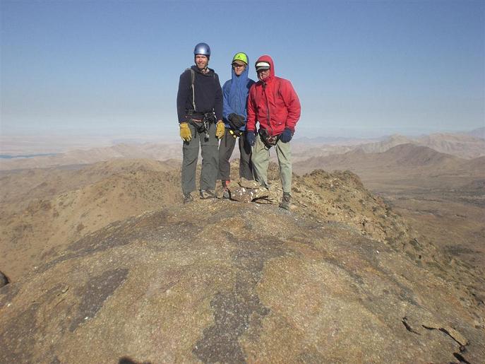
Atop Jumbo - from reader's left,
Matthew, Adam, and Bob.
(Courtney P. photo)

Our hike to the summit boulders is short with only about 1,300 feet of elevation gain.

There are two roped pitches. The first one is at the top end of a "crawl space" with numerous foot-size boulders than can topple at moment's notice. We wear helmets. Courtney free-climbs in a series of chimney moves, and then Bob ropes-in. He is not willing to try reproducing that effort, and finds a solution by crawling under a chockstone followed by a few short moves.

I am next, followed by Matthew. We wait while Courtney examines the second pitch. We are in shadow and, temporarily motionless, I commence to shiver a bit.

After Courtney free-climbs the boulder I rope-in for this friction climb with a scarcity of hand and footholds - one for which climbing shoes (i.e. not rigid mountaineering boots) are preferred.

Bob's turn - and he wants to climb the rope for security. This reminds me I have brought prussiks, which would have been helpful had a fixed line been constructed. Ironically, Bob scoffed that I had brought prussiks - and yet his current difficulties could have been aided through their use. Bob makes it after a struggle.

Bob
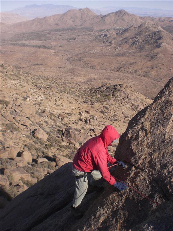
Bob about to rappel
the friction pitch.
(Courtney P. photo)

The final ten feet is on an easy boulder slab. The summit register is quickly signed, wind being the culprit.

I rappel the friction pitch, and then give Bob a fireman's belay while Courtney belays from above with Bob on-rappel. Bob elects to rappel the crawl space rather than rappel (in the open air) down more large boulders. The crawl space rappel is dead-vertical.

We recover our daypacks and head down thankless brush obstacles and smaller boulders to a deserved break in the sun partway downslope. Here I enjoy half a peanut butter and prune sandwich, the balance when back at my car.

After the final rappel Bob and I are again independent travelers. We return to the tri-junction, then drive east under a mile to a mica mine with main building, parking 0.1 mile north of it as our makeshift trailhead for Mica Mountain.

The climb of Mica Mountain is short enough. Bob does well, ascending at 1,000 feet an hour, and we summit after only 1 hour 21 minutes. The usual suspects have signed the register; I share a honey bun with Bob (no time to prepare a sandwich), and we descend. The entire round trip is hardly more than 2 1/2 hours.

Colorock
Colorock summit -
climbed by Courney and Matt
soon after Jumbo Peak.
(Courtney P. photo)
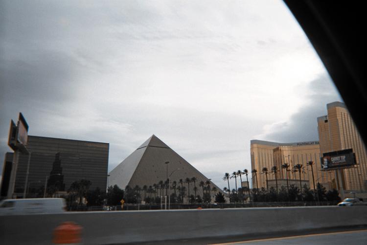
We get lost on the drive-out. Backtracking to the 1.8 mile junction I posit that Bob's written notes, "continue straight", led us along the wrong road on the return by continuing west rather than "turn right, ascending the hill". We (and especially Bob) are pleased to spot his camper after exactly 4.0 miles from the tri-junction.

Nearly 4 p.m., Bob leads us quickly north on New Gold Butte Road, the aim to reach pavement after 21 miles before complete darkness. We then continue a few miles to this nice pullout just as final light recedes.

It is enormously windy this evening (yet warmer), and the wind howls through the night. I am most happy to enjoy supper inside Bob's camper under these conditions: it would have been hard to light and cook with my backcountry stove under these conditions.

Monday, December 7 - Drive Home

Rain. The ten-day forecast was accurate - a remarkable computational tour de force. We caravan to Exit 75 and consider options. It is certainly possible to climb Frenchman Mountain this morning - albeit with an unsavory mix of rain and wind.

I've had enough recreation, and decide to head on home. For Bob the decision is harder as we learn that Interstate-40 leading to Flagstaff will receive one or two feet of snow. He decides to wait one day and hike the Frenchman Mountain summit access road on Tuesday. This allows the frontal system to pass before driving home.

My drive becomes intense for the final 150 miles (of 410 for the whole day). The rain is very heavy at-times, turning to snow at 4,200 foot Cajon Summit. I even leave Interstate-15 at Temecula, just 50 miles from home, as the freeway is becoming flooded. Most drivers are similarly cautious, except for a few moron-jerks who insist on driving 70+ m.p.h. despite the conditions.

I am most happy to be home after that drive.

Bob hikes Frenchman Mountain the next morning, and I receive a 1 p.m. phone call from him at Kingman, Arizona as he waits Interstate-40 to open from a truck mishap caused by the snow accumulation. He too is home by evening - again, a day after myself.

Frenchman Mountain has two possible highest points. Bob reports that the north point is higher; and that to access the highest natural ground one proceeds via the (cliffed) east side by swinging around a pole along the south fenceline. A fall there would be fatal - and so in the future I might tie-into the pole before reproducing Bob's maneuver.

Luxor snow
Iconic GREED -
"Luxor" and other hotel/casinos
of the Las Vegas strip.
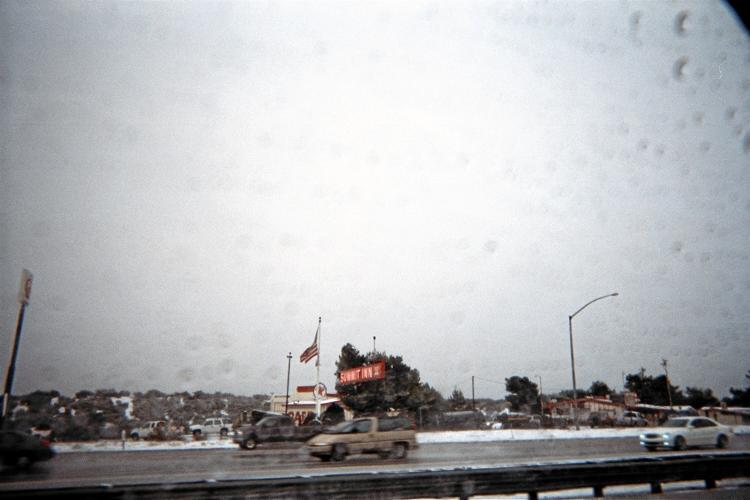
Snow at Cajon Summit
along Interstate-15.

Summary

The truck odometer reads 1066.7 miles on returning home. These "Adam truck miles" are typically one-hundredth more than standard statute miles.

As usual I enjoyed Bob's company - and the shelter provided by his over-the-cab camper. Our next joint adventure will be to old Mexico for a bunch of their state highpoints, the Sonora prominent point, and the ultra Centinela.

On preparing this report I am directed to Courtney Purcell's website for downloading and sharing photographs. Courtney is also a book author!

Examining that site I am surprised to see he was in Ecuador climbing some of the very same peaks that I did a mere month earlier in December 2008. Then too I find that he summited Aconcagua, the highest peak outside Asia, in January 2007 - just one year after I did with Edward Earl and John Sype.

Could this be the start of a partnership, exploring other Andean peaks of mutual interest? It's wonderful to dream: for my sake anticipation is half the fun.

conflagration
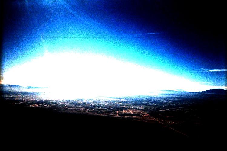
Night view of Las Vegas ablaze after a nuclear holocaust -
as viewed from the summit of Gass Peak.

GOOD RIDDANCE!