(click for enlargement)
Text by Edward Earl, as abstracted from a post to the prominence discussion group.
Photograph courtesy of Richard Carey.
Summit coordinates (NAD27 datum): UTM zone 11 (488432 Easting, 3700225 Northing).
GPS track of our return path as provided by Richard Carey (large: 516 kilobytes).
Note: The benchmark lies below the actual summit at 2,416 feet.
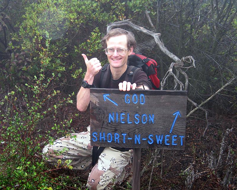
Nielson benchmark is near a little-known summit which has about 1,150 feet of prominence. Though in Riverside county, its proximity to Interstate 15 near the county line makes it a convenient target for San Diego-based, prominence-oriented peakbaggers. Though obscure in a sense, it is actually quite impressive if you know how to identify it; it is the "prominent" (in the lay sense of the term), bouldery, brush-covered mountain visible from Interstate 15 for several miles in both directions. The summit is crowned by a single, large, pointed, triangular boulder. The most convenient access to the mountain is from the vicinity of the Rainbow Conservation Camp (RCC), a California Department of Corrections facility for adult female inmates. Several days before my visit to the peak, I called the conservation camp at 760-728-2554 to inquire about access and asked if there were any special precautions we should take when in or near the camp. The officer said it shouldn't be a problem, but that I should check in at the front office upon arrival for any special instructions; and so that they would be aware of what we were doing, so that the corrections staff would not take any undue concern about an unknown group of people skulking around near the camp. On 2007 April 8, Adam Helman, Richard Carey, Terry Flood, and I convened at the Park and Ride by the Mobil station at Interstate 15 and CA Route 76. The preferred way to get to the peak from Interstate 15 approaching from the south is to exit at Mission Road, turn east at the top of the exit ramp, and then immediately turn left (north) onto Old Highway 395. Reset or note your odometer at this point. At 1.5 miles, turn right onto Rainbow Glen. (A left turn at the same intersection would take you under the freeway, but there are no interchange ramps.) Rainbow Glen soon becomes Rainbow Valley Road. At 2.4 miles, Rainbow Valley Road turns 45° left at a small triangle intersection. Go straight ahead on 8th Street and immediately cross Camino Rainbow. At this point, brown signs begin to show the way to the RCC. At 2.6 miles, the road abruptly turns 90° to the right and becomes Rice Canyon Road. At 2.7 miles, turn left at RCC sign onto Rainbow Heights Road, which climbs and winds. At 4.5 miles is a Y-junction where Rainbow Crest Road comes in at a sharp angle from the right. At 4.6 miles is a 5-way intersection where you make a 45° right turn onto Rainbow Heights Road East, indicated by an RCC sign. At 6.6 miles, you arrive at the camp, an insecure facility with a picket fence along the front. The roads are paved the entire distance. We parked outside the office but found it locked on this Easter Sunday. After searching around for a couple of minutes trying to find someone to talk to, a corrections officer appeared. I explained our plan. He said we should avoid the interior of the camp, but there would be no problem staying around the perimeter. We parked our car on an unpaved turnout just outside the front fence, donned our hiking boots, shouldered our packs, and went on our way. The weather was dreary, overcast with intermittent drizzle. We re-entered the camp and immediately turned left along the fence and passed to the left of a fire station next to the camp. We followed a road in this direction which we could see through the trees. After a few minutes, however, we realized that this road headed west, not north as we desired, so we returned to the fire station and headed north along a gravel parking lot behind the fire station. We followed a network of roads passing to the right of a hill topped by a concrete water tank and then to the left of a small reservoir. Just past the reservoir we proceeded though a gap in a barbed wire fence (probably the county line), and found a trail heading through boulders and brush up the ridge ahead. As we climbed up into the clouds, visibility dropped to less then 100 yards and there were no views. We were now in an area that harbored a complex network of usually well-maintained but unsigned trails. Much of the area smelled faintly of burned wood; and although there did not appear to have been a major wildfire, the ground was sometimes smudged in soot and/or littered with small charred wood chips. We suspect that this area is used as a firefighter training ground. After some trial and error, we found a good trail that climbed directly up the ridge toward our goal. At about 1,950 feet, the trail leveled off and we encountered an unsigned junction at which we turned right, followed about a minute later by a signed junction which indicated "SHORT-N-SWEET" to the right; "GOD" and "NIELSON" to the left. We chose left.|
|
|
Adam points in the correct direction. (click for enlargement) |