4,000+ Foot Prominences September 2011 Trip Report
© September 2011 Adam Helman
(Click on any image for enlargement.)

Note 1: All coordinates use the WGS84 datum.
Note 2: Mouse-click any image for detail.

Background

After a somewhat unsatisfactory summer of western county highpointing I am eager to do something significant prior to an October New England trip. One item of great interest is the lower 48's 4,000+ foot prominence list with 142 members. Most of them have been climbed as county highpoints; and as such I begin the journey with fully 116 of them behind me.

On this trip I raise that total to 120 by planning a southwestern circuit that includes three in south Utah and one in New Mexico ("P" is "prominence" and "E" is "elevation"):

  1. Navajo Mountain (P 4,236 feet; E 10,346 feet)

  2. Chicoma Mountain (P 4,291 feet; E 11,561 feet)

  3. Abajo Peak (P 4,550 feet, E 11,360 feet)

  4. Monroe Peak (P 4,117 feet, E 11,227 feet) or
    Glenwood Mountain (E 11,226 feet)

Monroe and Glenwood are six air miles apart, and are so close in their official elevations that both summits must be visited to ensure one has climbed a 4,000+ foot prominence. The other, slightly lower peak then has 1,846 feet of interpolated prominence.

I plan an aggressive itinerary that lasts all of six days. Although I want to spend more time on the road, I am concerned that as of recent my peakbagging trips are becoming too filled with extraneous activities; and wish to prove that I can still execute a multiday journey with nothing but driving, hiking/climbing, eating and sleeping.

I get my wish, albeit at the expense of my alertness while driving.

sheep dogs
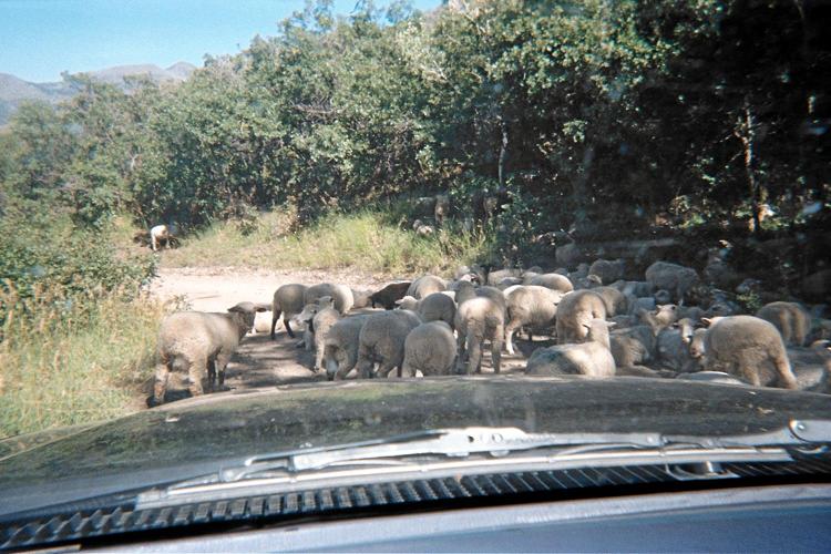
Sheep herd blocks the
Monroe Peak approach.
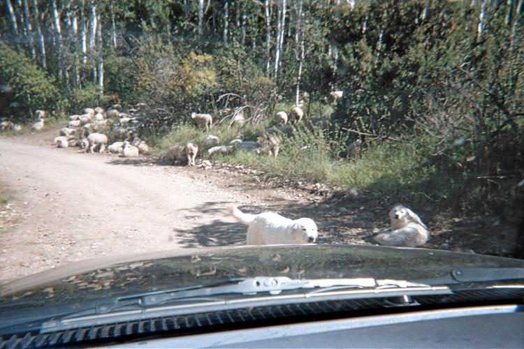
These dogs are in-charge
of all operations.

Trip Details

Thursday, September 15 - Mountain Pass

I drive 267 ATM ("Adam Truck Miles") to the Bailey Road exit on Interstate-15, at Mountain Pass (4,700 feet) to make the next day's drive more tolerable. One ATM is 1.01 normal, statute miles - so it's actually 270 miles for the afternoon and early evening.

Across the freeway is a very active mining operation. The lights are so bright they cast shadows at my location perhaps one-third mile away.

A nearly full moon rises around 9 p.m., and is my friend for most of the night.

Friday, September 16 - to the Reservation

I reaallly don't like driving long distances. As a necessary component of the sport, there's no choice apart from flying and renting which brings its own problems.

However the effort is rendered more tolerable with caffeination! I am now infatuated with not only hot or iced coffee with chocolate, but also a particular brand of "Java Monster" called "Irish Blend" in a green can. Admittedly pricey at nearly $3 each, it does provide caffeine, calories, 10 grams of protein, an assortment of B-vitamins, plus an "energy blend" of unspecified content.

Another item of lesser importance yet still significant for remaining marginally alert is the radio. NPR (National Public Radio) features excellent content that seems a "cut above" the standard crap one hears, filled with ads and idiotic music. Located on the bottom few megahertz of the FM band, I can nearly always pull-in some signal regardless of where my travels take me in the western states.

There is also chewing gum and the air conditioning which must blow into my face, directly, to provide a refreshing, alertness-enhancing effect.

So it is that I converge on tomorrow's venue from the south, via Arizona, even though the peak lies entirely within Utah.

I leave Indian Route 16 and drive a few-tenths mile west on the muddy approach road. It appears too risky - I could easily get stuck with an approaching storm. So I back-off and park next to an orange windsock at an unimproved airstrip located to the south and immediately west of the highway.

Navajo Mountain
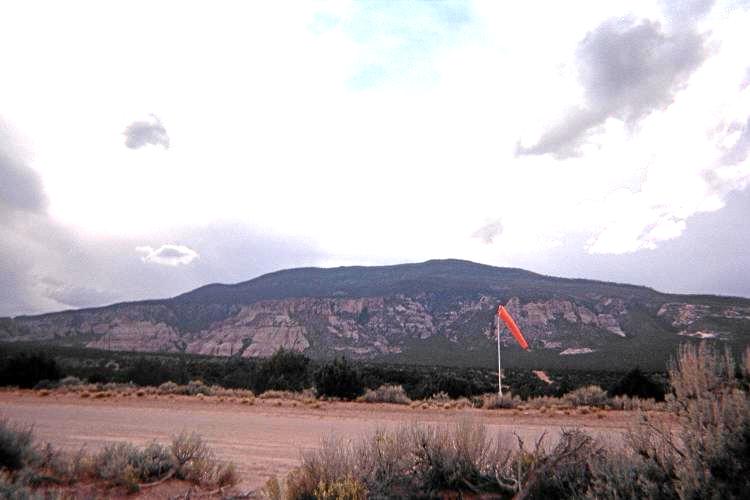
Navajo Mountain from my
carpark at the airstrip.

It's 4 p.m., and there's time to read from a borrowed book, Anticancer, from a neighbor who is very much "into" health food as a result of being a cancer researcher himself. The contents are astonishing: the standard western diet and way-of-life more generally seems specifically designed to promote the growth of tumors and their metastasis (spread) throughout the body.

Then too the American food industry has ensured that cancer will remain a threat by engaging in cost-saving practices that are antithetical to providing a healthy diet. The main culprits are refined sugar (which cancerous cells eat like candy); a low omega-6 to omega-3 fat ratio (which results from feeding cattle soy and corn rather being grass-fed); and a lack of phytochemicals which are prevalent in unprocessed vegetables and fruits.

From this carpark, tomorrow's effort will be somewhat larger than expected had I been willing to drive the muddy road and park where others have.

A thunderstorm passes by around suppertime, and I hurriedly dash inside the camper shell because I am only wearing street clothes that will not dry properly. There is lightning both near and far; and this trend continues for much of the evening, dampening my spirits considerably because the rain does not abate at sunset.

I receive a nearly mortal shock to my phyche about 8 p.m. when, simultaneously, a lightning bolt strikes very near while a local's vehicle stops right in front of my truck (how did he FIND me in the darkness?), the lights shining directly upon it. This one-two "punch" leaves my heart racing, and I put down the mixed fruit cup I was set to enjoy.

Know that I am on the Navajo Reservation, and without any permit that "officially" is required to be here at all.

He (or she) drives-off without comment, and I continue trying to sleep, without success, because the rain sounds like hammer-blows atop the metal camper.

The final cloudburst is at 11:25 p.m., whence the moon plays hide-and-seek with clearing clouds until I arise at the ridiculous hour of 4:20 a.m. to "beat the heat".

So much for a "10% chance" of "isolated storms" - a forecast which I had relied upon in deciding to drive the day I did.

Saturday, September 17 - Navajo Mountain

It's going to be a moderately long day with some 15 miles of foot travel and 4,300 feet of net elevation gain. However all of it is on a road - clear to the top.

After just one hour I cache water at 7,200 feet and continue. There's a dark, ominous cloud only over the peak. That's a shame, of course, as it suggests a chilly time on-top with wind yet no sun.

annotated boulder
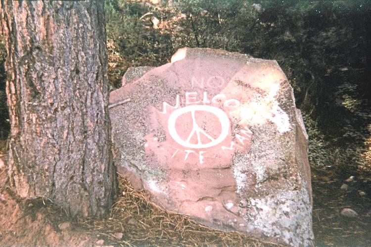
A mixed message sent by
the local population.

However this issue pales to what happens about 1,000 feet below the top: certain muscles in my upper right leg become painful to climb with, extremely stiff and unwilling to "cooperate". It's the same pain which has plagued me on many efforts of the season, beginning with Denali in early June.

The pain is immediately relieved on cessation of uphill travel. Walking downhill seems OK - a test I simply MUST perform because, as the saying goes, getting back is mandatory.

I stop for a GPS-based elevation reading which shows I am only 700 feet below the top. So I take a pair of aspirin, wrap my right thigh most tightly with an elastic band designed for sports injuries, and continue with a tree branch as walking cane.

No joy. It's windy on-top and the entire affair was somewhat painful. The summit communications equipment allow for a cell phone call, and I alert my mother that there's a problem and that it might take the entire day to descend.

Descend I do - and in good time since my leg is not painful any longer. I eat my "summit" lunch at a major road bend at 9,000 feet, enjoying the expansive views. I return to the windsock via a shortcut - a bermed, very sandy straight road connecting the airstrip to the muddy approach road as it heads northwest.

summit
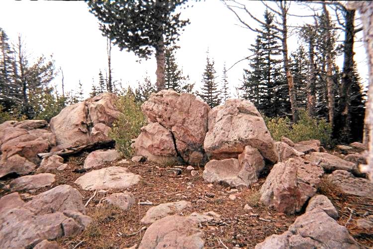
Navajo Mountain summit boulders

There is roughly 125 feet of elevation lost at 8,500 feet; and about 50 feet lost between the airstrip and the west-trending approach road. Hence my total gain is some 4,650 feet for the day, consuming 7 hours 38 minutes for the round-trip.

It's only 12:48 p.m. when I meet the car. However I am mentally exhausted from having sleep just four or five hours. After changing clothes I plop down on the camper shell's interior and doze for several minutes before re-arranging items and driving on - first to Kayenta, Arizona and ultimately to a Wal-Mart in Farmington, New Mexico after sunset.

I am quite hungry, and enter the store not expecting a piping-hot whole roast chicken, ready-to-eat, just waiting for purchase. I also get a loaf of sourdough bread to soak-up the rich juices on the container's bottom. With a bunch of mustards and tabasco sauce I enjoy nearly half the bird before realizing that I can save the remainder for at least one day, without refrigeration, before it "goes bad". This superbly delectable treat will be my "Dogpatch Ham", and well-earned given the day's painful experience.

It's been a long day - and there's more to come.

Sunday, September 18 - Chicoma Mountain

The alarm sounds-off before dawn, and I am a bit reluctant to intitiate another 14 hour day. Still, if I am to remain on-schedule I must drive 190 miles to Española, New Mexico, drive 27 miles of dirt, climb Chicoma, and then reverse it all by day's end.

Originally I planned on going east on Route 64, yet I find it in great need of repair from my experience using it between Ship Rock, New Mexico and Farmington. In fact, the entire roadbed would have to be ripped-up to fix its nightmarish bumps and squiggles.

So I take Route 550 southeast from Bloomfield instead. It's essentially a freeway, with double lanes in each direction and a 70 m.p.h. speed limit.

cairn
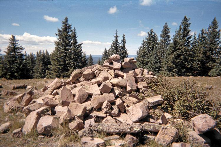
enormous Chicoma Mountain
summit cairn

This report on Chicoma Mountain claims that FR144 is a "superhighway" compared to most New Mexico forest roads. Don't believe it: there are rocky sections and eroded sections. Both force one to slow down to almost a crawl. Allow from 1 1/4 to 1 1/2 hours in either direction. Furthermore, from mile 9 to 13 the road climbs a south-facing slope with nearly vertical drops and no guard railing. You do NOT want to negotiate that section in the dark and/or in rain.

I park at this road junction with a whopping 10,850 feet of elevation, set on hiking the jeep track southeast to this saddle at a measured 10,909 feet.

From there I find hints of a former trail, yet they are unhelpful. I head 120° true, and come to a somewhat level area at 11,200-300 feet. Surely this is not the top! So I continue on the same heading, and exit the forest cover at the bottom of a pretty green tundra slope just 150 feet below the top.

The summit features a huge cairn; while at the benchmark I obtain WGS84 coordinates (36.00734° N, 106.39779° W) and 11,562 feet.

I am quite tired, again, from lack of sleep because there was a police arrest of some drunk driver at the Wal-Mart lot last night; followed by a trucker who decided to park next to my vehicle at 3 a.m. and idle his motor the entire time. So with daypack as pillow I lie down in the shade of a small spruce evergreen and sleep for several minutes before enjoying a small cherry fried pie and descent.

summit vista
New Mexico at nearly treeline
from Chicoma Mountain's summit.

Back at a gasoline station I am desperately tired. Somehow I muster the will to drive on rather than just call it a day, have a "Mississippi Mud" ice cream sandwich, and return to Farmington the way I came.

However I know that being near the Fall equinox driving west from Bloomfield on Route 64 at sundown will be horrendous with the sun directly in my viewshed. So in Bloomfield I park and organize stuff for the evening, driving west just after the sun sets.

It's again dark when I arrive at Wal-Mart. I left in dark and now I return in dark. As I prepare for a meal of cold chicken a man parks close-by, gets out, and tells me this is a safe place to be for the night. He's half Jicarilla Apache and half Navajo, and hungry! So I take a knife, cut down-the-middle my remaining chicken, and let him choose his portion together with half the remaining sourdough bread. I also give him four mixed fruit cups for dessert and napkins.

So it is that the entire bird gets consumed without any waste - as had been my intent - without any refrigeration, salt-brining, or pickling in vinegar.

I sleep considerably better tonight, no disturbances.

Monday, September 19 - Abajo Peak

I arise at 6:30 a.m. rather than 6, having calculated that today will not be quite as long so I can sleep just a bit longer.

Not so!

The venue lies in Utah some 200 road miles to the west and then north. It's a drive-up, a slothful concept that would have most climbers sneer with scorn and disbelief. I do admit feeling a bit silly driving clear to the top of a prominent mountaintop. However if I am to remain on this self-imposed schedule it's mandatory.

Abajo ahoy!
Abajo Peak from FR087
is right of center.

The approach road is both called FR087 and B102. It begins one mile west of Monticello, Utah at this T-junction. To get there, drive west from Route 191 starting two blocks south of its junction with Route 491 (take W 200 S which becomes Abajo Drive). Why does no previous report mention this essential fact?

Stupid, stupid, stupid. When a report is written the level of detail provided should be such that the reader can completely reproduce your successful efforts without having to either guess or waste time.

From that junction it is 10.8 ATM (10.9 miles) to the summit communications towers. The pavement ends (as of 2011) 1.7 miles along the route near the obvious lake. Thereafter all side-roads are obviously inferior and ignorable.

The final several tenths mile of road is narrower and climbs steeply up the peak's south-facing slope. Again, you do not want to be doing this by dark and/or in the rain: driving off the road here (requiring a mere second or two of inattention) would be fatal.

summit towers
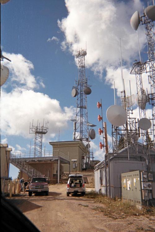
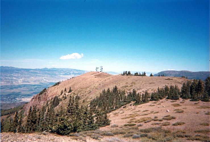
Abajo Peak summit
antenna farm

At the top I find three workers. Exiting the truck cab the oldest (and fattest) one makes some negative gesture with his hands suggesting that I am not welcome. Seeing my GPS unit in-hand he says,

"Which tower are you going to GPS?"

I reply,

"The summit!"

I pass right by him, and walk the final few dozen vertical feet. Unless he has a gun pointed at me I am NOT going to back down once so close to the prize: there are no "No Trespassing" signs anywhere, and so I am completely within my right to be here.

It takes an hour for returning to the cited road junction. I sleep for a few minutes, or at least try to; get gasoline in-town, have some lunch there, and continue 220 more miles to the next day's pair of venues.

symmetric rock
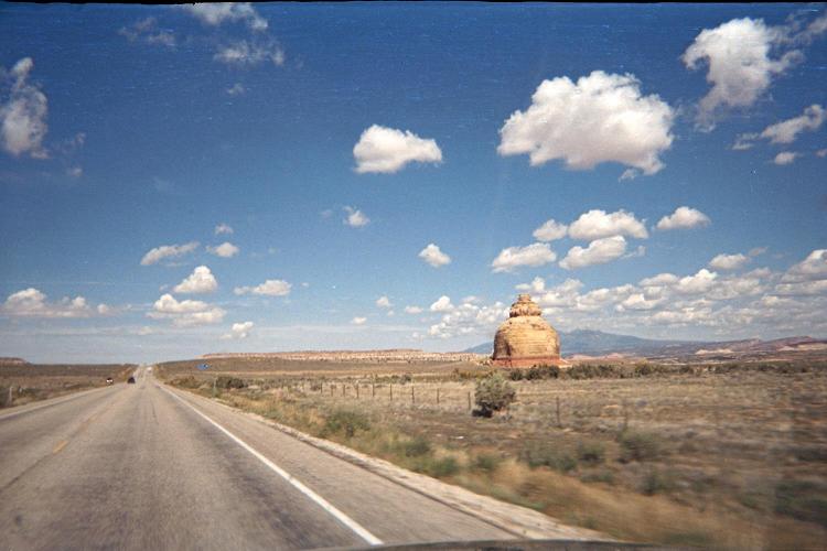
Along Route 191 is a rock formation
which appears shaped like a bell
coming from the south. Abeam the object
its true, oblong form is revealed.

It's not necessary to drive-up Monroe Peak this late afternoon to remain on-schedule. So instead I decide to drive partway the forest road for climbing Glenwood Mountain, also called "Signal Peak", the next morning. This is a most confusing name since there's already a "Signal Peak" in southwest Utah, indeed, the Washington County highpoint and with 4,505 feet of prominence.

Zeroing my odometer in the town of Glenwood here I drive east, expecting it to be 15 road miles to the desired pair of trailheads cited in this web page at summitpost.org.

It's already half past five, yet I wish to use all available daylight. So I continue driving. After 3.7 ATM (3.7-3.8 miles) from the cited town junction one must turn left at this T-junction. The road is steep at-times by now as it climbs north-facing slopes both in and outside of national forest land.

At about 13 miles the road is again somewhat steep. After about 14 miles encounter Big Lake. Be certain to stay left (southwest) here; and also stay left (west) here.

green rock band
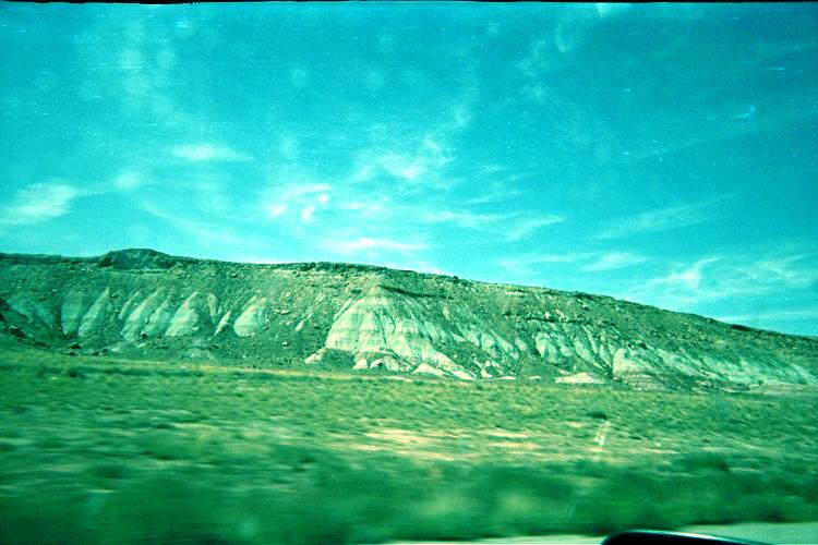
North of Moab, Utah along Route 191
is a horizontal band of ancient, green rock.

(The stunning rock color did not come-through
in the original image, which was then modified
to create a more vivid, realistic green.)

After about 15 miles you are nowhere near the desired trailhead. So the cited summitpost page is completely incorrect in this regard. Instead you are at this junction where you turn right (west) and continue for 3 additional miles.

There appear to be two trailheads at the road and separated by roughly 0.2 mile. The north trailhead is 17.8 ATM (18.0 miles) from the cited Glenwood junction; while the south trailhead is 18.0 ATM (18.2 miles) from it. The trailheads are at nearly identical elevation, some 1,000 feet below the summit.

I park about 100 feet south of the south trailhead after 7 p.m., having taken about 1 1/2 hours from Glenwood town center. It's getting dark soon, and chilly owing to the 10,250 foot elevation.

I sleep very well tonight, ten hours in fact, there being absolutely no sound to disturb me.

Tuesday, September 20 - Glenwood Mountain and Monroe Peak

I find the south trail of marginal use - often its presence is ascertained only in that a fallen tree has been obviously sawed, leaving a two or three foot wide gap. This Glenwood Mountain effort lasts 2 1/2 hours and entails 100 feet of elevation loss after topping-out at a key ridgeline saddle some 15 minutes before reaching the top. The effort's "crux", if there is any at all, is gaining elevation on the steep slope from 10,800 to 11,100 feet prior to hitting this ridge.

Glenwood Mountain
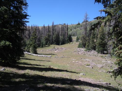
Alpine meadow and evergreens along
the short Glenwood Mountain hike.

The summit has three or four contending rock outcrops within a hundred yards of one another. I find the highest by visual inspection to be this one at (38.62535°N, 112.01571°W) and with a GPS-measured 11,123 feet.

On the return I find parallel, curvilinear grooves in the tundra under (west) of the cited ridge. This is 11,100 feet and well-distanced from what I would call arable farmland. Each groove is several hundred feet long, several feet wide and nearly as deep. These grooves are visible in satellite imagery.

Glenwood Mountain
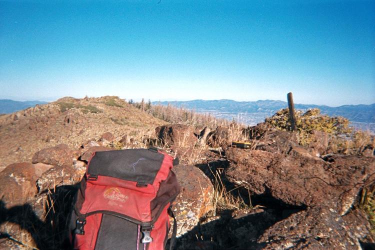
GPS unit atop the most likely
highest rock at Glenwood Mountain.

What ARE they?

Anyhow, I take just an hour for driving out, continue to Richfield, and soon find myself on the road for Monroe Peak as described in this trip report.

From pavement's end I measure 9.7 ATM (9.8 miles) to this junction; whence it is 2.8 additional miles to the (southern) summit area with 11,227 foot benchmark (including a short spur road for the final 0.1-0.2 mile).

The first 3 or 4 miles on-dirt can be steep; on the descent I use low-range to avoid riding the brake. I encounter a large flock of sheep at 2.4 miles in both directions. They get out of the way both by nudging my vehicle's nose forward ever-so-slowly; and by more abruptly honking the horn. Two shepherd dogs curiously eye me on driving-out.

Monroe Peak
View north from Monroe Peak's
slightly higher south summit.

The journey's goals complete, at around 3 p.m. I have lunch (spicy hot dog, soda, ice cream bar and half a large macadamia-white chocolate cookie) and drive west to I-70's western end at I-15; thence south to Saint George, Utah for a Motel 6 room. I want to reach Mesquite, Nevada where the rooms are cheapest and come with a free breakfast. Yet as I again am getting quite sleepy, feel it prudent to "call it day".

Wednesday, September 21 - Home

The 450 mile drive home is uneventful. However the half cookie intentionally saved is put to good use with more "Java Monster" brand "Irish Blend". Immediately after I pass through the Virgin River Gorge, on I-15, during the short portion when it's inside Arizona. Being just one-half hour after sunrise the shadows provide excellent photographic material, and I take several pictures, admittedly with some risk, while in-motion on the windy road.

Some hours later I successfully find the pizzeria, once chanced-upon, embedded in a Union 76 station just west of Exit-143 on I-15 in Hesperia, California. Their pizza (and more) is superb and highly recommended.

Summary

FINALLY a summer trip with positive outcomes throughout. My days are filled with activity directly related to peakbagging just as I set out to demonstrate - and yet at the expense of my alertness and, likely, overall enjoyment as well.

My pickup truck's odometer read "140,202" on trip commencement; and "142,609" on conclusion - a total of 2,407 "Adam truck miles" which appear to be roughly one-hundredth larger than normal, statute miles.

I don't intend upon completing the CONUS (Contiguous United States) 4,000 foot prominence list because several difficult peaks are in the North Cascades of Washington where the weather is generally atrocious apart from four good days in summer. As they require partners it's quite difficult to acquire them when folks generally are available only on weekends. Given that I do not live in Washington I cannot sit interminably the entire summer waiting for the required coincidence of weekend and fair weather.

I will be satisfied with perhaps 135 - the remaining seven or so falling in the "required partner available only on weekends with unstable weather" category.

Interstate-15
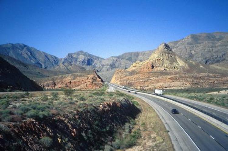
Interstate-15 enters the Virgin River Gorge in this
west-facing view from Utah to extreme northwestern Arizona.