Elevation: 7365 feet Prominence: 5545 feet Location: 50:45.9 N 118:50.6 W Backroads Mapbook: Kamloops/Okanagan, Map 37:D1 Climb Duration: One day or less depending on how high you drive. Difficulty: Class 1
Driving Instructions: From the town of Enderby located on Hwy 97A north of
Kelowna turn east (right if coming from the south) onto the paved Enderby-Mabel
Lake Road. Follow this in an east/northeast direction for about 20 miles or so
to the signed Three Valley-Mabel Forest Service Rd. Turn left (north) onto this
good quality dirt road. Follow this for perhaps 8-10 (?) miles and look for the
Mt. Mara Rd. (also listed as La Forge in the mapbook) on your left.
I recall passing under some power lines and crossing a small bridge perhaps
a half mile or so prior to reaching this intersection. After making the left turn
proceed approximately a half mile and reach a fork in the road. Take the left fork.
This road eventually leads all the way to the summit lookout.
A sign indicating “Road closed due to construction” was posted here in Aug. 2008,
however the road was open and no construction activity was encountered.
High clearance is pretty much a necessity beyond this point.
Description: Morton Peak is located in a relatively gentle subalpine region
and has a lookout located on its summit. The name Mt. Mara appears to be used
in association with the lookout although the mapbook indicates the true Mt. Mara
(which is lower) to be several miles to the SW. In any event the
lookout at the end of the road
sits on the highest point in the area.
The crux of this route is the drive up the road. Several days before someone had
coaxed a Toyota Tacoma all the way to the summit. With my own vehicle (also a Tacoma 4WD)
I parked at about 6200’ near a cabin site. This is the transition area from trees
into more open meadowland.
At this point the road actually improves and I probably
could have driven to the top, but it seemed wrong to drive through this lovely parkland
and not hike, given the scenery.
I would highly recommend parking considerably lower than this though,
as the road was extremely rough and not worth the wear and tear on your vehicle.
There is a good level parking area off the road suitable for overnight camping
at a road spur perhaps a couple of thousand feet lower (elevation not noted).
From this location it would be a moderate one-day hike to the top and back.
Once the road enters
the meadowland at about 6000+ feet
keep an eye out for the
summit lookout which is towards the left end of the high ridge containing several
other high points to your north. In this area the road levels and even descends
somewhat turning to the left from a northerly to a more westerly direction.
Once you have
spotted the lookout
it is easiest to just set out cross-country.
In the area (below and southeast) of the saddle east of the lookout pick up a
good quality trail
leading to the summit.
Photos (taken August 2008):
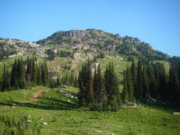
3183: View of road in meadowlands. Note the summit lookout which is just barely
visible if you look closely to the left of the tall trees in the center of the frame.
3184: View north from about 6000+ feet. Lookout is out of the frame to the left.
3186,
3195: Surrounding views.
3187: Old horse trail leading to the summit.
3188: View from lookout window.
3190: Lookout
3191: View eastward along the ridge.
3192,
3193: Views of the lookout from the ridgeline to the east. Note the trail faintly
switch-backing up beginning on the left side of the
lowest snow patch in 3192.
3197: View of the high ridge. The lookout is towards the left end.