Elevation: 7644 feet Prominence: 5397 feet Location: 50:10.4 N 117:54.0 W Backroads Mapbook: Kootenays, Map 17:A3 Climb Duration: 1 day from the trailhead. Difficulty: Class 2 or 3 depending on the route taken. Additional Resources:
Where locals hike in the West Kootenay by Kathy and Craig Copeland
Driving Instructions: From the small town of Nakusp head south on Hwy 6 for about
13 miles to the turnoff for the
Arrow Park ferry.
This small ferry runs (for free)
from 5 am to 10:30 pm. Take the ferry across the lake and head east and then north
on Saddle Mountain Road along the west side of
Upper Arrow Lake and follow it about
6 miles to Saddle Lookout Road. Turn left (west) onto this small, rougher road.
A sign at this point states (inexplicably) that the trail to the lookout was closed.
Ignoring this sign, drive up this rough and overgrown road to about 4700 feet.
The trailhead is hard to spot as it is located in a brushy area and the signpost
was found lying on the ground. The trail itself was in pretty good shape.
The road continues beyond the trailhead and is drivable to about 5000 feet.
(Note that the Copeland book gives the TH elevation as 5510 feet-this appears to be an error.)
Description: Upper Saddle Mountain overlooks an area of
large lakes and is
located a couple of miles north of the slightly lower Saddle Mountain which has an old
lookout on its summit.
There is a fairly good trail which leads up to this lookout.
A high cliff band runs on the north side of Saddle Mountain separating it from the
easier terrain between it and Upper Saddle. It is possible to get past this obstacle
in one of two ways.
One way is to drop down off the back side west from the summit
lookout through brush and small trees and follow the easiest line back around to the
ridge saddle north and below the cliff band (route seen in
this photo).
Continue northward on a descending traverse dropping to about 5900 feet on the east side
of Point 7608 to a small basin. From here follow the line of least resistance
up the slope to the east ridge of Upper Saddle. Climb up through some
light brush and trees
to the east ridge
and follow it easily to the summit. This route does not exceed Class 2.
The second alternative bypasses Saddle mountain and the lookout by leaving the trail
where it nears the edge of the cliff band around 6500-6700 feet.
With a bit of searching a short Class 3 step downhill into the basin to the north
can be negotiated, although a half rope for a handline might make things a bit easier.
From there, traverse across the basin to join the route at the base of the east ridge.
On our climb we ascended via the first route and returned via the alternative.
Note: From the summit of Upper Saddle we observed a number of possible
communications buildings a few hundred feet below and to the west.
It is possible that roads leading up to, or near, these structures from the west
may provide an easier route to the summit.
Photos (taken July 2006):
0514: Arrow Park Ferry
0516: Saddle Mountain Lookout Building
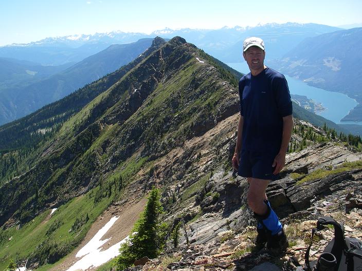
0518: View to the south from the lookout.
0519: Upper Arrow Lake
0520: View from Saddle Mountain LO toward Upper Saddle Mountain. (summit behind and right)
0521: Initials of former lookout carved in the rock on the Saddle Mountain summit.
0523: Route descending from Saddle Mountain From the saddle pictured right and below
the lookout drop down through the trees to the grassy area below.
0526: View from the summit of Upper Saddle back toward the Saddle Mountain LO
0527: View NW of Upper Saddle. Note structures at the right side of the frame.
0528: More structures to the W/NW
0529: Upper Arrow Lake with Nakusp at the left edge.
0530: View from the summit of Upper Saddle back toward the Saddle Mountain LO
0531,
0533,
0534: East ridge of Upper Saddle
0535: View from the basin looking up toward the east ridge.
Upper Saddle Mountain summit view back toward the Saddle Mountain Lookout