Adams County Highpoint Trip Report

Date: June 25, 2009
Author: Adam Helman

approach road instructions - the "bear essentials"

Mouse-click any image for a larger version.

This effort was part of a larger journey collecting Idaho, Montana, and Washington county highpoints in late June and early July 2009.

The entire road from Council, Idaho to Bear, Idaho is now paved.

Once in Bear (a tiny community lining the road), continue north 4.8 miles on vy good gravel as FR105. Zero your odometer after driving this section.

Then, "bear" left onto a lower-quality continuation of FR105. After just 0.2 mile, "bear" left again. At 1.7 or 1.8 miles, encounter a major backcountry junction. "Bear" hard right (greater than 90°) onto FR112, signed with "Black Lake Campground 14 miles".

I was stopped after 5 miles by snow on the road, and, as it was too narrow for turning-around, I backed-down, in reverse, to a point where a three-point turn was possible.

As a consolation prize I parked and then climbed Smith Mountain with summit lookout (8,005 feet) with some 450 feet of elevation gain. Being lazy I just used tennis shoes, (rather than change into boots) - and this even though some snow was underfoot.

Smith Mountain is prominent in the lay sense, being the sentinel summit of a large area when viewed from the south. I climbed it in-part to survey whether multiple snow patches covered the approach road. If not, some shoveling at the one patch that stopped my vehicle would be feasible. However I saw many parts of the approach road covered. Adams County will be revisited another summer.
sign FR112 Smith Mtn
At a major backcountry road
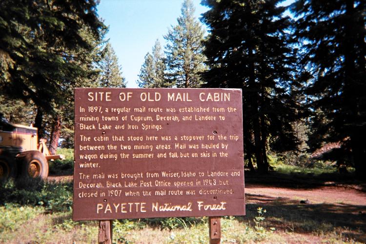
junction one finds this sign.
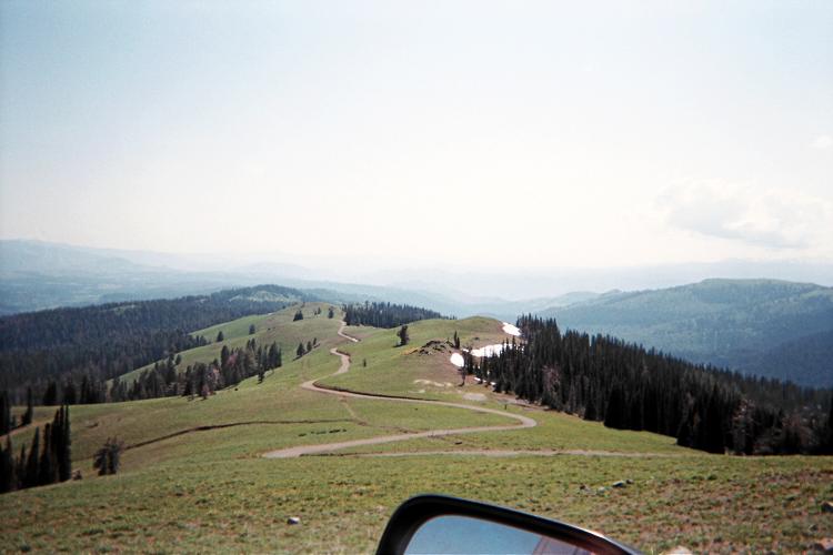
View down FR112 after
roughly 5 miles.
Smith Mountain and its lookout
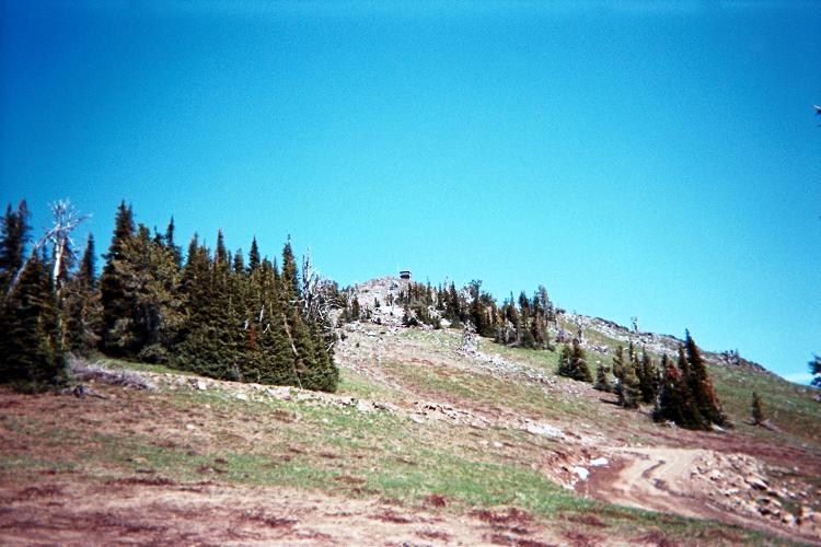
from the approach road.