Northern States early summer 2009 Trip Report
© July 2009 Adam Helman
(Click on any image for enlargement.)

Background

Examination of this March 2009 county highpoints completion map reveals that my long-term goal of finishing the eleven western state's county highpoints is realizable with a few summers more effort. To wit, of the 414 counties in that region there are but 44 counties remaining - roughly one-ninth of the total.

The current journey may not have occurred, or would have been greatly abbreviated, had I remained at Denali this late May and early June with a West Buttress expedition organized by AMS, the Alaska Mountaineering School. Simply stated, after three weeks on a block of snow and ice, it takes quite some time for one's psyche to gear-up for even seeing another mountain - let alone spend three weeks climbing them while making good some 4,000 road miles.

However I did not remain long on that climb, to say the least. The "ifs" and "whys" of my decision still haunt me, and others - and yet I have learned from that experience to some extent how not to make decisions on a world-class mountain.

Against this background lies Bonanza Peak in Washington - arguably the overall toughest county highpoint in the 48 contiguous states in a pure mountaineering sense. I need this peak as part of my overall, long-term goals as it is, obviously, a western county highpoint.

Finding partners for this climb is difficult. However my friend Greg Slayden is interested in organizing an ascent for early July with Dennis Poulin and Grant Myers. I have climbed with all these men at venues ranging from Grand Teton to Mount Olympus. I am reluctant to force myself upon them - and yet I make it clear through E-mail that I will be hard-pressed to locate others should I be forced to look elsewhere.

Greg invites me, albeit with the stricture that I must not allow others to know about our plans.

Now this all transpires in early May before I fly to Alaska. Greg understands that I might not be willing to attend Bonanza on account of Denali - after all, both he and Dennis have been to North America's rooftop.

When I return prematurely from Denali, however, it is clear that, not only will I attend the Bonanza Peak climb: I will make it the centerpiece of an extended, three week peakbagging trip.

Hence the origin of my current journey. To make the driving less boring I add a bunch of prominent peaks on both the outbound and return legs. I also visit my brother and his family on the central California coast before coming home just in time for my 49th birthday.

Trip Details

Saturday, June 20 - Glass Mountain in California

True to prediction, I am at the trailhead for Glass Mountain eight hours after departing San Diego. Glass in on the California Fifty Finest prominence list; and is located north of Bishop. Factually, Glass Mountain per se is not of current interest - rather, a summit immediately southeast is slightly higher and hence owns the large prominence.

Glass Mountain
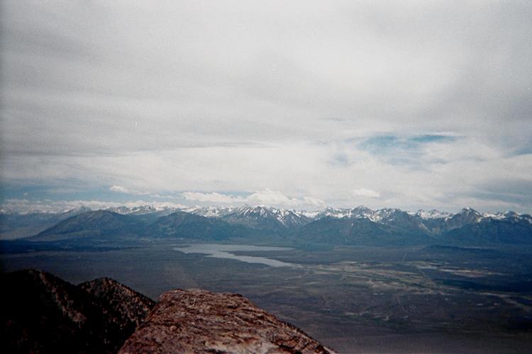
Sierra Nevada from the
summit of Glass Mountain.

The four wheel drive trailhead is at WGS84 (37.77346° N, 118.68695° W), elevation 9,345 feet. It is 0.4 road mile from the penultimate road junction to the final junction (with 4WD road).

The elapsed time for my ascent is 1 hour 4 minutes; and I found the scree to be tolerable rather than the grueling slog others have warned about.

Summit views are expansive, ranging from Boundary, Montgomery, and White Mountain Peaks in the eponymous range; to the Sierra Nevada with the Minarets both south and west. Having just left home, I can enjoy fresh food - here, a kosher chopped liver sandwich on rye bread with ketchup and onion (a classic combination).

clouds
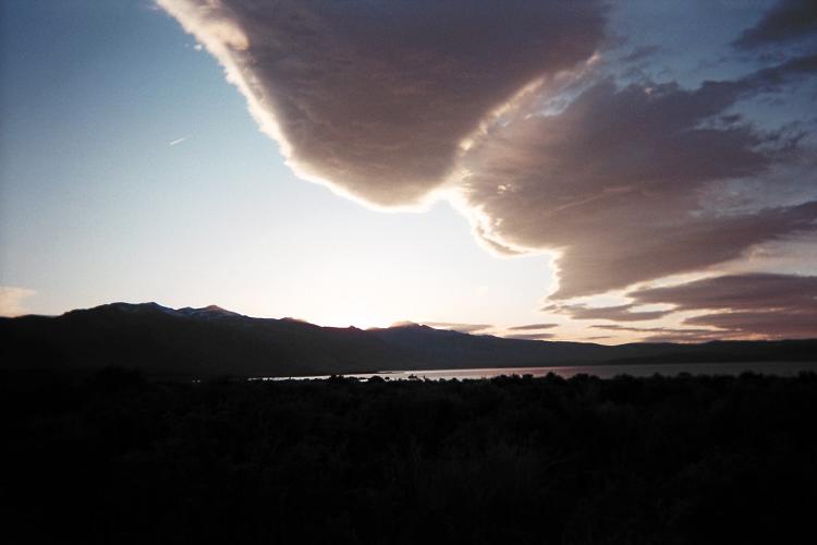
Clouds at sunset, Mono Lake.

Descent is a rapid 38 minutes, and includes retrieval of a beautiful 2 1/2 pound obsidian chunk.

Being only about 3:30, I forego the original camping plan and drive towards my next venue. Eventually I camp near the south shore of Mono Lake.

Sunday, June 21 - Mount Patterson in California

With more than 4,000 feet of prominence, Mount Patterson definitely commands respect. Parking at Lobdell Lake, I find that hiking around the eastern shore followed by walking the berm serving as the lake's northern end is much shorter than hiking around the western side.

Patterson with snow
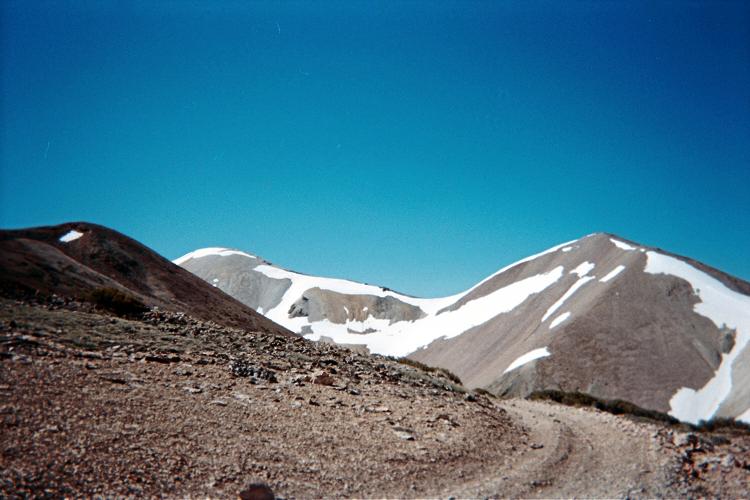
two miles high, Mount Patterson

The wind progressively becomes a chilly nuisance; and, by the time I hike the large, flat area above 11,000 feet it requires three layers and wool hat. There is in addition a fair amount of snow on adjacent slopes - but not really the ridgelines. At the summit it is so windy that I hunker-down on the leeward side and stay only long enough to take a photograph of the tattered American flag whipping wildly. Descending rapidly, I eat my summit food only upon reaching a hairpin bend at 10,400 feet.

summit flag
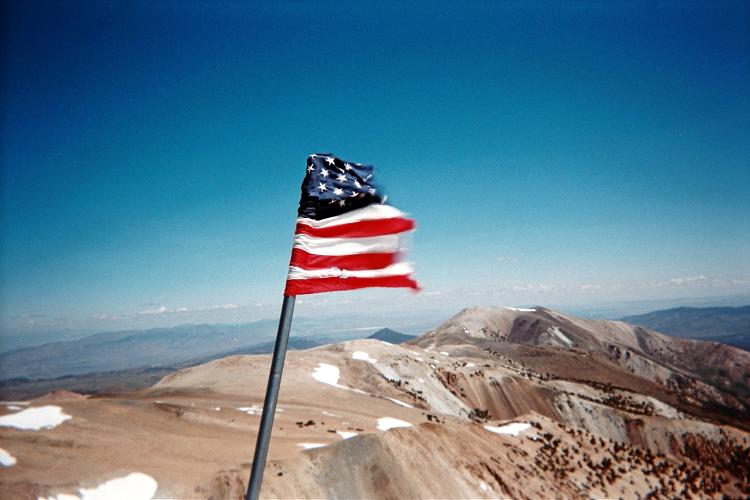
Atop Mount Patterson
with Old Glory.

All-told the 10 mile effort consumes 5 hours; and I drive towards Lake Tahoe via Carson City, Nevada. Eventually I camp 0.1 mile along the 0.6 mile rocky jeep road leading to the trailhead for the newly discovered Placer County, California highpoint.

Monday, June 22 - unnamed 9,040+ feet (Placer County, California)

My hike to Placer County's highpoint is described in this trip report.

Most of this day is driving, and I insist on a minimum of 400 miles. The route is largely on Interstate 80; and turns north on US Route 95 at Winnemucca. Southeast Oregon is lonely and desolate as ever; and I cross into Idaho and drive to mile marker 9 where, turning south on dirt, I find a secluded place to camp on the road's side after a mile or so.

orange truck
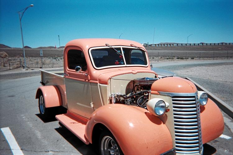
Seen at an I-80 rest stop
is "Orange Creamsicle".

Tuesday, June 23 - unnamed 4,763 feet (Payette County, Idaho) and tire trouble

My efforts to reach Payette County's multiple possible highpoints are described in this trip report.

Fifteen miles south of Cascade, Idaho along ID Route 55 I am waiting in a construction zone when a driver going the other way points out my nearly flat left front tire. I cannot pull-over since this is a canyon; and, besides, there are dozens of vehicles packed like sardines waiting for the signal to move ahead.

pickup truck
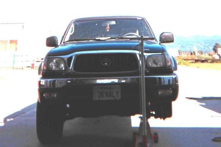
"DENALY" without
the left front tire.

It is horrible to sit like this while I know the tire is slowly losing air! In fact, I am finding it hard to stay calm....

Once the flagman clears us for travel, I drive along the shoulder at 30 m.p.h. with emergency lights flashing in the effort to reach Cascade before the tire rim hits pavement. Fortunately the very first business is a tire repair store!

I lie, claiming that I have a flight out of Spokane the next evening. The repairman switches priorities and works right away on my vehicle. We place the spare tire on the left front after balancing it with this high-tech device; and a newly purchased tire of the correct outer diameter becomes my spare tire. It does, however, have a slightly smaller width.

fence
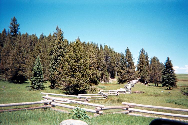
Zigzagging ranch fence
beneath Snowbank Mountain.

My vehicle whole again, I drive the approach road up to the western summit of Snowbank Mountain. The road is maintained snow-free because the summit features an important FAA radar facility. Reaching the top by 6:30 p.m. I am again on-schedule despite what could have easily set me back an entire day.

While enjoying the late afternoon views I meet a young Israeli couple who have driven their rented SUV across much of the western USA, having started somewhere around the bay area. They are surprised to hear my Hebrew; and I take their photograph so at least they'll have one picture with both of them inside it. She is attractive.

Sunset is not until nearly nine this evening; and I enjoy supper, as always, on the tailgate with my pack all set for the next day.

Wednesday, June 24 - Snowbank Mountain and unnamed 7,971 feet (Gem County, Idaho)

My trek to Gem County's spot elevation 7,971 is described in this trip report.

After a few hours driving I am, yet again, at a trailhead for some county highpoint. I have shunned the campground option as it is lower in elevation (hence hotter), costs money, and offers the possibility of noisy neighbors. Instead, I car-camp alone at the trailhead under growing shadows.

Thursday, June 25 - Cuddy Mountain (Washington County, Idaho); Smith Mountain

My climb of Washington County's Cuddy Mountain is described in this trip report.

The next goal is Adams County. It is a long approach drive, one which, fortunately, is made less burdensome by a now all-paved section leading from Council, Idaho to the tiny community of Bear.

road
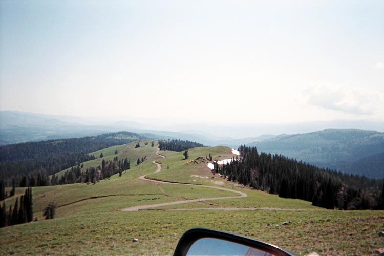
Looking down FR112 from near
the turnaround snowbank.
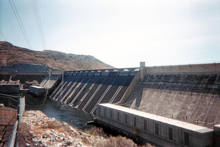
Unfortunately the approach road goes higher than the trailhead as it wends its way in counterclockwise fashion. After some 5 miles along FR112 I am stymied by a snowbank. Rather than risk all by attempting to drive across it, I back-off, literally, by reversing down the mountain road until I can safely turn-around.

Details of this experience, and of my "consolation" ascent of nearby Smith Mountain, are described in this trip report.

I stay at a campground for free since there is no campground manager to check whether or not I have paid.

Friday, June 26 - drive to western Montana

What to do with all of my extra time? I cell phone Bob Bolton who offers some possibilities. The most tempting option is Rock Creek Butte, most prominent Oregon summit I have yet to climb. However it entails a 200+ mile end-around, back through the Boise area, in order to cross the Snake River which forms much of the Idaho / Oregon border. Bob suggests that there's a good chance that a cliff-like portion to the trail, on the northern slopes (hence shaded) will still support snow.

Given these negatives I opt for traveling north, and then northeast, bound for Missoula and then the trailhead for Mineral County, Montana's highpoint. It is slated for my August journey. Hence doing it now will free time for a different venue currently undetermined. Driving US Route 12 is slow, and features several road construction stops.

I meet friend Jim Perkins at his Missoula workplace a full hour after my original estimate. We exchange notes on Mineral County and of an upcoming joint effort where Jim will finish the entire Montana county highpoint list. After two slices of hot pizza (thanks Jim!) and a gas station soft drink I head northwest on Interstate 90 to my trailhead.

Saturday, June 27 - benchmark Quartz (Mineral County, Montana); another vehicle issue

My climb to Mineral County's benchmark Quartz is described in this trip report.

On returning to my vehicle the gear shift functions but the transmission refuses to shift out of "Park". I search the manual and find nothing of use. It is 15 road miles back to pavement.

Fortunately I get the faintest of cell phone signal - one bar only - and it is intermittent at that! This is strange because yesterday, on arrival, I got no signal whatsoever. Providence? You decide.

I call a Toyota emergency road service number. They never return my call. I call "911" - and get the Mineral County Sheriff Department. This man is quite cooperative. I describe my exact location, including GPS unit-derived coordinates; eventually providing explicit road directions for how to reach my vehicle from the interstate.

After my approval, the nearest towing service is contacted. Delays occur. However it is a beautiful, sunny day and I have plenty of food. Apart from about one gallon, more water is a 2 1/2 hour round-trip away.

My mother gets involved in all of this since I know she, unlike the strangers I must deal with, will not give up in getting my vehicle back to civilization. When I finally hear an approaching vehicle, still a half-mile down the road, I call to inform her of the good news.

The upshot: somehow I had accidentally jammed the four wheel drive gear shift lever into "Neutral". Problem solved - and I can drive off the mountain rather than be towed (which would be difficult owing to the resulting combined 40 foot wheel base). Back at the shop, I pay $150 / hour for services rendered - and the 2 1/4 hours comes to $337.50.

Now I keep three gallons of water in the vehicle so that I have enough to walk out from any trailhead in the lower 48 states.

I camp at the same pullout along Cedar Creek Road that I used last summer for accessing Illinois Peak, the Shoshone County, Idaho highpoint.

Sunday, June 28 - drive to Spokane, Washington; Motel 6

With Bonanza Peak the next scheduled climb I have a lot of spare time. My automobile is due for its standard maintainance - and yet it is Sunday when dealers are closed. Given these facts I take a room in eastern Spokane and plan on visiting the dealer early next morning.

I make a bunch of cell phone calls to county highpointers, learning from Bob Bolton that Don Desrosiers has completed four northeastern states on the same day! From Greg Slayden I receive the word to make advance reservations with the boat company for our approach to Bonanza Peak.

The evening is spent watching television, and I am pleased to learn of a stellar weather forecast for our Bonanza Peak climb. A bottle of 11% ale with and after supper has me falling asleep on-time.

Monday, June 29 - Grand Coulee Dam; Badger Mtn (Douglas County, Washington); Chelan Butte

After the dealership I visit the Grand Coulee Dam and take-in its largesse. I intended to spent more time, including the visitor center; and yet somehow I just want to "get going" again - however not before stopping at a gasoline station where the barbecue chicken on a stick is absolutely delectable.

dam
Grand Coulee Dam

My efforts at Douglas County's Badger Mountain are described in this trip report.

"Where to camp?" becomes the next question. I drive along the Columbia River's eastern side and later cross into Chelan, a tourist-oriented community at the south end of Lake Chelan. It is hot, and I decide to drive the summit road of nearby Chelan Butte, spending the night at its summit.

The following instructions are sufficient to reach the top of this 2,000+ foot prominence via Chelan Butte Road.

From Alt-97 in Lakeside (two miles west of Chelan) locate its junction with Chelan Butte Road at WGS84 (47.83574° N, 120.05419° W), elevation 1,167 feet, and across the street from a hotel. Zero your odometer. At 1.5 miles the pavement ends at (47.82698° N, 120.05300° W), elevation 1,800 feet. Bear left here, and continue on good dirt (but initially washboarded), most steeply at times, to the summit antennae complex after a total of 4.6 miles.

My transmission fluid temperature warning light turns red some 200-300 feet below the summit; and I immediately take the nearest flat area to park for the night. From there I walk 150 vertical and perhaps 1,000 horizontal feet to the summit area.

The highest natural ground is a rock within the southeastern fenced area (innaccessible: there is barbed wire of the circular, "concentration camp" variety atop the tall fence). Fifteen feet southeast of that rock I obtain WGS84 (47.80695° N, 120.03413° W), elevation 3,836 feet at waist-level and the same elevation as the aforementioned rock. There is a benchmark atop one large boulder immediately east of this fenced compound.

The views are wonderful in every direction. I can see Badger Mountain to the south; the Columbia River and Route 97 on its east bank; Lake Chelan, and a multiplicity of high peaks in the North Cascades. I journey twice from my carpark, during supper, south all of 100 yards to this subpeak with an interesting, flagged wand at its tippy-top.

This camping area is an excellent alternative to staying lower down in the heat, expense, and crowds of some state park.

Nightfall, with total darkness is not until nearly 10 p.m.

Chelan Lake summit pole summit antennae
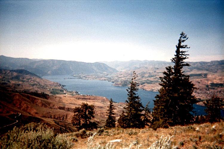
Chelan Lake from atop
Chelan Butte.
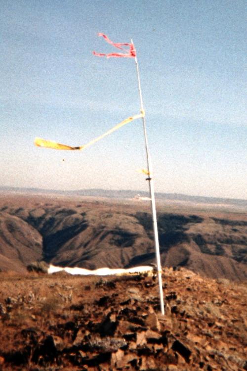
Pole with streamers at
the south subpeak.
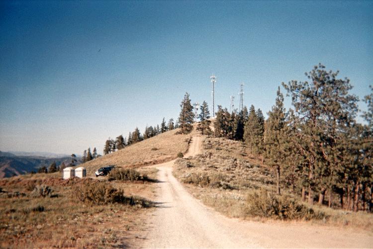
Chelan Butte summit
antenna farm.

Tuesday, June 30 - Chelan, Washington and Lake Chelan State Park

I launder clothes - yet without detergent since the machine "ate" my quarters, TWICE, without providing anything in return.

With an entire day and virtually nowhere to drive I treat myself to a sizeable brunch at one combination café and new-wave grocery store. I have an extended conversation with the owner, and then the head food procurer / cook, about the world of food - and, in particular, about the benefits and pitfalls of genetic modification.

The cook is interested in my imminent ascent of Bonanza Peak, and notes that he and friends go backpacking every now-and-then. I am amused, yet say nothing, because, even at just 24 years of age, he is quite heavyset and, by his own admission, has diabetes.

After this meal-sized crepe with "everything" added, I enjoy a pint of (!) dark chocolate jalapeño ice cream from the grocery while yet seated at my table.

I visit the library to verify the gorgeous forecast; and, by the late hour of 1 p.m. I am already at Lake Chelan State Park with a space reserved for myself and Dennis Poulin. It is ferociously hot as I spend two hours stuffing my overnight backpack with contents needed for Bonanza Peak.

Dennis arrives around 5:30, and we have an extended dialogue about county highpointing and specific mountains. Indeed, Dennis and I climbed Grand Teton together last summer. Sometime during this I am forced to interrupt the stream in order to cook supper - a package of spaghetti with tomato sauce and parmesan cheese. Forgetting that the sauce was not included, Dennis gives me two cans of V-8 juice which I boil-down in the pot as a decent replacement.

We both turn-in around 9 p.m amidst a throng of "tourists" enjoying their summer vacation. For them this park is the end-goal. For ourselves it is merely a way-station to something far, far grander and interesting.

Wednesday, July 1 to Friday, July 3 - Bonanza Peak (Chelan County, Washington)

Bonanza Peak is the indisputible prize of my trip. Our ascent of Chelan County's highpoint is described in this extensive trip report.

Please read it!

After Bonanza Peak, Dennis and I drive the Chelan Butte summit road, eager to avoid the state park and its heat. At the same elevation my temperature warning light goes "on", again, and I am forced to park as previously. I then drive as Dennis' passenger to the summit area so he can also add the peak to a growing prominence list.

Dennis enjoys a Subway foot-long sandwich while helping me diagnose the vehicle's problem. Eventually we find that a cap to the transmission fluid dipstick is NOT properly closed. I suspect that the Spokane mechanic had not done his job properly - this explains all of the observations.

seracs SUMMIT! traverse
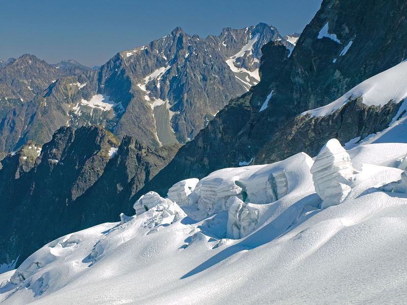
House-sized seracs on
the Mary Green Glacier.
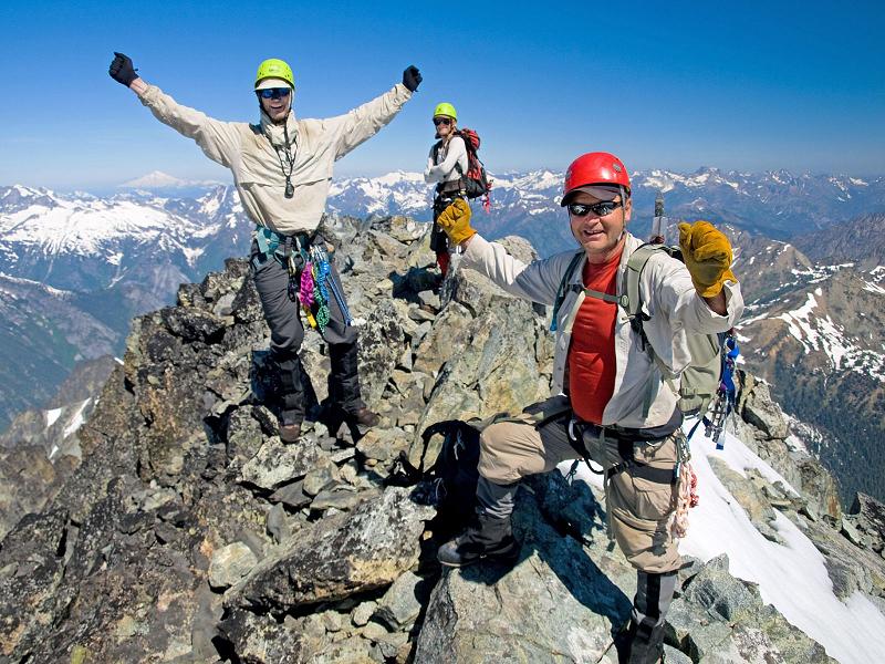
Greg (left), Dennis (right), and
Adam atop the confined summit area.
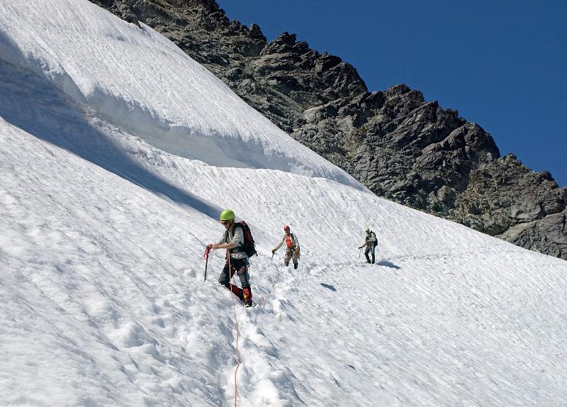
Traversing on-descent.
Adam clips-through a picket.

Independence Day - drive to Mount Adams wilderness

After about 220 road miles we attempt a near drive-up prominence, as Huffaker, only to find each of two southern approaches locked tight, with gates, right at the valley floor. On another day we'd be happy to gain the elevation on-foot - however this is supposed to be a rest day in-between two all-day climbs.

Mount Rainier
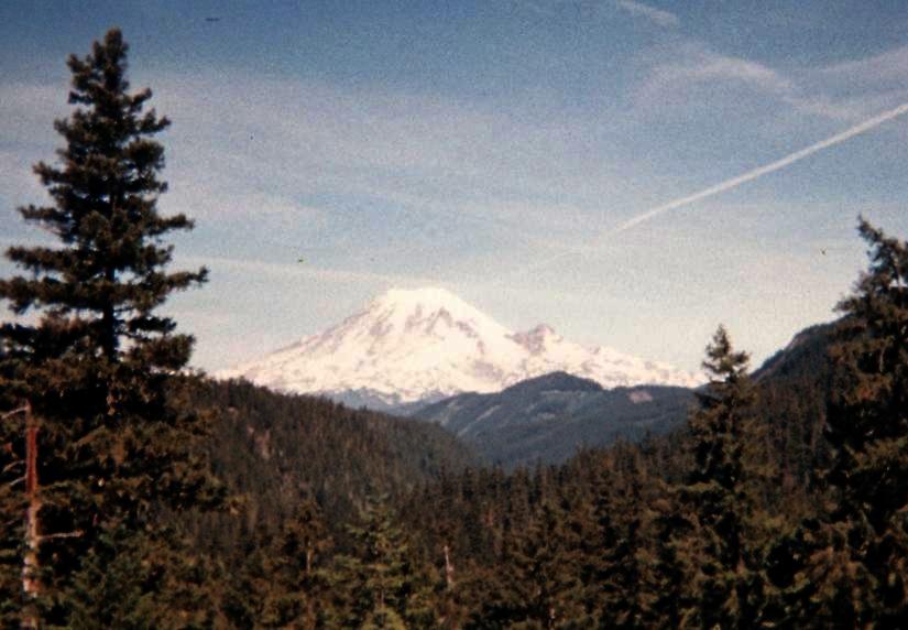
Mount Rainier from US Route 12.

We return a short distance to the nearby town along US Route 12; and purchase items for a makeshift Independence Day picnic upon arrival at our trailhead - including chips and salsa, pretzels, sliced roast beef, and a small watermelon that I keep in the snow so it remains crisp and crunchy to enjoy.

Our trailhead suffers from mosquitoes and lack of shade. We do our best; and agree to a rather early start time for mitigating, at least in part, arduous hiking on soft, soft snow later the next afternoon.

Sunday, July 5 - Skamania Pinnacle liner (Skamania County, Washington)

Our ascent to the Skamania County liner is described in this trip report.

watermelon
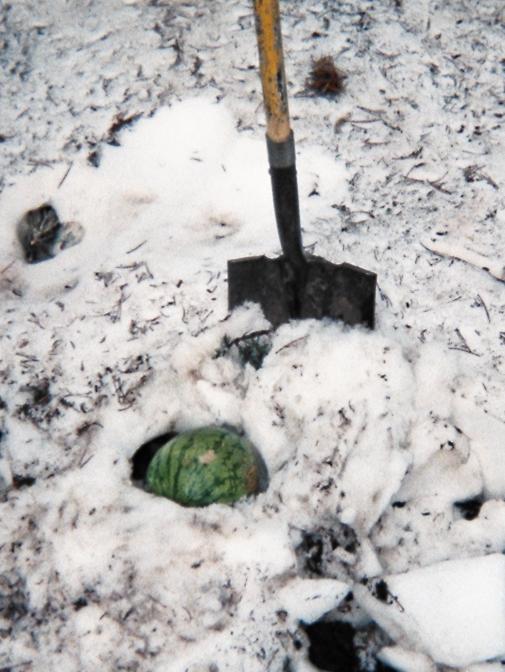
Watermelon prior to
snow-burial for
Independence Day.

I camp at a pullout along Washington Route 14 roughly 50 miles east of greater Portland, driving to where the vehicle is hidden from onlookers by a stand of evergreens. The trees also provide welcome shade.

Amidst a bunch of garbage I find an unused and clean book intended to be used for logging summit entries! I plan to bring it for Jim Perkin's Montana completion climb as a register for all future climbers.

Monday, July 6 - Vancouver, Washington

The weather has changed - radically. It is now gray skies, with cooler temperatures. This is actually good for my upcoming venue which lies at low elevation: walking a road for eight hours in 95° heat would require packing five or even six quarts.

Bob Bolton offers me a bicycle to lessen the time and effort of a hike which is nearly level for a large fraction of the distance. I consider the trade-offs, since I will not be able to acquire the bike until he comes home from work ... several hours from now.

I decide against the bike option, and visit a Vancouver, Washington indoor shopping mall. There I enjoy a "Chinese" lunch in the food court (with mushroom chicken, stir-fried vegetables and sweet & sour pork); followed by a delicious Napolean French pastry from this coffee shop. I also purchase white chocolate chip brownie cookies from a third vendor, and, finally, a broad assortment of gourmet chocolates from a candy shop (one-half pound). With the newly-found shade, and cooler temperatures, chocolate will not melt - and will lift my spirits on what will be a most boring hike the next day.

By 4 p.m. I am at the infamous lower locked gate, hence my trailhead, for tomorrow's effort. A bunch of reading is accomplished, plus a lazy supper - generally the one thing I look forward to once arriving at the day's final destination.

Tuesday, July 7 - benchmark Huckleberry (Wahkiakum County, Washington); Bob Bolton

My hike to the Wahkiakum County highpoint is described in this trip report.

In that report you will note a considerable level of discomfort was achieved. That discomfort would shortly contrast with a most excellent time thanks to Bob Bolton in Vancouver. Bob arrives home about 4:30 p.m. and promptly caters to my desires - including a shower, clothes for laundering, and, of course, dinner.

We attend Olive Garden, that Italianesque eatery where I also enjoyed dinner after climbing Mount Jefferson in 2006. After a cool ice cream-based drink we have the requisite dishes of salad with bread sticks - double portions for myself and triple for Bob. My entrée is "steak gorgonzola alfredo" - the meat cooked, by my preference, "raw as the law allows". It is most filling and delicious, the pasta containing spinach in addition to the signature ingredients ... and a balsamic vinegar glaze on the four steak medallions. Bob, being a vegan, enjoys spaghetti (or capellini?) with a tomato-based sauce.

We opt for dessert at-home.

The evening is largely a photo session with Bob proudly displaying images from his rather extensive collection. We focus on Bonanza Peak, with "stops" at Mount Deception (that he just climbed), and assorted Cascadian peaks.

Then, by nine o'clock, we sit at the kitchen bar stools as I listen to Bob recite from a book one of his favorite descriptions on adventuring in the North Cascade wildnerness. The Columbia River Gewurztraminer, a sweet white wine, is enjoyed with home-baked cookies - purchased that afternoon at a Cathlamet gas station along Washington Route 4.

SO...the day's first half was bitter while the second half is sweet indeed.

Wednesday, July 8 - Mount Scott (Crater Lake National Park)

I enjoy coffee with Bob before he works - and I drive south, through Portland, to eventually enter Crater Lake National Park for its highpoint.

The hike, all on-trail, entails 1,300 feet of elevation gain and consumes all of 44 minutes on-ascent. There are several small groups making the effort, ranging from an older man with his son, a mother and son group (the son, being only about seven, refuses to budge), to a pair of extremely thin teenage girls who are, I dare say, as fast as myself.

However "everybody" makes this summit - one with grand views of Crater Lake. I also identify Mount Thielsen and Diamond Peak to the north.

Crater Lake
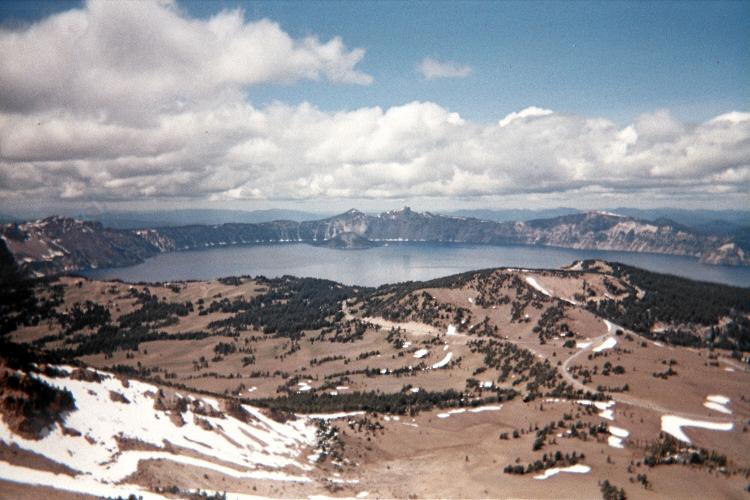
Crater Lake from
Mount Scott's summit.

The trailhead coordinates are WGS84 (46.92916° N, 122.02985° W), elevation 7,675 feet. the highest summit rock (on the far, north side of the lookout building) has WGS84 (46.92295° N, 122.01628° W), elevation 8,934 feet. The trail's lowest point is perhaps 200 yards beyond the trailhead, and lies roughly 50 feet lower. Hence the net gain is 1,300 feet - not the total gain.

I continue south on US Route 97, and one section of road has me heading directly towards magnificent Mount Shasta!! Southward progress is halted at a Wal-Mart in Redding, Calfornia.

I eat my packaged noodles cold, and largely raw, to avoid security cameras seeing me cook on the tailgate. Here, the posted sign of "NO RVs ALLOWED OVERNIGHT" concern me even though I clearly do not have an RV per se. The noodles are soaked in water to make them less raw than otherwise.

A quart of cold skim milk (from the store) with leftover brownie cookies is my dessert. Then, during the 9-10 hour, I talk by cell phone to Edward Earl while lying on the many pillows in my camper shell. We discuss Bonanza Peak, of course, and the various aspects of that effort.

Mount Shasta
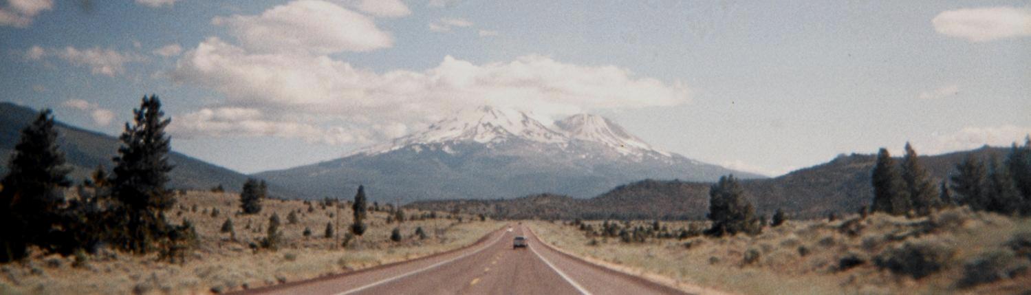
Magnificent Mount Shasta appears to sit directly on my path
as I drive south on US Route 97 into California.

Thursday, July 9 - South Yolla Bolly in California; dinner with Dale

South Yolla Bolly is by far the most prominent California summit I have not yet climbed. In fact, it is the most prominent non-ultra (5,000+ foot) prominence in the entire state. With some 4,800 feet of the stuff, and on my route home, I had to visit its summit.

Dennis Pouilin has a good review at summitpost.org . To that work I add the following road distances and comments.

It is 13 miles from Corning (on Interstate-5) to Flournoy along A-9. It is 6 additional miles from Flournoy to Paskenta whence M-2 begins.

It is 17.5 miles, not 19 miles, along M-2 until the pavement ends. Once ended, it is 6 more miles until the guard station.

It is 9 miles along M-22 until the turnoff (on one's left) for 25N19. It is indeed rough along the 2.2 miles of 25N19 until the backpacker's trailhead at road's end. I obtain WGS84 (40.03820° N, 122.82872° W), elevation 6,870 feet at the general trailhead parking area for backpackers.

I obtain for the highest summit rock WGS84 (40.03640° N, 122.85434° W), elevation 8,086 feet.

Assuming a 1.3 mile one-way hiking distance, the total distance from interstate to summit is thus 55 miles.

I revel in being atop the range highpoint - and with nobody around, likely, for miles in any direction. My trip is now complete, it only remains to get home.

I am so certain nobody is around that I change into street clothes while standing atop the tailgate.

Back in Corning by 2 p.m., I inform Dale's secretarial staff that I plan to visit him this evening. The drive through heavy traffic is unwelcome, and yet this rush is required for being treated to dinner with my brother at a fine restaurant ... my secret ambition.

We eat at Spanish Bay along the coast, our appetizer fried calamari with two sauces. My main dish is steak with a blue cheese butter, again, minimally cooked to ensure a juicy interior and crispy finish. There are bacon/parmesan-crusted potatoes and a chilled iceberg lettuce wedge with blue cheese dressing.

Dale's entrée is filet mignon with a bernaise sauce; and he generously lets me enjoy two mouthwatering bites. For dessert I have a chocolate pecan pie slice with twin scoops of vanilla ice cream. It is a far, far cry from eating raw noodles while seated on my tailgate, wondering if I'll be evicted from the parking lot.

Friday, July 10 - family time along central coast

I re-stock Dale's kitchen with a lot of dry goods ranging from canned tuna fish to much fruit juice. The children will enjoy it too.

Right after lunch I settle-in to reading my birthday gift from Dale, The Los Alamos Primer - a compendium of the lectures presented to the scientific staff for getting them "up to speed" on the current state of knowledge for how to build an atomic bomb as of April 1943.

A half-hour later Dana calls (Dale's wife), saying the boys (my nephews) are at their ranch home and would like to see me. I abandon the book (which has since been finished after coming home) and drive the 14 or so miles.

Upon arrival I find the roof under remodeling, and workers are making a most noisy and unwelcoming mess. So I "kidnap" Aaron and Daniel, taking them to Coldstone Creamery in Salinas where there is both peace and quiet - plus some tasty flavors for each of us. I particularly like the butterscotch pudding ice cream - with added walnuts for textural contrast. A jar of jelly beans is our perennial friend, and mixing these into the ice cream is a favorite habit.

We enter the Albertson's where, much to their shock and amazement, I tell the boys to choose whatever they want from the candy aisle. A passing shopper hears this and appears surprised by my words.

Candy at-hand, and a family-sized Stouffer's macaroni and cheese frozen dinner for later, we drive to Dale's Monterey apartment where Futurama videotapes and old Gilligan's Island episodes are enjoyed into the afternoon and evening.

Dale and his oldest son Moshe arrive (age 11), having eaten dinner out. Later, we congregate in Dale's bedroom to watch the final, ninth inning of a "no-hitter" being won by the San Franciso Giants - their first one in over three decades.

Saturday, July 11 - drive home

I drop-by the ranch home where Dana presents me with another birthday book - this one on major mountaineering expeditions gone infamously awry. I love reading these tales, and in part because it is highly unlikely that I will ever personally climb in the High Himalaya. However I would like to go trekking there - someday.

The drive home to San Diego is uneventful, albeit there is more summer vacation traffic through the Los Angeles basin than I would have wanted.

Summary

All my goals are achieved with a single substitution - including the Bonanza Peak climb. My pickup truck's odometer suggests 4,221.5 road miles total. These "Adam truck miles" appear to be roughly one-hundredth larger than normal, statute miles.

Now I have (only) 36 counties remaining, one-eleventh of the 414 county total in the eleven western (contiguous) United States. I'd like to make good 13 of these on my upcoming August trip - including Mount Olympus.