Mineral County Highpoint Trip Report

Date: June 27, 2009
Author: Adam Helman

This effort was part of a larger journey collecting Idaho, Montana, and Washington county highpoints in late June and early July 2009.

Previously posted trip reports are sufficient for accessing the trailhead as a flat, bulldozed area next to a locked gate. At my pickup truck I obtain WGS84 coordinates (47.03882° N, 114.90060° W), elevation 5,983 feet.

Upon arrival I note an interestingly-shaped peak some five miles west. DeLorme Idaho atlas identifies it as Illinois Peak - and I had climbed it last summer as the Shoshone County, Idaho highpoint. I likely do not recognize it because it is still covered in snow.

The next morning I set out around 6 a.m., and reach the road's end with remarkably good time of just seventy minutes. The "ideal" location to leave the road and bushwhack up the creek gully is where the road suddenly veers sharply left, leaving the gully proper. Roughly 100 meters east of this ideal spot I obtain WGS84 (47.01793° N, 114.91824° W), elevation 6,003 feet.

The bushwhack goes OK (yet steep at times!) until topping-out on the Landowner-Quartz ridge at WGS84 (47.00821° N, 114.93184° W), elevation 7,014 feet. Heading southeast, the trail becomes increasing snow-covered. Eventually I must choose between snow and hopping over deadfall. The snow generally wins.

After an arduous ascent of the connecting ridge (the snow has six-inch suncups), I summit benchmark Quartz with the reading WGS84 (46.99556° N, 114.92221° W), elevation 7,779 feet. It has taken some 3 1/2 hours.

The descent is worse since snow is now soft and the deadfall remains. On reaching my ridge-topping-out waypoint I head in the generall direction of the gully and its creek. My exact route choice (a guess) is a bad one as soon I am amidst tall brush, entangling vines, and it is alltogether hot and uncomfortable.

I take a long break on reaching the road, finishing my summit food in some shade. I return to my truck after 7 or even 7 1/2 hours, and find that it will not shift out of "Park". Read my overall report for what ensues....

locked gate
The locked gate serves as trailhead,
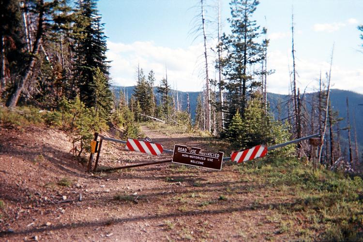
with a perfectly good 4 1/2 miles of
road beyond. I don't know anybody who
enjoys seeing this - in brief,
"GATES SUCK".

(Mouse-click for detail.)