Boise County Highpoint Trip Report
Date: July 16, 2012
Author: Adam Helman
note: All coordinates are in the WGS84 datum.
This effort was part of a larger journey
collecting Pacific Northwest county highpoints in summer 2012.
The "new"
upper trailhead
is at (44.02654° N, 114.87760° W), elevation 7,183 feet - having been moved closer to the highway
in light of Wilderness Boundary regulations.
I estimate 150 feet of elevation loss navigating cross-country in the forest, from Imogene Lake
to the summit ridge. This section features tricky navigation and consumes more time than anticipated.
I estimate 50 feet of elevation loss along the approach road and trail prior to reaching Hell Roaring Lake.
This is relevant for those, such as myself, who decide to park short of the new trailhead.
In this case the total elevation gain is computed as (10,700 - 7100) + 2 x (150 + 50) =
3,600 + 400 = 4,000 vertical feet.
I had parked
just 0.7 mile along the approach road's bad portion, so eliminating 300 feet of elevation gain
on-foot relative to the lower trailhead, at (44.02591° N, 114.85288° W) with elevation 7,118 feet.
This left me with an estimated 21 or 22 miles round-trip - a long day indeed, lasting 13 hours from
4:49 a.m. to 5:53 p.m.
The combination of Elmore County's Snowyside Peak, climbed two days earlier, and the current effort,
raises my home glob radius to 774 statute miles - the largest value possible out of San Diego
notwithstanding visits to the plains of Texas.
photographs
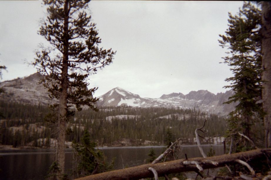
|
Mount Cramer as seen from Imogene Lake is in the middle background.
Its right (east) ridge is taken to the summit.
|