Bonneville County Highpoint Trip Report

useful route information

Date: August 2, 2010
Author: Adam Helman

note 1: All coordinates are in the WGS84 datum.
note 2: Mouse-click on any image for detail.

This effort was part of a larger journey collecting Idaho and Montana county highpoints in August 2010.

north face
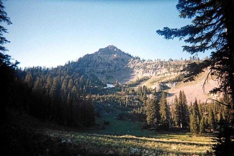
The north face of Mount Baird
soon after leaving the main trail.

Your trail is located on the parking area's south side. It becomes difficult to follow when it enters a gravel stream bed within 20 minutes of starting out. Take a waypoint of the last definite trail location before negotiating this section. However it's difficult to get truly lost as the trail simply goes up the narrow canyon, eventually hugging the north slope and climbing steeply for a while until roughly 7,500 or 7,600 feet.

ridge
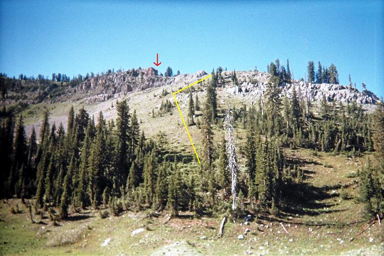
One route leading to the ridgeline.
See the text for an explanation.

Beyond an 8,000 foot meadow (where again the trail can be lost), follow switchbacks until this trail bend at (43.37065° N, 111.10368° W) and 8,848 feet. Begin cross-country travel here.

Follow the faint path noted in a previous report as it trends southeast around the east flank of the 24,000:1 chart's 8,920+ foot hill. After a few minutes you are treated to an excellent view of Mount Baird as shown in the first photograph.

final slope
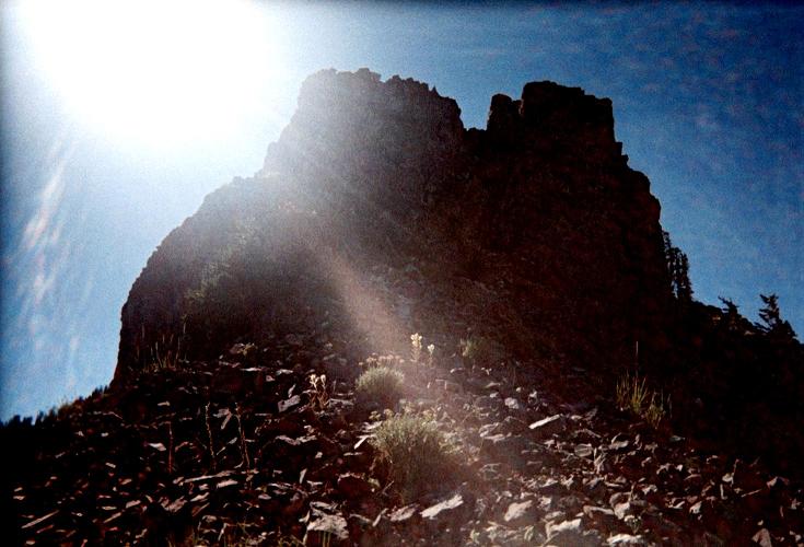
The final few hundred vertical feet
nears a 100% grade (45 degrees).

Look southwest to the obvious ridge. Using the second photograph as reference, ascend the partly forested slope, aiming for a flat section at the yellow line's upper end with coordinates (43.36690° N, 111.10231° W) and elevation 9,233 feet. Avoid going through the trees since the underbrush entangles and slows you.

Walk the ridge until the cliff shown at the red arrow. Locate a path to the right (west) as it bypasses the cliff, eventually topping-out above it with a single Class 3 move. Continue along the ridge until perhaps 300 or 400 feet below the summit, one that now looms steeply above you as shown in the third photograph.

Remarkably, a path exists that follows the ridge, steeply, towards the summit - which is still hidden from view at this point. The path braids into several possibilities perhaps 100 or 150 feet below the top. I recommend leaving the ridge here and follow whatever route "works" for you.

With clear skies a summit view of Grand Teton is possible as seen in the final photograph.

I take 3 hours 5 minutes for the ascent and 6 hours 16 minutes for the round trip.

summit vista
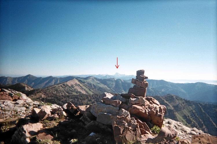
Summit view northeast with
Grand Teton under the red arrow.