Northern Rockies August 2010 Trip Report
© September 2010 Adam Helman
(Click on any image for enlargement.)

Background

This journey is part of my long-term goal of finishing the eleven western state's 414 county highpoints. I begin this trip with 26 counties remaining - 5 are in Washington, 12 in Idaho, and 9 in Montana. The current effort is largely directed at Montana with the explicit aim of completing its 56 county highpoints.

A separate report for every county highpoint is available.

Mount Cleveland is the most significant effort, highpoint of Glacier National Park and the eponymous Montana county.

Note: All coordinates use the WGS84 datum.

glacial horns
View northeast from Mount Cleveland's summit.
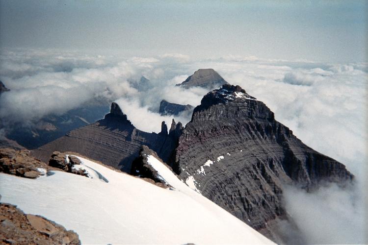
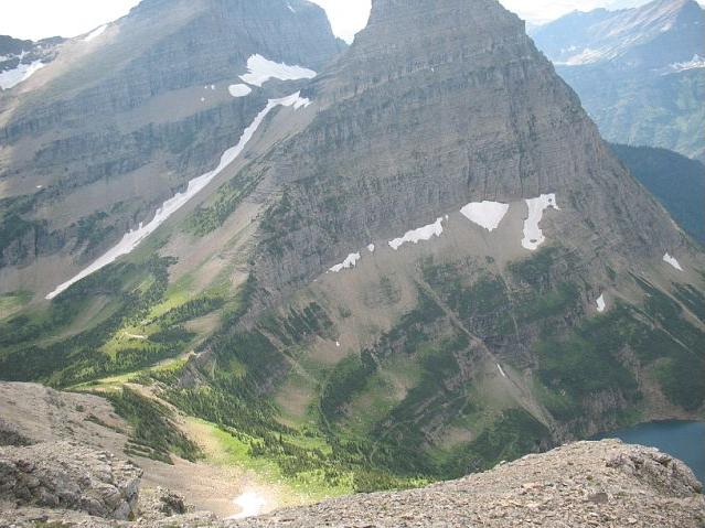
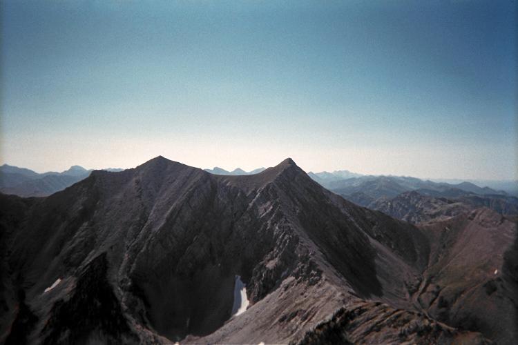
Awesome, glacially-scoured topography, such as shown,
spurred the formation of Glacier National Park.

Trip Details

Friday, July 30 - To Utah

It's a long way to Montana from San Diego, and I've driven Interstate-15 many times. To break the monotony I drive to the Utah desert and camp near Frisco Peak. It has over 4,000 feet of prominence and thus forms a good target given that I've already completed all Utah county highpoints.

One highlight comes at the Maverick gas station just west of Exit 62 on the north end of Cedar City, Utah. Here the hot dogs and sausage are being grilled outdoors next to the store's entrance. It tastes much better than the usual fare available within, having a blackened exterior crust yet still juicy on the inside.

new battery
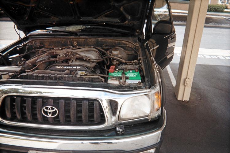
A new green battery is installed
before the 4,000 mile journey.

I arrive at the chosen spot around 4 p.m. and spend the next several hours enjoying views down into the valley. Frisco Peak should take only a few hours, and will be the least arduous of 13 planned climbs.

The following information is instructive, provided here because, unlike county highpoints, there is no website dedicated exclusively to posting trip reports for peaks on prominence-based lists. Skip to "Saturday, July 31" if you don't want these navigational details.

It is 8.2 ATM from the turn west in Millford along Route 21 to the desired broad dirt road at (38.43893° N, 113.15351° W) on the highway's north (right) side and very near mile marker 68.6 were one to actually be there. One ATM (Adam Truck Mile) is about 1.01 normal miles since my odometer reads about 1% too low.

It is 9.0 ATM from the cited turnoff generally northwest to level parking at (38.52838° N, 113.26277° W) and 7,438 feet elevation near the former Golden Reef Mine.

I drive my pickup truck, with four wheel drive engaged, for 0.3 additional mile and then head back to the indicated parking area since no level camping spot is located - and the road is taking no less time than were I to simply walk it. Therefore I recommend the cited parking location to future peakbaggers. The road is very rocky and you are prone to a tire puncture.

Saturday, July 31 - Frisco Peak and into Idaho

I zip up the summit road, reaching the top in less than 90 minutes. The highest natural ground is on the summit's west side with multiple communications buildings and towers. A photograph shows the green building closest to the true highest point.

All-told the round trip takes 3 hours 25 minutes, including a half hour summit break with chips and cream cheese / Hunan red sauce as "salsa".

Frisco Peak summit
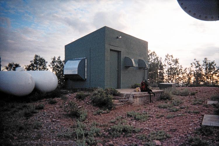
The highest natural ground is
nearest this green building.

The drive through greater Salt Lake City is uneventful as I continue north into Idaho.

The town of Blackfoot is closest to my next goal, and I leave it after needlessly topping-off the tank near the "Y-Motel" - so called, presumably, because it's at a Y-shaped road junction on the south end of town.

While buying an ice cream sandwich the cashier tells all who can hear how overworked and flustered she is. She's clearly a heavy drinker from the wrinkles on her face. I tell her that a good walk in the countryside will settle her nerves. She replies, "Yeah, to the nearest bar." I respond, "Life is what you make of it." and then leave the store. It's amazing how screwed up people can make themselves.

Roughly 25 miles later I am camping near this historic marker at a road junction. A nearby storm cell has me wait to eat supper so I can enjoy it, on the tailgate, without getting rained upon. I detest rain - it ruins this hobby from SO MANY aspects.

Sunday, August 1 - benchmark Blackfoot (Bingham County)

Details of my climb to the Bingham County highpoint are provided in this trip report.

Bingham County is a "non-classic", meaning that it's something you would do only when trying to finish the county highpoint list of that state. It is not necessarily enjoyable when compared against other efforts.

benchmark Blackfoot
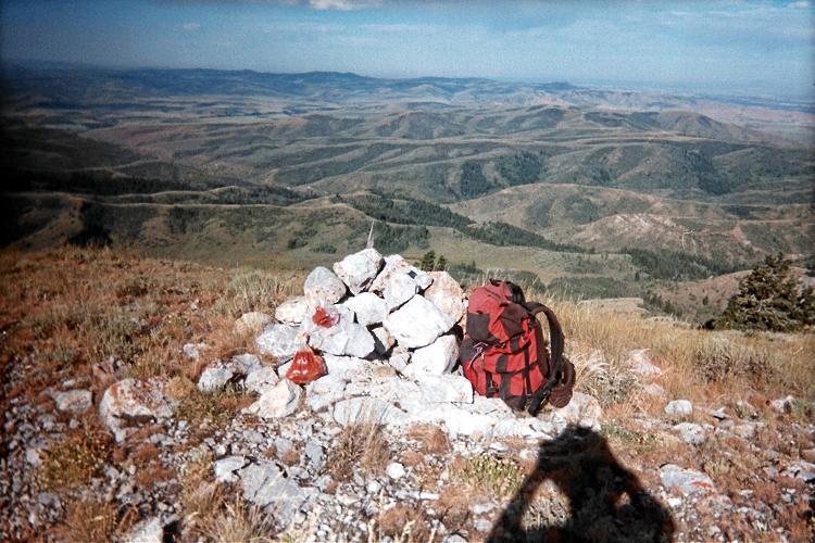
Bingham County highpoint's summit cairn
looking west. Red-brown object at
its lower left contains lunch.

Furthermore, this is one of those counties with access issues. Visiting the highpoint requires crossing private land; and one is definitely leery of any possible encounter with the landowner when permission has not been explicitly granted.

Imagine for a moment if the likes of a Mount Hood or a Mount Rainier were on private land!

There is a saving grace: Bingham is my very last western USA county with these concerns.

The next county's highpoint lies east. However there is no obvious way of getting there by driving in that general direction. No - I must use US Route 26, first passing through Idaho Falls before taking it generally east to near the Wyoming border.

I arrive around 3 p.m. and try my best to stay out of the sun. There are nearby groups at this end-of-the-road trailhead, including a family with two whining babies. I am glad to see them leave; and don't anticipate newcomers since it is Sunday evening - so requiring anybody to take Monday as a vacation.

Monday, August 2 - Mount Baird (Bonneville County)

Shouts of "Aaaaaaaayoooooo" begin at the trailhead and continue until treeline. I am alerting any creatures, particularly bears, of my presence so that they are not startled. It is the surprised bear who is most prone to attack.

Details of my Mount Baird climb are provided in this trip report.

Grand Teton
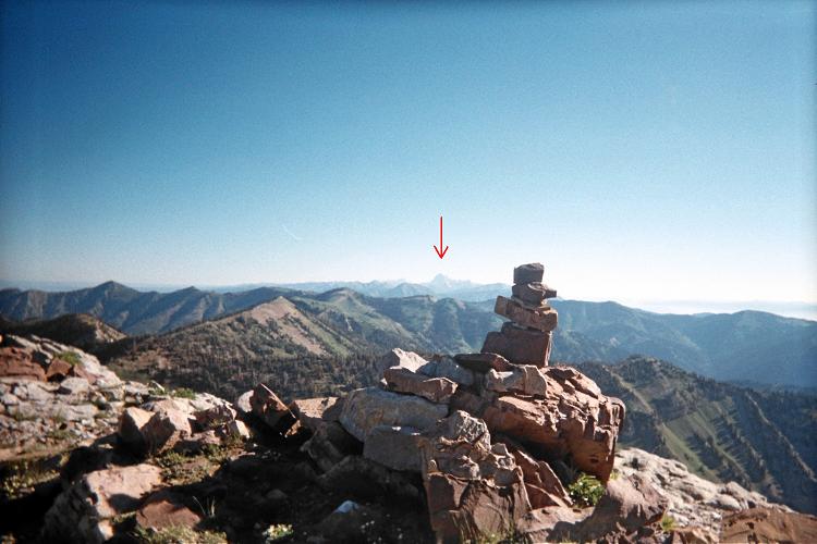
Summit view northeast with
Grand Teton under the red arrow.

The final 300 vertical feet is surprisingly steep! Nevertheless it's not hard to summit; and once there I enjoy a superlative 360° view - including Wyoming's Grand Teton on the far horizon to my northeast.

All-told the ascent takes 3 hours 5 minutes; the round trip 6 hours 16 minutes.

My next goal lies north very near the Montana border. To get there I enter Montana by road and then hike south into Idaho. This theme of crossing state boundaries on-foot has precedent at both Big Horn County, Montana and Carbon County, Montana.

I arrive at the Mile Creek trailhead with plenty of daylight. A group of four women have just completed their hike, and somehow a dialogue starts regarding my own intentions. They are quite amused to see my county highpoints completion map (as a printed copy); and wish to examine cohp.org in one month to see if indeed Montana "turns green" according to my wishes.

A 6 ounce bottle of chilled red wine is very much enjoyed from their ice cooler. Feeling just a bit giddy I say goodbye as they drive off - and then prepare a cold supper because it's simply too hot and sunny for preparing pasta.

Tuesday, August 3 - unnamed 10,400+ feet (Fremont County); Montana

Fremont County has to be done on this journey because the road grid demands that it be combined with both Gallatin and Madison Counties in Montana.

Details of my Fremont County efforts are provided in this trip report.

The trail is annoyingly shallow at-times for the six miles it takes to reach a junction along the CDT (Continental Divide Trail) at 9,333 feet elevation.

trailhead view
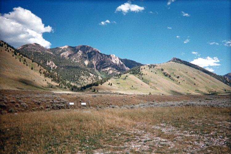
View from the Mile Creek trailhead.
Route proceeds up the obvious canyon
left of center, paralleling the ridge of
the triangle-shaped grassy slope at center.

Indeed, on my descent I save perhaps a full hour, and miles of nearly horizontal travel, by cutting-off switchbacks. How this is achieved is unusual. The trail is not visible from above owing to tall plant growth everywhere. Further, I am reluctant to simply head straight downhill because there is no guarantee I will intersect the trail since it slowly meanders south while zigzagging up a west-facing slope.

So how do I do it? A series of dayhikers are coming up the trail as I descend - and their heads are plainly visible above the tall plant growth. So whenever I see humans I know a trail is underneath them ... and I bushwhack directly towards them. Most are teenagers wearing shorts, unprepared for the weather that's about to hit them.

I return by around 2 p.m. and drive south, then east to West Yellowstone where this thunderstorm cell continues to unleash a most terrific downpour. I enjoy a personal-size pepperoni and sausage pizza at one convenience store (adding fresh garlic); and then continue with ice cream as the storm has not let-up and so staying indoors seems best.

Eventually of course I drive to my next goal - this time exclusively inside Montana. The trailhead parking is distanced a half mile from the trail itself; and it appears this arises from new, private home construction. The weather has relented.

Wednesday, August 4 - Wilson Peak (Gallatin County)

The road grid suggests that I climb Hilgard Peak of Madison County, Montana before this one, as it lies in-between the Fremont County, Idaho highpoint and Wilson Peak. I decide on Gallatin County's highpoint before Hilgard Peak for two reasons:

Set against these desirables is an extra 80 miles of driving. That's a pittance compared with knowing the summit rock is climbable after taking several hours to get there - several hours thrown out if unable to summit on account of snow.

Details of climbing Wilson Peak are provided in this trip report.

sedimentary rock
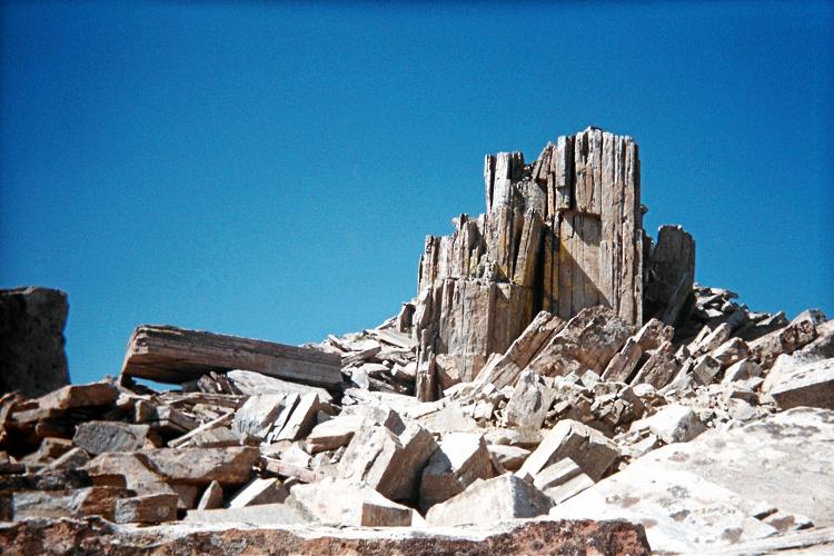
These sedimentary rocks were
completely upended to the vertical!

Wilson Peak's northeast ridge is enjoyable, being above the treeline and so with great views. Halfway from saddle to the summit are these impressive sedimentary rock formations with some of the huge boulders upended ninety degrees so the layers are dead-vertical!

The final summit push comes with a surprise: an interesting series of climbing moves that force me to rate its difficulty higher than did previous authors. However those efforts came from the other side - and it's plain that routes converging from the west are technically easier.

With a clear view I note that the north side of Hilgard Peak's summit area is snow-free.

With a 4,600 foot elevation gain and nearly ten hours duration I really don't want to climb Hilgard Peak the very next day. I will get to its trailhead around 6 p.m. with only enough time to eat supper and go to bed. THEN I will arise before first light and ask myself, "Do I really have to do this all over again?"

With only 22 remaining county highpoints in the contiguous western states (of 414!) I honestly want to enjoy them - without reluctance to burn another 1,500 calories, alone, in grizzly country, constantly watching the weather.

So I take a motel room in Butte, Montana and plan on a "day off".

Thursday, August 5 - Butte, Montana

There's a "free" continental breakfast in the motel office. While there I have an extended conversation with a Polish man and wife who are taking an entire year's leave from their work to explore the Americas from top to bottom - from Alaska to Chile.

The doughnut is absolutely divine, stuffed with cream filling and topped with a crunchy, brown sugar peanut glaze. I squirrel-away four fruit-filled granola bars for Hilgard Peak; and then do my laundry. While waiting for the clothing I purchase some really nice food at the next-door supermarket, including four slices of cheesecake in different flavors.

I had been longing to visit the Museum of the Information Age in Butte, Montana for at least one year - ever since my last Montana trip. It does not disappoint as I explore every nook and cranny of its exhibits over two hours by late morning.

Finally I drive south towards the next serious goal - of course, yet another mountain peak! However I chance upon a restaurant inside the gas station convenience store; and enjoy a full lunch featuring roast beef sandwich au jus, half of which has melted swiss cheese. The waitress / cook thinks it odd that I'd want the full side order of cheese on just one-half the sandwich. Although I did not explain why at the time, it's because I want the cheese to be in proper proportion to the meat - and, with several ounces of the latter and just two slices of cheese that's only possible if the "cheese density" per bite is double what it's supposed to be. Enough said.

Then too, adding green tabasco sauce to the gravy is something I'll have to reproduce at home one of these days.... . The onion rings are also tasty ... as-is the 5 inch chocolate creme pie I have as take-out, saving one-half for the trailhead.

As you have guessed, I really enjoyed this meal!

There are many vehicles at the trailhead. I find six states represented among the five adjacent cars plus my own vehicle from California. Of course none of their owners (apart from myself) are interested in Hilgard Peak. The majority are backpacking to some remote lake, and possibly fishing while there.

UT plate     CA plate     ID plate     WI plate     MT plate     MI plate
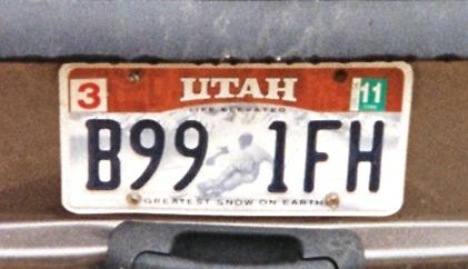
Six states represented at the trailhead.
I'll be the only owner getting really "high" 8-).
The sky opens around 7:30 p.m. and does not abate. By 9 p.m. the parking area is so wet and muddy that I get out of there and re-park at a pullout one-half mile from the highway's junction with the dirt and gravel approach road.

I hope for decent weather by morning: I've taken an entire day-off to climb Hilgard; and have eaten a lot of food to that end as well for energy. If I have to wait one day then all of that is for nothing.

Friday, August 6 - Hilgard Peak (Madison County)

This is an epic dayhike! Although I knew that an early start is advisable, I did not forecast that I'd be climbing the 3-400 foot tall summit massif three times in order to reach the very tippy-top.

two mile high pond
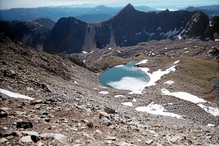
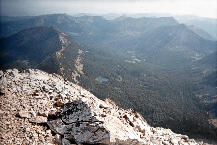
This two mile high pond at
10,500 feet shimmers
in the sunlight as I reach
the climbing route's base.

Most folks climb Hilgard over multiple days. However I really don't relish the idea of camping alone in Mr. Grizzly's backyard - and as would be required for an overnight affair.

Details of climbing Hilgard Peak are provided in this trip report.

I arise at 3:37 a.m., return to the trailhead, and walk at 4:22 a.m. fully two hours before sunrise. Breakfast is one-half hour into the route by headlamp, with Frosted Cheerios and 12 ounces of mocha-cappuccino milk spiked with coffee grounds. Plus more shouting "Aaaaaayooooo!" to alert any bears of my presence. It's a bizarre, almost surreal experience, this eating in the dark while constantly wondering "What's OUT there?".

After several hours I reach the summit complex's base at 10:25 a.m. However I am uncertain how to proceed. I start climbing one seemingly promising lead, yet turn around after about 100 feet because it is just too difficult for being the preferred route.

I then turn left and climb a second route with several Class 4 moves, consuming much valuable time. I ascend all but the final 30 feet of that summit tower, only to note an untraversible ridge leading to a higher tower that I cannot reach. There appear to be 4 summit towers, and I am near the wrong one's top! I halt my ascent as there is now no longer any point.

I let out a wail of uttermost despair,
SO LOUD the echo is heard seven seconds later.

Crows (or ravens?) sound-off in the basin well below me in response. Is this the end? SO MUCH EFFORT for nothing? Black clouds are gathering... Have I squandered my only chance to summit before they make the steeply angled rock too wet for climbing?

Hilgard climbing route
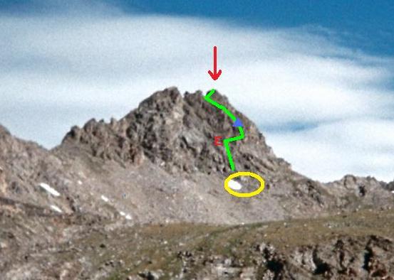
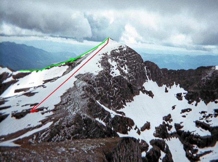
Hilgard climbing route is green;
red arrow is above the highest
of four summit towers.

I descend to the summit complex's base and traverse to what I guess to be the "correct" route's starting point at (44.91620° N, 111.45774° W) and 10,972 feet. Thereby I find a Class 3 route (i.e. not Class 4 as commonly believed for Hilgard Peak). The photograph sketches my route in green, a full description provided in my Madison County trip report as already noted.

I return in five hours from the summit - which is quite a contrast with the eight hours needed on the ascent due to attempting the final rock climb three times. The watch reads 5:51 p.m. for an elapsed time of 13 hours 29 minutes; my estimated round-trip distance is 15 miles; and the total elevation gain is 5,750 feet.

Climbing Hilgard Peak as a dayhike clearly requires an early start. Knowing what I do now, a repeat effort would take roughly 12 hours.

I camp at the trailhead, tired yet completely satisfied. Furthermore, tomorrow will be another rest day before going to the next 8 or 10 hour effort. Not having to climb tomorrow, and being justifiably lazy, supper is hardly more than two scrumptious slices of cheesecake "shmeared" with honey and peanut butter.

YUM!

Distances and elevation gains in Montana exceed that of most other states. Compared to say Colorado, where chasing "fourteeners" is commonplace by summer, Montana has a sparser population density (which makes for a less dense road grid); and a general yearning to go fishing and hunting rather than peakbagging.

Saturday, August 7 - rest day

Oh, I suppose that one could drive at 6 p.m. for 150 miles to the next trailhead; getting there after 9 p.m. - and then magically be ready to bag the next peak by arising before first light. After all that is eight full hours of sleep. However there's a few items called "supper", "re-packing", and (heaven forbid!) even "enjoying Montana".

So, if one is even fractionally sane the preferable choice is a rest day. I find a somewhat shorter highway route that cuts-off going north to Bozeman and then west. Montana-287 takes me to Ennis, Montana as the first community large enough to support a restaurant. I want a full breakfast, there being time for such a luxury only on a day-off.

waterfall
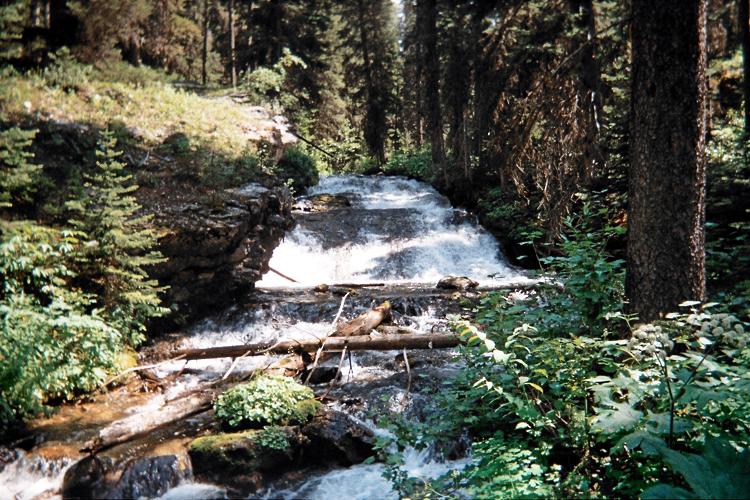
A waterfall seen on the
Warren Peak approach hike.

However the town seems to be hosting some art festival and, being a weekend morning, every establishment is jam-packed. I settle for a gas station's cheeseburger (a strange breakfast!) drenched in Chinese black pepper sauce from my spice kit (stranger still) ... and washed down with my usual hot chocolate / coffee combination ("mocha") as I drive away.

One might write that without caffeine much of Montana would remain unclimbed. Is that considered cheating? After all, many mountaineers protest to the use of bottled oxygen on the great peaks of High Asia. Then, how far of a stretch is it from supplemental oxygen to caffeine when both enhance performance?

While needlessly getting gasoline in Anaconda, Montana I get a cell phone call from Dennis Poulin. He's one of the friends for climbing Mount Cleveland in just over a week. Dennis tells me that John Hamann cannot come owing to work constraints; and so the permit has been placed in my name with "304" as the number-du-jour. John should consider a different employer!

I continue to the trailhead, arriving mid-afternoon. Around 5:30 p.m. a woman returns from her backpacking. While I sit on the tailgate, her dog approaches me in a most unkindly manner - snarling and nipping at my knees. She shouts to the dog without success.

I grab my ice axe, raising it in the air like a baseball bat, prepared to take a swing. She becomes frightened for the dog's sake and physically pushes the dog away to her car, leashing it to the rear end.

Later she must pass by me to reach the outhouse - and the tension between us can be weighed with a scale. Only after she drives-off do I eat supper.

Sunday, August 8 - Warren Peak (Granite County)

Details of my Warren Peak climb are provided in this trip report.

The trail annoyingly starts north - the "wrong" direction; reaches an old trailhead in 1/4 mile; and then enters forest heading east before (finally!) trending southeast in the desired direction.

Lost Lake
Lost Lake is aptly named,
hiding in a remote valley just
beneath the Continental Divide.

There is a beautiful, broad waterfall 100 feet south of a bridge crossing one-half hour into the approach hike. Edith Lake comes at 5 miles - trail's end. I get water and bushwhack from here.

After a thankless talus-strewn traverse around subpeak 9452 I climb Warren Peak's southwest slope to its summit. Here I am treated to great views, including West Goat Peak of the adjacent county highpoint. It is next on my agenda. There is also Lost Lake nestled in a remote valley adjacent to the Continental Divide.

I return after 4,400 vertical feet and 14 miles sometime around mid-afternoon. By now I've decided to climb one mountain every other day. It makes the trip considerably more enjoyable. The motel room in Anaconda is well-timed as a thunderstorm passes through town just as I check-in.

I recall eating two TV dinners bought at the Safeway store; plus much fresh fruit for dessert.

Much later I talk to the motel clerk. She's originally from Lebanon and has lived in Anaconda for 31 years. She recommends Donivan's a few blocks east for my breakfast cravings.

Monday, August 9 - Anaconda, Montana

I really do need more calories for these 10 hour efforts - and protein too. At Donivan's I order the steak and eggs, following it with peach pie à la mode.

There is no hurry. I visit the Anaconda public library to log-onto this website and record my ascents - a "first" for myself since I created that functionality.

Warren Peak
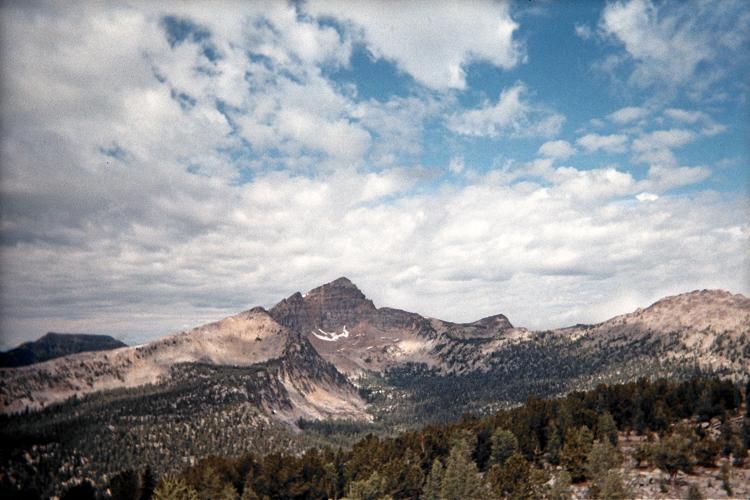
Warren Peak seen from roughly
9,000 feet on West Goat Peak's
northwest ridge.

There's an empty seat - yet a "Post-It" sign is affixed to the monitor claiming the computer is reserved. I ask the teenager to my right, who replies that his friend is coming to use it. I ignore his statement and use the computer anyway since his actions are contrary to library policy - and despite him saying "Don't mess with me.".

Satisfied that my recent ascents are recorded I leave town at roughly noon. I reach the trailhead for my next effort around 3 p.m. with plenty of time to read, listen to the shortwave radio and examine my route maps for the next day.

I still find radio to be "miraculous" despite understanding the concepts: streaming information through nothing at all over thousands of miles! Cuba, Germany, Brazil and China are among the locations I pull-in after stringing a wire to one nearby tree and affixing the opposite end to the radio's telescoping antenna.

If memory serves me correctly I finally eat my first hot supper this evening. Most days it has either been too toasty to use the stove OR it is raining and so it's best to eat inside the camper shell - and one dare not use the stove there! Perhaps it is macaroni and cheese with a can of salmon that I enjoy.

Regardless I generally have a salad course with cabbage: it seems to last unrefrigerated for nearly two weeks before the edges turn color and acquire an "off" taste. That's a remarkably long time before spoilage sets in. I therefore rely on cabbage for long trips.

Tuesday, August 10 - West Goat Peak (Deer Lodge County)

Details of my West Goat Peak climb are provided in this trip report.

I make the wrong choice in taking trail TR130 around to the west side of my goal. It is too long and clearly unmaintained with deadfall and muddy sections near each minor stream crossing. Once off-trail, and after reaching an important saddle there are rock outcrops along the peak's northwest ridge for several hundred feet - indeed, clear to treeline. This impediment considerably slows progress.

East Goat Peak
East Goat Peak from
West Goat's summit.

A better choice is likely trail TR129 as described elsewhere.

The weather worsens as I quickly ascend the northwest ridge, turning to hail for the final several hundred vertical feet. I continue since there is no thunder. Once on-top the weather clears enough for views of East Goat Peak (see photograph) and, later, of Warren Peak in nearby Granite County to the west (see above).

The 21 mile round trip consumes 11 hours 50 minutes, including a 15 minute breakfast break, at dawn, already 3 miles into the approach hike.

Shouting "Aaaaaaaayooooo" on a regular basis at least makes me think that I'm thwarting some bear encounter. I really should bring pepper spray. I have it sitting in the red duffel bag. The bottle must be carried in such a manner that it can be immediately used - and that calls for wearing it on one's waist. However I don't own trousers for outdoor use with belt loops. Hence I'd have to wear my climbing harness, affixing the pepper spray can to one of the gear loops.

The combined weight of spray can and harness is over two pounds. In my cost/benefit calculus it is not worth carrying that extra weight over nearly 200 miles of trail (as the totality of my efforts on this journey) for the miniscule probability that a bear is both present and willing to attack me.

With a total elevation gain of 4,800 feet and the cited 21 miles I return at around 5 p.m. - and am satisfied to just camp right here for the night.

Wednesday, August 11 - rest day

I really did enjoy breakfast at Donivan's - and there is one more item on their menu I sorely want to try. It's about a dozen miles out of my way, but that's little in the grand plan. I save some road mileage by taking Montana Route 569, so avoiding Butte, and enter Anaconda around 9 or 10 a.m.

It's their "collosal omelet" that I crave. Inside this large offering there's three kinds meat, both swiss and cheddar cheeses, and several vegetables including onion, tomato, and bell pepper - then more cheese melted on top. I opt for cottage cheese rather than hash browns, and partly because my slice of berry pie goes well with it (think "berry cheesecake"). The "decaf" coffee is spiked with hot cocoa mix saved from that motel breakfast six days ago.

deadfall
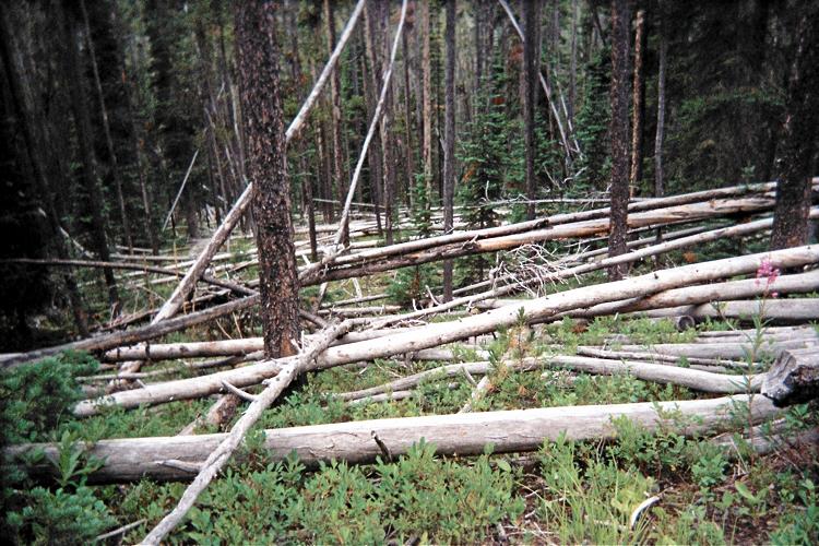
This deadfall is typical of
what's available alongside
TR130 at West Goat Peak.

I don't eat a sizeable breakfast merely because it's enjoyable. More importantly, I really do need thousands of extra calories for these lengthy, nearly day-long efforts. That desirable can be achieved by consuming many many granola bars, and other items labeled as "trail food". However such a plan is both unappetizing and lacks enough protein. If I don't get enough protein I'll burn muscle since I don't carry on my person an ample supply of fat - not even close. So, yeah, steaks and omelets, although pricey, are actually good for me at this point - a turnabout from standard dietary recommendations.

Last year I turned back on the approach drive for Mount Powell on account of stormy weather and an inexplicably undriveable section of road. I did not know what to expect as I approach this potential obstacle... yet all traces of its slippery constitution are absent.

This is a large relief as I easily access the desired trailhead several miles later.

Again, I have arrived mid-afternoon with plenty of spare time. I walk the road beyond, confirming that it's too risky for continuing by vehicle. The usual late afternoon rains come, and I use that time to both nap in the camper shell and do some reading.

Around 8 p.m. with only an hour of light remaining two teenage boys arrive by jeep at the same parking area. They are clearly half drunk, with a beer can in one hand. I ask, "What are your intentions?" They want to drive the remaining road and get to this abandoned ghost town a few miles beyond. "Town" is too grand a concept for that collection of nothing more than a few lunch tables and maybe some destroyed log cabins.

Well into darkness they return and head downhill. Writing a month later I still wonder how far they really got given what I saw the next day.

Thursday, August 12 - Mount Powell (Powell County)

Hiking the jeep track to approach this peak after a spell of wet weather is a mess. Eventually the track becomes inundated with water, and I am forced to leave it prematurely in the general direction of my goal.

Details of my Mount Powell climb are provided in this trip report.

wildflowers
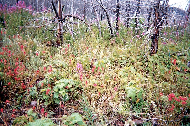
Assorted wildflowers near
the Red Mountain approach road.

For the descent I opt to avoid a section with sidehilling - and also the wet, nearly impassible road section, by going directly to a saved GPS-based waypoint at a specific bend in the jeep track. This is a mistake as I am downclimbing a seriously steep creek bed; followed by a stream crossing that is made possible only my "miraculously" finding a log to cross-over.

Mount Powell is my 400th mountain with at least 2,000 feet of mean (interpolated) prominence.

A get a reasonably-priced motel room in nearby Deer Lodge. After showering I treat myself to this pint of huckleberry ice cream into which are mixed a hazelnut-chocolate granola bar and assorted nuts. Soon after comes a Hungry Man fried chicken TV dinner... but not until after I call back Bob Packard who has just researched the weather forecast on my request.

clearing storm
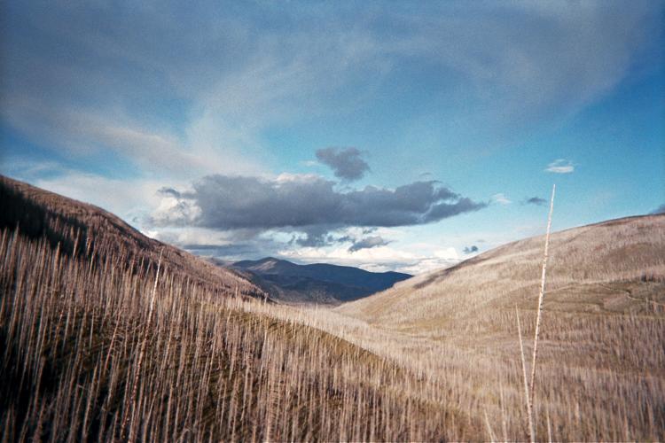
A clearing storm the afternoon
before Red Mountain.

The next peak I want to attempt could have serious road approach issues in wet weather. I have Bob Packard's trip report for Pondera County. We agree that, given the current weather forecast it's better that I try a less weather-sensitive peak instead.

Several county highpointers assist me during my journey by providing me Internet-based weather forecasts. These include Andy Martin, Greg Slayden, and Bob Bolton - in addition to Bob Packard.

It rains heavily after midnight, pounding the roof above. It's a good night to be indoors.

Friday, August 13 - Montana Route 200

This is no morning to be outside - let alone climbing a mountain. It's still drizzling. Fortunately the market is just a block away, and I enjoy a nut-crusted doughnut with an energy drink as I launder my clothes at the motel. Later I return to the room and heat a "Philly Cheese Steak" microwaveable breakfast entrée . Hot Chinese-style Hunan Red Sauce serves as condiment. Finally I check out at nearly 11 a.m. after the weather improves.

I have a mere 100 miles to drive, much of it east along Montana Route 200. Lincoln, Montana is the nearest community to my forest road. I enjoy a deep-dish "personal" pizza there; and then head out, once again, for the desired trailhead.

The weather is holding - barely. By late afternoon the clouds have largely cleared as seen in the photograph. I am elated by this seemingly good fortune, and eat supper confident that tomorrow will be a simple matter - one that, according to my only report takes just four hours.

Saturday, August 14 - Red Mountain attempt (Lewis and Clark County)

Unfortunately dawn comes with a light drizzle. I sleep for an hour more, and, by 7 a.m. the rain has ceased. Nevertheless there is a heavy cloudcover, and I cannot see the desired route. I start out anyway, hiking west up the jeep road and taking the obvious, left fork after 0.1 mile.

BIG MISTAKE

Nearly two miles later I am still heading west, and clearly off-route. To set things straight I bushwhack steeply up a slope in the general direction of spot elevation 8245. I top-out at 8,100 feet and see that hill 8245 lies on the opposite side of a saddle several hundred feet below me to the northeast.

I descend quickly, getting ever-wetter from the plants which have taken a soaking. By the time I reach the 7,200 foot saddle I too am completely wet ... and then ... and then ...

two grizzly bears squarely in my path just 100 feet away!

I stop and make myself "look large" by raising my arms. The bears are unimpressed, and simply lope away in a perpendicular direction. I slip, the rocks wet as well. I am off-route, cold, cannot see the route shrouded in cloud, and have wasted considerable effort. I give up and save this one for a better day.

I return to "DENALY" (my vehicle's license plate) well before noon and change into dry street clothing. A few hours later I stop in Choteau, Montana on U.S. Route 89 and refuel both the car and myself. I call my mother who senses that I am somewhat distressed. It's not really the bear encounter. Rather, I have not had a single day without rain falling on me ever since I came to Montana.

I hate rain. I loath the very concept.
It ruins SO MUCH that is enjoyable in this sport....

  • Dirt approach roads become mud and cannot be driven.
    Worse, they cannot be driven out.
  • Rocks get slippery and too dangerous when the route is steep.
  • Clothing gets wet, no matter how "waterproof" they are claimed to be.
    This is uncomfortable and eventually serious if hypothermia is possible.
  • My glasses get too wet for seeing the route. With enough heavy rain
    going without glasses is the only way to see anything at all.
  • Nothing is enjoyable any more when outdoors - from hiking to
    eating on the tailgate.

motel room

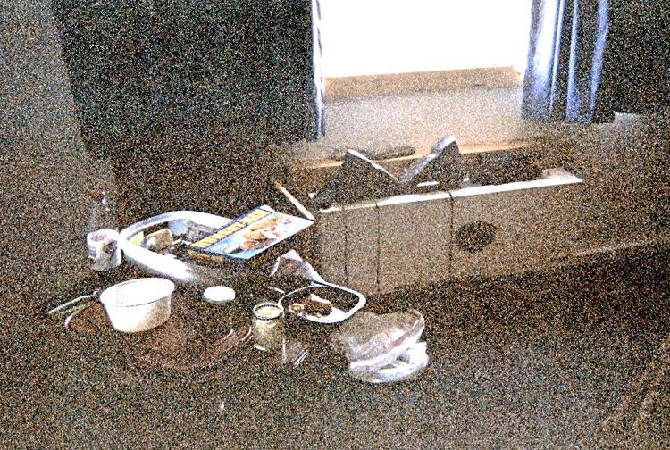
Inside the Warbonnet Motel room with
boots and socks drying on the heater
and a "Mexican Fiesta" TV dinner
halfway through its consumption.

She convinces me that I have to rest before going to Mount Cleveland, the most important effort of my entire trip. She convinces me that, even though I have not "earned" the privilege, that I should go to Browning, that town run by the Blackfeet Indians, and get a room for the night. I'll be able to enjoy the evening, watching television, getting a decent forecast, and eating hot food at my convenience without the threat of rain ruining my meal.

I feel somewhat better by bedtime. Better still, the weather forecast for the next several days is gloriously clear: perfect for our upcoming Mount Cleveland backpack and climb.

Sunday, August 15 - meeting for Mount Cleveland

Mount Cleveland is on many peak lists. Better known as the highest point in Glacier National Park, the coveted summit is just one of ten county highpoints in the contiguous states on the Triple Crown list and map.

pass
Mount Cleveland -
Stoney Indian Pass is at left
as seen from the "gray band"
of our west-facing traverse.
Stoney Indian Lake
is at lower right.

List membership requires that a county highpoint involve at least 5,000 feet of elevation gain by any route; be an ultra summit (at least 5,000 feet of topographic prominence); and be an APEX summit ("toughest 20" county highpoint outside of Alaska).

Mount Cleveland does not disappoint in these matters.

Andy had wanted to climb Mount Cleveland for a few years, as did I - and yet we both missed-out on a pair of adventures with other county highpointers because of Park Service limitations on group size and a lottery held each Spring to reserve backcountry camping spots.

Dennis joined our plans soon enough - as did John Hamann of Alamogordo, New Mexico. Indeed, it is John's application which "won" the lottery, providing us with a mid-August slot at Stoney Indian Lake the night before our summit bid. As noted John is unable to attend owing to work-related constraints on his vacation time.

tricky move
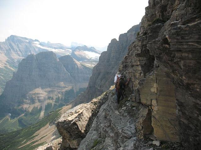
Mount Cleveland -
At-times the east traverse
is narrow with sharp drops.
(Mouse-click to see Andy and Adam.)

I arise from my Browning, Montana room and perform errands before starting-in on a Kahlua chocolate cream pie ($12.99) intended to provide plenty of energy for the upcoming effort. At 4,000 calories it will certainly fit the bill! (Sorry, no actual Kahlua is included - it only tastes like the "real deal").

An hour later, Dennis and I meet at 11 a.m. near the Visitor Center in Saint Mary, Montana. It is located one-half mile west of US Route 89 and the main mass of Saint Mary proper. There we secure the actual camping permit after I am briefly quizzed by a ranger on a 15 minute videotape about precautions taken while in the Glacier Park backcountry.

Standing Indian
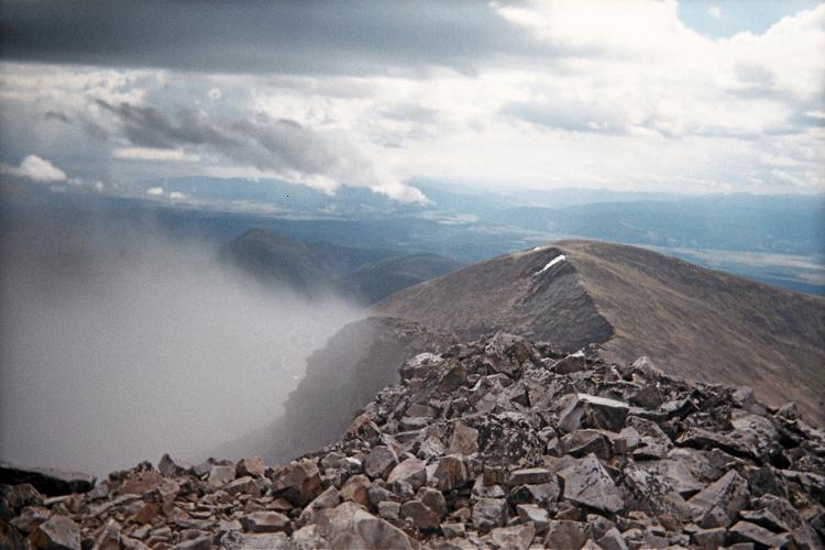
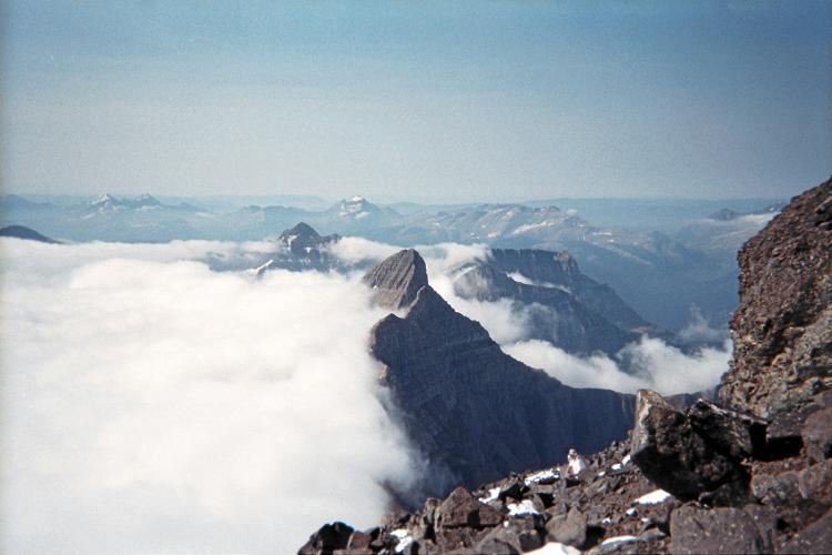
Morning clouds are blocked
by Stoney Indian Peak as
seen from roughly 9,500 feet
on Mount Cleveland's south ridge.

We enjoy lunch together, Dennis with a ten dollar swiss cheese / mushroom hamburger, and a plate of nachos for myself. The prices are high during tourist season. Then we caravan into Canada via the Port of Chief Mountain entry point by taking Montana Route 17 northwest from US-89.

We spend the afternoon and evening at Waterton Springs Campground. Andy arrives within the hour, and we share a single space, number 218, large enough for at least our three vehicles and Andy's one-man tent.

There is much to talk about, and pack for next morning, as we swelter in the afternoon heat. Andy and Dennis shower. I don't, having just been in a motel room. I save a quarter of the pie for breakfast the next morning before we drive to the boat launch.

Monday, August 16 - boat ride and Mount Cleveland approach hike

We enter Waterton Lakes National Park at a pay kiosk. After parking in Waterton township, about an hour later we take the international boat ride south, crossing Upper Waterton Lake to the Gaunt Haunt ranger station in the USA at its south end.

The boat ride is enjoyable on this, only the second sunny day in weeks. We can only imagine how depressing it would be to hike into our camp for eight miles... completely in the rain. Providing fair skies on numerous important climbs I've done with him,

Dennis does not disappoint in these matters.

USA
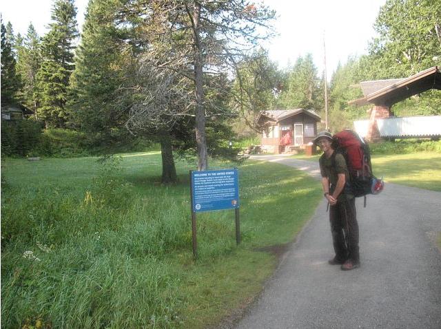
"Welcome to the United States"
along the paved path between
boat landing and Goat Haunt.

We are deposited on the east side of the lake's southern shore, and walk on a broad, paved trail for about 1,000 feet west to the Goat Haunt ranger station. A backcountry permit, affixed to my backpack, is inspected - as is the United States of America passport.

This is an official United States entry point - and a sign makes that quite clear as shown in the photograph. Remoteness does not detract from this fact.

The entire eight mile hiking approach to our high camp is on well-maintained trail, gaining most of 2,150 vertical feet in the final two miles.

deer
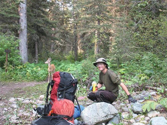
Adam and a local at the
Kootenai Campground
trail junction.

At the Stoney Indian Camp the Park Service separates tent spaces from food preparation from outhouse. Deers enjoy visiting the area, and largely to lick salt from backpacks and other items. Small rodents are also seen - and I deem these nuisances as more prevalent and serious a threat than the odd grizzly bear owing to their vastly higher frequency.

For supper I enjoy four-cheese pasta with added salami. I cook it in two batches so that the experience is drawn-out. Later I sleep in the tent with Dennis. It is remarkably uncomfortable because it's simply too warm and there's just not enough floor space.

Andy wants to start an hour before dawn. I want to start so as to not require a headlamp - about 30 minutes before theoretical sunrise at 6:29 a.m. We reach a compromise, and I set my watch's alarm feature accordingly at 5:15 a.m.

Tuesday, August 17 - Mount Cleveland summit day (Glacier County)

Details of our Mount Cleveland climb are provided in this trip report.

This is it! The BIG DAY! Weather is beautiful as we start out, in darkness, bound for Stoney Indian Pass. Andy begins 15 minutes before Dennis and myself; and we join at the pass, taking a break before continuing. The sun has yet to rise.

The climb's "navigational crux" is at-hand shortly enough: picking a route to the southern end of the so-called "gray band" traverse on the ridge's west face. Rock cairns are strategically placed here-and-there for our descent; and we ponder if their absence is an intentional effort by the Park Service to weed-out backpackers trying to do something beyond their safety envelope.

gray band
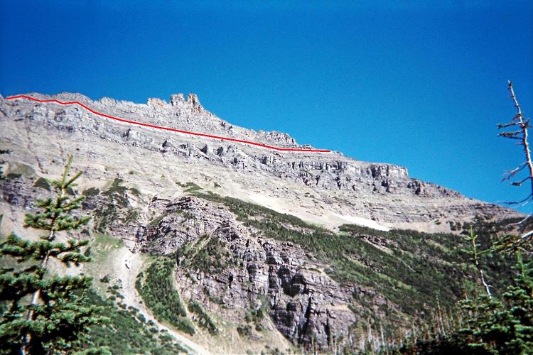
The "gray band" is followed
to traverse from above
Stoney Indian Pass to a notch.

The gray band takes all of 20 minutes. It is simply a goat path traversing on a ledge which leads to a notch in the ridge where one crosses over to the east side. Dennis and I downclimb maybe 30 feet just before the notch to avoid some Class 4 terrain. Andy remains high, takes his time, and we meet on the notch's east side.

Clouds dampen our view of the ensuing traverse, one that is fully 1 1/4 air miles in length not counting the twists and turns. At-times visibility is limited to 100 feet. We are not perturbed, however, as the general route is well known and we have GPS capability.

goat
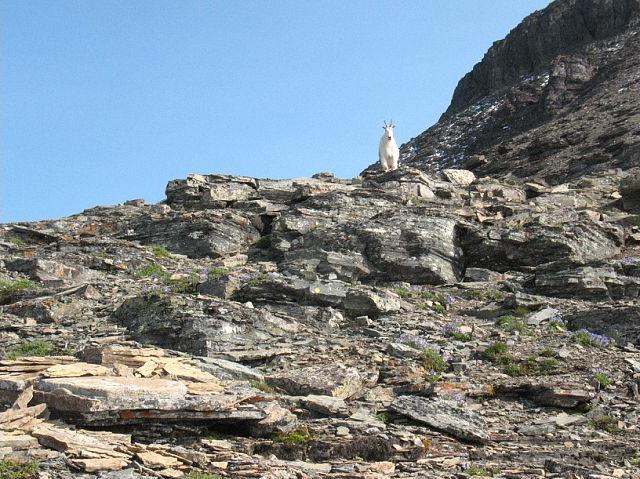
A mountain goat above 9,000 feet
suggests bears will not
perturb our summit bid.

At the traverse's north end we have a break before crossing the windy saddle which leads to the upper mountain. Finally at around 9,300 feet we climb above the cloud layer into a sunny day!

A mountain goat hints that bears will not pose a threat as we get ever-closer to our goal. Indeed, reports exist of climbers being turned back by bears feeding on cutworms and moths on the highest reaches of our peak. The goat's mere presence suggests that bears are not in the general area.

Andy on snow
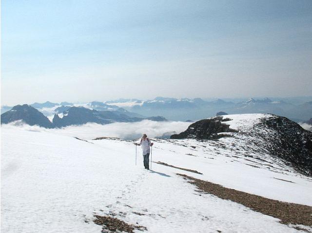
Andy pushes ahead on
the final, snowy slope.

The recent storm from a few days ago has left snow above 9,500 feet as we near a subpeak. Coverage is limited, and I try to avoid it since wet boots and rock-hopping are a poor combination. We take a nice break just prior to topping-out on the subpeak.

Beyond the snow gets thicker yet never poses a true obstacle. Andy punches through every now-and-then; and yet I find it wholly appropriate that snow be here, mere miles from Canada, in a park named after glaciers.

summit!
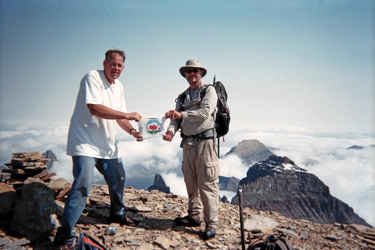
Success! Andy (viewer's left)
and Dennis display the
State Highpointers logo.

There are snow cornices from last winter. Somehow I get ahead of the others, and enjoy complete solitude for the last few hundred vertical feet and quarter mile. I take a magnificent photograph soon after arriving at the summit lest the clouds suddenly evaporate and thereby lessen the moment's elusive ambience.

Dennis and then Andy join me shortly enough, and we engage in a series of photographs both of these surroundings and ourselves. I enjoy a pastrami and swiss cheese sandwich on pumpernickel bread purchased in Browning two days earlier, saved for the occasion, and with ranch dressing.

east traverse
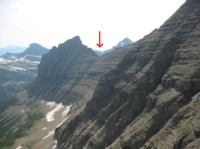
The east-facing traverse
on descent requires return to
the indicated ridgeline notch.

The descent is uneventful - except that now we get a full view of the eastern traverse for the first time. We meet a pair of climbers at the saddle just before the traverse and exchange information.

The climb is basically finished on reaching Stoney Indian Pass around 5 p.m. We then separately head down the trail, and I return to camp after 11 hours 26 minutes.

We are delighted to have climbed Mount Cleveland!

Wednesday, August 18 - Mount Cleveland return hike; Browning, Montana

The desired boat departs at 11:25 a.m, and we arise early enough to give ourselves a one hour leeway. So after cold "bananas and cream" oatmeal I hike with Andy at 7.

Ten minutes before the Kootenai Lakes Campground junction three guys, maybe age 20, come the other way and ask, "Is this is the way to Waterton?". I ask if they refer to the Waterton Lake boat launch. On confirming this, I reply, "Well, you've only wasted 20 minutes." They follow me north and then to the boat launch.

aquamarine lake
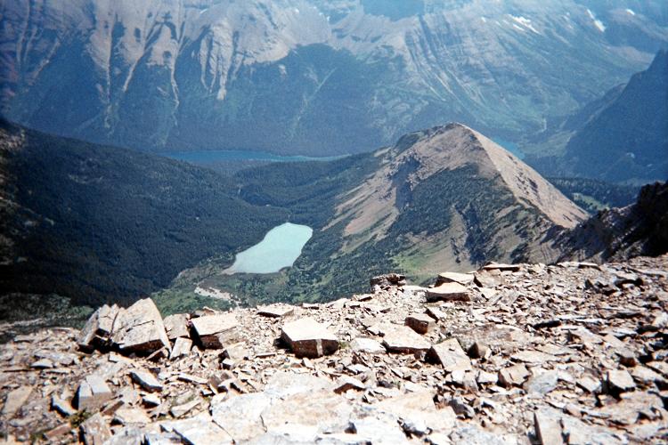
Mount Cleveland -
This lake is a stunning aquamarine
from glacial loess (fine silt).

This park gets a lot of "bozos". No wonder there are so many draconian rules - to protect them from auto-destructing.

We arrive at the ranger station around 10:20, and find nobody there to check our permit. We drop our packs at the boat launch, munch on food, awaiting the throng of tourists on the outbound ride before finding seats for our return.

I use the rented satellite telephone to wish my mother "Happy Birthday" on this, her 75th birthday.

Once the boat is in-motion the narrator mentions and points to Mount Cleveland. I spontaneously shout "Yyyyyyyesss!", and point to Dennis and Andy with three fingers raised to indicate we all were just there.

OH if only those other passengers could experience what we have!

grand vista
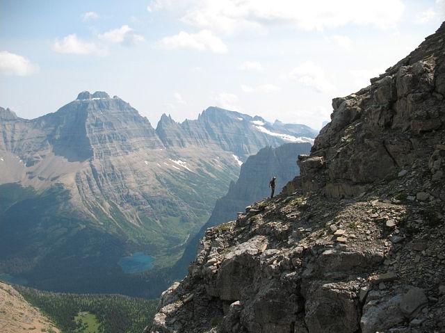
Mount Cleveland -
Adam set against the magnificent
scale of our surroundings.

By that means this boat ride would seem most trivial and uninteresting. Mountains have a way of doing that to other activities...

The round-trip distance equals a marathon - just a bit over 26 miles. This includes a minimum of 9 miles for summit day; yet more likely 10 miles is a better estimate. Our total elevation gain is a devilish 6,666 feet.

I consider whether Pondera County should be attempted tomorrow. The good weather forecast will hold if I wait one day - and by now I do deserve that very same motel room in Browning.

I hear from my mother that she is ill, having eaten cole slaw that disagrees with her stomach. She visits the hospital, yet is sent home with a misdiagnosis that does not address her true problem.

This news dampens my appetite, of course, but there's nothing I can do to help matters. I decide to delay the next highpoint until the day after tomorrow so that I can monitor what's going on back in Los Angeles.

Thursday, August 19 - disturbing news from home

My mother returns to the hospital. I am days of driving away, so any malady will likely be finished by the time I get there. Furthermore, the staff know how to handle whatever situation may be taking place far more than myself. Therefore it is logical to just continue with my climbing plans, trying to push her illness away when I must concentrate on the task at-hand.

This decision could be considered callous and uncaring. Nein, non, nyet and NO - such a conclusion is the result of being overly sentimental, acting on impulse rather than rational thought.

Never let your heart make the decision.

nearby peak
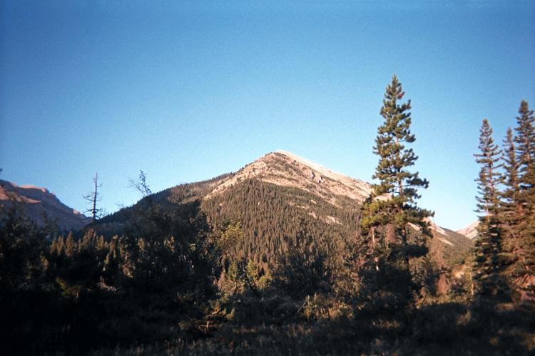
This mountain hides the Pondera
County highpoint as viewed
from the approach trail.

Nevertheless as it does not detract from climbing plans, I intentionally linger in Browning so as to receive any news from home. After arising around 7 a.m. I get gasoline at the local Exxon station, taking note of what I'll later have as breakfast. Then I visit Glacier Laundry when they finally open at 9. I experience a case of dejà vu: I've been here before....but when? Oh yes - just prior to climbing Mount Stimson in 2008, and with Bob Bolton and others as they wash clothing.

What an effort THAT was!

While the clothes are washing I return to the IGA supermarket and buy food. I revisit the gas station and eat "breakfast" - including fiery hot chicken wings. Finally I retrieve the clothing and leave town around 11 a.m.

It's just 30 miles to Dupuyer along US Route 89 - and there's no cell phone signal in this tiny community. So I head for my trailhead along broad Swift Dam Road, arriving quite early around 2 p.m.

I cannot contact her because of moronic hospital policy that precludes strangers from communicating with patients. As far as they are concerned I am a "stranger" to my mother since over the phone I cannot prove that I am her son. So I rely on my brother Dale, a medical doctor, for relaying information to me. Apparently he can learn her status in a professional capacity. So it is that, using a rented satellite phone I learn she is "doing OK" - yet with no description of exactly what is wrong with her.

It is hard to climb tomorrow given this lack of definitive information.

Friday, August 20 - unnamed 8,400+ feet (Pondera County)

Details of climbing to the unnamed Pondera County highpoint are provided in this trip report.

The route starts easily enough, following trails for about 4 miles. Then comes a truly nasty bushwhack up a gulley with wet rocks hiding under brush, bushes galore, and, at one point, avalanche debris which forces me to sidehill on an adjacent slope.

Mount Fields
Mount Fields is south-southeast
of the Pondera County highpoint.

Happy that section is finished, I soon reach a lower and then an upper basin. I battle high winds which nearly knock me over as I climb to a saddle immediately southwest of the goal. Once on top I find Bob Packard's summit register but don't care to examine the contents - it is simply too windy. I sit maybe five minutes downwind some ten feet below the summit, and only have a small granola bar instead of my "summit" sandwich - one which eventually gets enjoyed on returning to the lower basin.

The round trip costs me some 10 hours, returning around 4 p.m. after a dawn start.

I return to Dupuyer, find no cell signal there, and continue south on US Route 89 to the far larger community of Choteau, Montana. Here I camp for free behind a grain silo even though there are motels and an organized campground mere yards away across the street.

I stop here for the night because there's a cell phone signal; and because I have not yet decided if I'll climb the next mountain tomorrow or the next day. Here, even if "tomorrow" is the verdict, the effort is short enough that a late morning start is entirely sufficient. Therefore in driving no farther I have nonetheless covered both possible outcomes. I call both Bob Bolton and Bob Packard to get a weather forecast. They independently concur that tomorrow has the better weather prospects.

Meanwhile I learn from Dale that our mother is still in the hospital. He provides a telephone number for contacting her directly - yet on each of four attempts I get the same damned message, "The patient you want is currently unavailable".

I go to bed uncertain whether I'll reattempt Red Mountain tomorrow.

Saturday, August 21 - Red Mountain success (Lewis and Clark County)

I arise around 7 a.m. completely alert, and, with blue skies decide to "do" Red Mountain today starting around 11. A breakfast burrito is slathered with hot sauce; and I drive south with the usual coffee / hot chocolate beverage.

Shortly enough I am on Montana Route 200, and stop at Rogers Pass to get a photograph. Here the lowest official temperature was recorded in the contiguous 48 states - a bone chilling -70° F.

Rogers Pass
self-explanatory

Having just been there a week earlier the road navigation is easy ... and this time I drive the right fork where I mistakenly hiked the left fork, and park 0.5 mile later when I cannot go farther except on-foot owing to both a creek and heavy brush.

Details of climbing Red Mountain are provided in this trip report.

I cross the creek on-foot and locate the old mining road as it veers right (east), loosing it's covering of heavy brush after about 200 horizontal feet.

The track zigzags up a south-facing slope, switching directions a total of three times before finally heading west along a ridge and gaining about 400 feet elevation. The final, west-trending (and longest) portion is barely recognizable as a former road. At its end is an old adit (horizontal mine entrance) as shown in the photograph.

old adit
End of the deteriorated mining
track reveals this old adit.

After reaching point 8245 I continue along the obvious ridge west, losing about 25 feet before continuing higher - now above the most tenacious of trees. The ridge trends north, and I am fighting a high wind by staying just to the east of the true ridgeline. I sidehill around the east side of peak 9250, a mistake owing to both the extra distance and effort of avoiding a twisted ankle which is all-too-easy to get when talus-hopping sideways. On the descent I go right over the top of peak 9250.

Red Mountain's summit has two possible areas. Likely the southwest area is higher, with a destroyed / dismantled rock structure and benchmark.

summit vista
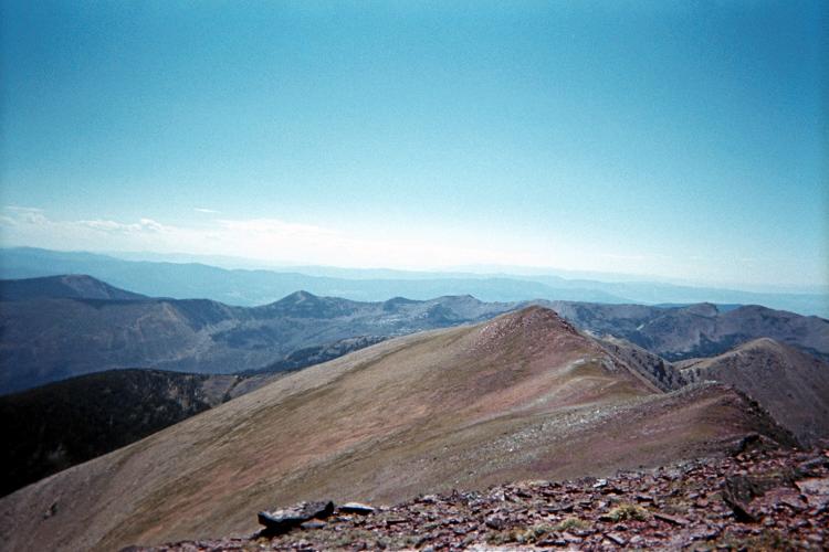
Summit view southwest with
point 9250 in mid-background.

Fifty or sixty miles west, on a rough 280° bearing I see a mountain range with plenty of snow. I am alarmed since that's the distance and direction of my next and final goal - Peak X of Missoula County. Were it not for this observation I may not have completed the Montana county list two days later, as it suggests taking an ice-axe which ultimately proved essential on that later effort.

My ascent consumes 2.4 hours; the descent 2 hours. The round trip takes 5 hours with a half hour summit siesta.

I continue only to the organized campground 8 miles from the highway. Noting no camp manager I omit paying the $8 fee. More importantly, I manage to squeeze the vehicle into a spot that's completely shaded so the camper shell is cool enough to enter before sundown.

For supper there's plenty of hummus, and enjoyed many many ways.

Sunday, August 22 - waiting-for-good-weather day

Today the forecast for Missoula is 20% chance of rain showers. On Monday that diminishes to "partly cloudy" and 10% - and on Tuesday it's supposed to be "sunny". Of course in the mountains where inclement weather is always exaggerated, that forecast translates to 99%, 98%, and 10%.

I neither wish nor need to wait two days for climbing the next mountain. So Monday it shall be, banking that "partly cloudy" will be good enough to summit. Meanwhile I leave the campground and enter Lincoln, Montana shortly enough about 15 miles later. I have arranged to call mother there, her cell phone left "on" for that purpose for one hour only (as she has no charger at her bedside).

Her treatment at the hospital is described, and it sounds pretty bad. Every test ordered takes hours and hours to return, interpret, and, if needed, take appropriate action. Their inefficiency shocks me.

This news comes just before and during breakfast - bad timing for my sake. The Greek omelet is superb, with plenty of thinly-sliced marinated meat, olives, tomatoes, onions, and of course feta cheese. I am disheartened by my mother's condition, and so fail to order the deep dish apple pie.

Peak X trailhead
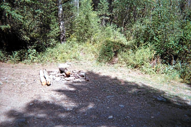
The unmarked trailhead for Peak X
lies just behind a fire ring.

Soon I enter Missoula, and somehow recall where the Southgate Mall is located from the previous summer! Here I spend some time in the cool indoors before heading out to the journey's final trailhead.

I revisit Oil and Vinegar, an upscale shop selling imported, flavored olive oils and vinegars plus more condiments. Recalling how tasty it was, I buy another bottle of "maple chipotle finishing sauce", thence wrapped for travel.

I buy a pint of Italian gelato for seven dollars, and sit down to enjoy it while other patrons eat lunch food. I've chosen four flavors, with perhaps the tastiest being the chocolate hazelnut which I mix with the coffee flavor - plus a chocolate almond biscotti crunched in for textural contrast. What I have in-mind is calories: tomorrow Peak X entails over 6,000 feet of elevation gain.

I reluctantly leave Missoula and head north on US Route 93 to Saint Ignatius, the nearest community to my trailhead. The approach road is driven, and I'm sitting pretty by mid-afternoon.

I do not have permission to be here on Indian-owned land. To get a permit costs about $22 and requires a 60 mile round-trip to Polson. I have taken the chance that no local will try to shoo me away.

At supper I'm not hungry yet I eat anyway.

Monday, August 23 - Montana completion at Peak X (Missoula County)

I do the "extra mile" to climb this mountain - and for good reason: it is the final mountain in my quest to complete the Montana county highpoint list.

There is light rain at 3:24 a.m. - and again at about 4:30. Similarly upon arising before dawn at about 5:15 a.m. I return to sleep until I can assess if a mountain ridge 3,000 feet above is visible, by daylight, and below the cloud deck. It IS visible at first light.

Then again, while contemplating whether to "go for it", and still under the sleeping bag, I use the shortwave radio to get an updated weather forecast just before 6 a.m. Instead I learn of an auto accident on Hawthorne Blvd. in Los Angeles on KNX radio 1070 kHz. The stupidity of having such useless information, from a thousand miles away, yet no local weather forecast is apparent.

Finally I tune-in NPR (National Public Radio) from Missoula on the FM band to learn of a partly cloudy forecast. That's good enough for me: I'll go.

The chocolate babka slice is enjoyed with well-caffeinated milk ... and I'm off with 4 1/2 quarts of water and 1,800 calories of food. The ice axe also comes, having seen snowfields while atop Red Mountain the other day some 50 or 60 air miles to the east.

East Saint Mary's Peak
East Saint Marys Peak is
climbed to reach Peak X.
My ascent route is green,
the descent in red.

The first 4,000 vertical feet is very steep for a trail. So steep, in fact, that in places the gradient reaches 100% - a 45° angle. Deadfall abounds - and it's sometimes hard to locate the trail on the fallen tree's opposite side. The trail eventually disappears completely.

Clouds remain ONLY over the Mission Range - everywhere else it is sunny. Without sun I shiver above treeline in damp clothing from ascent through the forest as the wind blows stiffly out of the west. Only movement resolves this, and yet I want to go slower in the intentional effort to allow for improved weather by the time I get above the current roughly 8,500 foot cloud base.

A water cache is left here at (47.29491° N, 113.90453° W) and 8,834 feet elevation - and remains there as described below. It is either a pint or full quart in a liter-sized polyethylene bottle. Snow from the recent storm dots the ground, and I switch to glacier glasses.

Shortly I reach point 8902. I'm now in the cloud with perhaps 150 feet of visibility. Nevertheless I ascend the ridge as it should lead to the summit of East Saint Mary's Peak.

I know when I've reached its summit only from the measured coordinates and as the terrain is lower farther to the northwest. Vacation Pass lies northeast from the chart, as-is Lowary Peak itself (Peak X), yet the "obvious" ridge seems north by my compass. In the clouds. I cannot see more than 100 feet.

What to do?

I descend the cited ridge perhaps 50 vertical feet, and, in a moment of visual clarity, see a Class 3 rock-based route leading in the proper direction along a snowfield's north edge. The rock is completely dripping wet from melting snow, and half the surfaces are covered in 2 or 3 inches of snow. NOT GOOD.

I have three options -

Remember that I am alone so this decision is entirely mine. A few unwelcome comments from Kahiltna Base Camp at Mount McKinley come to mind after I decided to not continue. I am outraged - and so this time it will be different.

Perhaps had I not consumed 4,400 calories yesterday (which lends me huge stamina) or not had raw coffee grounds in my milk things would have gone differently. But not today.

The 50° snow is descended facing-in, plunging the ice axe and kicking steps for about 100 feet. It's hard work. More importantly,

What am I DOING here alone in a whiteout
with nothing but a shaft of metal to avert disaster?

COMPLETING MONTANA.

The gradient eases to maybe 20°, and with clearing weather I happily descend to just above the Saint Mary's / X saddle, leaving yet another water cache.

Peak Y
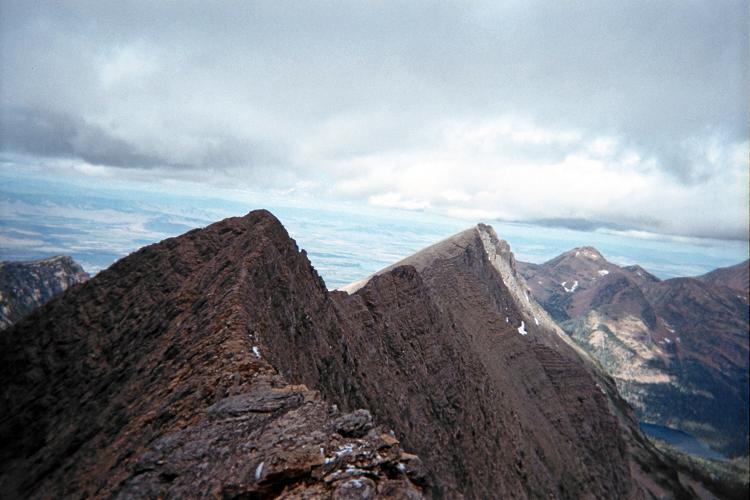
Peak Y is to the left in this
view from Peak X's summit.

To the immediate northeast are a series of three or four peaks - and Lowary Peak (Peak X) is the second from left. Remaining below the ridgeline, I summit at 12:45 p.m, so completing the Montana county highpoint list.

A most erratic "Congratulations!" comes from my mother while using the satellite phone. I learned in Missoula that she's at home, eating real food for the first time in a while.

I obviate reascent of East Saint Mary's Peak by returning to the saddle and then picking my way across cliff bands to the route below point 8902. I do not recommend this concept as the additional distance negates the advantage of avoiding the 600-700 foot reascent. Furthermore, finding weaknesses in cliff bands is problematic, and requires high Class 3 scrambling at the very least.

I return to the ridgeline trail several hundred feet below my 8,800 foot water cache. It will remain there for now.

rare vista
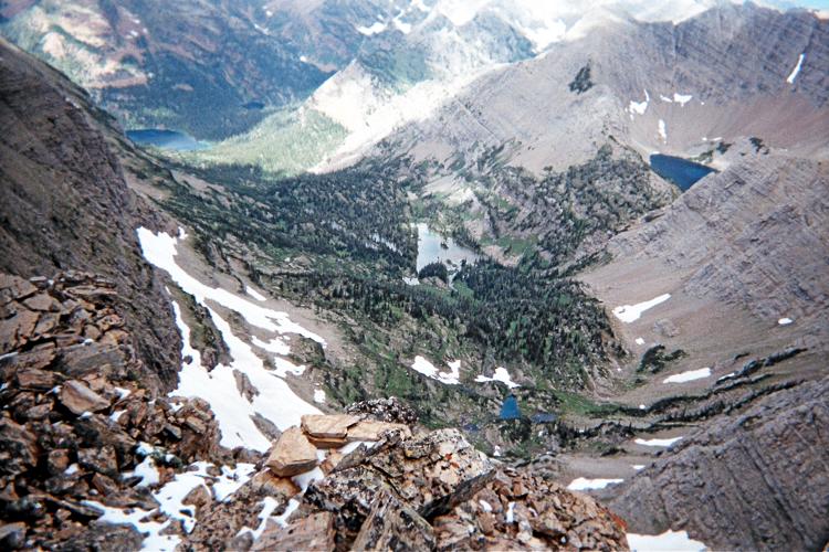
View 'straight down' from
Peak X's summit to what
must be a rarely visited valley.

Snowfields appear to be a permanent feature as both Bob Packard's report (July 30, 2002) and Jim Perkin's report (July 21, 2007) write of snow and how to bypass or directly deal with it. Moss-covered rocks near the trailhead suggest the Mission Range receives more precipitation than nearby ranges. Corroborating evidence is that no other mountain range in my travels had anywhere near the same amount of snow from last winter. Not even close.

The ascent takes me 6 hours, and 10.9 hours for the round trip. Under better conditions 10 hours is quite likely. The total elevation gain as I climbed Peak X is 6,350 feet.

Peak X is not on the APEX list of "toughest 20" county highpoints in the contiguous states. However as I climbed it the mountain certainly seemed like it should be!

On returning to my pickup truck I shout, twice in fact,

"Woooo Hoooo! All fifty-six counties done!"

- although I'm somewhat confident that only the wildlife hear me.

I sleep here, it being too late to "get my money's worth" at a motel room. I can shower tomorrow evening on the long drive home.

I am emotionally relieved in not having to inspect weather forecasts, worry about bears, arise before dawn, put on disgustingly dirty leather boots, suffer a twisted ankle, drink tasteless water without wanting to, and a zillion other things that climbing peaks necessitates. In essence, my trip has just ended.

Tuesday, August 24 - south to Pocatello, Idaho

I can either take two or three days to get home. It's 1,315 road miles from Saint Ignatius, Montana to home using Interstate-15 - and roughly the same distance using US Route 93 until it hits I-15 just east of Las Vegas. It is 1,475 road miles from the Port of Chief Mountain Canadian border crossing to home. In a sense, then, I have already begun my drive to southern California.

I had tentatively penciled-in climbing Swasey Peak in the Utah desert. However my trip is already going to be 4 weeks in duration; and, frankly, it's time to go home instead of doing yet another peak.

I head south, having decided to 1) take Interstate-15 after meeting it just outside Butte; 2) forget about Swasey Peak on the 4,000+ foot prominence list; and 3) take three days to drive home. I-15 will have more services - and more often. It will also have multiple lanes in each direction so that I am not stuck behind a slow truck.

One concept is to split the driving into three equal portions. However there is no sizeable community at the one-third point, namely, at the Idaho / Utah border. Seventy miles north is Pocatello; to the south is Ogden. I "gain" an hour of time upon entering Nevada during the second driving day as I enter the Pacific Time Zone. Hence THAT day should be the longer of the first two days.

With the above logic I drive to just Pocatello for the night - just over 400 miles.

Wednesday, August 25 - south to Mesquite, Nevada

I pass clear through Utah, stopping only to break, typically, every 200 highway miles for both a half tank of gasoline and food.

My goal is definitely the Virgin Hotel and Casino in broiling hot Mesquite, Nevada. Here the rooms are seriously cheap ($24.95) because management expects guests to lose money, statistically mind you, at the gambling tables. I don't gamble in such an uncontrollable manner. Besides, I've done enough "gambling" on this trip!

casino
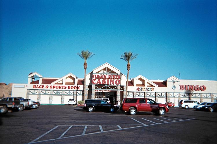
Virgin River Hotel and Casino
in Mesquite, Nevada

After about 505 road miles I arrive at 3:15 p.m. in the new, Pacific Time Zone - and am delighted to learn that I have a free breakfast pass to be used any time. It is hot enough at 107°F that I wear a sunhat just to walk the 100 yards from my room to the main building which houses registration, casino, and restaurant.

I use the free pass soon enough within an hour of my arrival. I order a house salad with blue cheese dressing, and it's quite welcome, as fresh vegetables, after eating dry food for the duration. The breakfast then arrives, consisting of two fluffy pancakes, two eggs "sunny side up", two sausage patties and two bacon strips.

I make a sandwich of one patty with swiss cheese from my supplies; and enjoy the pancakes with both butter and a combination of maple syrup plus that expensive "maple chipotle finishing sauce" purchased at the Missoula shopping mall.

After chilled lemon meringue pie for dessert I pay all of six dollars as the summed price of salad and pie - the "breakfast" itself having been free. This is an exceptionally good deal!

The evening is spent most lazily watching a silly 3 hour movie on the TV set. To relax I have two 6-ounce bottles of Zinfandel wine from the gift shop - and enjoyed with a Hershey's chocolate bar. Wine and chocolate pair well together - especially dark chocolate.

Thursday, August 26 - home

The final 410 road miles are uneventful. As usual I spend some of it listening to radio talk show hosts, especially Rush Limbaugh. I do not believe in his insane rhetoric - rather, I listen to him largely because it keeps me alert.

Summary

One of the advantages in working on a state's county highpoints list (as opposed to other possible peak lists) is that you are forced to visit EVERY part of the state.

So I have seen ALL of Montana, from where Custer made his "last stand"; to the northeastern empty quarter, so cold that almost nobody calls it home; to some of the lower 48 states' remoter tracts of land: the Beartooth Range where nothing is easily climbed; Glacier National Park where only bears are permanent residents; and dozens of other special places that happen to all be mountaintops.

gifts
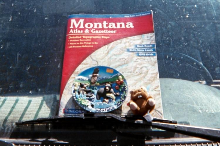
Montana saucer and beaver are
displayed on the windshield
after return to my home town.

The journey's goals are achieved - chiefly a Montana state completion as shown on this timestamped map. I join Bob Packard and Jim Perkins as the only finishers of this 56 county list.

As with other state completions I reward myself with some minor gifts - a six inch saucer decorated with some idyllic Montana scene of playful bears, snow-capped peaks, and an eagle soaring above all; plus a tiny stuffed beaver.

The plate sits on the desktop currently supporting this computer monitor - and used by my late grandfather, a rabbi, for writing his sermons. The beaver now sits in my truck cab on the front dashboard. In both cases the souvenirs are placed in a highly visible location - so that I can remember "Montana" with great joy and frequency.

My pickup truck's odometer suggests 4,092 road miles total. These "Adam truck miles" appear to be roughly one-hundredth larger than normal, statute miles.

I estimate the total elevation gain for my journey at 58,000 feet, which is almost exactly 11 vertical miles. The horizontal distance hiked is estimated to be 168 miles.

I have no idea how much elevation gain and distance completing Montana requires. What I do sense is that it's the toughest state I've finished among nine, and with California coming a close "second".

Now I have (only) 14 county highpoints remaining, one-thirtieth of the 414 county total in the eleven western (contiguous) United States.

With 402 of them, by coincidence I have visited the same number of western county highpoints (including Alaska and Hawaii) as I have 2,000+ foot prominences anywhere.

VISIT MONTANA. You will be amply rewarded.