Flathead County Highpoint Trip Report

Mount Stimson (10,242 feet)

Dates: August 10-14, 2008
Author: Greg Slayden

participants: Bob Bolton, Duane Gilliland, Edward Earl, Greg Slayden, Adam Helman

photographs are largely by Bob Bolton with some from Greg Slayden.
Mouse-click any image for a larger version.

Preamble (by Adam Helman)

This report's text was originally published by Greg Slayden, and is reproduced here to allow for embedded images as kindly provided by Bob Bolton. In addition, Greg maintains a dedicated Mount Stimson web page at his peakbagger.com website.

For myself, this effort is part of a larger journey collecting Montana and Idaho county highpoints in August 2008.

Bob Bolton's Mount Stimson photograph album

Greg Slayden's report follows with minor comments when appropriate.

Mount Stimson
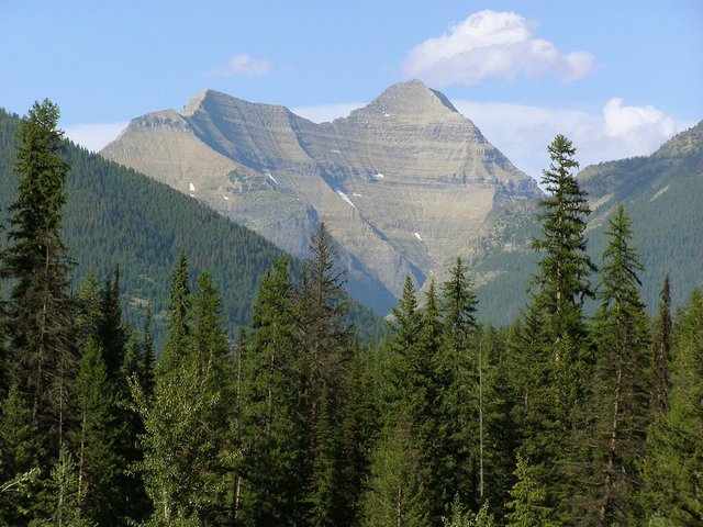
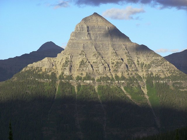
Mount Stimson as seen from U.S. Route 2 to the southwest.

Summary

A five-day expedition to Mount Stimson, using a new approach from the east to access the standard southeast ridge route to the summit.

Day 1: Took boat across Two Medicine Lake (5164') and hiked to Dawson Pass (7598'), then north to Cut Bank Pass (8000' on traverse), then down Cut Bank Pass trail to the Upper Nyack campsite (4180'). Gain 2836', loss 3820', Distance 15.5 miles, 9.5 hours, all on trail.

Day 2: Forded Nyack Creek and bushwhacked up the Stimson Creek drainage in heavy brush 2 miles to a campsite at 6040'. Gain 1860', distance 4.2 miles (2 straight line), 6 hours.

Day 3: Climbed class 4 cliffs to gain the Stimson-Pinchot col and then followed the southeast ridge to the summit, and returned same way. Gain/loss 4102', distance 4.3 miles RT, 11 hours (including 1 resting on summit).

Day 4: Bushwhacked downhill, forded Nyack Creek, and climbed Cut Bank Pass trail to a 5200' camp. Loss 1860', gain 1020', distance 7.8 miles, 7.5 hours.

Day 5: Hiked on trail up to Cut Bank Pass, and then down the long Pitamakan Pass Trail to Two Medicine. Gain 2700', loss 2740', distance 12.7 miles, 8 hours, all on trail.

Totals for trip: Gain/loss 12,518', distance 44.5 miles, 41 hours of hiking.

Route Discussion

Based on summit register entries, approximately five to eight parties a year climb this peak, and virtually all of them climb the southeast ridge from the Stimson-Pinchot col (S-P col). There are two commonly-used routes to the S-P col, each used by about half the parties: (1) Pinchot Creek and (2) Beaver Woman Lake; and this second route has two approaches.

1. Pinchot Creek route. Pros: This is the most direct and shortest route to the base of the southeast ridge, and there are good camps in the cirque just below the col. Cons: You must ford the wide and deep Middle Fork of the Flathead River, and there is no maintained trail up the Pinchot Creek valley. By most accounts, it is about 6 to 8 miles of bushwhacking, stream wading, and looking for faint elk trails.

2a. Beaver Woman Lake route via Coal Creek. Pros: A maintained trail leads to near timberline and a designated campsite at the lake, minimizing bushwhacking. Cons: You still have to ford the Middle Fork of the Flathead, the Coal Creek trail has several more deep fords, the Coal Creek trail has been plagued with blowdown in recent years and is difficult to hike, and from the Lake to the S-P col you must do a long and nasty traverse on a ledge across the daunting NW face of Pinchot.

2b. Beaver Woman Lake via Cut Bank Pass. Pros: Avoids fording the Flathead and the blowdown and fords of the Coal Creek Trail. Cons: A very long and circuitous 2-day approach on trail via Surprise Pass that gains and loses almost 4000 feet, and you still have to contend with the Pinchot face.

Our party decided to pioneer a new route that reaches the S-P col from the northeast by bushwhacking up the Stimson Creek drainage, after a trail approach over Cut Bank Pass. Pros: Avoids the Flathead ford, the blowdown and fords of Coal Creek, the long trail via Surprise Pass, and the Pinchot face. Cons: 3500 feet of gain/loss on the approach, 2 miles of nasty bushwhacking, and one relatively easy ford of Nyack Creek.

Introduction

Our five-person team assembled in East Glacier, Montana on Saturday evening, August 10th. Bob, Duane, and I drove from Washington State all day, while Adam and Edward arrived independently in their pickups, both in the midst of long peakbagging adventures. Duane's Chrysler sedan was not the "mountain car" that Adam and Edward were expecting, so they didn't recognize us until we hopped out and hailed them.

After reintroductions we had a group dinner, started to get our gear organized, and all of us save Adam spent the night in a spartan and inexpensive room at Brownie's Hostel.

[Adam comments: I car-camped at a pullout along the Two Medicine Lake approach road.]

Day 1 - Sunday, August 10, 2008

We drove to the Two Medicine boat dock in the southeast corner of Glacier National Park by 7 AM and continued to pack and organize our gear. We had reservations for the 9:00 boat cruise down Two Medicine Lake that would save us a few miles of hiking, so we had plenty of time. I went to get our camping permits--like in most National Parks, this is a very bureaucratic chore. Fortunately, Mount Stimson is in the "Nyack Wilderness Zone" of the park, the only place they allow camping in undesignated areas and you don't need advance reservations to avoid being turned away from an objective. We secured permits for the Upper Nyack designated campsite for Sunday and Wednesday nights, and "undesignated" for Monday and Tuesday nights. The process of getting the permit took about half an hour, and they gave us 2 bear barrels to take with us (we only wound up taking one).

After final gear organization (where I managed to get a bear barrel into my big pack), we had snacks for breakfast in the well-stocked Two Medicine campground store. Then we boarded the small boat at 9 AM for the 20-minute ride down the scenic lake - it was very windy on the water. At the west end of the lake we got off the boat and shouldered up our heavy packs and started the 2400-foot gain hike up to the Continental Divide at Dawson Pass. The trail was a popular and well maintained National Park trail, and it gained elevation relatively easily. A ranger and two tourists were on nature hike, and we passed each other all the way up the pass. Here we also started our practice of yelling loudly at regular intervals to alert nearby bears of our presence - Adam bellowed his booming "Ayyy-Ohh" call, startling me at first.

The trail emerged at timberline and soon climbed to Dawson Pass (7600'), where it was very windy and the sky was full of dark, leaden clouds. From this point, the trail turned north for a couple miles and slabbed the west side of a couple of peaks on the Divide, providing fantastic views of the peaks to the west, especially Stimson. However, it was so windy and dark we would not enjoy the scenery much. We were cold and worried about the possibility of imminent rain.

We stopped for a food break not far above Dawson Pass, just before the trail went into the teeth of the wind, and then trudged along the spectacular trail. When not being blown over by the wind, we scanned the cliffs below the Stimson-Pinchot col, trying to see if we saw a way up. Some ramps on the Stimson side of the col seemed to offer the best route.

traverse
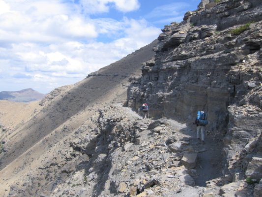
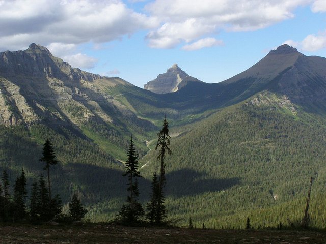
The traverse from Dawson Pass to
Cut Bank Pass is very windy.

After two miles of the contouring, the trail turned a corner above Cut Bank Pass at 8000', and here we cut off a huge switchback by heading downhill on rocks toward the pass once past what looked like a cliff band. The wind here was especially intense - Bob was actually blown over by one gust. A final obstacle was a small snowfield where all of us except Adam broke out our ice axes to cross - the lone Californian in our team preferred to go around on the rock.

At Cut Bank Pass (7900') we rested, but not for long in the strong wind and with threatening skies. We soon headed downhill on the Cut Bank Pass trail westward, towards the Nyack Creek valley. This was a much rougher and less-used trail then the popular ones near Two Medicine. It slabbed steeply downhill to the Mount Tinkham saddle, crossed it, and then started down the Tinkham Creek drainage. At the saddle it started to rain, and as the trail wound down the scenic meadows we put on our raincoats and were glad we were no longer on the high ridge trail.

The Cut Bank Pass trail soon entered the woods, and due to low usage it was pretty brushy, with the trees and bushes on either side soaking our lower bodies pretty thoroughly. A trail crew had recently cleared this trail of downed logs, which was nice, and the footway was good, but we were still a bit miffed about its condition. In a few days our opinions were to change on this, though. The brushiness had us worried about sudden surprise bear encounters, so we all got into the routine of making loud noises - Adam's "Ayyy-Ohhh", Edward's hooting, Duane's loud "Hey, Bear", Bob's operatic call, and my poor imitation of Robert Plant's "Immigrant Song" wail.

Nyack camp
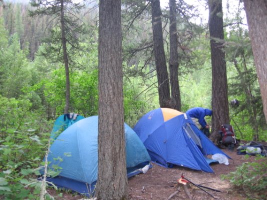
camp the first night at Upper Nyack

We saw a party coming uphill just as we entered the woods, and another couple of backpackers down lower - these were the last people we would see for the next four days. Eventually the trail flattened out, and the rain stopped, and we arrived at the junction with the Nyack Creek Loop trail (4700'). Here we debated what to do - it was another 2.6 miles to our permitted campsite at Upper Nyack, and we were tired of full-pack hauling, but there did not seem to be any better places to camp in the brushy woods.

So after a rest we started heading WNW along the Nyack Loop, mostly flat and, although not as brushy as our last trail, still wet. We made good time to a scenic waterfall canyon and then an empty Patrol Cabin, which I mistakenly thought was our campsite, which was still a ways farther. We had to then trudge along for another mile, having to cross a stream where I slipped and got my feet wet, and we finally arrived at the Upper Nyack designated campsite (4180') at about 7 PM.

We pitched our tents, cooked our dinners in the separate food-prep area, and then built a fire (actually allowed here) to dry out a bit. It was a nice site, with great views of Stimson through the trees, but it was a long hike to get water from the Nyack Creek over dry gravel bars. Due to our late arrival it got dark relatively soon, so we put out the fire and retired to our tents. I was alone in my small 1 1/2 person tent, while Adam and Edward shared a tent, and Bob and Duane another.

Day 2 - Monday, August 11, 2008

Our plan for today was to attempt to bushwhack up towards the Stimson-Pinchot saddle, and if that did not work, hike the Nyack Loop Trail over Surprise Pass to the vicinity of Beaver Woman Lake.

We slept in a bit due to yesterday's exertions, and after breakfast and packing up camp at Upper Nyack we headed back east the way we came on the Nyack Loop. Yesterday we had noticed that the trail paralleled Nyack Creek closely at a point a quarter mile before we got to camp, and that seemed like a good place to cross it, a prerequisite for starting our bushwhack. So after hiking about ten minutes we left the trail for the nearby riverbank rocks and soon located a relatively wide and shallow spot to cross at WGS84 (48.54954° N, 113.58155° W).

bushwhack
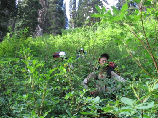
Adam during the bushwhack
seems none too happy.

Here we each modified our footwear in our individual ways - taking off socks and keeping boots on (Adam), using flip-flops (Edward) or sandals (Bob, Duane), or going barefoot (me) - and carefully waded the stream. The water was cold and about knee-deep, not too bad as wilderness fords go - the main danger was very slippery rocks coated with some kind of invisible algae. On the far bank we dried off, rested, and got geared up again.

Our goal was now to bushwhack two miles uphill to treeline just below the Stimson-Pinchot col. We confidently struck out into the forest and at first it wasn't too bad. There was a lot of downed trees, but the brush was not too bad, and we found intermittent game trails to follow. It was a dry yet overcast day, with no dew on the plants, perfect for our task. Our progress was slow but steady - Edward usually was our point person out in front, and I went second with my GPS to nudge him when we got too far off course in the trackless, flat forest. We essentially paralleled Stimson Creek, often in earshot to our right.

The occasional elk trails that were a godsend, but they never lasted long before petering out - they seemed to mainly climb hills and rarely traversed flat areas. As we went farther in, the terrain got brushier and the amount of fallen logs was staggering. We were constantly detouring around endless deadfall and blowdown, much of it with lots of spiky branches intact. We all banged our shins, fell down, punctured our hands, and otherwise got scarred up from the constant battle with the vegetation.

bushwhack
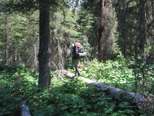
A log provides brief relief during
the bushwhack - yet requires balance.

After a couple hours we came upon Stimson Creek in thick riparian brush and crossed it on a convenient log at WGS84 (48.537117° N, 113.577574° W), since it seemed to be best to be on the west side of the creek to hit treeline sooner. After the crossing our route got much harder - we now had substantial uphill and had to fight head-high stands of thick trees, devil's club, and miserable downward-sloping slide alder. We could rarely see our feet as we bulldozed through, and the countless detours around logs were most annoying. Sometimes we got lucky and blundered onto an elk trail or dry streambed that lasted a few hundred yards. One streambed provided an interesting crux of low branches, forcing us to crawl like commandos in a jungle tunnel.

We were making progress, and after trying out the margins of a brushy slide path clearing to our right we just headed uphill, finding that the taller and denser the trees, the less the brush. Finally our elevation gain started paying off in the form of lower and lower brush, and by 5600' we had pretty much broken free from the worst head-high stuff. Feeling free, we walked uphill in pleasant meadows towards a wide cliff band that appeared to block our progress. At the 5920' contour we dropped our packs beside a stream coming from a waterfall off the cliff, thinking we'd camp in the meadows nearby.

high camp view
View northeast from high camp.
Note the U-shaped terrain
hallmarking glacial activity.

However, it was kind of buggy and still a bit brushy there, so 4 of us (all but Adam) decided to scout out a route up the cliffs to the right and see if there were better campsites above. So we set out without our packs and fought through a dense stand of short conifers to an elk trail that climbed around to the top of the cliffs, where a beautiful shelf of slabs provided excellent views and really nice campsites. We were so enamored of the place as we explored it that we forgot about poor Adam below - when we returned to him he was wondering what happened to us.

So we hauled our packs up another 100' to the shelf at WGS84 (48.52067° N, 113.58963° W) and set up our tents next to the slabs. This area had a nice brook over to one side where we could do our food prep, enough trees behind us for shelter and food hanging, and even lots of large rocks lying about to serve as chairs. Best of all were awesome views to the east of the Continental Divide peaks, and west uphill to the foreshortened bulk of Stimson.

Tinkham
Tinkham Mountain from high camp.
Note the multiple avalanche paths.

We had taken 6 hours (from about 10 AM to 4 PM) to bushwhack two miles with a gain of 1860', but my GPS tracks showed our actual bushwhack distance was over 4.1 miles. We were tired and bruised, so after dinner, socializing, and chores we retired early to rest for our summit day tomorrow.

[Adam comments: Views from our high camp are breathtaking. Bob Bolton in particular takes advantage with a series of excellent photographs. The U-shaped valleys and horn-like peaks speak of the region's glaciated past.]

Day 3 - Tuesday, August 12, 2008

We got up at 6 AM at our 6040' campsite below Mt. Stimson, and after breakfast and getting packed up we started hiking about 7:20 AM. It was a beautifully clear blue-sky day. Our first goal was to reach the Stimson-Pinchot col, and none of us were sure if there was a way up, or if our route would be blocked by impassable cliffs. We had a short climbing rope, but no protection, harnesses, or slings, so that was really just a last resort.

saddle
The Pinchot-Stimson col as
seen during our approach.
How do we get up there??

First we climbed upward over meadow, a talus field below an old moraine, and some marshy ground around a seasonal lake. After climbing a grassy slope we came up onto a moraine crest, where vestigial low-angle snowfields, steep talus slopes, and then cliffs guarded the obvious Stimson-Pinchot col. There seemed to be two main options - we could climb towards the low point of the col using what looked like a ledge system through a 100' cliff band, or we could head much farther right up what might be a system of talus ramps that would take us to the SE ridge of Stimson well above the col.

Bob seemed most enthusiastic about the ramps, but there were enough trees growing among the direct ledges that we all agreed to try that first. Our view of the routes was so foreshortened it was hard to tell anything about steepness. So we crossed the snow and then struggled up a short but steep slope of miserable scree mixed with hard dirt where it was really hard to get purchase - it was a kind of ramp between two minor cliff buttresses, to the left of a large alluvial fan that could have been an alternate route.

We climbed the scree/dirt to a high point that was to the right of the col above, where we could enter the cliff band on ledges that we could in theory follow left (and uphill) to the col. Edward led, and found a route that seemed promising - we'd go along a relatively flat ledge towards the left (viewed from below), and then climb up a level on a gully or step when it looked easy. These steps were high 3rd-class or low 4th-class climbing, but relatively easy to go up.

Mount Pinchot
The steep and dangerous northwest
face of Mount Pinchot.

At one point Edward had cut back to the right, and seemed to be having some difficulties, so I continued ahead on a ledge where there was a very tight squeeze between a cliff wall and a small conifer. Beyond this I could see the col just above, and after some easy scrambling up some relatively solid blocks I soon found myself on the flat tundra of the Stimson-Pinchot col. Loudly exulting, I called to my companions below. Edward soon emerged from his route, a bit above me, and the others followed a variation of my "tree squeeze" route.

Even though we were only at 7400' and had a long way to go, we were all ecstatic about reaching the col - the unknowns of the route were behind us, and we knew that many others had climbed the southeast ridge of Stimson with no serious obstacles. I cached our rope, since we knew we would not need it at all on this trip.

climbing route
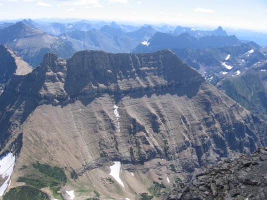
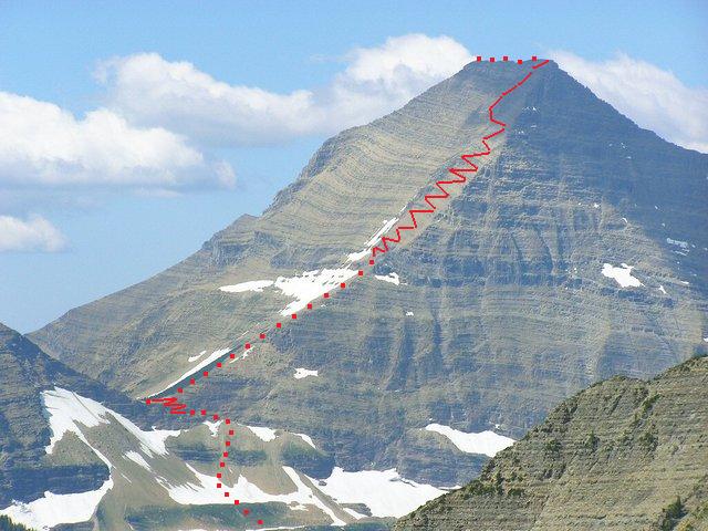
The Mount Stimson climbing route
progressively steepens up the indicated ridge.
Also note the tortuous cliff band passage
prior to gaining the indicated saddle.
(Mouse-click for a clearer view.)

After a hearty round of congratulations about our successful pioneering, we took a nice rest and then started up towards the summit. At first there was even a nice boot-track that led uphill on easy slopes along the crest of the ridge beside a grove of windswept trees. The way got steeper and covered with more talus and scree, and after about 1000' of pretty easy scrambling our route gradually changed into a never-ending series of cliff bands. They were generally between two and five feet high, with wide ledges between them, and there was usually an easy gully or set of steps to help us get up. But sometimes we had to detour on the sloping ledges quite a way to find a good route up, and the rock was really crumbly stuff.

At one point I was climbing a gully and the rock fin I stepped on disintegrated, and I fell a foot or two before catching myself - I was fine, but I had slammed into Bob right behind me and somehow bruised his ring finger. Thankfully it was not serious. At various times we all knocked off loose rock, and we tried to stay out of each other's fall lines the best we could. I was glad I had my helmet, as were Bob and Duane - we tried to avoid being above the helmet-less Edward and Adam.

Bob
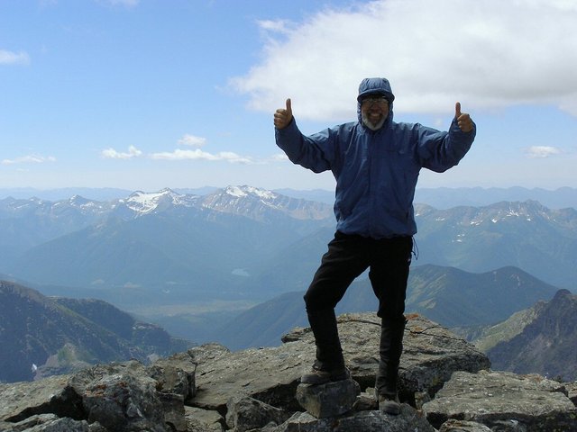
Bob Bolton at the summit.

We took a couple of rests, and as we neared the top the terrain got steeper, with narrower ledges, taller cliff bands, and more difficult gullies to surmount them. It was a wild, remote, and daunting mountainside, even though it never got above 3rd class climbing. Suddenly, though, we scrambled up a cliff band to emerge on the long, narrow flat summit ridge. The very top of Mount Stimson was at the far end, and an easy tiptoe along the crest was all we had to negotiate. These last few minutes of pleasant ridge gave me a nice chance to reflect on the effort I had put forth and anticipate the imminent summit ahead.

At the summit cairn, we all got together, touched it at the same time, and hugged all around. We felt very emotional about our achievement of climbing this monstrous mountain, especially by a new and unknown approach route. We then spent an hour on the summit - it was a beautiful day, with a few clouds and a light breeze. We rested, ate lunch, read through and signed the summit register (Bob Packard's entry from 2004 was the second one in the book), and took in the panorama.

log entry
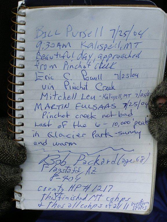
Bob Packard's summit register
entry upon completing the
western USA county highpoints.
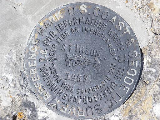
By 1:15 PM it was time to go down, so we packed up and retraced our route along the flat summit ridge, and then plunged down the southeast ridge. For us, it seemed it was more work going down the innumerable cliff bands than going up - each short drop down a band meant either a face-in downclimb, a short leap, or an awkward crab-walk. The slope of the ledges between the cliff bands drifted us to the south a bit, too, and we then had to start working our way back towards the crest of the ridge. It was tiring, and we each would try out our own lines down in search of easier going. This helped us avoid sending the inevitable rocks down on our companions, too.

After a while the terrain got easier, and in a couple hours we had reached the 8500' level where the cliff bands had mostly disappeared and we could actually hike down the rest of the way on easy scree or talus. We picked up the boot track near the grove of trees and were soon back at the col, where we had left our ice-axes and rope. While we rested, I went to check out an interesting cairn on the far side of the col that marked the end of the Pinchot face traverse from Beaver Woman Lake, something we were glad we were not doing.

benchmark
summit benchmark

We now had to descend the cliffs and ledges from the col, and I led us down a few rock steps and then promptly got off route. We should have build some cairns to guide us down, but in the excitement of getting up to the col in the morning I guess we never thought of that. We were looking for the tree-squeeze ledge, and after a few false leads we found it, with Edward going first. Once past the tree we had a couple of somewhat harrowing gullies to descend as we worked our way across and down. It definitely seemed 4th class on descent as we took our time, one by one, down the steep sections. Bob cut his finger on his stowed ice-axe on his pack during one move, and we had to stop on a ledge to bandage it.

It was not too long before we were on the miserable slippery dirt/scree mixture and had no more cliffs to worry about. Bob, Duane, and I, though, were so appalled by the steep dry slope we made a beeline for a nearby snowfield that reached to near our ledge exit, and there we happily plunge-stepped down the soft snow. At the next snowfield over we even managed some standing glissades. At the top of the moraine we all regrouped and then made our way down the easy terrain to camp. We arrived back at about 6:20 - it had taken us 5 hours up, 1 hour on top, and 5 hours down, for a total of 11 hours camp-to-camp for the 4100' foot vertical round trip.

We were happy that we had a camp already set up, so all we had to do was get down our bear bag, cook dinner, rehoist it, and then crash out.

[Adam comments: I enjoy the extended dinner hour as do others. Greg even gives me a whole bunch of extra pasta with a creamy salmon and pesto sauce.]

blue lake
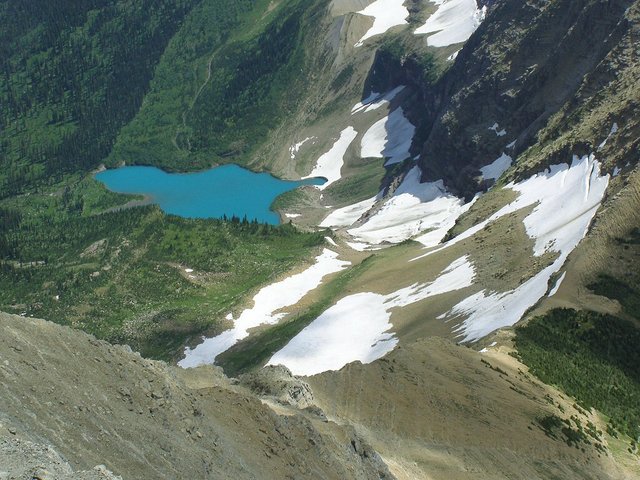
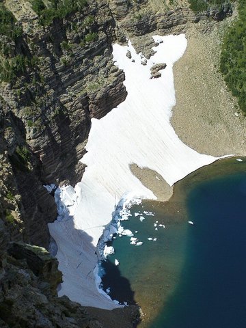
A view of the ridge that we must downclimb
from Mount Stimson's summit.

This lake's color captivates us while high on Mount Stimson.
(Bob Bolton photograph)

Day 4 - Wednesday, August 13, 2008

We slept in a bit this morning, and after a leisurely breakfast we broke camp, got packed up, and reluctantly left our pleasant, scenic, and convenient campsite for the miserable bushwhack back down to the Nyack Loop trail. We were a bit faster going downhill than on the way up, since the vegetation growth direction was not against us, but it was still an ordeal. I was GPS point man for our journey, trying to follow our upward track when leading or else helping steer Edward when he led. We did get a bit more adept at climbing over logs without banging our shins, but it was still a classic brush-bash, especially the first part, before the Stimson Creek crossing.

Nyack stream ford
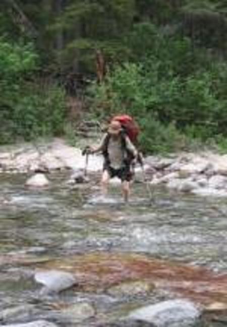
Adam crosses Nyack Creek
during the descent from
Mount Stimson high camp.

We crossed Stimson Creek on the same log as before, and took our main rest right afterwards. From there the more open terrain was nice, but we had a harder time finding elk trails and my GPS did not work as well in the dense forest. As we neared Nyack Creek it suddenly jumped, negating my recent navigating and forcing us to hack through some nasty stuff to get to our ford.

We knew the drill with the ford, and we each took off our boots and made our way across. I wish I had brought some sandals, both for the ford and for camp wear - the rocks were very slippery and uncomfortable on my bare feet, and my ice axe was indispensible for keeping me upright as I waded.

Once across we had a nice long rest and debated what to do. Our camping permit had us staying at Upper Nyack, the same designated site we had been at three nights ago, and it was only about ten minutes away by trail. However, many of us (especially me) wanted to start hiking out up towards Cut Bank Pass, where we could camp in the nice meadows at treeline. This plan won over its skeptics, especially Bob, who was not keen on a lot of uphill. But most of us wanted to get more miles behind us today.

Stimson group
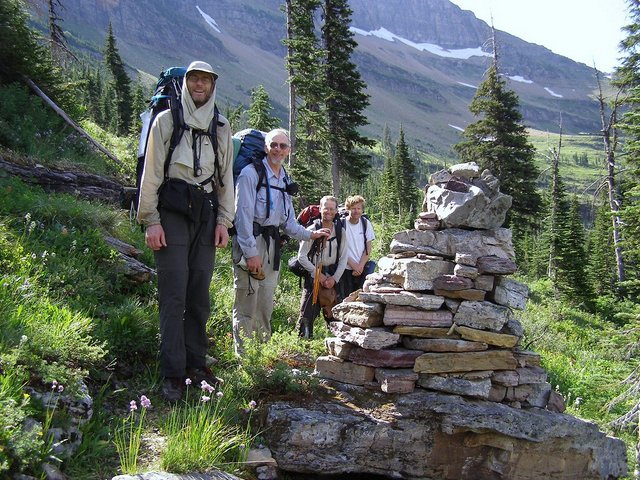
From viewer's left - Greg Slayden,
Duane Gilliland, Adam Helman, Edward Earl.

So at about 4 PM we left the ford area, regained a maintained trail again, and hiked the easy flat 2 miles or so past the minor stream crossing and the patrol cabin (still deserted) to the Cut Bank Trail junction and another rest. Then the uphill grind began on the brushy trail that had soaked us on the way down on Sunday. However, it was now dry, and after our bushwhacking experience the trail seemed perfectly fine to us now.

I hiked behind Bob for this stretch and we passed the time telling extended stories about some of our memorable past expeditions to the mountains. A couple miles up the Cut Bank Pass Trail, at about 5200', we crossed a small creek and noticed a campsite area just off the trail. We had missed this area on the way down, and we thought we'd have to climb another 1000' or so to camp in the higher meadows. But we were very tired and this place seemed to fit the bill nicely. We were still in the Nyack Zone, and we were within the spirit of our permit, camping in an undesignated spot instead of the reserved designated one.

So we set up our three tents one last time, trying to be as far from the trail as possible, and did our food prep away from the tents, near the brook. My bear barrel now fit all my food, plus some group garbage, and it also made a nice camp stool for me. Once again, we retired to our tents tired after another long day.

Day 5 - Thursday, August 14, 2008

Our goal today was to hike trails over the Continental Divide to our cars at Two Medicine. We left our campsite at 5200' in the Tinkham Creek basin and hiked uphill on the Cut Bank Pass Trail, our bodies tired from lots of full-pack hauling. The trail soon broke out above the trees, and we enjoyed the beautiful meadows high in the basin - our trip down this trail had been in the rain and we couldn't enjoy it. The views of Stimson behind us were spectacular.

The trail gained the saddle east of Tinkham Peak, then slabbed steeply uphill to Cut Bank Pass at 7900'. Here we took a nice long rest, and decided to return to Two Medicine using the Pitamakan Pass Trail, instead of the Dawson Pass Trail we had used on the way in. The reasons were that we didn't want to climb up to 8000' or more to the switchback above (we wanted to be done with vertical!), we didn't want the pressure of having to make the 5:15 PM boat across the lake, and we thought we'd try something new.

high meadows
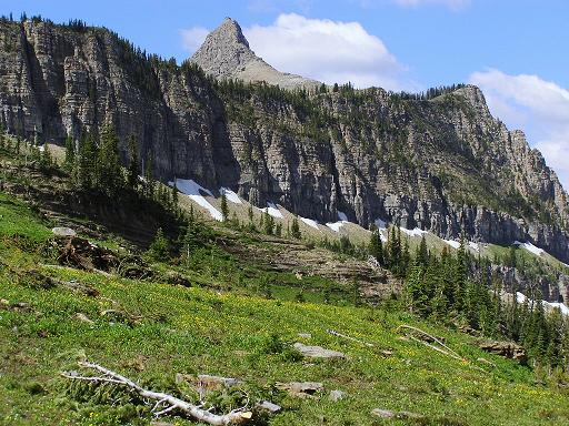
An idyllic view of high meadows
with Tinkham Mountain prior
to reaching Cut Bank Pass.

So we set off towards Pitamakan Pass, dropping a bit to avoid the snowfield but then getting confused by way paths and having to climb a bit to the real trail. As we approached the pass, we saw the first other people we had seen in four days, since Sunday - amazingly, it is still possible to find real solitude even in a mid-August hike in a popular National Park.

The trail at Pitamakan Pass was spectacular, with awesome views to the lakes in deep valleys below, and we stopped to take many photos. The trail then switchbacked downhill steeply towards Oldmans Lake and the weather started getting downright hot. It was nice to reach the pine forest on the valley floor, and we then started the long, flat hike out the valley of the Dry Fork.

During this long stretch of trail we started realizing that we probably made a mistake in returning this way - this route took you all the way around the massive bulk of Rising Wolf Mountain and seemed to never end. We were tired, footsore, and cranky after many miles, and we just wanted to get back. The worst section was after we turned off the main trail for the cutoff to Two Medicine - this last 1.5 miles of trail climbed up and down annoyingly as it skirted the toe of Rising Wolf. Poor Duane started to get blisters due to all the pounding and his heavy pack.

snow bergs
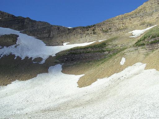
Snow bergs far below the
Pitamakan Trail on the
fifth, final day.

By the time we neared the end of the trail we were a scattered troop of zombies, each of us in our own private hell as we dealt with the ups and downs. The worst was when the trail suddenly came upon a river with RVs in the campground right across it, but then climbed up a steep hillside to get around the bend to the footbridge. And the trailhead at the campground was a good half mile or more of road walking from our cars. So we were happy to be at the end of our hike, but disappointed at what we still faced. It was 5 PM.

We left Duane at the campground trailhead to tend to his feet, and the rest of us hiked to our cars at the lakeside parking lot past the countless RV tourists thronging the area. I stopped at the just-closed ranger station to see if we had to sign out and make sure we could return the bear barrels behind the building, and after waiting the ranger came out to lower the flag and I chatted briefly with him - we were OK on both counts. We then went to the campground, picked up Duane and our dropped packs, and then returned to the lakeside area, where we did our real unpacking and organizing. Best of all was getting some ice cream treats from the store there. My other errand in the area was returning the bear barrels to the ranger station, and calling my wife on the nearby payphone.

The five of us then headed back to East Glacier in our three cars, eager to find lodging for the night that involved a bed and shower. The reality of our accomplishment was finally sinking in - we had climbed the fearsomely monstrous Mount Stimson, and by an entirely new approach route, too. We had seen absolutely zero evidence of any human activity between our Nyack Creek ford and the Stimson-Pinchot col, and the even the Internet was utterly bereft of any mention of this route.