Fremont County Highpoint Trip Report

Mile Creek approach

Date: August 3, 2010
Author: Adam Helman

note 1: All coordinates are in the WGS84 datum.

note 2: Mouse-click on any image for detail.

This effort was part of a larger journey collecting Idaho and Montana county highpoints in August 2010.

The junction on Route 87 is at (44.76349° N, 111.46692° W), with at least two large structures immediately at-hand to the east. This is useful if arriving in darkness.

On turning east do not continue through the decorative gate a few hundred feet beyond. Instead, turn immediately right (south) and then continue as the road eventually bends east to the trailhead.

trailhead view
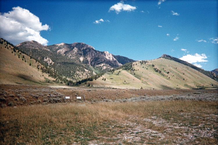
View from the Mile Creek trailhead.
Route proceeds up the obvious canyon
left of center, paralleling the ridge of
the triangle-shaped grassy slope at center.

The trail is annoyingly shallow at-times for the six miles it takes to reach this junction along the CDT (Continental Divide Trail) at (44.72149° N, 111.40231° W) and an indicated 9,333 foot elevation.

Indeed, on my descent I save perhaps a full hour, and miles of nearly horizontal travel, by cutting-off switchbacks. How this is achieved is unusual. The trail is not visible from above owing to tall plant growth everywhere. Further, I am reluctant to simply head straight downhill because there is no guarantee I will intersect the trail since it slowly meanders south while zigzagging up a west-facing slope.

CDT sign
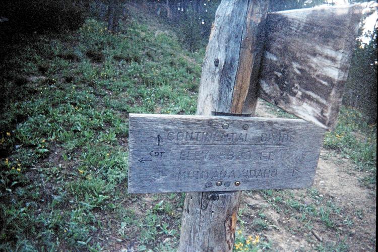
Sign encountered on topping-out
at a saddle several miles-in.
Montana is left (north), Idaho right.
Indicated elevation is 9,333 feet.

So how do I do it? A series of dayhikers are coming up the trail as I descend - and their heads are plainly visible above the tall plant growth. So whenever I see humans I know a trail is underneath them ... and I bushwhack directly towards them. Most are teenagers wearing shorts.

From the saddle I follow the CDT as it slowly gains the 9,980 foot saddle northwest of Targhee Peak at (44.72620° N, 111.39518° W). Here one sets out cross-country north for the highpoint.

summit vista
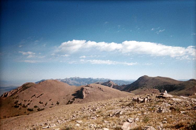
Summit vista from the central
of three 10,400+ foot contours.

Seeing dense treeline krumholtz on the ridge immediately at-hand, I traverse east of the ridge, soon boulder-hopping in the effort to return to it. I recommend that one remain on the ridge, as the trees are readily walked-around.

Remarkably, there is a nearly invisible dirt track that one can follow along the ridge as one hikes to the left (west) of a 10,360+ foot hill at (44.73420° N, 111.39768° W). Dennis Poulin personally reports that he and Dean Molen climbed this hill and found a register within a week of my effort.

The central of three 10,400+ foot contours is highest by inspection - although the broad, northeastern contour is a close rival.

While at the summit I look 12 1/2 miles away on a roughly 345° bearing to find the summit massif of Hilgard Peak snow-free. That's important because I plan to climb it, the Madison County, Montana highpoint, in a few brief days - and snow on the high angle rock would be problematic.

I estimate 16 miles round trip if one does not cut-off switchbacks.