Camas County Highpoint Trip Report
Date: July 21, 2011
Author: Adam Helman
note 1: All coordinates are in the WGS84 datum.
note 2: Mouse-click on any image for detail.
This effort is part of a larger journey
collecting Idaho and Washington county highpoints in July 2011.
Park along FR182 on the opposite side of Route 75 to avoid vandalism
which can occur is you lazily park at the pullout. I camp one-quarter mile
from the highway where nobody can easily see my vehicle.
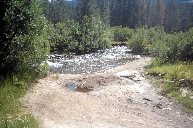
I arise at first light and wade across the river in tennis shoes. The water
is so cold it has me hyperventilating to avoid passing out. I wear a parka to
get warm quickly as possible; and have a piece of cake in my pocket as "reward"
on getting to the opposite shore. This is, witout doubt, the climb's crux moment.
The forest road leading west from Idaho Route 75 is in disrepair, with numerous deadfall
and water issues besides the Owl Creek River crossing at the very start.
I estimate it's length at 3.5 miles, such that 7 extra miles are hiked compared
with a driveable road and a facile river crossing.

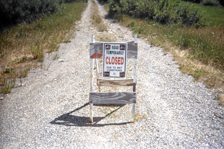
|
|
ridiculous understatement...
("Road closed due to wet conditions.")
|
...and the TRUTH!
|
Once at the road's end in a meadow (it is barely discernible) start-off cross-country
on a general heading of 210° true. However do not cross the main stream
just south of the road's end. Rather, cross 3-4 minor streams coming from the west -
each being just 2 or 3 feet wide such that they may be "jumped" if desired.
After one-quarter mile assume a new heading of 240° true. This will get you
to the saddle just north of point 9616 feet (see the waypoint below).
The following GPS-derived waypoints are of use.
(43.83579° N, 114.65336° W) - Large tree trunk across the forest road.
It will stop any vehicle that has crossed the Owl Creek River, and renders
nearly meaningless taking such a risk.
(43.82817° N, 114.69092° W) at 8,023 feet - end of forest road.
SAVE this location with a GPS device.
(43.82693° N, 114.69212° W) at 8,096 feet - in the forest
(43.82617° N, 114.69331° W) at 8,124 feet - in the forest
(43.82496° N, 114.69530° W) at 8,260 feet - Leave the forest,
and go "straight up" a narrow, dry stream bed to your west.
(43.82492° N, 114.69815° W) at 8,593 feet - top of dry steam bed
(43.82256° N, 114.70182° W) at 8,687 feet - Going towards point 9616.
(43.82089° N, 114.70421° W) at 8,981 feet - In trees below point 9616.
(43.81975° N, 114.70759° W) at 9,502 feet - saddle northwest of point 9616.
One must get to this point.
(43.81869° N, 114.71069° W) at 9,558 feet - alpine basin. I left water here,
yet could not find it on returning from the summit (!)
(43.81680° N, 114.71271° W) at 10,021 feet - Enroute to summit (this is not
going through the saddle connecting the highpoint with point 10,441 feet).
(43.81479° N, 114.71490° W) at 10,342 feet - spot elevation 10,337 feet
and the county highpoint.