Northern Tier July 2011 Trip Report
© August 2011 Adam Helman
(Click on any image for enlargement.)

Background

This journey is part of my long-term goal of finishing the eleven western state's 414 county highpoints. I begin this trip with 14 counties remaining - 5 are in Washington and 9 in Idaho. The current effort is largely directed at Idaho.

A separate report for every county highpoint is available.

Big Horn is the most significant effort, highpoint of Lewis County, Washington.

I will not describe the plans, and plan changes, which result in the final itinerary. They are most involved, and unfortunate in that historic snow levels in Washington state diminish what is reasonably available.

Trip Details

Wednesday, July 13 - saving four hours

The long journey is rendered a bit less onerous by starting at night and driving some 275 miles to a car-camp on the south side of Mountain Pass along Interstate-15. The north side has a large mining operation, and is the access point for Clark Mountain on California's Fifty Finest prominence list.

Thursday, July 14 - central Utah

Just a boring day on the interstate. I call it quits immediately south of Salt Lake City, taking a room at the local Motel 6.

route summit vista
Bell Mountain route (Lemhi County).
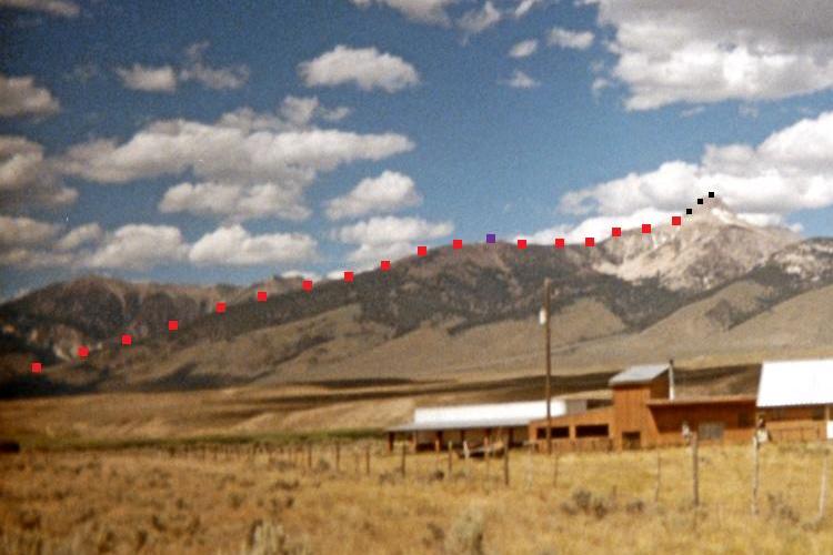
The violet square is for point 10,201.
The black squares are for the final 700 feet.
(Enlarge for viewing these items.)
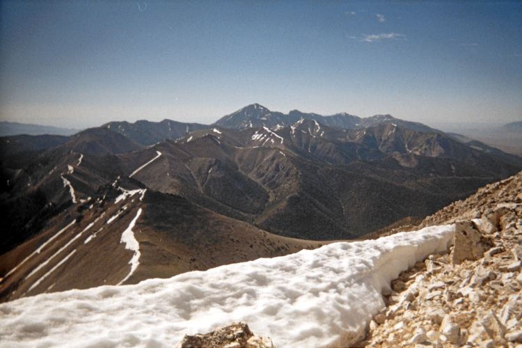
Diamond Peak is less than 10 miles from
this summit view at Bell Mountain.

Friday, July 15 - trailhead

I am now in east central Idaho, driving between two of the three parallel ranges containing the state's highest peaks. I camp at the base of Bell Mountain just below the canyon entrance because I don't like the mud seen along some of the forest road. Tomorrow will be a 5,000 vertical feet day.

Saturday, July 16 - Bell Mountain (Lemhi County, Idaho)

Details of my Bell Mountain climb are provided in this trip report.

The room in Arco, Idaho is sufficient - and next to a roadside display featuring the conning tower of a nuclear submarine (!). I explore this oddity the following morning...

conning tower
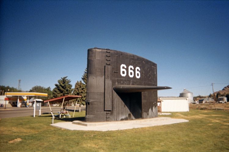
An outdoor display of nuclear navy
memorabilia in Arco, Idaho.

Sunday, July 17 - EBR-1 Nuclear Reactor

...Evidently the area is of historic importance to the development of nuclear power. By 9 a.m. the EBR-1 (Experimental Breeder Reactor #1) museum is open, 18 miles east of Arco; and I explore this compound in absolute fascination. Outdoors lie a pair of nuclear-powered jet engines, on rusting test stands, designed for a nuclear-capable jet bomber that never flew owing to immense safety concerns. President Kennedy cancelled after a billion dollars were spent.

Inside is the actual facility where electric power was generated for the first time from nuclear fission in December 1951. I spend over two hours here, and consider this hands-on museum the most educational, impressive and "fun" museum in memory.

I drive northwest between parallel ranges and camp at next day's trailhead.

facility entrance sign engine test stands
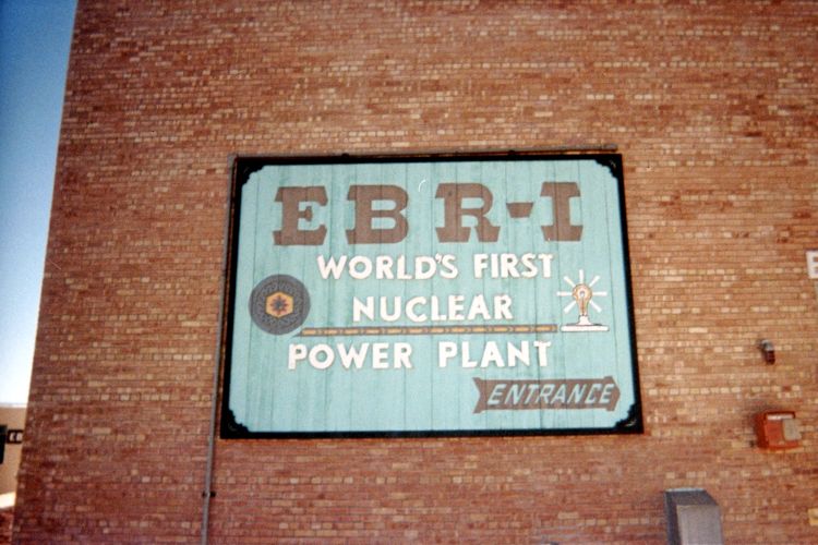
Entrance to the EBR-1
nuclear reactor facility.
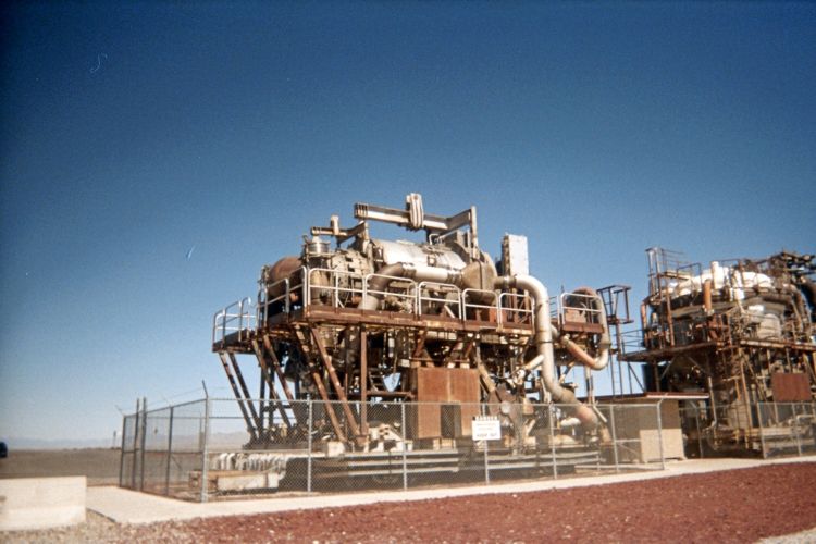
Test stands for nuclear-powered
jet engines in the Idaho desert.

Monday, July 18 - Clark County, Idaho

Details of my Clark County highpoint climb are provided in this trip report.

By late afternoon I find a room in Leodore, Idaho with the thermometer nearing ninety degrees. There is some question about operating the satellite television. However it is soon figured out. More problematic is the lack of air conditioning. I should have inspected before signing-on.

Scott Peak
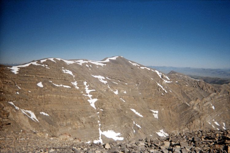
Nearby Scott Peak from the Clark County highpoint.
Tortuous bends in the sedimentary layers
testify to enormous geological forces.
(Enlarge to examine this detail.)

Tuesday, July 19 - Montana return

Soon enough I pass through Salmon Idaho, yet not until after I enjoy some wonderful cinnamon babka cake with cold Starbuck's frappuccino. In Salmon I search for a salmon lunch yet leave disappointed.

Route 93 enters Montana at a 7,000+ foot pass, and soon enough I am in Conner, Montana enjoying biscuits with sausage gravy for lunch prior to forsaking civilization's amenties for a lonesome trailhead. The forecast is for clearing weather.

Wednesday, July 20 - Idaho County bust

The weather fails to cooperate as I hike the ridgeline trail. It deteriorates, markedly, at around 8,000 feet. Water is cached at the day's highest point for a future attempt.

I drive south, perhaps a bit hurriedly, to reach another trailhead for tommorow. On reaching the forest road for Camas County I see this sign, "road temporarily CLOSED due to wet conditions".

What an understatement!

My desired road is completely severed by the Owl Creek River with about 15 inches of flowing water.

I cross the stream with tennis shoes to "prove" the concept's viability for the next morning; and then camp 1/4 mile along FR182 on the opposite side of Route 75 so that a passing motorist will not see an abandoned vehicle and vandalize it.

Thursday, July 21 - Camas County, Idaho

Details of my Camas County highpoint climb are provided in this trip report.

I drive south over Galena Pass to the ritzy communities of Ketchum and Hailey, Idaho. Ketchum is right next to the famous Sun Valley ski community, and everything is WAY overpriced. Still, I really really want a real bed and a shower - and the decision to pay or suffer an afternoon in the heat, without shade yet for free is a tough one.

I take a room.

understatement truth
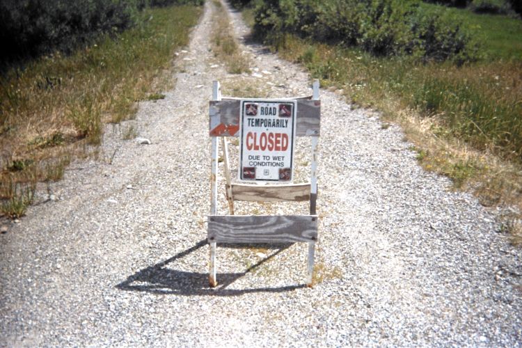
ridiculous understatement...
("Road closed due to wet conditions.")
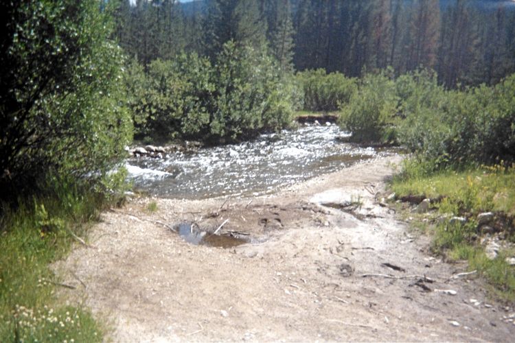
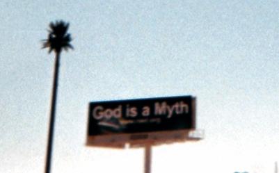
...and the TRUTH!

Friday, July 22 - change in plans

The tennis shoes are ruinously wet and dirty after crossing the creek four times. They are abandoned in the room, and I buy NEW tennis shoes, plus attractive green thongs (for girls?) at a discount store. The thongs are for any future stream crossings.

A large and expensive lunch ensues with Hyndman Peak on-tap for the next day as a 5,000 vertical foot ascent (calories are the connection). The crab Rangoon appetizer is acceptable - while the entrée of salmon filet in a spicy chili-garlic sauce is wonderful. Still, I "must" have dessert: "flaming" bananas, fried, and served with two scoops of vanilla ice cream, chocolate sauce and cashews (requested in-place of boring peanuts).

An Internet session at the Hailey library reveals fair skies for wettest, western Washington. So I table my Hyndman Peak plans, reluctantly, and begin the drive - one that's aided considerably by a liter of Mountain Dew soda with its 150 mg of caffeine.

I sleep in a gravel lot used by truckers along Interstate-84 at Boardman, Oregon.

Saturday, July 23 - Larch Mountain & Capitol Peak

After passing through greater Portland I somewhat trivially hike this pair of summits, one of which, being the slightly higher, has at least 2,000 feet of prominence.

By around 5 or 6 p.m. I am at the trailhead for "Wynoochee Point" - our group's nickname for the Grays Harbor, Washington county highpoint. I enjoy the hummus many ways that was originally earmarked for the Hyndman peak trailhead.

summit view
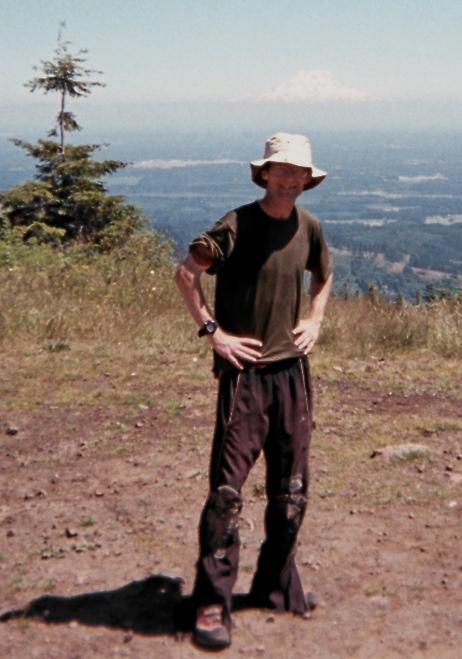
Author atop Capitol Peak;
Mount Rainier in distance.

Sunday, July 24 - flat tire

I awaken to a left rear flat tire. It's about 30 miles to the nearest farm and assistance if I don't repair this. Worried that the Wynoochee Campground will be unpeopled by the time I get off the mountain, I abandon the climb so as to ensure a safe return by vehicle.

There is no repair service on Sunday. I must sit for much of the day doing almost nothing in the Thunderbird motel room where the manager knows me from previous attempts at Grays Harbor County.

The day's highlight is supper at a Salvadoran restaurant only one block down the street. I especially enjoy the main dish with chicken in a spicy sauce wrapped in four corn tortillas - and the whole affair topped with shredded lettuce, sour cream and Mexican cheese.

Monday, July 25 - Rock Peak

This is mainly a drive with a short bushwhack for twin summits. I park due north of the northeast contender, and climb most steeply at-times to the top. I highly UNrecommend this tactic. On descending the southwest summit I mistakenly go down the wrong direction - yet learn my error after just 200 vertical feet. Returning to the forest road was a nightmarish tangle that wasted much time and energy.

I cross Puget Sound at Port Townsend, and enjoy the evening at Duane Gilliland's home in Burlington, Washington. A large salad is featured as per my request since it's hard to get fresh food on a long road trip without making an effort to visit supermarkets.

Tuesday, July 26 - locked gate

My pickup truck gets the intermediate-service 15,000 mile maintainance, having just ticked-through 135,000 miles. Then I drive to Anderson Mountain only to find a locked gate at the base. There's not enough time (it's 11 a.m.) for a 16 mile hike.

I spend the afternoon somewhat aimlessly, visiting an outdoor fishing and hunting store (where at least I find a two pound bag of pepperoni sticks for just $7); and have a sushi lunch at one upscale supermarket Duane recommended.

This evening we enjoy a "potato bake" at his home.

Wednesday, July 27 - Round Mountain failure; Boeing

Round Mountain is a bust because the trail becomes impossible to follow; and going cross-country is too problematic because the visibility is limited to only 300 or 500 feet. I abandon the effort after one hour.

In Renton, Washington I pay $20 to tour the Boeing production facility. Here I see 747s under final assembly, and also 787s in a separate and moving line.

I return north to spend the night at Duane's home. A family birthday is celebrated at Olive Garden while I elect to stay put and eat leftovers in the kitchen.

Thursday, July 28 - Pilchuck

This one was nearly a bust as well owing to snow. Most hikers (this is a very popular venue) are completely unprepared, with tennis shoes and tee-shirts as their chief outerwear.

I check-into a Motel 6 (to ensure a room), and then drive to the famous Space Needle - yet refuse to pay $15 for parking. So I take a picture while in the car and return to my (paid) room for a few hours in the late afternoon.

At 7:30 p.m. I meet Greg Slayden, his wife Tracy, and Eric Noel for dinner at the Acropolis. It's a pizzeria, yet I start (!) with spumoni as I don't want others to wait as I enjoy dessert. My entrée is a spinach and beef lasagna dish, piping hot. Greg arranged this dinner because Eric had decided to not join us at Big Horn - yet I wanted to at least meet him.

B-47 Constellation
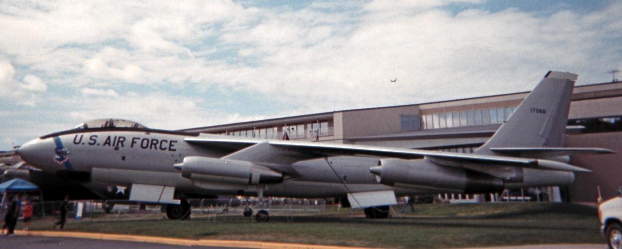
A B-47 Stratojet medium-range
bomber of the early 1950's.
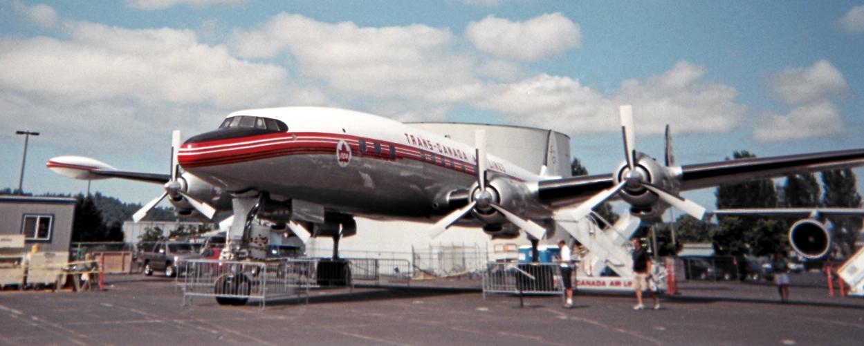
A Lockheed Constellation airliner
from roughly the same era.

Friday, July 29 - Air Museum

I pack for Big Horn by reorganizing stuff from daypack to overnight backpack. Then I visit this very fun and educational air and space museum located just 5 miles north of Seatac. There's an Anglo-French Concorde, a VC-137 used as the first jet-powered presidential transport, and much much more (such as an M-21 variant of the famous SR-71 Blackbird spy plane).

I spend nearly 4 hours at the museum, and then reluctantly head south to US Route 12 for the next day. Eventually I have a room in Morton, Washington but it's terribly overpriced.

Saturday, July 30 - Big Horn approach

A "free" hot breakfast comes with the room. I eat at least 1,500 Calories worth in light of Big Horn, and head east on Route 12 for the trailhead where everyone comes by 11 a.m. There is Greg Slayden, Adam Walker and Craig Willis.

Details of the Big Horn climb are provided in this trip report by Craig Willis.

I have considerable discomfort negotiating loose, mushy snow on the approach to our high camp because it's all sidehilling with a heavy backpack - a combination I'd never previously encountered.

A "buffalo chicken" - style macaroni and cheese dinner is enjoyed, called that because of chili spices and blue cheese in the mix. Later I have a mini coconut pie in the sleeping bag.

It's a very unwelcome night because of a side-gradient that has me falling onto Greg. We buttress the ground with his pack. Still, the babbling brook of snowmelt is RIGHT NEXT TO our tent, and I cannot sleep without wearing a woolen hat over the ears. Then, to hear my watch's alarm at 4:30 a.m. I wear it on my forehead underneath the hat.

Big Horn
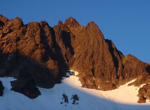
Big Horn at sunset
(Craig Willis photo).

Sunday, July 31 - Big Horn summit day (Lewis County, Washington)

As noted, our efforts are very adequately described in this trip report.

I have no desire for breaking camp and heading out. It is time to call a halt after 12 hours, have supper, and hike out by morning. But I am outvoted - everybody else either prefers, or MUST, be at work the next day.

So after I share both cinnamon AND chocolate babka with everyone (mine with cold "coffee") we head downhill bound for the trailhead. Greg and I get there an hour after darkness at 9:43 p.m., the others a few minutes sooner. I am in "death march" mode, my legs unwilling to cooperate, and would stop in my tracks were it not for the stupidity of such a decision.

After all three drive-off I reorganize everything so as to make room for sleeping in my camper shell. A peanut butter sandwich on rye bread suffices, there being no desire for starting to cook at 11:30 p.m.

Greg rappels
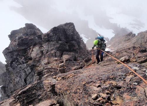
Greg Slayden rappels steep, cruddy rock
(Craig Willis photo).

Monday, August 1 - northeast Oregon

A planned series of construction delays along Route 12 is followed by an uneventful drive through Oregon. I finally get a room in La Grande, Oregon for cheap enough.

Tuesday, August 2 - Idaho return

I guess the day's highlight is having KFC (Kentucky Fried Chicken) for lunch at the junction of Interstate-84 and Route 20 in Mountain Home, Idaho.

It's "finger licking good"!

On the short approach drive to Hyndman Peak I see three possible mountains any one of which could be my goal. I am hoping that the middle peak is "it" owing to its nice, triangular shape. I get my wish.

The third piece of fried heaven has been saved for adding to my supper pasta dish.

Wednesday, August 3 - Hyndman Peak (Blaine County, Idaho)

Details of my Hyndman Peak climb are provided in this trip report.

I debate whether to call it "enough" for one journey. It's been three entire weeks; and the weather forecast is not rosy. My right upper leg is not entirely well, and there is business to do at home. I will decide in the morning.

Thursday, August 4 - lonely Nevada

It's 890 road miles from Hailey, Idaho to home using USA Route 93 through Nevada rather than Interstate-15 through Utah. I choose the shorter, more efficient option (this includes Nevada Route 308 south of Ely); and find myself in Alamo, Nevada at day's end - 1 1/2 hours from Las Vegas.

There is NO cell phone signal with my carrier for the entire route from the Idaho border to south of Alamo. The only exception is in Ely. National Public Radio (NPR) is my companion for much of the drive, the FM reception being remarkably good given the distances involved.

God myth
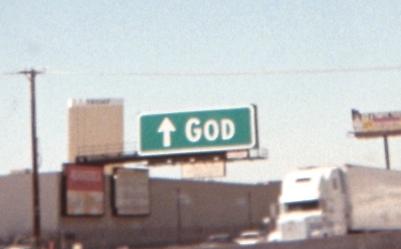
An unusual sign along
Interstate-15 in Las Vegas.
The opposing philosophy.

Friday, August 5 - home

The day's highlight is a pint of "Peanut Butter Panic" ice cream purchased in Primm, Nevada one mile shy of the California border. Leftover chocolate babka goes inside, and I find it possible to eat the pint while driving provided that I don't deal with mix-ins at such a time.

Summary

The journey's goals are far from achieved - and so I am returning to Idaho, and perhaps Washington as well, in a mere week.

My pickup truck's odometer suggests 4,785 road miles total. These "Adam truck miles" appear to be roughly one-hundredth larger than normal, statute miles. Hence the true distance is just over 4,800 miles - I believe a personal record on a single journey.

Now I have (only) 9 county highpoints remaining, one fourty-sixth of the 414 county total in the eleven western (contiguous) United States.

I'd like to at least halve the remaining count on my upcoming journey.

Adam and Craig W.
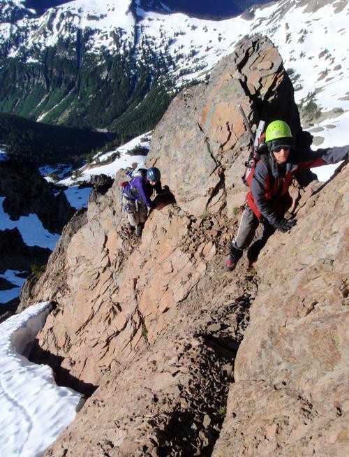
The author (above) and Craig W.
on the Big Horn summit ridge.
(Craig Willis photo)