Clark County Highpoint Trip Report

Date: July 18, 2011
Author: Adam Helman

note 1: All coordinates are in the WGS84 datum.
note 2: Mouse-click on the image for detail.

This effort was part of a larger journey collecting Idaho and Washington county highpoints in July 2011.

It is 3.1 road miles along Nicholia Road from its start along Route 28 to this junction at (44.35430° N, 112.99979° W).

It is then 4.5 road miles southeast (with a wire gate at 4.0 miles) to this junction at (44.30592° N, 112.93859° W).

From that point it is 4.0 miles to the trailhead at (44.32565° N, 112.86382° W).

There is a wire gate at 1.1 miles. The last few miles are rutted, and high-centering is possible. Low-clearance vehicles are no longer an option.

Here are some intermediate waypoints for the climb using the route described in Ken Jones' report.

(44.33648° N, 112.85529° W) at 8,044 feet - Trail 006 / 081 junction.

(44.34159° N, 112.84500° W) at 8,373 feet - Trail 081 veers right (southeast), may be inundated with water for a few hundred feet.

(44.34074° N, 112.83855° W) at 8,979 feet - End of ATV trail (which is quite steep from 8,400 feet onwards). From 8,900 to 9,700 feet the forest is steep with perhaps a 35° slope.

(44.34080° N, 112.81985° W) at 10,471 feet - Eastern margin of the 10,600 foot obstacle noted in Ken Jones' report. It is steep and always loose from here to 10,800 feet. The talus improves a bit for the final 500 vertical feet to Webber Peak's summit.

(44.34372° N, 112.81055° W) at 11,228 feet - The Clark County highpoint. The liner just west is lower by inspection.

My round-trip consumed 8 hours 21 minutes. The net elevation gain was 3,600 feet; the total gain 3,900-4,000 feet.

Scott Peak
Nearby Scott Peak from the county highpoint.
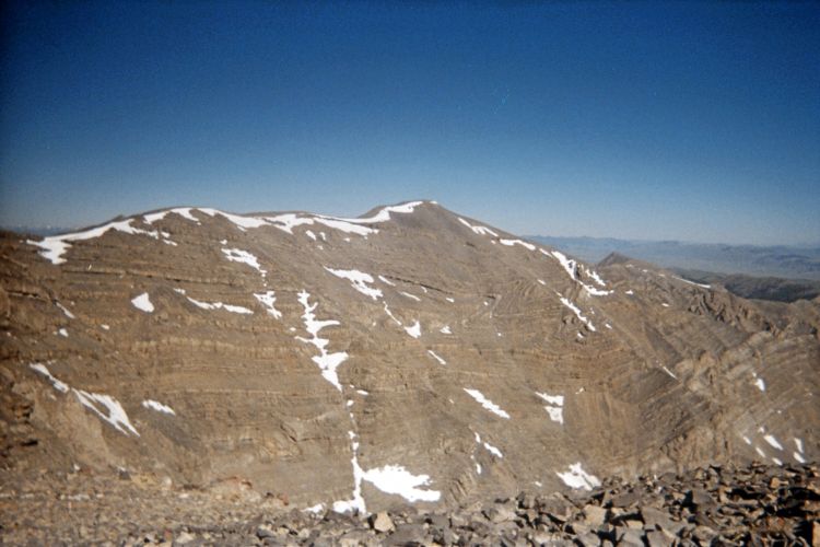
Tortuous bends in the sedimentary layers
testify to enormous geological forces.
(Enlarge to examine this detail.)