Date: July 20, 2012
Author: Adam Helman
note 1: All coordinates are in the WGS84 datum. note 2: Mouse-click images for enlargement.
This effort was part of a larger journey
collecting Pacific Northwest county highpoints in summer 2012.
Bob Bolton and Duane Gilliland and I find this effort thankless enough to dub "unnamed 9439"
something like "Sidehilling Peak" instead. We consume roughly 14 hours round-trip.
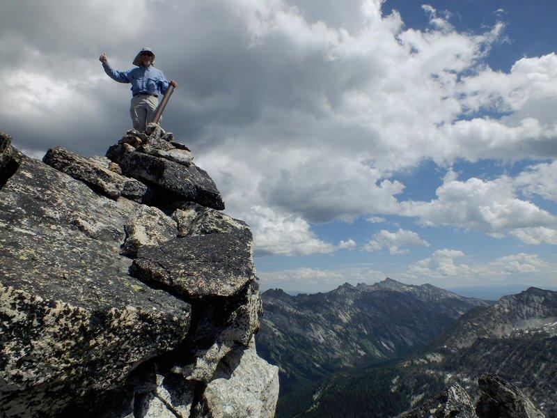
Duane atop the desired highpoint.
(Bob Bolton photo)
Our route was an attempt at optimizing the
route taken by Dennis Poulin.
In a nutshell, one leaves the west-northwest trending ridgeline at
this saddle
with coordinates (45.82931° N, 114.37192° W) and near the 8,410 foot spot elevation.
(Note how reaching this saddle entails a 200 foot descent from spot elevation 8,611.)
Then head cross-country generally northwest for interminable miles, sidehilling, until within one-half mile
of the goal (see below for explicit instructions).
However along this length, as with Dennis we too were forced to lose elevation for getting beyond a certain
rock rib (see Dennis' report); and similarly on the return we had to ascend above the rib to remain on
climbable terrain.
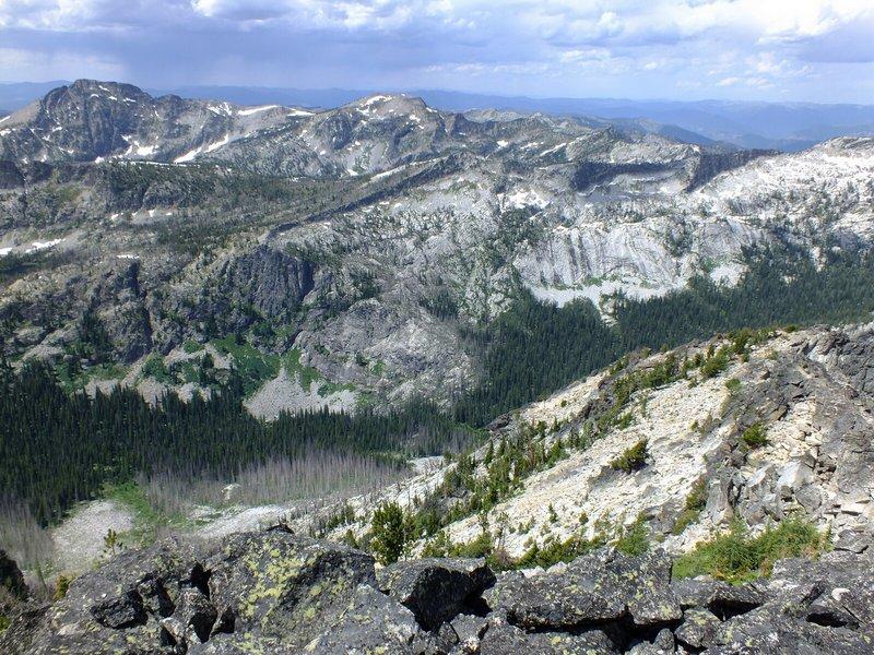
General view from the highpoint area.
(Bob Bolton photo)
Eventually you want to gain
this saddle
with coordinates (45.84536° N, 114.39922° W) at some 8,800 feet elevation and just over
one-half air mile from the highpoint. Next either head right over Bare Peak, or, as we did, contour
around its south aspect, trying to not lose elevation. Then within one-eighth mile of the highpoint
your route turns more northerly to follow the ridge. This final short distance is Class 3 for certain.
Choose your route wisely and remember it for the descent. If your route appears to exceed
Class 3 then try another one.
All-told the total elevation gain is perhaps 800 feet larger than the net gain - hence roughly 4,200
or possibly 4,400 feet.
I locate my
water cache
at (45.81960° N, 114.35410° W) left the previous summer; and 'steal' a quart from it during the
late afternoon descent to our vehicles. There remains 1.7 quarts for some future highpointer's use -
being 2,000 feet above the trailhead this option is definitely to one's advantage. This cache is
at the base of an obvious 10 or 15 foot boulder, hiding underneath some plate-like, flat stones.
This is one peak reserved just for those intent on completing the Idaho county highpoint list
as it honestly has no saving grace.