Dukes County Highpoint Trip Report

Ferry Instructions

Date: May 20, 2012
Author: Adam Helman

note: All coordinates are in the WGS84 datum.

This effort was part of a larger journey collecting New England county highpoints in May 2012.

It amazes me that nobody has had the common sense to describe in sufficient detail the ferry boat situation for reaching this county highpoint. I intend to correct that...

The most popular boat company for reaching both Dukes and Nantucket Counties is The Steamship Authority.

Boats departing for Dukes County (advertised as "Marthas Vineyard" at their website) originate in Woods Hole, Massachusetts. However one does not drive to the boat dock. Rather, you park at this large, remote lot at (41.55973° N, 70.61911° W) along Palmer Avenue some 4 road miles north of the dock. To get there simply continue south on Route 28.

bouldertop
Steve Brown (at viewer left)
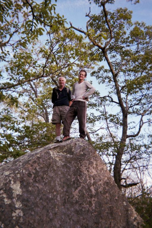
and the author atop a boulder
near yet not at the highpoint.
(Mouse-click to enlarge.)

From this parking area a "free" bus takes you to the boats. The "free" is a misnomer: you are charged by the calendar day $12 as of 2012. Thus if you arrive at 5 p.m. and depart at 5 a.m. the next morning (as I did) you are charged $24 for just 10 hours of parking.

[I paid nothing by annoying the naive, boyish attendant so much with complaints of unfair pricing that I exited the lot without payment - in turn because the credit card reader was not functioning and I claimed to have no cash with me. You will likely not be as fortunate.]

The boat ride to Marthas Vineyard is 45 minutes in either direction. Check the online schedules which change seasonally; plan on a specific departure time, and then park one hour beforehand. Tickets are purchased at the dock, with these published prices. Advance reservations are not required if making the passage without a vehicle.

Boats departing for Nantucket County (advertised as "Nantucket" at their website) originate in Hyannis, Massachusetts. Here one does drive and park at the boat dock located on South Street at roughly (41.65095° N, 70.27705° W).

To get there by automobile head east on Route 6 and take the Yarmouth Road exit south (which may at-times be called "Willow Street"). Continue into Hyannis and turn right (west) onto Main Street. A few blocks later turn left (south) onto Pleasant Street. Then turn left (east) onto South Street and follow signs to the dock on your right side. These explicit directions are given because of the (unwelcome and stupid)) one-way street grid.

Parking is roughly $10 per day, and only credit cards are accepted at the automated exit kiosk.

There are "slow" and "fast" boats to Nantucket Island. The slow boats have published 2 hour 15 minute travel times. However in my experience the boat departs later than the published time and arrives earlier than the cited time - just like airlines and in order to feign the appearance of perfect "on-time performance". The fast boat takes only one hour yet costs significantly more.

Seasonally-dependent schedules are available here with the corresponding fares here. As of 2012 the one-way fare via slow boat is $17.50 and $35 via fast boat. The choice depends largely on whether you are trying to do both counties in one day. If so then it behooves you to consider a taxi at both counties rather than bicycle. However it is unlikely that a taxi driver will take one to Folger Hill (on Nantucket Island) over dirt roads.

Once on either island there are plenty of bicycle shops and taxi drivers eager to take your money.

The highest ground for Dukes County appears to be a four foot tall boulder at (41.35701° N, 70.73845° W).