Nantucket County Highpoint Trip Report

Ferry Instructions

Date: May 21, 2012
Author: Adam Helman

note: All coordinates are in the WGS84 datum.
note 2: Photographs are by Steve Brown.
note 3: Mouse-click photographs for enlargement.

This effort was part of a larger journey collecting New England county highpoints in May 2012.

It amazes me that nobody has had the common sense to describe in sufficient detail the ferry boat situation for reaching this county highpoint. I intend to correct that...

The most popular boat company for reaching both Dukes and Nantucket Counties is The Steamship Authority.

Boats departing for Nantucket County (advertised as "Nantucket" at their website) originate in Hyannis, Massachusetts. Here one drives to and parks at the boat dock located on South Street at roughly (41.65095° N, 70.27705° W).

To get there by automobile head east on Route 6 and take the Yarmouth Road exit south (which may at-times be called "Willow Street"). Continue into Hyannis and turn right (west) onto Main Street. A few blocks later turn left (south) onto Pleasant Street. Then turn left (east) onto South Street and follow signs to the dock on your right side. These explicit directions are given because of the (unwelcome and stupid)) one-way street grid.

Parking is roughly $10 per day, and only credit cards are accepted at the automated exit kiosk.

There are "slow" and "fast" boats to Nantucket Island. The slow boats have published 2 hour 15 minute travel times. However in my experience the boat departs later than the published time and arrives earlier than the cited time - just like airlines and in order to feign the appearance of perfect "on-time performance". The fast boat takes only one hour yet costs significantly more.

Seasonally-dependent schedules are available here with the corresponding fares here. As of 2012 the one-way fare via slow boat is $17.50 and $35 via fast boat. The choice depends largely on whether you are trying to do both counties in one day. If so then it behooves you to consider a taxi at both counties rather than bicycle. However it is unlikely that a taxi driver will take one to Folger Hill (on Nantucket Island) over dirt roads.

Boats departing for Dukes County (advertised as "Marthas Vineyard" at their website) originate in Woods Hole, Massachusetts. However one does not drive to the boat dock. Rather, you park at this large, remote lot at (41.55973° N, 70.61911° W) along Palmer Avenue some 4 road miles north of the dock. To get there simply continue south on Route 28.

From this parking area a "free" bus takes you to the boats. The "free" is a misnomer: you are charged by the calendar day $12 as of 2012. Thus if you arrive at 5 p.m. and depart at 5 a.m. the next morning (as I did) you are charged $24 for just 10 hours of parking.

[I paid nothing by annoying the naive, boyish attendant so much with complaints of unfair pricing that I exited the lot without payment - in turn because the credit card reader was not functioning and I claimed to have no cash with me. You will likely not be as fortunate.]

The boat ride to Marthas Vineyard is 45 minutes in either direction. Check the online schedules which change seasonally; plan on a specific departure time, and then park one hour beforehand. Tickets are purchased at the dock, with these published prices. Advance reservations are not required if making the passage without a vehicle.

Once on either island there are plenty of bicycle shops and taxi drivers eager to take your money. Once rented the cobblestone streets in Nantucket such as Main Street are a nuisance. The sign for Pleasant Street is not plainly visible - and is required for reaching Sankaty Head upon leaving that community headed east. Plan your route at the bicycle shop as not all the streets have cobblestone.

Sankaty Head areas

With the former lighthouse location at (41.28362° N, 69.96519° W) higher ground lies immediately east. A tall, brown wood fence blocks access to the cliff's edge. However we (David Olson, Steve Brown and myself) bypassed this obstacle by skirting around its northern terminus, thence returning south.

[The lighthouse is currently 400 feet to the northwest.]

The house's backyard immediately south-southeast, abutting the cliff edge, supports another 108+ foot contour with its northeastern corner at (41.28266° N, 69.96431° W); and was visited very briefly by each of us in-turn.

[These coordinates are taken from satellite imagery - not observed on-the-ground. Hence they may be inaccurate by several meters in any direction.]

The third, most southerly 108+ foot contour was observed to be lower and not visited.

lighthouse Folger Hill
The lighthouse at Sankaty Head as
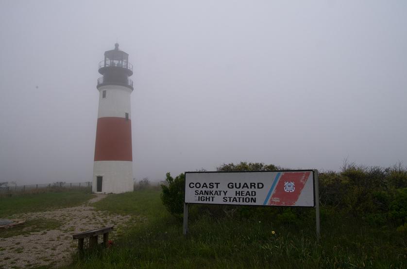
seen from the original location.
Adam (viewer left) and David
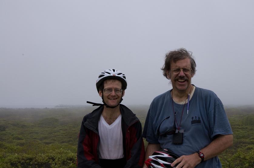
Olson atop Folger Hill.

Folger Hill (108 feet)

Some day Folger Hill at (41.28044° N, 70.00876° W) may become the county highpoint. We visit it just-in-case...

Folger Hill requires travel along dirt roads which are at-times sandy. In particular, it will not be available by taxi. Our bicycle route is described here, followed by an alternative that, although resulting in more total miles traveled, features less travel off of pavement - an important consideration for biking.

After Sankaty Head we travel to this junction at (41.28484° N, 69.97458° W) along Polpis Road. We head west-southwest to this junction at (41.27629° N, 69.99471° W) along at-times a sandy path that is perhaps more suitable for hiking if time permits.

Now turn right (northwest) and travel a short distance to this junction at (41.27713° N, 69.99609° W). Here take the left fork and travel to this junction at (41.28142° N, 70.00636° W). Cache bicycles here and hike on the obvious side-road to your left (southwest) until reaching the highest ground at an obvious, open area.

For returning to pavement retrieve the bikes, continuing northwest to this "T"-junction at (41.28445° N, 70.01325° W). Turn left (west), disregarding this junction at (41.28468° N, 70.02025° W) and this junction at (41.28582° N, 70.02530° W), as both have roads leading right (north) to private property with unbikeable tracks. Continue southwest about 1/4 mile farther to Altar Rock Road at (41.28433° N, 70.02838° W) and take it by turning right (northwest) to paved Polpis Road.

The alternative route entails taking the return path from Folger Hill to Polpis Road in both directions, i.e. depart Polpis Road at Altar Rock Road, heading southeast bound for Folger Hill, passing the junctions noted above, caching bikes at the cited junction, walking to Folger Hill - and then reversing the entire route back to Polpis Road.