Sanders County Highpoint Trip Report

Snowshoe Peak (8,738 feet)

Date: July 14, 2008
Author: Adam Helman

Participants include John Hamann, John Stolk, and Adam Helman.

Mouse-click on any photograph for enlargement.

western approach via Snowshoe Lake

This effort is part of a larger journey collecting Montana and Idaho county highpoints in July 2008.

Owing to their proximity, this climb of Snowshoe Peak it paired with an ascent of McDonald Peak; yet with a rest day in-between since each effort entails over 5,000 feet of elevation gain. This rest day is essentially mandatory given the 14+ hour days each mountain poses.

For many of us the chief draw of Snowshoe Peak, and indeed of McDonald Peak as well, is that they are both ultra prominences, i.e., peaks with at least 5,000 vertical feet of
topographic prominence. We are all "working" on completing the 57 summit ultra list of the contiguous United States; and these two summits fit neatly into that picture as two of Montana's four ultra summits.

The same climbing party is interested in both summits with the exceptions of Grant Myers and Edward Earl who plan to attempt British Columbia's Kootenay Mountain while John Hamann, Charlie Winger, Tim Worth, John Stolk, and I climb Snowshoe Peak. However we five differ in opinion as to the preferred climbing route.

The standard climbing route is an eastern approach via Leigh Lake and is rated "marginally Class 4". Concerns about how early season snow might adversely effect that route suggests to John Hamann that the far longer yet technically easier Snowshoe Lake route from the west should be considered.

Noting this state-of-affairs a full month before the actual climb I decide that John H. would appreciate having somebody along - and, with that concept foremost in my thoughts I propose that Charlie W. and Tim W. use the Leigh Lake route while John H. and I go via Snowshoe Lake. Then, if Charlie and Tim wish to, they may descend with John H. and myself to the west; and I would ferry them back to the Cabinet Range's eastern side.

John Stolk calls me on July 8 while I'm in Billings and so joins us for both peak climbs. Owing to its length, John is initially surprised that I would consider the Snowshoe Lake route as a dayhike rather than an overnight affair. Nonetheless he joins John Hamann and myself for this western approach.

Meanwhile, Edward Earl gets a flat tire that forces abandonment of his Kootenay Mountain plans. He appears at the Leigh Lake trailhead and so joins Charlie Winger and Tim Worth for that route. All-told, three of us climb from either direction; and the hope is that we'll meet at the summit for a round of congratulations, photographs, and exchange of route details.

With this background secured the story continues.

Late on the afternoon of July 13 I meet John Stolk and John Hamann at a campground roughly one mile south of the MT Route 56 / MT Route 200 junction.

We caravan 19 miles to the Snowshoe Lake trailhead and find that the approach road is washed out two miles before the "normal" trailhead. Noting the poor car-based camping options at the washout, we locate an organized campground a few miles away. Unfortunately the campground rules include closure of the entrance gate until 7 a.m. That's too late for us, and we return to the road washout for camping.

What happens when somebody learns of a family emergency? What if there's a forest fire? We find this imprisonment until seven o'clock to be bizarre and highly unsatisfactory.

route
The route from Snowshoe Lake.
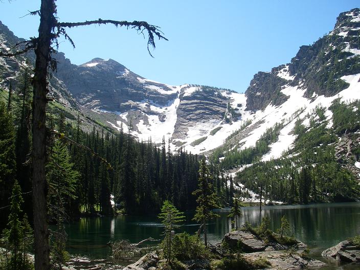
The snow is chosen immediately
right of the rocky slope at center.

My supper includes Chinese-style marinated pork plus the balance of a chocolate cream pie that I gave to folks in celebration of my 48th birthday the previous day at McDonald Peak. Energy requirements for the next day serve as my excuse to consume the pie. John H. eats take-out food (it looks great), finishing it as "breakfast" the next morning. John S. enjoys pasta - I believe macaroni and cheese.

Meanwhile the usual round of discussion with John H. ensues, topics ranging from the politics and science of global climate change, to how I can tolerate three solid weeks of county highpointing. I really like talking to John H. as his mindset and overall philosophy appears nearly identical to mine.

The highway turnoff for the Snowshoe Lake route is 16 miles from the Montana Route 56 / Montana Route 200 junction. From there it is 2.0 miles to the road washout.

lake
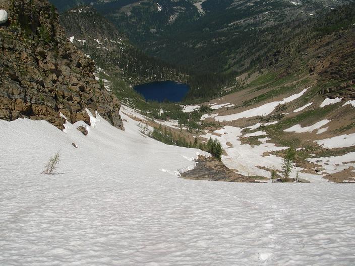
Looking back towards Snowshoe
Lake from the ridgeline saddle.

As noted above, the campground where we met on July 13 is about one mile southeast of this highway junction and along Montana Route 200.

I arise at 4:30 a.m. for a 5:15 a.m. start along the stream-braided, washed-out road. After my maple bar with coffee milk the normal trailhead is reached within one hour; and we take this obvious main trail until a 4,550 foot junction leading to Snowshoe Lake. This main trail is easy to follow and allows for rapid passage.

From this backcountry trail junction to Snowshoe Lake it is much slower going. There is an abundance of deadfall; and this often makes the trail, called in one report a "manway", somewhat difficult to spot on the opposite side. This "trail" is clearly unmaintained.

ridge
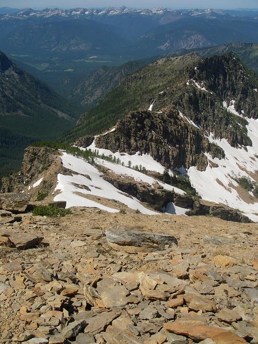
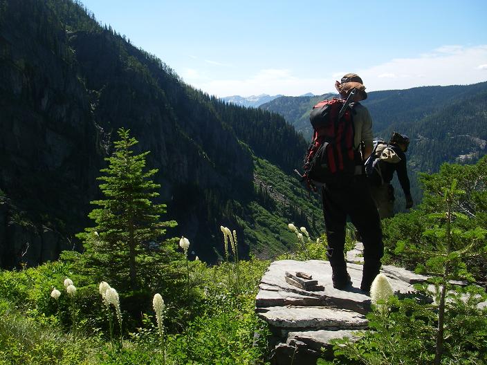
View west down-ridge
to the 7,500 foot saddle.

Along this "manway" there are 4 stream crossings to be negotiated, with each one entailing a loss and regain of elevation. The first crossing is particularly harrowing as one clings to branches whilst walking atop a fallen tree trunk mere inches from running water. I would loath having to make such a crossing with a full-sized backpack - and as would be required for an overnight climb with a camp at Snowshoe Lake.

There is a steeper portion of the route just prior to Snowshoe Lake where one surmounts a series of rock slabs. It is not (in my opinion) Class 3 as one Summitpost author claims. I term it "high Class 2". Some cairns assist in locating a good way up this section.

Near Snowshoe Lake we encounter snow patches as it is approached from the north and then skirted-around its eastern shore. We take a good break at the lake, fill on water and snack food, and prepare for largely snow travel beyond. Despite the calorie loading of the previous day I am starting to feel fatigue.

broad view
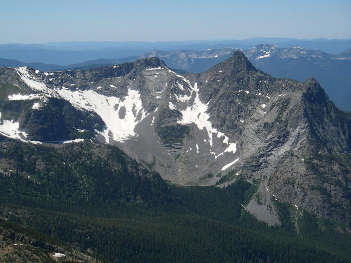
View of the terrain
while high on the ridge.

We approach the obvious 7,500 foot pass on easy snow. However the terrain becomes increasingly unforgiving, and we have a choice of climbing a series of cliff bands straight in front of us, or a moderately steep snow slope to the right.

I attempt the cliff band while John S. goes for the snow slope. This is fitting as I am from southern California and John from Washington! I am forced to jump down about three feet into the moat created by the warmer rock; and then climb onto the rock with a few cautious steps. It is now apparent that the rock is "weeping" water everywhere, and is simply too slippery to climb with any degree of safety. I bail out, and most cautiously kick steps sideways in the high-angle snow to meet the path already sketched out by John S. Having shouted to NOT follow my route, John H. is already climbing the snow slope.

John
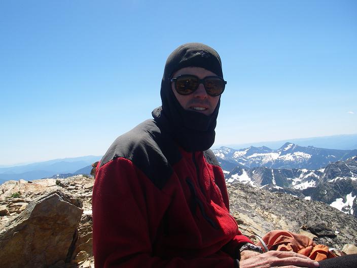
John Stolk at the summit.

Well, John H. and I take quite a while to ascend this moderately-angled snow. By the time we're on top, and indeed at the pass, John S. is already one-half hour ahead of us. From here the going is nearly all on rock as John H. and I scramble towards John S. who eventually waits for us a few hundred feet under the summit block.

The final 300 vertical feet is steeper and entails some routefinding. Nothing exceeds Class 3, and we summit at 1:12 p.m. - a full 7 hours 57 minutes after starting out!

lake
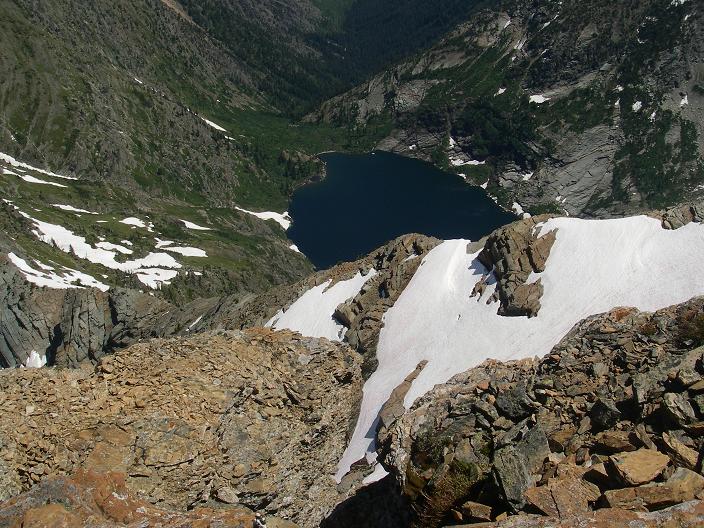
Leigh Lake from the summit.

The other summit group, consisting of Charlie Winger, Tim Worth and Edward Earl, had already reached the top at 11:30 a.m., waited 1 1/2 hours, and began their descent. They are spotted perhaps 500 feet beneath us. We shout and wave. I hear Edward's characteristic whistle, and this serves to identify him. Indeed, this is the first time I am aware (and hence surprised) that Edward has joined the climb.

It is suddenly nippy and windy - enough to wear an extra layer and liner gloves. Much food is opened and shared, including a large tin of sardines in mushroom sauce that I had given to John H. seeing as I saw him enjoy sardines atop another peak the previous Spring in the southern California desert - one Providence near Interstate 15. I enjoy camembert cheese with turkey bacon on an "everything" bagel.

descent
About to descend the rocky portion
just below Snowshoe Lake.

We depart at 1:45 p.m. and consider the best way down to Snowshoe Lake. I suggest taking an unexplored route down some obviously dry cliff bands. I am, however, outvoted by the others; and we rapidly descend the ridge to the top of that moderately-angled snowslope. By now the snow is quite soft, and it makes for some acceptable glissade practice. Saving considerable time by this means, we are in good spirits shortly afterward as we near Snowshoe Lake for a well-earned break and re-watering.

We re-enter the zone where bears are a greater threat since, now in the forest, it is difficult to spot one nearby without having first startled it by our presence. To this end I resume my ultraloud shouts of "AAAAA-OOOOOOH" at the top of my lungs. This blast is heard for easily one-half mile, and perhaps farther still, as we all hear the echo reverberating on the nearby slopes and hence compute the distance traveled by the time lag.

cascades
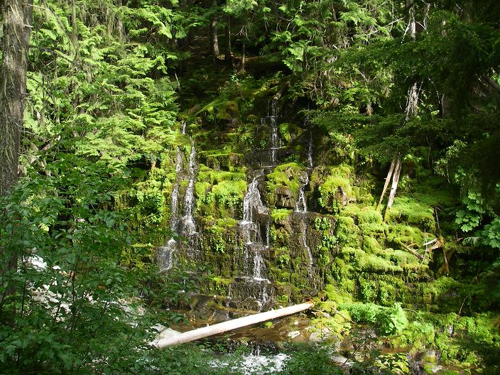
A set of cascades
near the forest trail.

By now it is hot as well, and none of us is enthusiastic about the deadfall-laden bushwhack-like "trail" lying ahead - plus the 4 stream crossings.

We are pleased to reach the main trail, and with it some rapid foot travel to our vehicles. More than an hour later at the trailhead we slump down, lying on our packs and, frankly, exhausted from our efforts. After ten minutes of this, while nibbling on my penultimate granola bar, I reluctantly make the call to arise and complete our "mission".

We return to our waiting vehicles at 7:44 p.m., six hours after the summit and 14 hours 29 minutes after starting out that morning.

The net elevation gain is 6,300 feet; and the total elevation gain is 6,600 feet due to drops in the trail at the four stream crossings noted. The round-trip distance is estimated as 17 1/2 miles. These statistics are sobering for a single day's hike.

After our climbs I discussed the merits and distadvantages of the Leigh Lake and Snowshoe Lake routes with Edward Earl. We conclude that the Leigh Lake route is preferred as it is MUCH SHORTER while being only of slightly greater technical level. The elevation gain is also less at some 4,500 feet.

After changing footware we caravan to the campground where we had met the previous afternoon. Too worn out for cooking hot food, and noting that tomorrow is merely a driving day (with consequent lack of need for high energy), my supper is largely a bagel with peanut butter.

The next morning is a most lazy one with much relaxed conversation, good, freshly brewed coffee from John S, and a round of back-slapping for having climbed in succession two tough peaks with over 6,000 feet of gain apiece.