Northern Rockies July 2008 Trip Report
© July and September 2008 Adam Helman
(Click on any image for enlargement.)

Background

Examination of my end-2007 county highpoints completion map confirms that my long-term goal of completing the eleven western USA state's county highpoints really is feasible. After all, of the 414 counties in that region I only have 67 counties remaining - roughly one-sixth of the total. To that end, on this trip I will concentrate on Montana peaks.

In addition for this journey I anticipate a Wyoming state completion at Grand Teton, one that is now planned in a fourth summer after three aborted attempts to participate in as many years.

Gasoline prices suggest that after this three week July journey that I leave my pickup truck in Billings, Montana; fly home for several days; and retrieve it for a three week August highpointing trip. This plan saves 100 gallons of fuel and roughly 15% of my annual carbon footprint. In obviating a second round-trip from southern California, this plan also saves four days of simply driving.

In this report I describe the three week July trip. My three week August trip is described here.

Teton Range
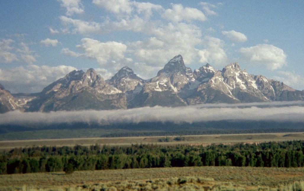
The Teton Range in Wyoming
(Yes, I really took this textbook picture myself.)

Trip Details

Tuesday, July 1 - drive to central Nevada

A new California law, effective today, prohibits driver cell phone use unless it is a hands-free model. I don't own one. So I only call when I have stopped for some important reason - generally filling the tank.

It is 530 road miles to the Columbine campground for climbing Arc Dome in central Nevada. It is a somewhat remote location, the nearest community being an Indian settlement 9 road miles back down the gravel road.

There is nobody else here, and I eat supper with Chinese-style pasta and a (kosher) roasted chicken kebab.

morning shadows 11,000 feet
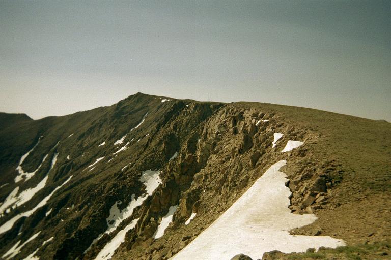
morning shadows soon after
starting the Arc Dome climb
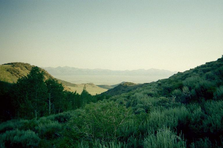
view south at about 11,000 feet
enroute to Arc Dome

Wednesday, July 2 - Arc Dome (ultra prominence summit)

Edward Earl and I encountered the season's first snowstorm last September 22; and with that turned back well short of the summit owing to fresh, deep powder - and no snowshoes. This time it would be different.

This is an excellent dayhike, all on-trail. There are lingering snowfields that make the route prettier than plain, dry ground. Some are large, others small. Some have interesting shapes. Others are just plain "cute", the poor white blobs slowly melting away never to resurface ... except the next winter it all starts anew.

My ascent consumes 3 3/4 hours, the descent 3 1/4 hours, and the total duration is 7 hours 50 minutes. The net elevation gain is 3,200 feet, the total gain 4,700 feet due to a 150 foot descent right after a 10,600 foot saddle; and a 600 foot descent just prior to final summit push.

This is my 46th ultra prominence in the contiguous USA, and number 74 worldwide. Recall that an ultra is any mountain with at least 5,000 vertical feet of topographic prominence. Outside the United States the cutoff value is 1,500 meters (4,921 feet).

Addendum: Edward Earl completed the contiguous USA ultra list, with 57 summits, on August 2 - and at Arc Dome.

Having come off the climb at about 3 p.m. I drive out, heading generally north. A well-earned ice cream and coffee snack at Austin, Nevada tides me over until supper. Then, there is still enough time for driving to just 8 miles south of Battle Mountain near Interstate 80. I stop there because it is barely within cell phone range for my mother's sake.

Arc Dome lichens
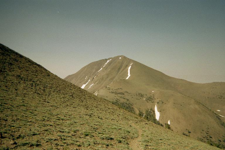
Arc Dome from the trail 
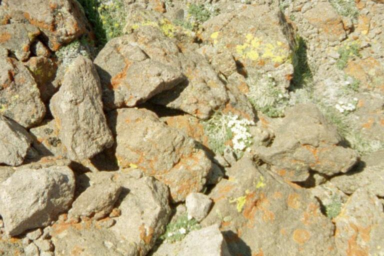
high-altitude lichens and tundra -
orange, yellow, and green

Thursday, July 3 - Jerome and Minidoka Counties in Idaho

Today I drive into Idaho via Interstate 80 and US Route 93. I decide to swap a pair of low elevation counties for Diamond Peak since I surmise that it is still snowbound on the critical final thousand vertical feet. Diamond is then saved for the August trip.

After I bypass downtown Twin Falls I head north to the Jerome County liner. Here, I drive through a pair of mud puddles too quickly, resulting in an extremely dirty vehicle - one that I intentionally don't wash to blend-in with the locals (apart from the California plates).

dirty car
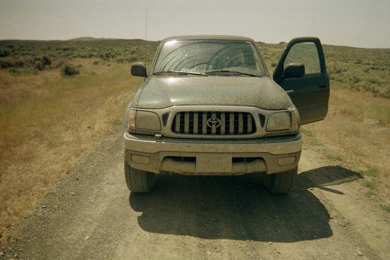
My pickup's license plate
is illegible after a mud puddle.
After visiting the Jerome liner I head generally north to Craters of the Moon National Monument and the Minidoka County highpoint - Bear Den Butte. My Minidoka-based efforts are described in this trip report.

The entire drive through Craters of the Moon is both lonely and remote - not a single other person or vehicle is seen. With 69 road miles, all gravel or dirt, a vehicle mishap would have been a serious matter. Fortunately I am prepared with gallons of water and a backpack large enough for walking out if required.

I camp on a county road 1/2 mile from Idaho Route 20. A farmer plowing the field makes much racket. Later he comes by and we chat. I will not accept his offer of a shower the next day - it is too risky coming from a complete stranger.

Friday, July 4 - drive to central Montana

The day begins with a cow "stampede" coming down the road - and I drive immediately to avoid being enveloped by them.

Soon I spy Diamond Peak 20 miles northwest while driving Idaho Route 20. As surmised, the southeast ridge is covered in snow at about roughly 11,000 feet - so vindicating my earlier decision to postpone it in favor of the Jerome / Minidoka pair.

I drive into Montana and eventually negotiate the approach road for Long Mountain and Big Baldy just south of Niehart along US Route 93. I camp just southeast of Long Mountain right on the forest road, confident that, being so remote, nobody is going to zip by and disturb me tonight.

The shortwave radio pulls-in Radio China International broadcasting Spanish to Latin America at 9,550 kHZ. I also tune to Radio Habana (9,560 kHZ) with their usual communist, fist-thumping rhetoric. It is most ironic to be informed of world affairs, in realtime, while completely isolated amidst Montana's backcountry.

Other good finds include a "classic oldies" station at 680 kHZ from Helena, Montana - and, as expected, CBK from Regina, Saskatchewan was quite intelligible at 540 kHZ.

moon rock stampede!
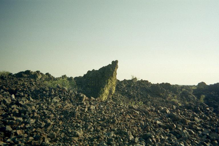
bizarre igneous rock at
Craters of the Moon
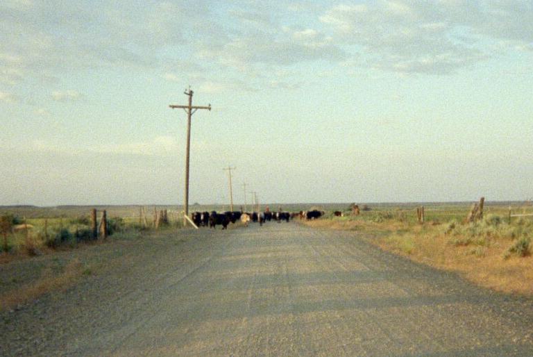
Cows approaching - time to go!

Saturday, July 5 - Cascade and Judith Basin Counties

The twin ascents of Cascade and Judith Basin Counties are described in this trip report.

This afternoon I drive US Route 12 east to Judith Gap, finding no public telephone as the general merchandise store has just closed for the day. Continuing east, I eventually camp along Swimming Woman Road 8.5 miles from Judith Gap Road and just barely into the national forest. This sets me up for the next day's climb of Greathouse Peak.

GPS reading Montana border
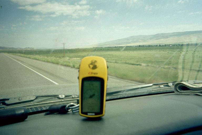
The GPS unit is receeding
from the last waypoint at 71.4 mph.
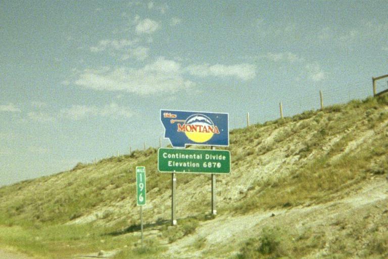
Entering Montana on Interstate 15.
Note the elevation.

Sunday, July 6 - Greathouse Peak of Fergus County

My ascent of Fergus County's Greathouse Peak is described in this trip report.

Note that Old Baldy competes in elevation for the honor of Fergus County highpoint. A ridgewalk between the two mountains is possible but appears to involve a lot of elevation loss and regain - and some rather steep scree slopes on the west flank of Old Baldy. Hence the latter is climbed the following day from a completely different direction.

After Greathouse Peak I drive south to Ryegate for a telephone call home - as there is no cell signal - not even in the town itself. Ice cream is yummy at the grocery store where the lady manager allows me to borrow her cell phone.

It seems to me that, with all the dirt roads crisscrossing Fergus County, and the absence of a viable cell signal, that it lacks the financial backing of neighboring counties. Inquiry into the matter brought nothing but scorn.

I drive back north, then east and north again for a carpark at the base of an abandoned jeep road leading up to Old Baldy. There is a logging road on the opposite (east) side of the main road.

UMRB center Missouri River
the Upper Missouri River Breaks
Interpretive Center in Fort Benton, Montana
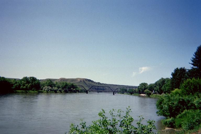
the Missouri River itself

Monday, July 7 - Old Baldy and Golden Valley liner

My hike to Old Baldy and the nearby liner for Golden Valley County is described in this trip report.

After this half-day effort I continue driving north through Lewistown - the county seat. After gasoline I enjoy one of my favorite combinations - hot coffee with a Butterfinger ice cream bar. The creamy, melting, peanut buttery confection contrasts well with the bittersweet hot coffee - necessarily enjoyed simultaneously.

I generally perform several tasks at a gasoline station. Apart from filling the tank, I must relieve myself; dump out trash; refill a gallon water jug from the spigot (asking first if it is potable); make handy the next county's set of topographic maps with reports; and (finally!) get a caffeine-laden snack. In deference to other motorists I fill the tank and then pull over to park elsewhere so as to free the pump for others. After that I perform the remaining tasks.

Eventually I camp near the base of Highwood Baldy for the next day.

gun artillery
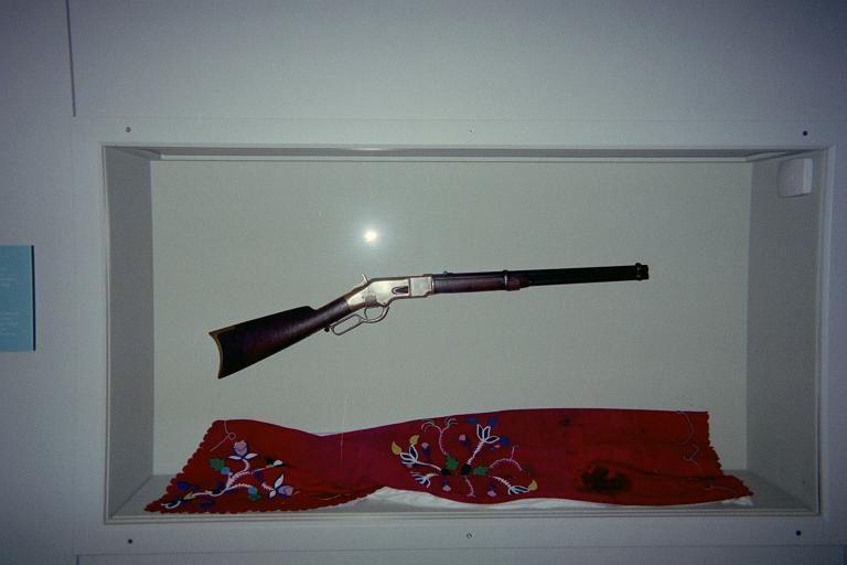
a gun surrendered by a tribal chief
during the 19th Century Indian Wars
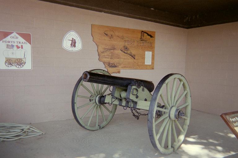
an artillery piece of the day

Tuesday, July 8 - Highwood Baldy of Chouteau County

My hike to the Chouteau County highpoint is described in this trip report.

The effort concluded around 9:30 a.m., I return to the paved road grid and visit the Belt Valley Grocery in Belt. A Cenex gasoline pump is available. Here I note to a local rancher (who inquires about my truck's gasoline mileage) that I've been getting 25 mpg outside California even though I get just 21 mpg inside. The California ethanol requirement is to blame for this inefficiency - it provides less energy content per gallon than gasoline. I won't delve into the specific thermochemistry here. Considering that gas prices in California are higher than elsewhere, one realizes that motorists in the Golden State are getting hit twice: they pay more for fuel that provides less mileage.

The Belt Valley Grocery serves wonderful fried chicken. I also enjoy a pint of strawberry ice cream with mix-ins of dried fruit and a granola bar. Clearly I am treating myself to a filling meal as I have completed the solo portion of my July journey.

I explore a Great Falls shopping mall. Though tempted to stay at a motel (as it is quite hot), I camp at Wal-Mart - the same one as during the Canada trip last month with Bob Packard. Owing to the heat I park in the shade on the eastern side of building and eat cold food as it is simply too hot for using my stove.

teepees inside teepee
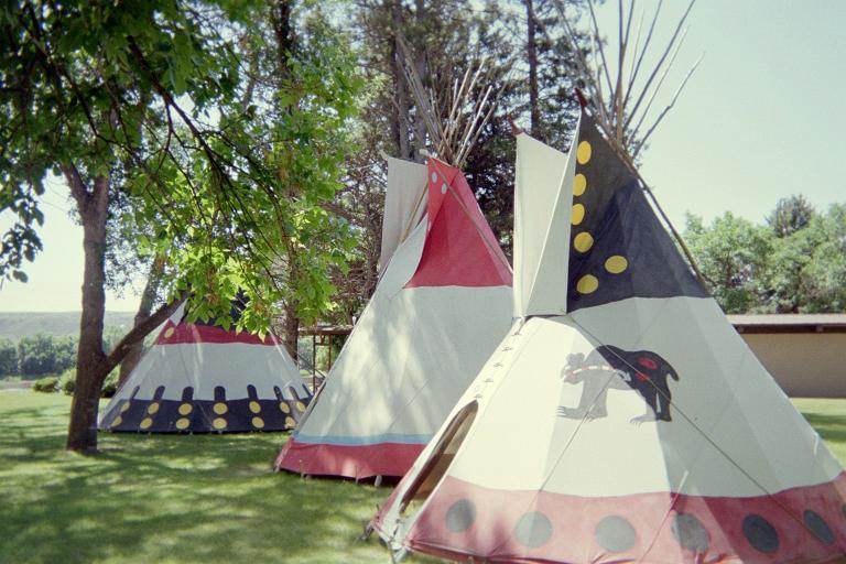
teepees on the Fort Benton original grounds -
now a city park
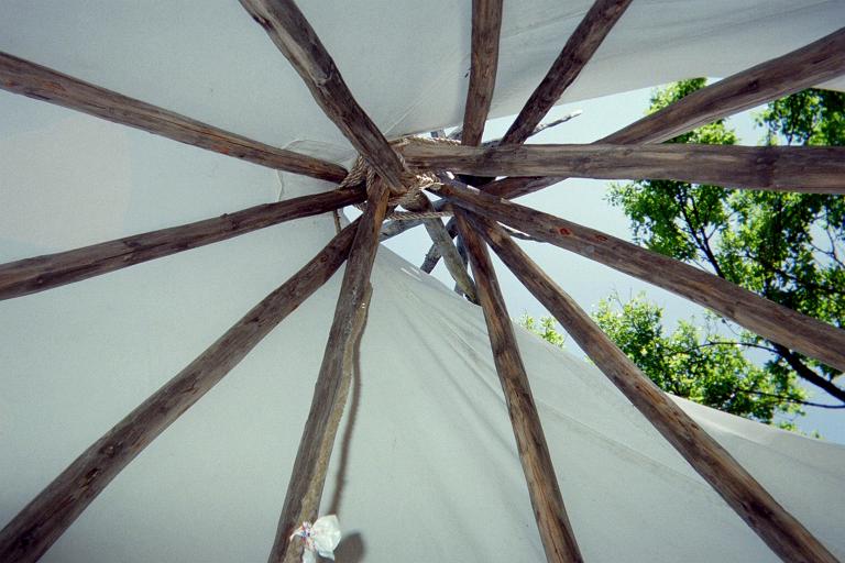
view skyward inside a teepee

Wednesday, July 9 - Fort Benton, Montana

The next morning I drive northeast on US Route 87 some forty miles to explore museums at Fort Benton, the first town in Montana and of historic note. There is a UMRB (Upper Missouri River Breaks National Monument) Interpretive Center.

I learn about Fort Benton as the terminus of steamboats plying the river upstream, providing the region with goods from back east. Remarkably, to pass sandbars over the final 100 river miles, boats were fitted to ropes attached to the shorelines and literally dragged upriver. Fort Benton was the farthest inland port in the world - over 3,400 miles from the sea.

I discuss with rangers my recent visit to the UMRB highpoint in June. Initially they were attentive and enthusiastic - until they suspected that I might have been trespassing. At that point the dialogue degenerated into continual accusations by one lady ranger that I had done wrong; and it would appear that nothing else mattered to her. I could hear her muttering in a low tone, "You trespassed you trespassed".

I left shortly after, vowing never to mention hiking or climbing to park personnel until asked first.

I drive north, far north, and meet Tim Worth at a playground / campground mid-afternoon in a hollow along Whitlash Road 2.4 miles south of Whitlash community and close indeed to Canada. We have good conversation. Later, a pint of fruit cocktail is chilled in the nearby stream and shared as dessert.

Gold Butte camping
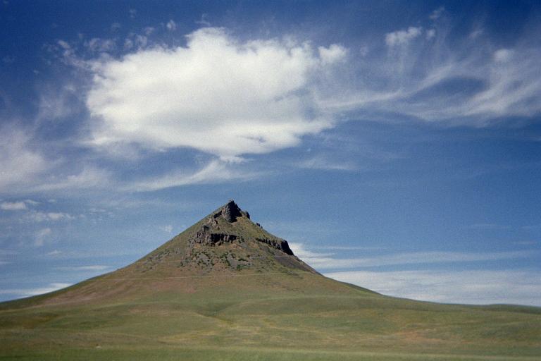
Gold Butte lies near Whitlash Road
as one approaches the Liberty and Toole
County, Montana highpoints.
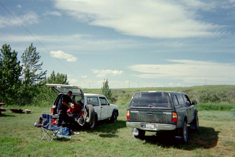
Tim Worth (left) and our vehicles
shortly after arrival at a park/playground
that serves as our campsite.

Thursday, July 10 - Mount Brown (Liberty County) and West Butte (Toole County)

Tim and I climb Mount Brown this morning, our efforts briefly described in this trip report.

Originally we planned to visit the Toole County highpoint, West Butte, the following day. However we have plenty of time (it is not even noon); and leaving West Butte for tomorrow makes it a rushed day since we must meet other climbers 300 miles away by 6 p.m.

Thus we climb West Butte in the afternoon's heat. Our efforts are described in this trip report.

We camp at last night's playground.

McDonald group summit ridge
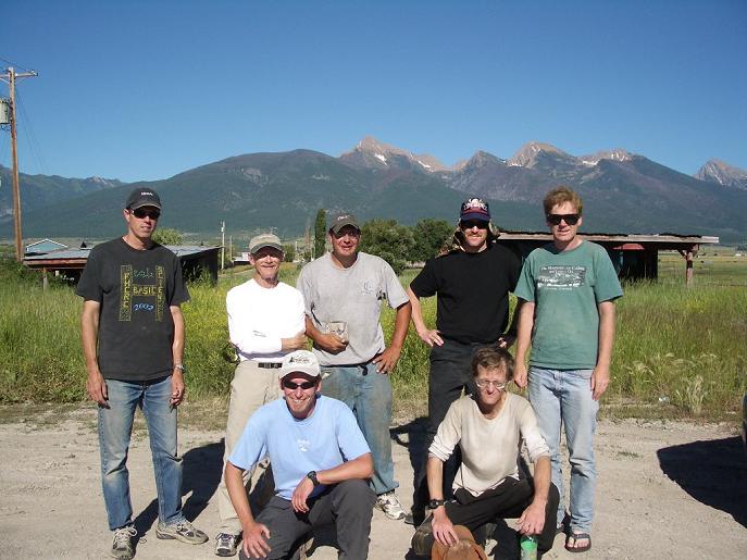
The McDonald Peak group. From viewer's left -
John Stolk, Charlie Winger, Tim Worth,
John Hamman, and Edward Earl.
Seated from left - Grant Myers and Adam Helman.
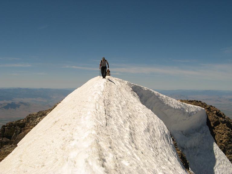
The summit ridge with Tim Worth
(front) and Adam Helman (rear).

Friday, July 11 - drive to Lake County and eight climber rendezvous

It is rainy and windy this morning. Nasty weather - and a good thing that we climbed West Butte yesterday!

We caravan west on US Route 2. We separate for some unknown reason, and I continue to Kalispell by 11 a.m. for a permit to camp and climb McDonald Peak within the Flathead Indian Reservation.

Anticipating my 48th birthday, in Kalispell I purchase a whole lemon meringue pie for myself, and a chocolate turtle fudge pie (with caramel and pecans) for other climbers. Then I enjoy an individual-sized (5-inch?) coconut cream pie and drive south along Route 93.

A gaggle of climbers meet 5-6 p.m. at the "44 Bar" parking lot at the Red Horn Road / US Route 93 junction - John Hamann (New Mexico), Charlie Winger (Colorado), Tim Worth (Colorado), John Stolk, Edward Earl, and Grant Myers (all from Washington) ... plus Jim Perkins who climbed McDonald Peak two weeks earlier.

Jim is here to meet other highpointers and assist with chains and his truck should the often muddy approach road prove impassible to other vehicles. Tim Worth and (I believe) one other person leaves their car behind, and we caravan in the remaining five vehicles to a pair of "trailheads" for McDonald Peak. Jim's assistance is not required as the road is remarkably mud-free.

It is good to see Edward after several months, the last time being to climb Mormon Peak last April in southern Nevada.

McDonald Peak will be a long and arduous effort.

view northwest lemon pie
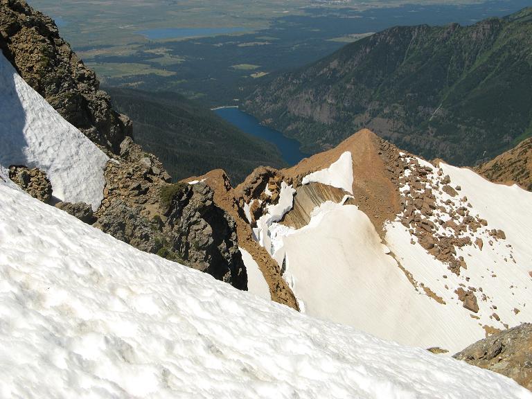
A view to the northwest from
McDonald Peak's summit shows the drainage
north of the one we bushwhacked across.
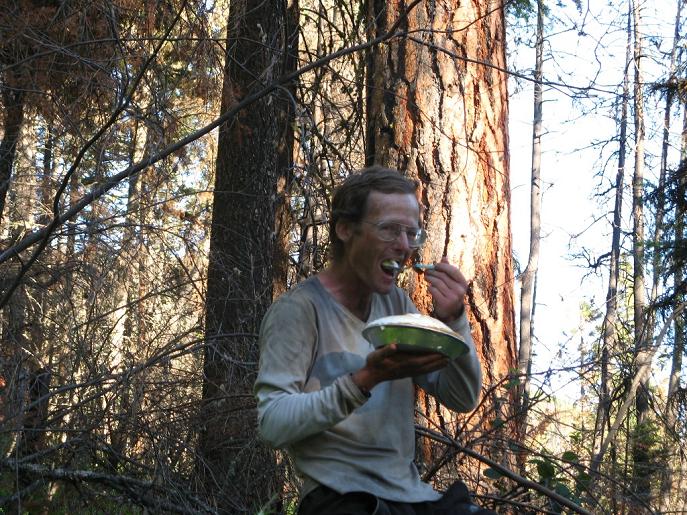
Adam consumes the lemon meringue pie
after returning from McDonald Peak.

Saturday, July 12 - birthday with McDonald Peak climb

Our ascent of McDonald Peak is described in this trip report.

The effort concluded, I sleep as last night at the lower of two carparks - this time alone as the others, including Edward, have gone to a state park.

river washout
The Middle Fork of the Flathead River
must be forded on a western Mount Stimson approach.
This was the road to be taken
for our Snowshoe Peak climb.

Sunday, July 13 - rest day

This is an intentional rest day in-between two very long climbs. Shortly after starting to drive I enjoy a breakfast burrito and then an extremely sweet huckleberry milkshake.

Later I pass by the Middle Fork of the Flathead River and take photographs. Fording it is necessary to climb Mount Stimson from the west. A group of us plan to come from the east next month; and these pictures provide ample backing for that decision as the river crossing would be problematic without some form of flotation device such as a rubber raft.

By mid-afternoon I meet John Stolk and John Hamann at a campground 3/4 mile south of the Montana Route 56 / Montana Route 200 junction.

A campground near our trailhead for Snowshoe Peak would have us "locked in" until 7 a.m. We thus camp at the road washout that serves as trailhead for our western, Snowshoe Lake approach. I eat supper (with Chinese marinated pork), and then the balance of that chocolate pie for energy the next day.

The road is washed out two miles prior to the normal trailhead. It will be another long day....

Clark Fork Paradise
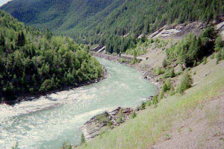
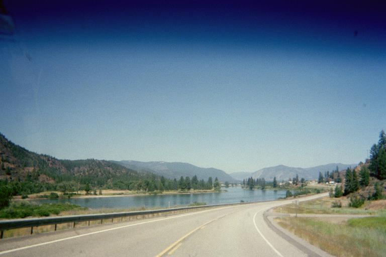
Clark Fork enroute to Snowshoe Peak
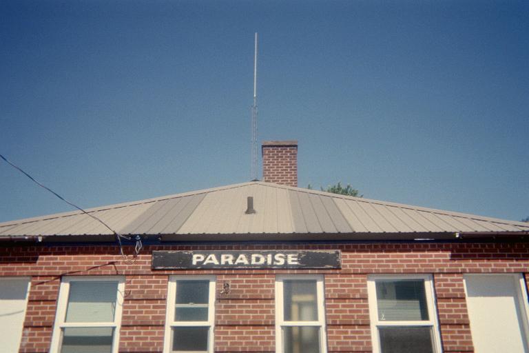
railway terminal at Paradise, Montana
("two tickets to Paradise")

Monday, July 14 - Snowshoe Peak by two routes

Our efforts climbing Snowshoe Peak, the Lincoln and Sanders County, Montana highpoint, are described in this trip report.

After this epic, 14 1/2 hour climb we are all tired - yet justifiably so. We return to the same campground where we met. By waning light I have peanut butter on a bagel - as I am too "worn out" to cook hot food.

These two climbs, essentially back-to-back, were noteworthy in their combined level of effort: 29 1/2 miles over 28 3/4 hours with some 12,800 feet of elevation gain.

I am pleased have once again climbed with everybody. There is a fair degree of male bonding that goes on here ... it is unavoidable after climbing something arduous, or technical diffulty, or just plain nasty (such as a terrible bushwhack).

Tuesday, July 15 - rest day

A lazy morning with John Stolk - and his good, freshly brewed coffee. John Hamann somehow gets locked out of his rental. A locksmith arrives from Idaho, the problem resolved at a cost. However what price can one put on bagging two tough mountains?

I wash clothes in the first major community driving southeast on MT Route 200 - Thompson Falls. Leaving town, I visit a supermarket delicatessen and eat a pizza slice with part of an (enormous) smoked turkey drumstick - I feel protein deficient. Then, a doughnut stuffed with apple pie filling.

Eventually I sleep at Wal-Mart in Missoula after visiting their Southgate Shopping Mall. In the mall I attend Oil and Vinegar - a gourmet food store, sampling exotic vinegars while finally purchasing a pricey bottle of "maple smoked chipotle finishing sauce" that I find absolutely wonderful on subsequent days with everything from salmon salad to the otherwise bland sausage and egg muffin often eaten for breakfast with coffee or hot mocha on driving mornings.

state capitol sculpture
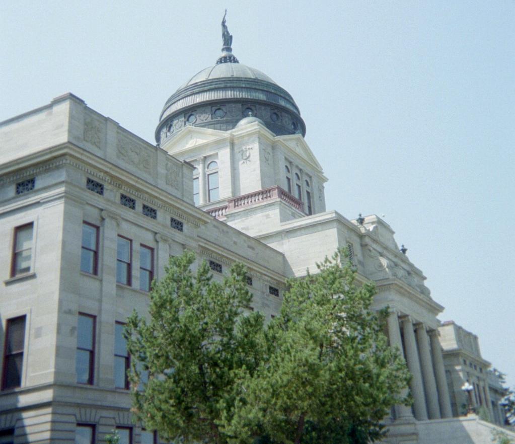
the Montana state capitol building in Helena
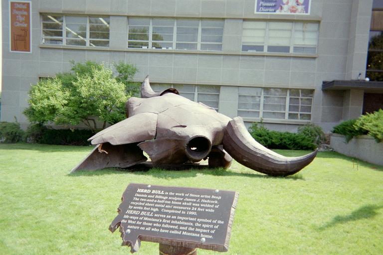
A sculpture adorns the entrance to the
state history museum near the capitol building.

Wednesday, July 16 - Helena, Montana

There is plenty of spare time since we climbed both peaks on their first possible days without using any "bad weather days" that I include in the original itinerary. I take a second day off from highpointing.

There is an excellent museum at the Montana state capitol - much to learn about the native peoples and the state's progressive settlement.

My Tacoma pickup is checked-over at the local Toyota dealer. I pay for air filter replacement but not the estimated $650 for a presumed transfer case oil leak. Why not? Becasue the oil level is full - and this despite having driven 2,828 miles from home. My best (and ongoing) hypothesis is that I was being mislead for the sake of taking my money for a nonexistent problem.

Addendum: I drove another 3,500 miles, through the end of my August journey, without any oil leak or oil pressure loss.

I drive to a level spot on the approach road for the next day, roughly 7,200 feet and shy of how high Andy Martin pushed HIS vehicle. Nearby I meet a sheepherder - actually a student at Montana State University (MSU) on a two week stint in animal management.

While eating supper on the truck's tailgate I hear a gunshot. The next morning on my climb I pass by the sheepherder in a pasture. He explains that was to ward off a bear clearly intent on "damaging" one of his flock.

cabin eagle
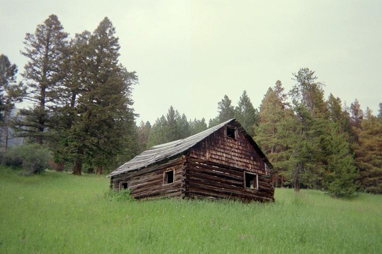
An abandoned cabin lies somewhere on the
way to Mount Edith. Montana is full of
these reminders of its pioneer settlers.
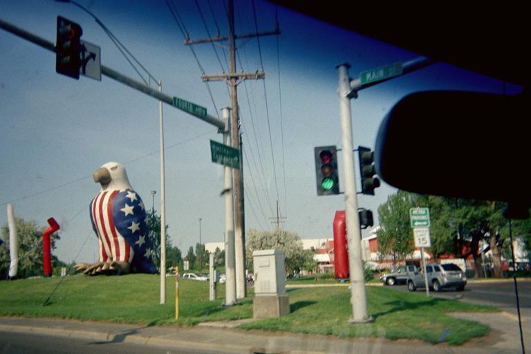
This patriotic, giant-sized symbolic eagle
sits in a somewhat more modern setting.

Thursday, July 17 - Mount Edith of Meagher and Broadwater Counties; Bozeman

This is a classic hike. I divert northeast one-half mile shy of the east-west main ridgeline to avoid needless time and distance on the ascent. I return the same way, the effort consuming some 3 1/2 hours.

I visit an excellent museum, near MSU on southern edge of Bozeman - "Museum of the Rockies". There are extensive dinosaur exhibits. There is a temporary bioluminescence exhibit as part of an ongoing rotation with interesting topics. There is a planetarium with free, different shows every hour. I enjoy huckleberry white chocolate-enrobed hazelnuts from the gift store.

Later I camp at Wal-Mart very near Interstate 90 on the north end of town. When at Wal-Mart I invariably enter for, at the very least, a cold beverage. Often there is a dessert to be purchased, such as raspberry cheesecake; or something more substantial. If a "Super Center" there is a full-scale supermarket inside - and I can do all of my food shopping right on the spot.

Then, in the morning, I can shave (every fourth day it would appear); and generally use their facilities before heading out on the road. At home I shave far more often. The fourth day criterion results from the excess heat and "dirty feeling" of a hairy face which becomes intolerable after than span. 'Nuff said.

museum dinosaur
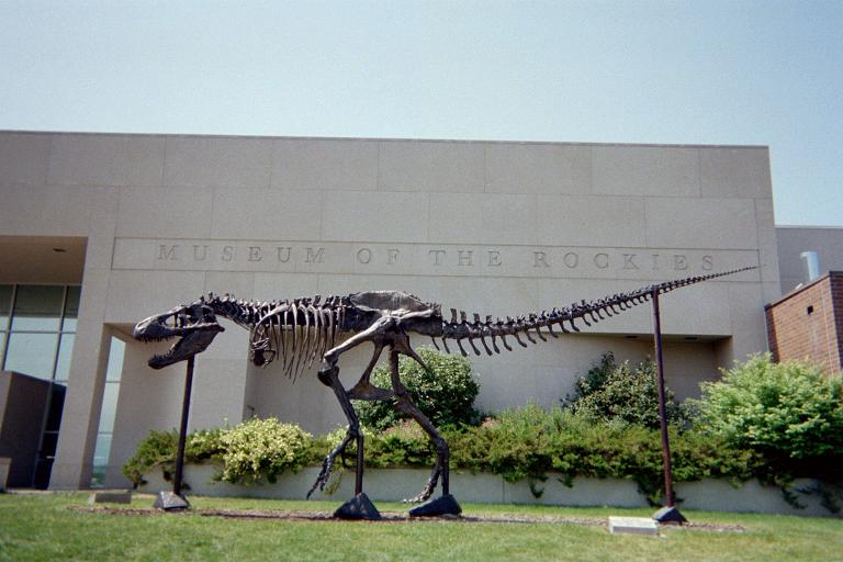
An emaciated dinosaur guards this
Bozeman, Montana museum's façade.
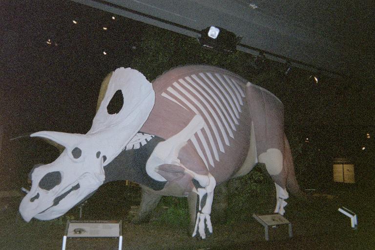
This dinosaur is reconstructed
emphasizing its bulky musculature.

Friday, July 18 - drive to Grand Teton National Park

I avoid potential bad traffic in Yellowstone National Park by an end-around on US Route 191 through extreme eastern Idaho.

I arrive in Jackson (the town), and, entering Jackson Hole, note significant snow on Grand Teton. That could be problematic indeed for my intended summit attempt. Upon visiting the Exum Guides office, they explain the path is tracked by previous parties. Hence the observed snow is not an issue.

Dean Molen
Dean Molen fooling around.
Dennis Poulin is at far right.

I camp at Gros Ventre with partners Dean Molen and Dennis Poulin. It is great to see them once again. Dean has an excellent sense of humor, and as I take his picture, Dean tilts an umbrella to show how windy it is when in-truth it is calm.

During the next two days we must pass a pair of rock climbing courses to demonstrate proficiency sufficient to scale Grand Teton by one of two routes. Then, we actually climb the mountain over two more days.

I am apprehensive about potential personality conflicts with the guide(s) during the training and climbing.

Saturday, July 19 through Tuesday, July 22 - Grand Teton training and climb

I succeed with Dennis Poulin to climb Grand Teton. Details of both the training and the climb itself are provided in this trip report.

Thereby I finally complete the Wyoming county highpoint list. As only the fifth person to do such, many highpointers on learning this news recognize it as a difficult accomplishment owing to the likes of Gannett Peak and Washakie Needles - let alone Grand Teton.

Grand Teton is one of my twenty (or even ten) most memorable ascents.

Wednesday, July 23 - drive to Billings

This is a driving day only, the goal to be in Billings, Montana for my flight home the next day.

I buy a 500 piece jigsaw puzzle featuring the Teton Range from a gas station / grocery store enroute to the south Yellowstone Park entrance. I'd like to assemble it with my young nephews on seeing them in October.

Cody Wyoming's Bill Cody Museum has five parts. I concentrate on the Museum of the Plains Indian; yet also visit the Museum of Hand Arms - with 1,800 guns and pistols on display!

I return to Montana and camp at Wal-Mart on the northeast side of Billings. I enjoy hummus many ways for supper - using leftover gourmet Italian sausages, garlic, balsamic vinegar dressing, and an entire bag of lettuce. Then, an ice cream sandwich with black licorice candy for dessert.

For some reason I enjoy hummus while car camping - and it's likely because hummus provides much nutritional value in a diet that often can easily degenerate into candy bars and ice cream. Furthermore if the day is hot I don't want to cook hot food. The hummus, being served cold, is a perfect solution.

Bill Cody Museum bears feasting
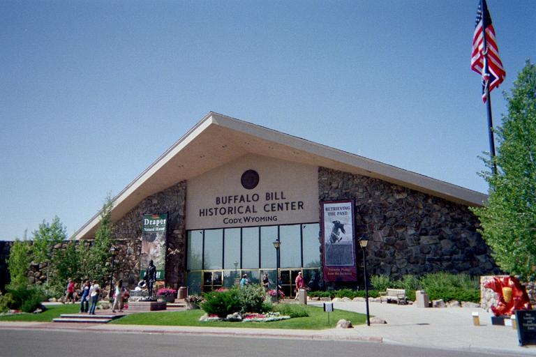
The Bill Cody Museum in Cody, Wyoming
is actually a five museum complex.
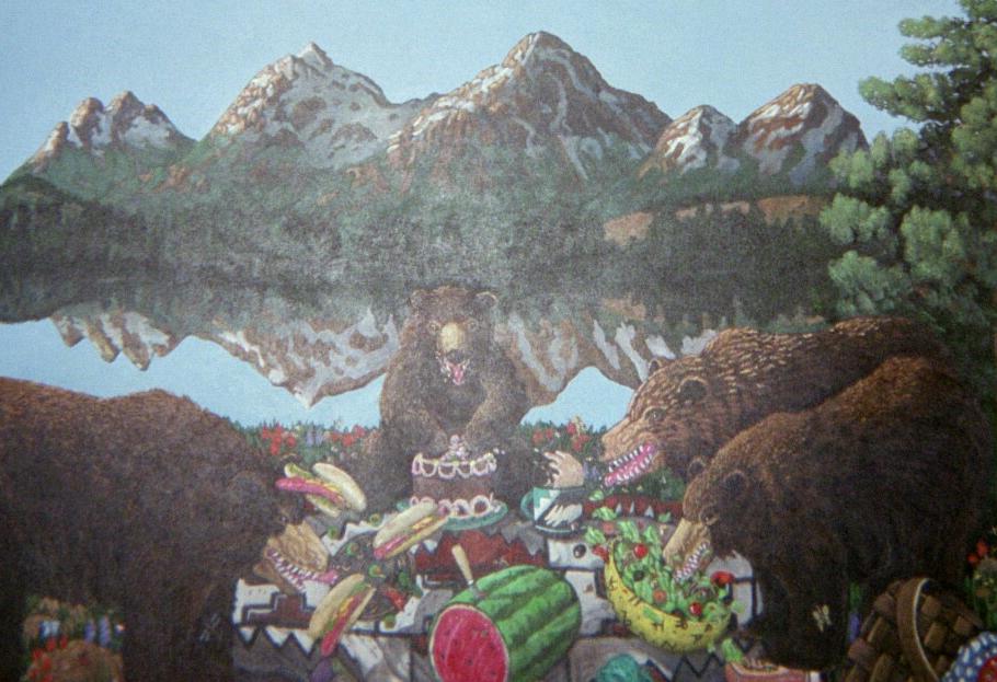
A painting with three bears
taking advantage of human carelessness.
The chocolate cake-eating bear looks
extremely enthusiastic.

Thursday, July 24 - return flights

As planned I leave the pickup truck at the long-term parking lot.

The airline's route to Salt Lake City has us overfly Grand Teton just 3 miles to our right (west) and 3 miles below - and I am perfectly positioned in a right-side window seat looking west. Quite the experience seeing it from such a vantage point - sipping from a tiny bottle of South African Amarula liqueur as a special treat. Unfortunately my disposible cameras (four of them) are in the overhead luggage bin.

Summary

All the goals are achieved - including the Wyoming state completion. Some 3,700 miles are behind me, while the August portion awaits. Now I have (only) 52 counties remaining, one-eighth of the 414 county total in the eleven western (contiguous) United States.

The Grand Teton climb is something special.

twin peaks
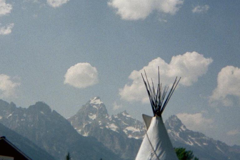
This juxtaposition of teepee and Grand Teton
demonstrates a similar profile on vastly different scales.