Stillwater County Highpoint Trip Report

Mount Wood - east summit (12,640+ feet) and west summit (12,649 feet)

Dates: August 3-4, 2008
Author: Adam Helman

Participants include Jim Perkins and Adam Helman.

Mouse-click on any photograph for enlargement.

This effort is part of a larger journey collecting Montana and Idaho county highpoints in August 2008.

Mount Wood can either be climbed in one very long day or as an overnight backpack. The route choices include coming via Mystic Lake (as with the state highpoint); or from the north via a 9,000+ foot carpark at the so-called "Golf Course". We choose the latter route.

Ward Thurman, friend of Jim Perkins and avid fisherman, joins us for the hike into a camp high on the Stillwater Plateau. His fourteen year son also comes; and the pair will fish in a nearby lake while Jim and I attempt the summit.

We meet at a public campground in Columbus near Interstate 90. Our overnight packs already prepared, everybody drives in Ward's vehicle for the long and tedious approach drive.

The first stop, almost immediately, is my reward for Crazy Peak the previous day - a pint of Ben & Jerry's Karamel Sutra - "A core of soft caramel encircled by chocolate & caramel ice creams & fudge chips".

trailhead
The Mount Wood trailhead. From viewer's left:
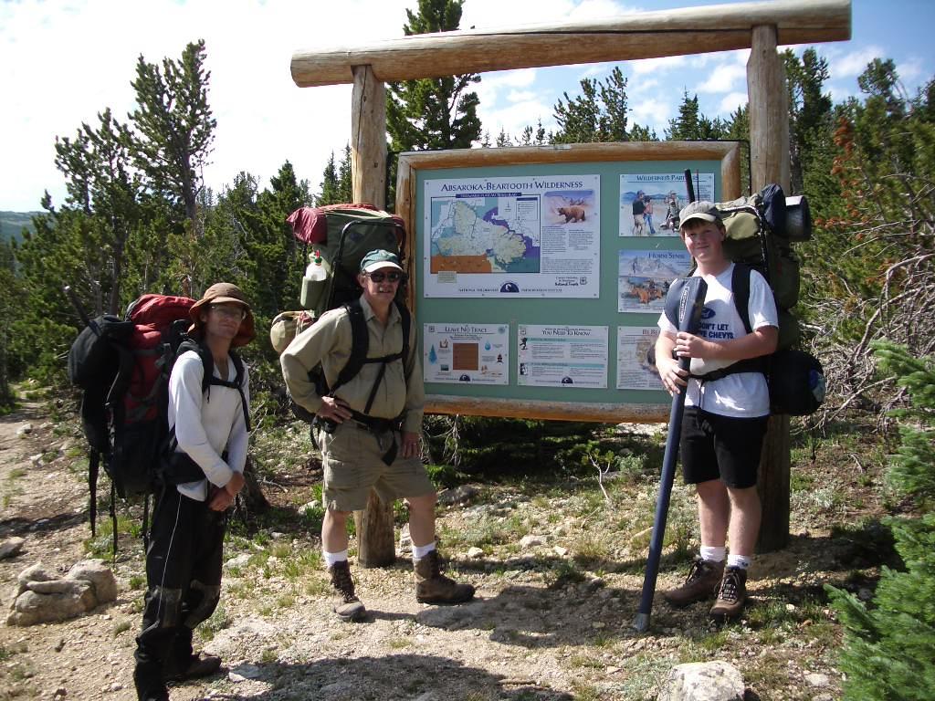
Adam Helman, Ward Thurman, and his son.

Later, in the small community of Fishtail, we stop for huge cinnamon rolls. I really don't want to eat the same thing for dozens of bites as this is boring; and so gladly accept about one-fifth of Ward's enormous pastry. Even though it is just a fraction of his roll, it is still a normal-sized piece since the rolls are more accurately described as entire 8-inch cakes!

The approach drive consumes two hours as we wend our way over unsigned forest roads. We park at the Golf Course and begin our hike onto the plateau around 10:30 a.m.

Straightaway one descends 100 feet along the trail. After some 1 1/2 hours we reach trail's upper end at roughly 10,000 feet; and I take a waypoint that later will prove most beneficial.

There is a permanent snowfield just south of our location; and we avoid it by heading southwest underneath a trio of smaller, melting snowfields prior to hiking more steeply onto the plateau proper at roughly 10,200 feet.

While heading south there is no need to hike higher than about 10,500 feet as our recommended campsite lies at roughly that elevation.

The one-way distance being six miles from our vehicle, we eventually erect camp around 4 p.m. at roughly 10,500 feet at a location both close enough for Mount Wood summit attempt and for Ward and his son to fish at nearby Lake Wilderness (9,425 feet).

At 6 a.m. Jim and I awaken to leaden skies. We are discouraged, and sleep one hour more for a re-examination. Encouraged by a clearing trend we arise and begin the climb proper.

We hike south over boulders for nearly one mile at roughly the 10,500 foot contour. The going is tedious, and we pledge to return a different route. We then are forced to descend to about 10,000 feet, and, unfortunately, this entails bushwhacking through some rather nasty krumholtz that proves very slow going.

high camp
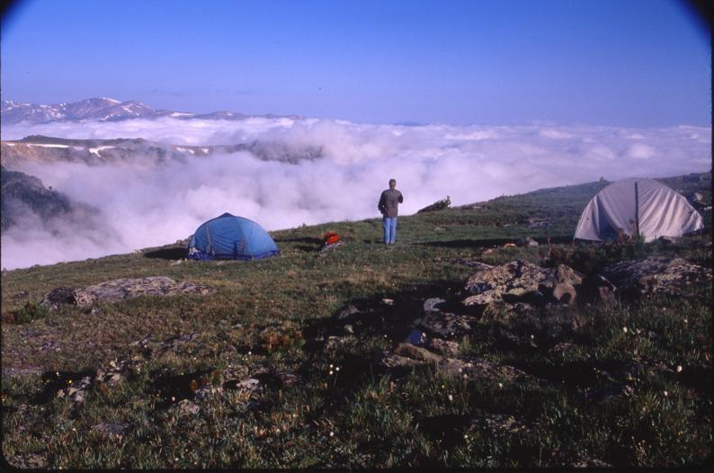
Our 10,500 foot camp on the Stillwater Plateau.
(Ward Thurman photograph)

To avoid this I recommend that future climbers descend directly from camp south / southwest to about 9,900 feet at the forest's edge. Then, travel past a pair of feeder lakes in the direction of point 10250T.

Hike to the east of point 10250T while continuing south to the base of several steep talus and scree slopes which rise to the main summit ridge. We stop for a break at this location; and contemplate a sane route up the slope immediately confronting us.

This route steers completely clear of point 12330T with its obvious technical issues. Tim Worth learned the hard way to avoid it; and we are the beneficiaries of his advise to descend (and hence to ascend as well) the route we describe here.

I have been on worse talus slopes. It is best to stay as much as possible on the green tundra (choose your exact path accordingly); because the dirt provides far better stability than the loose rock. Never mind what a national park ranger would say about preserving the tundra - do yourself a favor and WALK ON IT when possible. After several hundred vertical feet the tundra disappears and you have no choice anyway.

After two hours Jim and I "top out" on the main ridge just south of the western summit. A gorgeous panorama suddenly unfolds to the east and southeast with ice blue ponds of meltwater amidst pristine white fields of snow.

We agree to climb the eastern summit first. I lead, gaining the east-west ridge connecting the two summits in short order. A Class 3 route is generated on-the-fly; and we reach the eastern summit after perhaps 30 to 45 minutes. With hindsight, a better route is to stay low and "pop up" just underneath the eastern summit block.

Mount Wood morning
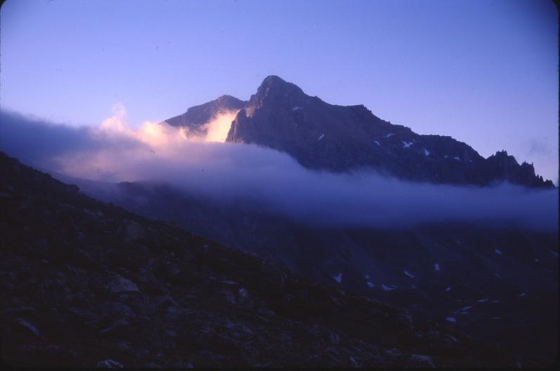
Mount Wood in early morning light
(Ward Thurman photograph)
We descend the summit block, encountering one tricky spot between snow and rock where I demonstrate squeezing between the two, facing into the rock, and then watch as Jim follows suit.

I am intent on nabbing the western summit, re-ascending to the connecting summit ridge only to find that it is too difficult to continue - especially as Jim has decided not to join me for the western summit.

A complete traverse between the two summits is too risky without a rope.

I cross west over the main, north-south ridge and examine the rock face immediately under (and north) of the western summit. It is not obvious how to proceed. I anticipate potential Class 4 terrain and so leave my pack with Jim for greater mobility. I climb a ramp from which I circle clockwise around the western slopes of the summit block. From there I discover a Class 2 route that travels south to the western summit with identifying rock cairn.

I stay but briefly, my summit lunch being in the daypack below. Unfortunately I forget the exact route of ascent, and find myself downclimbing some really serious terrain that is certainly Class 4. I shout to locate Jim and my pack.

The above description should assist those who wish to efficiently visit both summits. In particular, stay low before ascending the eastern summit block; do not attempt the traverse between the summits; and climb the western summit by winding around its western flank.

To me these observations are not obvious; and so I truly wonder why no previous reports describe these items.

The question arises as to which summit is the higher, and with that distinction, is the true county highpoint. Greg Slayden provides the following excerpt from "Select Peaks of Greater Yellowstone", a tome written by Exum guide Tom Turiano.

"Both early and modern maps of the Beartooths that include Mount Wood locate the summit at the westernmost of several high points along the summit ridge. Yet, from a rest stop [1000' below the top] the broad summit a half mile to the east appears higher. It is impossible to ascertain from the 1986 Mount Wood quadrangle if the east summit is indeed higher than the west because both summits show only one forty-foot contour line above the 12,600 foot index contour. However, the 1949 15-minute Mount Wood quadrangle shoes three fifty-foot contours above the 12,500 index contour on the eastern summit and only two on the western summit. My own makeshift leveling instrument revealed that the eastern summit might indeed be slightly higher. Nevertheless, engineer and survey leader James P. Kimball designated the lower western summit as "Mount Wood" on his 1898 map, and it has been labeled as such on every map since. . . . The sharp west summit undoubtedly was an easier survey target than the broad east summit, perhaps another reason that the name "Mount Wood" was applied to the lower west summit."

Thus by most reasonable measures, Jim Perkins appears justified in climbing only the eastern summit.

I eat my bagel with camembert and imported Italian sausage while Jim explains that we must break camp and return this evening regardless of the hour. I am somewhat dismayed by this prospect - it is already 1 p.m. and so we won't return to camp before 5 - suggesting a hike out on the plateau by darkness.

Evidently Jim had not informed his wife that he could be a day late due to unforseen circumstances.

Mount Wood panorama
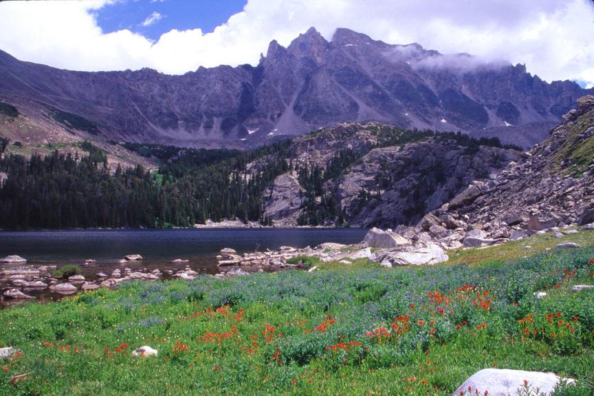
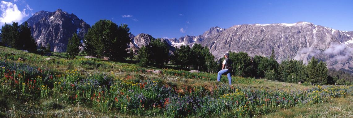
Mount Wood panorama
(Ward Thurman photograph)

Jim and I descend the talus slope, and take a well-deserved break near point 10250T before heading back the recommended ascent route, i.e. past the pair of feeder lakes; thence contouring around the forest's edge at around 9,900 feet; and only then ascending onto the Stillwater Plateau with camp. Take a GPS-derived waypoint of camp before departure to get you back there without guesswork: camp will not be visible as you ascend onto the plateau.

I am extremely unhappy about packing out after this climb. I am tired, at least temporarily, and will not be able to eat my fill of fresh fish if I must then walk with full pack right afterwards. Nonetheless the fresh trout is tasty and filling. I supplement it with flour tortillas ("fish taco") and a variety of spices. Finally I enjoy coffee as a last resort to get myself going. One should "fish for carbohydrate" rather than protein under such circumstances!

We depart around 7 p.m. with roughly two hours of useful daylight. That's enough to get us halfway back to the vehicle. By nine o'clock headlamps are ready for use, and I adise people not to employ them until they become absolutely essential in order to maintain dark adaptation.

That GPS-derived end-of-trail waypoint is now most important. Without it we'd be "flying blind", so to speak. Sometime after 10 p.m. we arrive there, all in one piece, and despite hiking over large talus for the final one-third mile on account of taking somebody's advise that we should go farther west when, in truth, we were on-course all along.

There are three locations on the trail where deadfall forces us to depart from it. Encountering them by darkness, one location causes such confusion that we are nearly forced to camp right there from our inability to find the trail beyond.

We arrive at Ward's pickup truck around 11:30 under brilliantly clear skies. The Milky Way is straight above us. The cold soda pop suddenly chills me, and I dump out what has not been consumed and hop into the cab.

We return to Columbus at about 2 a.m. (!), and I sleep by 3.

panorama
Mount Wood is at left in this panorama from Wilderness Lake.
(Ward Thurman photograph)


The net elevation gain for this route is 3,600 feet since, as noted, the trail "bottoms out"
100 feet below the trailhead elevation shortly after: 12,650 - 9,050 = 3,600 feet.

The total elevation gain is 3,600 + (100 + 500 + 200 + 600) = 5,000 feet.

100 feet corresponds to the loss in trail elevation noted;
500 feet corresponds to the loss from camp to basin near point 10250;
200 feet corresponds to the loss in-between scaling both summits;
600 feet corresponds to the gain from the "feeder lakes" to camp on return.

GPS-derived WGS84 coordinates -

Description Latitude, Longitude Elevation (Feet)
car park at "Golf Course" (45.35605°N, 109.82503°W)  9,159
trail upper terminus (45.33635°N, 109.82839°W)10,030
100-150 yards north of camp (45.29417°N, 109.84908°W)10,473
base of gully on west side of Wood (45.27501°N, 109.82671°W)10,248
topping-out on the summit ridge (45.27386°N, 109.81316°W)12,469