Northern States June 2006 Trip Report
© July 2006 Adam Helman
(Click on any image for enlargement.)

Background

This journey forms part of a grand plan to reach the highest point of various counties in the eleven states that comprise the contiguous western United States.

As nearly all of the southern and mid-latitude county highpoints have been visited, I am largely restricted, insofar as new county highpoints, to the northern tier of states along the Canadian border - Idaho, Montana, and Washington states.

The ideal season for these states is shorter than for more southerly western states. Snow impedes progress until mid-July in many cases. However for a trip in June many options exist for the lower elevation counties of eastern Washington and Montana. The venues of this journey are selected based on these considerations.

Gasoline prices currently hover around three dollars a gallon. A rough calculation suggested that flying to Spokane, Washington and renting a high-clearance vehicle is cheaper than driving my own Toyota Tacoma from San Diego. Spokane was selected because it offers the lowest vehicle rental rates, regardless of rental agency, of all reasonable starting points - including Billings, Boise, Salt Lake City, and Seattle.

I rented a high-clearance SUV rather than an economy passenger vehicle because I swore that I would never again rent an "el cheapo" passenger car for county highpointing after my last trip to Montana saw the vehicle impotent after rainy weather - let alone on rocky, rutted mountain or country roads as required on the various driving approaches to the highpoints. I got an excellent deal with National - the base rate $175 a week for a "smaller" SUV that rates a not too shabby 25 miles per gallon on the highway.

The journey was an exhausting one - as expected when daylight lasts sixteen hours and there is opportunity to fill in all of the time with either hiking or driving to the next venue. The typical day began just after sunrise, perhaps 6 a.m., and nonstop progress ensued until the sun law low in the northwest quadrant at 8 p.m. Sometimes I started earlier, indeed before dawn, when access was a concern. I ate my cold supper on the car hood and promptly slept on the rear passenger seats by 9 or 9:30 p.m. To remain alert at the wheel I found myself napping for ten minutes every three hours or so - coffee only goes so far when you refuse to drink more than one cup daily to prevent addiction.

My plan was to "clean up" southeastern Washington; incorporate several northern Idaho counties in a fashion convenient to the road grid; drive way on over to southeastern Montana; and then visit High Plains counties in counterclockwise fashion until the Canadian border. Finally, after returning to Washington, I would drive to isolated Klickitat County if time permitted.

Trip Details

Tuesday, June 20

The DeLorme topographic atlases were bound for Seattle without me. I had forgotten to retrieve them from the upper bin - a young lady having distracted me during the entire flight with her intelligent discourse. Waiting at the baggage claim area, the pilot of a return flight to Spokane hand-delivered the three atlases to me. I could now depart.

I arrive at the Karakul Hills of Adams County at eleven p.m. Excited that my first new county highpoint in several months is at-hand, I cannot contain myself. I head out with headlamp and GPS unit for the highpoint, a mile west in a farmer's field, using the Big Dipper to orient myself. A slightly bizarre experience, I find myself just barely able to discern the horizon from artificial lights far in the distance. In said fashion I visit the highpoint area, and return to my vehicle around midnight.

Wednesday, June 21

Franklin County is next. I snoop around the farmhouse on the approach drive; find nobody at home (although the radio is playing loudly in the living room), and proceeded on my business.

Walla Walla County is secured by late morning. I park at a saddle some 500 feet below the summit and proceed on-foot from there.

Columbia County is the afternoon's venue. I hike on trail to Oregon Butte's summit amidst the occasional snow patch and much unwelcome deadfall. Upon return to my SUV at the Teepee Trailhead a note on the windshield requests that I report trail conditions to the Umatilla National Forest district office if convenient. I thus visited the Pomeroy office next morning and described my experience - including the locations of deadfall on the trail that would turn back all but the most determined hiker.

I arrive in Dayton at 6 p.m. emotionally exhausted. The ice cold fudge bar helps - but with a drive to the next day's venue at-hand there is little time for real relaxation. I camp one-half mile southwest of the Alder Thicket Campground along FR40.

Thursday, June 22

Asotin and Garfield Counties are done together. Asotin is easy (see this report) - but for Garfield the approach road, FR4030, has plenty of fallen branches. I was stopped one-half mile shy of the trailhead by a large trunk; and hiked from there. My failed effort is described in this report.

I now have a "theoretical red" splash of paint on my completion map - a most unsavory thought. I would return to Garfield County near trip's end for a re-attempt.

I drive east on Highway 12 into Idaho and visited, using the convenient Soldiers Meadow Road between them, both the Lewis and Nez Perce County highpoints.

I drive north on I-95 and, arriving at FR377 with plenty of daylight (it is about 7:30 p.m.), drive the dirt road clear to the summit of Bald Mountain - the Latah County Highpoint. Details are provided in this report.

I drive to an organized campground along Highway 6, and, finding nobody around, did not pay the $8 fee. Being already 9 p.m. and getting dark, I enjoyed a self-heating meal of pasta shells with ricotta cheese and mixed vegetables inside the rich, thick tomato sauce. After a bowl of cereal with (warm) milk I fell asleep instantly on this - another long long day of driving and hiking.

Having flown to Spokane I have neither fuel nor stove - nor an ice chest to keep items chilled. The self-heating meal is thus a welcome respite from an otherwise monotonous set of cold suppers.

Friday, June 23

The road grid suggests I return to Washington for Whitman County's Tekoa Mountain. Details are provided in this report.

I drive north on I-95 for the Benewah / Kootenai County pair. Details are provided in this report.

Montana road
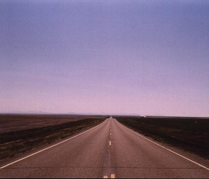
An endless ribbon of concrete in north central Montana.
I depart Cataldo on I-90 bound for Montana around 3 p.m., driving roughly one-half the total 600 miles to my next venue as Custer County. I camp in the national forest immediately east of Butte, Montana. Another ridiculously long day. Yet after just 3 days I have secured fully eleven western county highpoints.

My rate of progress would slow now that I am in Montana - the counties are larger (so the driving distances are greater); some of the hikes are several hours in duration; and, as I was soon to learn, unseasonably high temperatures would effectively prohibit any afternoon highpointing. Thus only one county highpoint daily - and that effort beginning at the break of dawn.

Saturday, June 24

I continue to Custer County and approach the highpoint area from the west, having read about poor road conditions from the eastern side. Details are provided in this report.

There was enough time to scout Rosebud and Treasure Counties. However I first "refueled" at a market in Ash Fork. A North Crow Indian community, I was aghast at the fraction of obese adults. Is this lifestyle or metabolism? Even the children were categorizable into very skinny and excessively overweight - with seemingly no middle ground. Bizarre.

grain elevator
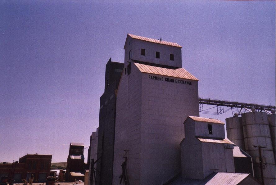
A pair of grain elevators in north central Montana.
My scouting efforts revealed a re-routed approach road west from Colstrip, and a host of other minutae that collectively formed my plan for the next day.

Sunday, June 25

Details of my bid for the Rosebud and Treasure County highpoints are provided in this report. It was just early afternoon when I finished - having gotten an "alpine start" at 3:30 a.m. I drove to Miles City along I-90 and got a room for the night.

Monday, June 26

Yet another looooong day with multiple highpoints. As these are individually short hikes, the afternoon heat was not (yet) a serious issue. I first visit the pair of bumps west of Cohagen for securing the Garfield County highpoint. Then I visit the Prairie County highpoint as either of a pair of contours on either side of Big Sheep Mountain Road. Finally I visit the McCone County highpoint, with details in this report.

I drove north on MT-13 to US Highway 2 just east of Wolf Point, and camp at an abandoned rest stop immediately northeat of the MT-13 / Route 2 junction. The red brick structure's bathrooms are locked.

Tuesday, June 27

After shaving in Wolf Point I drive to Zortman for Phillips County. Details are provided in this report.

While passing through Chinook I find a nail in the right rear tire while poised to receive fuel at an Exxon station. Losing air, I quickly drive to an auto mechanic shop two blocks away and have the problem tire patched for a mere $12.50 plus a five dollar tip for handling the issue in a prompt manner. National Car will never know.

Port of Entry
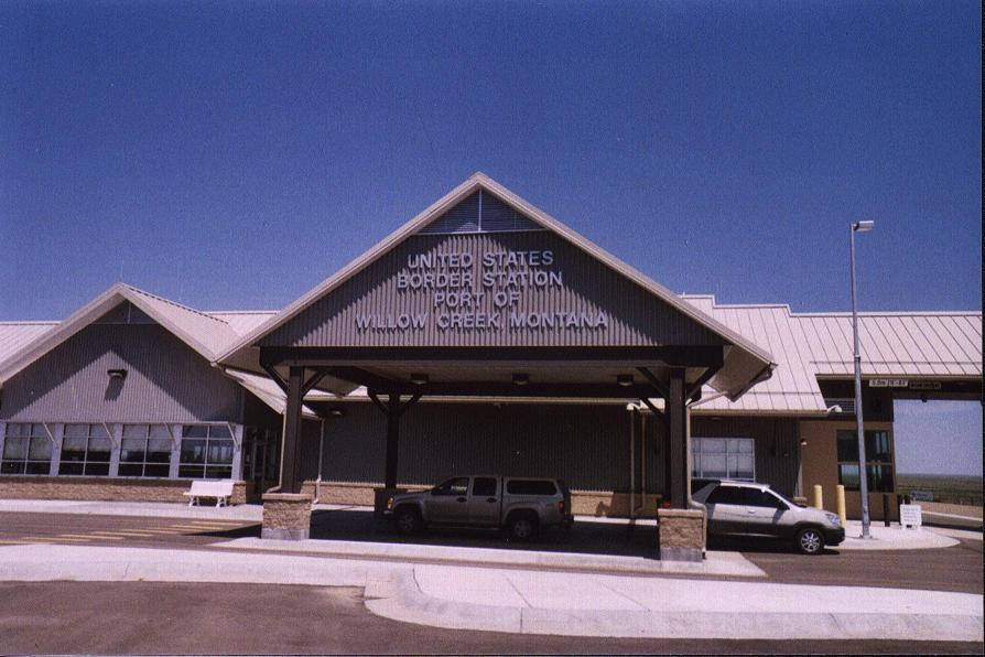
The Willow Creek, Montana Port of Entry
into Saskatchewan and Canada.
There is enough time to do Blaine County before sundown. However I am ahead of schedule and in need of slowing down - I feel like I've been highpointing far longer than one week. I receive permission from the daughter of the rancher to hike his backroads for the Blaine County highpoint the next morning.

A Blaine County Sheriff Department vehicle stops, and the officers investigate me just while I get around to the business of sleep. I am at a gravel pullout and the land is not signed.

(Officer) Do you have any weapons?

I show him my ice axe.

The officer draws his sidearm and tells me to drop it and remain seated in the vehicle.

The officers then check my identification and note that a neighbor saw my car and was concerned about a vehicle parked in such an unusual location. At the time I am stripped to the waist, sleeping with just a rolled-up pair of hiking pants and white socks. I must have appeared strange - yet completely within the law.

Wednesday, June 28

Atop the Blaine County highpoint a stiff breeze creates a welcome coolness that contrasts with the day's growing heat - even though it is only 7 a.m. A rattler warns me of its presence hidden within the summit ring of stones - and I take my break 100 feet west and out of the strongest wind.

I fill myself on hot food at an Exxon station while still in Chinook at 10 that morning - again, there is lots of spare time today.

I drive north from Havre to the Canadian Port of Entry at Willow Creek. My chief aim is to visit Saskatchewan for the very first time. I meet the American border guard and walk into Canada to his counterpart. My GPS unit reads within 0.3 arcsecond of exactly 49° N, some thirty feet, as I stand colinear with two white obelisks marking the precise boundary. My passport is stamped - and I return from Saskatchewan into Montana.

Montana wheat
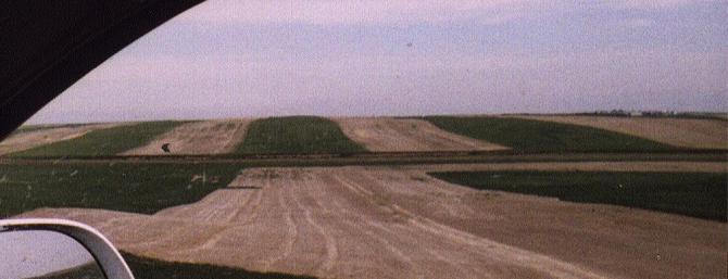
Montana fields typically alternate between
rows of planted and fallow land.
The American border guard says he has never seen somebody walk into Canada like this, only to return immediately afterwards. Welcome to the strange mindset of a county highpointer - disinterested in city comforts (Regina? Moose Jaw?), and yet completely absorbed in his own world.

I start using the camera, documenting typical scenes from the countryside of north central Montana. My first photograph displays the American port of entry building. I am not allowed to photograph the border agents.

There is plenty of time to investigate Hill County. With much time to kill I spend the afternoon in Havre at both the public library and an indoor shopping mall. The temperature is excessive - by various accounts the mercury climbs to 95 or 97° F by 3 or 4 that afternoon. The two indoor venues provide ample relief. It would have been crazy to climb uphill in that weather.

I depart Havre for the Hill County highpoint - loftiest summit of the Bear Paw Range and on Indian land. I decide upon an eastern approach to the mountain for the next morning, and camp just south of the Beaver Creek County Park at the Four Souls turnout - one of several campsites with Indian-derived names and south of the Park boundary right along Beaver Creek Road.

Baldy Mountain
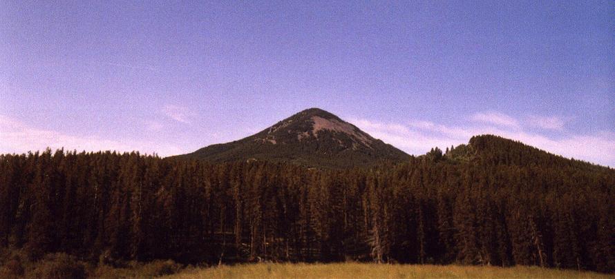
Baldy Mountain - the Hill County, Montana and
Bear Paw Range highpoint.
Thursday, June 29

I climb Baldy Mountain this morning, beginning before sunrise as described in this report.

The library work reveals a weather system set to pass through western Montana the next day. I therefore decide to leave Montana that afternoon and return to northern Idaho - where the forecast is more favorable. The Montana roads will be dirt for Liberty and Toole Counties, and if the rain is substantial I could find this problematic. In contrast the Idaho roads are on National Forest land and will likely be gravel - a vastly preferable surface in bad weather.

I drive U.S. Highway 2 into northwest Montana, planning the final fifty miles for the morning; and take a room in Libby, Montana. A large serving of licorice and huckleberry ice cream preceeded supper, and yet did not adversely dampen my appetite for the vegetarian entreé of beans, cashews, paneer (soft cheese) in a spicy sauce purchased at a health food store in the Havre shopping mall.

Friday, June 30

The Boundary County highpoint is visited this morning. Details are provided in this report. I drive the relatively short distance to Sandpoint, thence to Clark Fork, in preparation for Scotchman Peak the next day.

giant penguin
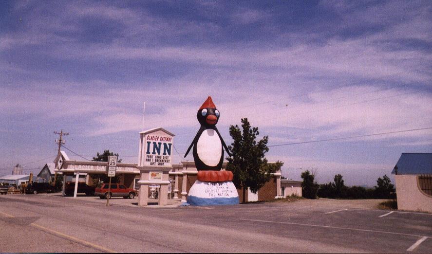
Cut Bank, Montana often has the lowest temperature
in the contiguous forty-eight states.
Saturday, July 1

The Bonner County highpoint is visited this morning. Details are provided in this report.

Holiday traffic is now a concern. The going is slow on I-95 until I reach Coeur d'Alene - whence I could drive at normal highway speeds. Evidently northern Idaho is a mecca for outdoor sports, including waterborne activities.

I return to Lewiston, and re-enter Washington along Highway 12 bound for Garfield County. I negotiate FR3040 enroute to Diamond Peak and find it is now clear of fallen branches, and, in particular, I can now drive all the way to the trailhead for the next morning.

A myriad of tiny (repeat: TINY) bugs congregate around anything warm - especially the car hood. I cannot eat supper atop the hood without hundreds of little insects, far smaller than a single millimeter, getting over my food. I eat on the nearby dirt ground.

Sunday, July 2

Both Diamond Peak and the nearby hilltop of similar elevation are visited in short order without snow being an issue. Details are provided in this report.

There remains Klickitat County. I should have visited its highpoint early the next morning owing to the heat. However I was at Satus Pass at 1:30 p.m. with several hours of daylight remaining. What would I DO if not the highpoint this afternoon?

Details of this poor decision are provided in this report.

I sleep at a very dubious establishment in Yakima because it is cheap. I get multiple telephone calls that night asking for "Jimmy" - and somebody knocked on the door claiming to be "Angela". Perhaps if these people had been highpointing for two weeks they'd understand I have no energy for such matters - I only want to sleep. That said, at 11 p.m. I awoke and drove to a gas station for a soda pop and a strawberry ice cream sandwich. Bad neighborhood - the clientele were obviously out on-the-town and generally of an unsavory character.

Monday, July 3

All that remains is a 200 mile drive, mainly east on I-90, to Spokane for my flight home the next morning. I lounge in my motel room, along Division Street, from mid-afternoon onwards. The Magnificent Seven provides ample entertainment on the television that evening.

Tuesday, July 4 - Independence Day

Richard Carey kindly retrieves me from the airport on my arrival. As with the outbound journey, no less than three flights are involved - this time from Spokane to Boise to Oakland to San Diego ... and consuming much of the day.

The first leg, from Spokane to Boise, flies right over Lewiston, Idaho. Having driven through there twice on this trip, I can identify several landmarks within and around Barney Metz's home town.

Richard drives me to his nearby home in Point Loma where I had parked my truck two weeks earlier in order to avoid the $40 one-way shuttle drive from my home in north San Diego County.

Radio Stations

Throughout northeast and north central Montana I receive more Canadian and North Dakota radio stations than local ones. When I tune to 540 kHZ and hear a good, strong signal I immediately suspect and then confirm CBK from Regina, Saskatchewan. It was positively wierd to learn about Calgary, Alberta traffic jams at 660 kHz while tooling along nearly empty country roads hundreds of miles to the south.

Summary

Twenty-four western counties are slightly better than my anticipated twenty-two. The difference is attributable to generally fine weather (except for the excessive heat); and my willingness to accept fourteen hour days of nonstop activity.

The rental SUV got a good carwash in Spokane prior to its return. It served me well along 3,887 road miles and a lot of bad backcountry roads. An economy passenger car would not have negotiated several of the approaches - especially Phillips County, Montana and Whitman County, Washington.

The additional counties raise my total county area to over one million square miles. The resulting completion map indicates these twenty-four counties with blue "+" signs.