Nevada Prominences July 2010 Trip Report
© July 2010 Adam Helman
|
|
(Click on any image for enlargement.)
|
Background
The original intent of this journey was to climb several county highpoints
in Idaho and Washington as part of my continuing effort to complete the western USA list.
Unfortunately I encountered unusual snow conditions that forced a complete re-think
of the entire trip's goals.
As such it morphed into a prominence-oriented journey with northern Nevada peaks.
These mountains are on the lower 48's 4,000+ foot prominence list with 142 members.
I climbed seven remote mountains, so completing the corresponding 24 peak Nevada sub-list.
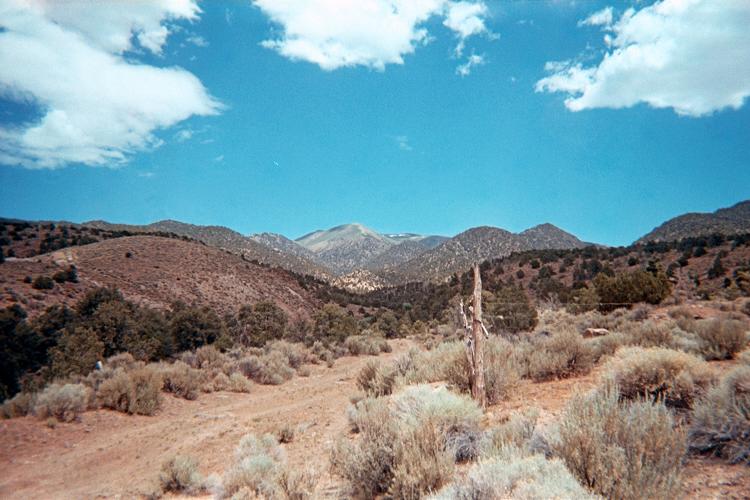
|
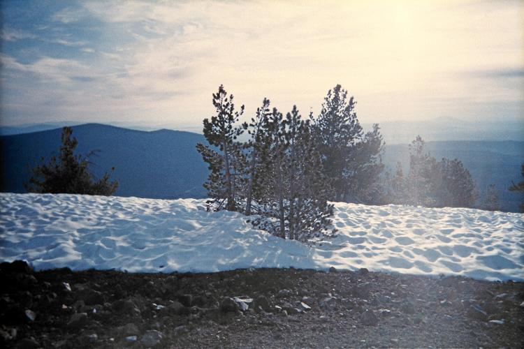
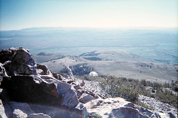
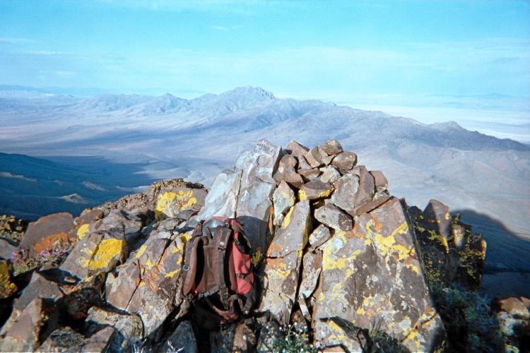
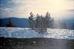
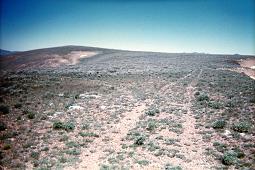
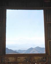
Summit vista from the Jackson Mountains highpoint.
|
Trip Details
Tuesday, June 22 - Dale in Monterey
I visit my brother Dale up the coast, and stay at his home for the night.
He treats me to a fine dinner, and, having arisen at 3 a.m. (to "beat" LA traffic)
I sleep before 9:30 p.m.
Wednesday, June 23 - northern California
My first hint that something is odd with the snow conditions comes when I drive
to the near the trailhead for Bully Choop; and prematurely turn-back at a fallen tree
blocking the approach road as I lack the time for walking from here.
The mountain is still covered in snow - which is unusual
for the end of June.
The following is new, useful Bully Choop information for future efforts.
- It is 25.7 road miles along Route 299 from Interstate-5 in Redding to Buckhorn Summit.
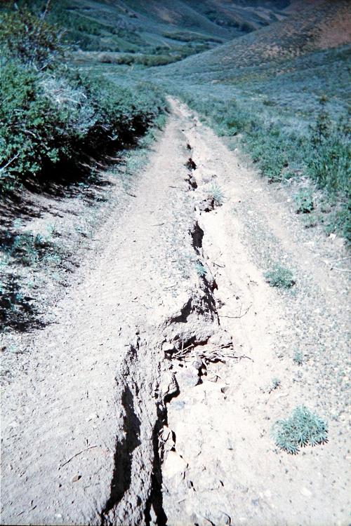
- The first 3 miles off-pavement is quite steep and eroded, gaining perhaps 1,500 feet.
Thereafter the road turns right (south), leveling-off and eventually descending.
- Remain on the ridge at (40.60014° N, 122.70450° W) and at
(40.59538° N, 122.70136° W).
- I turned-back after 8.0 miles off-pavement; and estimate 4 remained to reach
the standard trailhead.
I continue to Goosenest, also on the California Fifty Finest prominence list;
and am forced to camp on the forest road short of the standard trailhead at snow on the road.
The driving approach coming from the northeast, beginning at Us Route 97,
is somewhat involved. I do not recommend it unless you have coordinates available
for several junctions and/or a Forest Service map.
Thursday, June 24 - Goosenest and through Oregon
I walk the road as it switchbacks and gains elevation. The trailhead lies to the
summit's northeast, and the trail is surely hidden in snow. Seeing a direct, south-facing
scree route, I head for its base and then climb steeply for several hundred feet
directly to the summit area.
Back at the vehicle around nine, the day's remainder is spent driving through Oregon
along US Route 97. Eventually I park short of the desired location for
re-visiting the Klickitat County, Washington highpoint. Reason? Snow - and at only
5,150 feet.
|
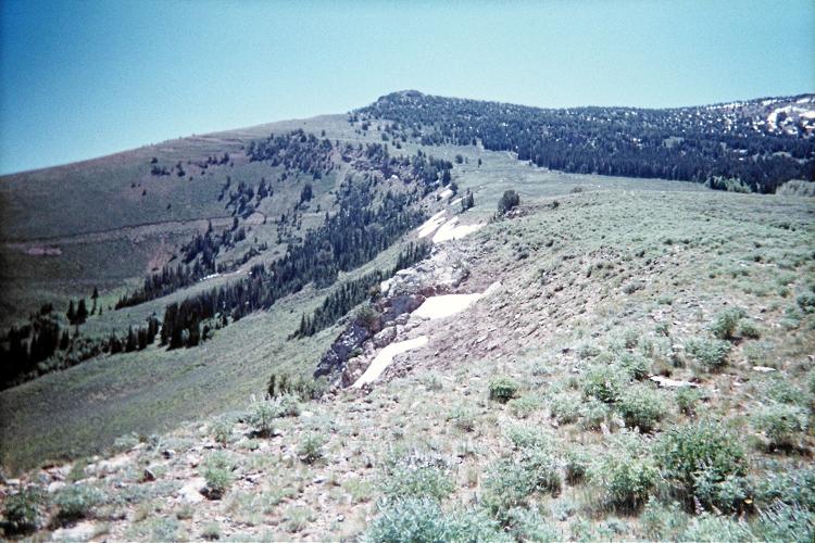
(left) Goosenest route follows the broad, forest-free slope.
(right) A summit view with residual snow.
|
Friday, June 25 - Klickitat County, Washington
I have come again to this county because
highpointers have demonstrated
that a higher area exists which I failed to visit several years ago.
Details of my efforts are described in this trip report.
Finished by late morning, I parallel the Columbia River along Interstate-84,
head through Portland, and eventually park alongside the trailhead for Mount Stone -
the Mason County, Washington highpoint.

|
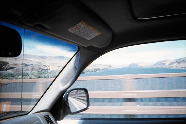
(left) Crossing into Washington at the Columbia River.
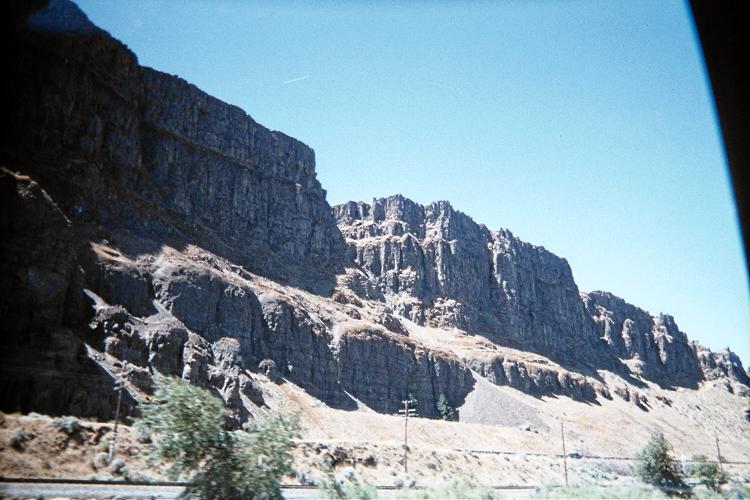
(right) Roadside geology while westbound on Interstate-84.
|
Saturday, June 26 - Mount Stone of Mason County, Washington
I fail to climb Mount Stone owing to Spring snow conditions.
Details of my efforts are described in this trip report.
The Pacific Northwest received little snow by winter followed by a substantially larger amount
in Spring. Then, cool temperatures and cloudy skies has prevented the snow from melting.
Without sun, and higher temperatures, it has not consolidated into a hard surface
that is easy to tread upon.
These conditions are disastrous for my efforts - and those of every climbing friend
I know who lives in Washington.
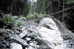
|
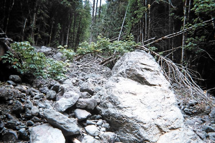
The rock avalanche which formerly prevented
driving clear to the Putvin trailhead.
|
I take a room in Aberdeen along US Route 12, watching the weather forecast carefully.
Sunday, June 27 - day off
I have been driving or hiking 14+ hours every day, and need a day with some time
for doing, well, not much at all.
Neverthless by mid-day I am at the trailhead for the next day's venue.
I arrive in a light drizzle despite sunny skies in Bellevue on the east side of Puget Sound
(as reported by Edward Earl at his Microsoft office).
I play with a new hand calculator as just purchased at Wal-Mart.
More importantly, what will tomorrow's weather bring?
Monday, June 28 - "Wynoochee Point" of Grays Harbor County, Washington
I fail to reach the county highpoint owing to poor weather and soggy footing
due to recently melted snow.
Details of my efforts are described in this trip report.
I drive to Bellevue and stay the night at Edward Earl's apartment.
Greg Slayden comes by, and us three have a nice two hour conversation
about many topics - especially the current snow conditions.
Tuesday, June 29 - Edward's Place
An ascent of Buckner Mountain, as planned with Bob Bolton and Greg Slayden,
would entail poor snow conditions and marginal weather. I cancel this effort,
one set for July 1-3 so as to "beat" the Independence Day crowd for securing a
camping permit within North Cascades National Park.
The day's highlight is lunch with Greg and Edward at the 25th floor Microsoft cafeteria.
I am delighted to find Chinese food, and have a two entrée combination plate,
as tofu and spicy fish, served with fried noodles. Parmesan cheese eclectically adorns
the noodles - and hot sauce enlivens everything in sight.
We discuss continuing issues of
a software project requiring our combined efforts - and related, of course, to peakbagging.
I arrange with Bob Bolton to climb Big Baldy of Valley County, Idaho this coming weekend.
Then I make a phone call to the Hells Canyon Recreation Area - and learn that the approach road
for climbing He and She Devil, an ultra prominence on my itinerary, is still blocked
by a snow drift.
This is devastating news, as it suggests that the cool Spring and heavy snows have effected
Idaho in addition to western Washington.
There is now little I have planned which will not be rendered far more arduous
owing to snow, in-turn because many trailheads will be inaccessible.
Wednesday, June 30 - Gathering Information
The day is spent gathering data to salvage my trip: peaks in northern Nevada that have
at least 4,000 feet of topographic prominence. I fancy "working" on such a list in a few years anyway;
and now it appears that I am going to get an early start. The lower 48 states have 142
P4K peaks, our shorthand for the 4,000+ foot prominence cutoff value. I already have climbed
104 of them - leaving 38. Seven of them are in Nevada, and I decide to climb them as
the balance of my journey.
I enjoy a chicken dinner with Edward, supplemented by a salad, plus numerous apple and
cinnamon-based pastries as I know he enjoys.
Thursday, July 1 - Drive to South Idaho
There are 720 road miles to the Matterhorn trailhead in northeastern Nevada.
I could drive it all today - yet there is no hurry given that the itinerary
has been severely shortened.
I take a room in Mountain Home, Idaho after 540 miles - far enough along so that I
can consider climbing Matterhorn the next day.
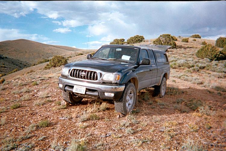
Friday, July 2 - Matterhorn
I arise before dawn and almost race to the trailhead so as to start by mid-morning.
So much caffeine is in me that, once in the general area, I drive across a foot of water
trying to reach the "new" trailhead rather than walk additional distance.
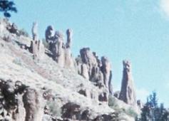
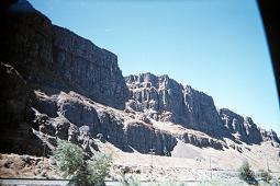
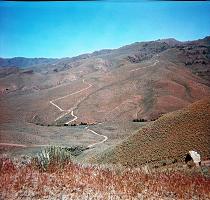
|
Rock formations visible from
the road north of Jarbidge.
|
I begin at 9:43 a.m. and finish roughly 6 3/4 hours later. Rather than drive out
(again, where's the hurry?) I simply retrace the approach road's bad section
and then camp in a dispersed area with a lunch table. I am tired from the over
4,000 feet of elevation gain, much of which entailed steep bushwhacking on a route
never previously described.
Somebody has inexplicably left a pint of pork and beans on the table -
and I use it as the centerpiece of my evening meal. There's a miniscule hole
on top, leading me to suspect that s/he was overly cautious about food poisoning.
If so, then why not just throw the can away? Regardless, it's another example of
the insanely overcautious attitude Americans take to their health and safety -
an attitude that will bankrupt this nation's Social Security program.
To Climb Matterhorn
I provide information that supercedes that posted at summitpost.org .
There is a new trailhead, and, with that, all previous reports are outdated.
Zero odometer at Rogerson, Idaho along US Route 93. Take the road west
out of town, and possibly signed for Jarbidge.
After about ten miles the road narrows to a single lane as it crosses
over a dam, and then resumes its normal width. At 46 miles pavement ends, you turn north
and enter a canyon with a community and stream to the left.
At 50 miles is a key junction (see photograph). Turn left,
noting "Jarbidge 13 miles". Stay left at 53 miles, and enter Nevada at 54 miles.
Jarbidge community is at roughly 63 miles, and the speed limit is a mere 10 m.p.h.
|
Turn left and proceed south when
50 miles beyond Rogerson, Idaho.
|
Continue through town. At the south end note the odometer and travel 1.7 more miles.
Now re-zero the odometer. Distances below are in miles and coordinates use the WGS84 datum.
0.0 The road bears right over a concrete bridge (disregard the
minor track lying straight ahead).
0.1 The road forks: right to Elko, left to the desired (new) trailhead.
(41.84550° N, 115.42886° W) at 6,692 feet.
0.9 Sign warns of a narrow, primitive road.
Those with low clearance and/or 2WD should park at left on grass.
This is 1 mile short of the new trailhead,
(41.83450° N, 115.42534° W) at 6,742 feet.
1.1 Sign warning of "ROAD HAZARD".
1.2 Two stream crossings; not recommended except with 4WD.
1.6 Third stream crossing.
1.9 New trailhead ("No motorized vehicles beyond this point").
(41.82248° N, 115.41564° W) at 6,680 feet.


|
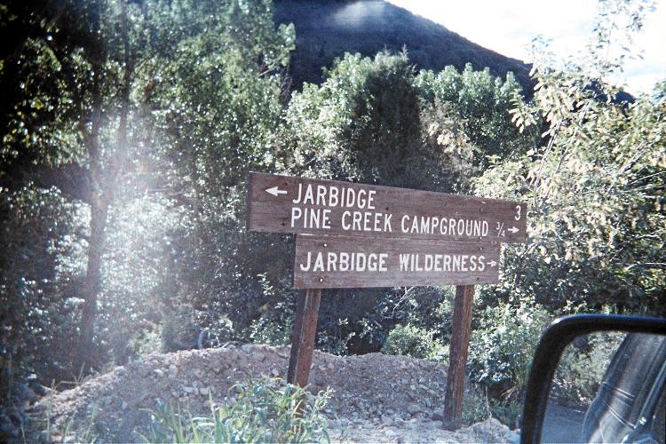
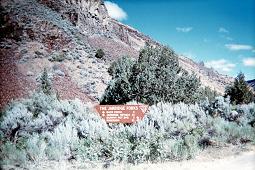
Three signs encountered on the approach
drive when south of Jarbidge.
(left) Sign describes the road leading to Elko (NOT taken to trailhead).
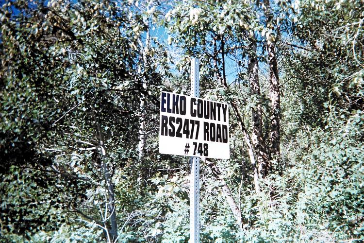
(center) This is the county's designation for the road taken.
(right) Continue south in the direction indicated (right arrows).
|
Walk the road 1/4 mile to a blockade, (41.81966° N, 115.41363° W) at 6,773 feet.
Find a footpath to the left (east) of the blocked road, and zigzag uphill along said path,
one which soon heads south.
A stream crossing is encountered along the footpath after it descends into the main drainage.
The coordinates are (41.81667° N, 115.41252° W) at 6,958 feet.
The former trailhead is soon reached with (41.81596° N, 115.41156° W) at 7,004 feet.
Take the foot path south of the message board and left (east) of the horse path.
If your sole objective is the summit, I recommend avoiding the circuitous route described
in summitpost. Rather, hike south until
this point
where a side drainage is encountered coming from the east.
The coordinates are (41.80691° N, 115.40492° W) at 7,240 feet.
I bushwhacked steeply up the slope delimiting the drainage on its north, passing over
spot elevation 9224
and reaching the main ridge north of Matterhorn.
This route entails, among other aspects, 2000 feet of gain in one kilometer -
roughly a 60% grade. There is much brush below 9,000 feet. To avoid it as much as possible,
climb the talus instead wherever it is available.
As alternative I suggest climbing that ridge delimiting the drainage to its south.
This concept has one approaching the summit from its south. Regardless, the top 100 or
150 vertical feet is steep talus - and looks like the "horn" from which
the peak receives its name.
For those in a whiteout I obtain for the summit (41.81076° N, 115.37427° W) at 10,865 feet.
Net elevation gain from the new trailhead is 4,200 feet. The total gain is 50 feet
more owing to small undulations in getting from the new to the old trailhead.
In addition my route entails 100 more feet for descending / reascending hill 9224 -
making for a 4,350 foot total elevation gain.
Allow 6 to 10 hours for the round-trip depending on your fitness level.
Saturday, July 3 - day off
I arise late, around 7, and reach Jarbidge about 9:30 a.m. There's plenty of time
as I plan to climb the next mountain tomorrow. In Jackpot, Nevada, on the state border,
I have a full breakfast with cheese omelet - plus fresh strawberry cream pie.
By noon I'm in Wells, and set for the short drive followed by a long afternoon.
Rather than just camp at the low clearance trailhead I continue driving one-quarter of
the way to the higher trailhead, parking at 7,150 feet to enjoy a commanding view
of the entire basin to my east from that high ridge.
A relatively fresh cowpie sits on the ground right in-the-way of getting to stuff
near the right passenger seat. So I decide to "hide" it by dropping a heavy rock on top.
It goes SPLAT ... and my shoes and trousers are disgustingly soiled in greenish shit.
I stay calm, and change clothing, outdoors, so that I can wash the mess away with some water.
Later I more carefully emplace stones that I walk upon in order to retreive items
from the passenger side. I do not wish to just move my truck since I am in about the only
spot that is level side-to-side and front-and-back for sleeping.
Apart from this mishap I have a splendid afternoon, and an evening meal featuring much hummus
enjoyed several ways.
Near sunset I awaken to a cow staring at me through the camper shell. A herd has stumbled
downhill to near the vehicle, and I bang pots together, and shout LOUDLY, to scatter them.
Independence Day - Hole-in-the-Mountain Peak
Twice I truly feel that I may fail. The inlet stream to Lizzie's Pond is running full-bore,
owing to snowmelt, and I cannot reasonably step into or jump across it. I cannot get a
"running start" because there's ten foot tall vegetation EVERYWHERE.
Indeed, this is inside the willow and brush-dominated bushwhack
one pursues after leaving the approach road, while bound for Lizzie's Basin.
I climb upslope, only to find steep slabs awash in water and spray that are too slippery.
I climb downslope, only to find no respite to the stream's power. Mind you, this is
all while breaking branches and sweating like a pig. It's AWFUL. I scream to relieve my despair.
Finally I remove my socks and wade across the pond itself. It's not deep, perhaps 18 inches
at most. On the far side I take a well-earned break and contemplate the remaining route.
I had selected a route while at my vehicle yesterday afternoon; and follow it largely
to-the-letter. So I reach 9,500 feet while yet in the basin before traversing to near
the 10,220 foot saddle east of the summit. There are three short snow sections - one steep
enough to plunge-in my axe while kicking steps.
Heading west, I reach a subpeak and note the summit a mere 50 feet higher and perhaps 200 feet away.
However the obvious route across a north-facing slope is all snow with at least a 50 degree angle.
Perhaps 55 degrees is a better estimate. An animal track traverses its width. I refuse
to follow suit: without a rope, if I slip and cannot self-arrest I will die since the
run-out is several hundred feet below.
The only way to summit is a gnarly, narrow rock-based route defining the ridge itself
as it heads due west. On its right edge is the snowfield. On its left edge is a thousand foot
sheer vertical drop into "Oblivia". I climb this route, which to my surprise has
plenty of handholds. With each move I consider whether it is reversible in the sense
that I can later downclimb it. One move in particular concerns me.
When I summit after 4 1/2 hours the time spent is brief. I retrieve the summit register
container and then abandon thoughts of making an entry. Rather, I want to "get over with"
downclimbing that last section until reaching the subpeak - and only THEN enjoy my summit
break with food. The cell phone works!
Once back in the basin I consider how to avoid that bad bushwhack cum stream crossing.
One option is to steer north of the pond rather than going along its south edge.
Another option calls for descending to about 8,800 feet; ascend about 100 feet to gain
the ridge delimiting the basin on its southern aspect; then hike through relatively
benign brush and forest to the approach road's upper terminus.
I choose the latter option - and, remarkably, find a trail to follow from
just before (i.e. north) of the ridge to the approach road itself. With such fortune
my descent consumes just 3 hours, and I recommend that route in the following description.
This afternoon I drive west on Interstate-80 to Elko, thence north on NV-225 and NV-226
to the low-clearance trailhead for McAfee Peak.
|
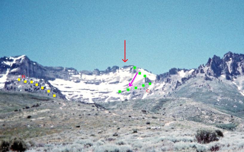
Hole-in-the-Mountain route. Red arrow shows the summit which is barely hidden.
Yellow squares indicate the recommended route to bypass the difficult bushwhack,
and crosses over the ridge at "R", from south to north. "C" is a chute that may be used
in late season to access the 10,220 foot saddle.
My ascent route is outlined in green squares, the descent by a steeply-inclined violet arrow.
|
Hole-in-the-Mountain Peak Route Information
note: Coordinates use the WGS84 datum.
From Wells, Nevada drive south on US Route 93 for 5.25 miles. Turn right onto NV 232 heading west.
After 8.5 miles on this road encounter "USFS Weeks Access" and turn onto that dirt road.
Drive 2.8 miles, through private land, to reach the 6,800 foot
low clearance trailhead.
There is no truly level ground for car-camping here. Do your best. A steep road continues
1.5 miles to 8,300 feet. I drove to 7,150 feet and parked just south on level ground.
I timed a man and woman as they descended this road to my location in a pickup truck.
They consumed 22 minutes for the 1.3 miles - a speed hardly faster than walking.
This is a steep and rough road. I do not recommend driving farther than I did.
To avoid a nasty bushwhack consider the following route for accessing Lizzies Basin.
Hike to the 4WD road's
upper terminus
at (40.94055° N, 115.10009° W), elevation 8,381 feet.
Locate a faint footpath due west as it enters low brush. Take it.
The path will be hard to follow. Here are some intermediate waypoints as it zigzags
to the ridge delimiting the south side of Lizzie's Basin.
- (40.94065° N, 115.10069° W) at 8,446 feet.
- (40.94097° N, 115.10242° W) at 8,554 feet.
- (40.94153° N, 115.10460° W) at 8,858 feet.
The ridge is crossed
at (40.94231° N, 115.10663° W) with elevation 8,994 feet.
Descend (Class 2) into Lizzie's Basin, losing perhaps 150 feet elevation.
That's a small price to pay for avoiding the nasty bushwhack I suffered.
Once in the basin your options are many. Edward Earl took the obvious, moderately steep chute
leading to very near the
10,220 foot saddle.
(It was snowbound when I was there. Hence I reached the saddle area by a completely different route
as I prefer steep talus to steep snow - at least when alone and unroped.)
From there gain 1,000 vertical feet, over one-half mile, traveling nearly due west to the summit.
A side-road heads north from the 4WD approach road at
(40.94056° N, 115.09460° W), elevation 8,185 feet. This takes one to
a bunch of electronic equipment. JUST BEFORE these objects a "trail" leads
generally west along the pond's south edge, taking one through what would otherwise be
a terribly arduous bushwhack. This path begins at
(40.94272° N, 115.09632° W), elevation 8,179 feet.
I found the path difficult to follow, and recommend the above ridge-traversing route
from the road's upper end since any bushwhacking is through two foot brush rather than
ten foot willow trees.
Monday, July 5 - McAfee Peak
This effort is half that of Hole-in-the-Mountain Peak. I use a new route that avoids
any significant elevation loss on the ascent by aiming straight for the main,
north-south ridge at a point where it is monotonically uphill to the summit.
This concept entails taking a 4WD track south as described in the route information below.
I take a room in Elko this evening.

|
(left) McAfee summit view east. Note the microniche harboring
trees and remnant snow on the mid-distance north-facing slope.
(right) The saddle just north of the summit area "three bumps"
features circular tundra - presumably an adaptation to the cold wind.
|
McAfee Peak Route Information
note: Coordinates use the WGS84 datum.
The Summitpost article's distance from Elko is incorrect. It is 57 road miles from Interstate-80 to the
turnoff
from NV-226 onto dirt for getting to the trailhead, using NV Routes 225 and 226. Twenty-five miles
are on NV-225 - the balance on NV-226.

|
Ruts on the 4WD
road taken east.
|
At this turnoff, and while entering Jack Creek, bear left after 0.1 mile
and then stay straight (rather than going left) a few tenths miles later
here.
It is 7.6 miles off-pavement (i.e. from NV-226) to the desired 7,450 foot
low-clearance trailhead.
There is room to car-camp immediately to the right (south) of this bend in the main road.
I encountered several vehicles along this county road - and it is barely wide enough to allow
one vehicle to pull-off while the other one passes. Perhaps my encounters are just because it was
the tail-end of the Independence Day weekend. Regardless, be aware of this issue.
The 4WD road is in bad shape, with (see photograph) foot+ deep ruts down the center in
some sections. Walk the road. As you pass by this
junction
take note that on the return you must bear left.
|
Be certain to hike left
here on the return.
|
Locate a
grassy track
at (41.54575° N, 115.97900° W) and hike south to its
end
at (41.54021° N, 115.98118° W), elevation 8,738 feet.
(These coordinates were measured with GPS unit and do not match coordinates suggested by
reading the topographic chart. I trust my horizontal coordinates more than the map.)
Head exactly southeast cross-country for the main north-south ridge.
A rocky pinnacle is visible in your general direction of travel. It is not on the desired ridge,
which lies farther, and should not be climbed. An intermediate waypoint I saved is
(41.53186° N, 115.97844° W), elevation 9,543 feet.

|
A busy downtown intersection.
Turn right - now heading south.
|
I reached the
ridge
at (41.52826° N, 115.97421° W), elevation 10,154 feet, and just north of spot elevation 10245T.
Walk the ridge south to a trio of bumps. The middle bump is highest. From it one has
nice views of the ridge as it swings southwest, including a summit communications facility.
In that regard, when you first reach the main ridge, note this facility and realize that
you only need hike one-third the distance to it.
Return the ascent route, so avoiding ascending both 9870T and 10005T.
Tuesday, July 6 - day off
This is a transition day from northeast to northwest Nevada. After some initial difficulty
finding US Route 95 north from Winnemucca I was enroute to the first of three more P4000+ summits.
I had some extra information provided by Bob Bolton, in the manner of road junction coordinates,
because I found the existing online information inadequate ("Go over the divide and look to
the left ... that's the road you should be on....").
The Duffer approach drive is seriously steep. My vehicle's automatic transmission fluid temperature
warning indicator goes "on" two-thirds way up that slope - and I stop briefly where nobody should:
a narrow section with major drop-off to one side and with no way for another vehicle to pass.
The engine itself has not overheated. This appears to be more of a computer glitch;
and occurs predictably whenever I am forced to drive a very steep road, uphill, at slow speed.
After 15 minutes I resume driving, and reach a nice carpark in-between the pair
of lakes (reservoirs?) cited as the general trailhead location. I am nearly atop a bluff
at 7,200 feet elevation.
A lazy afternoon is spent, seated in the auto's shade reading a magazine.
I had tried to drive farther south, but that jeep track is simply too muddy in just one spot.
|
View east on the McAfee hike just prior to taking the faint 4WD track heading south.
|
Wednesday, July 7 - Duffer Peak South
The descent is much faster owing to a few navigational decisions on the ascent which
could have been improved upon. Then again the existing information provided no hint
of a better option. The round-trip consumes roughly 5 1/2 hours, including a summit break.
Once back at Denio Junction I fill the tank (only one-fourth is needed), and head for
the Jackson Mountains highpoint using Edward Earl's instructions. Eventually I park
at a large, flat area with elevation 7,250 feet. I explore some abandoned mining buildings
50 feet higher, and suspect that Edward has parked near them based on his report.
I enjoy the late afternoon, have supper, and, as usual, sleep by around nine.
To Climb Duffer Peak
note: Coordinates use the WGS84 datum.
From Denio Junction (which generally has pricey gasoline), drive west on Nevada Route 140
for 10.0 miles to Knott Creek Road. Do NOT turn onto "Knott Creek Road" after 9.4 miles:
this takes you to ranch property without access.
After 9.5 miles of good gravel on Knott Creek Road turn left (east) onto a side road
at (41.7514° N, 118.8422° W). Gridley Lake (which may be entirely dry) is to your west.
Zero the odometer and drive this road while disregarding all side-connections.
After 5.2 miles you top-out at a pass and see for the first time the steep section,
across the valley, and to be taken shortly enough.
Disregard the road leading south, and descend into the valley, reaching this
junction
after losing 600 feet of elevation. Drive north a mere 0.2 mile to a
second junction
and begin the steep drive. Your odometer should read 5.8 miles.
The elevation is 5,300 feet - so if you cannot drive this portion the net gain on-foot will be 4,100 feet.
In the summer a very early start is prudent. Perhaps by late September a trek beginning at this level
will be tolerable.
|
The steep driving approach
to Duffer Peak South.
|
At just under 10 miles you reach another
pass
and get views of Onion Valley Reservoir. Drive south, passing a picnic area, and continue,
now uphill again, as far as the road conditions permit. I parked after 10.2 miles immediately west
of the road, on grass, and near some trees and boulders. From this vantage point the road continues
around the east side of Little Onion Reservoir.
Hike or drive the 4WD road south as it passes a house, turns west and crosses the reservoir's inlet stream,
and then heads south again as it gains elevation for the first time. It ends with a
sign
at (41.66502° N, 118.76088° W), elevation 7,635 feet.
Look northeast and find a trail doing a right ascending traverse of the hill. Take it.
At (41.66669° N, 118.75705° W) and elevation 7,748 feet do not descend to the streambed.
Continue straight, now south or southeast, as the path (evidently once a two-track) enters
forest and then exits into a meadow at
(41.66329° N, 118.75446° W) and elevation 7,822 feet.
The path cannot be followed through the meadow. Set your sights to the east-northeast and start
in that general direction. The path enters sagebrush, and hence may be followed,
at (41.66265° N, 118.75245° W), elevation 7,936 feet.
Another meadow / sagebrush transition occurs
at (41.66324° N, 118.74932° W), elevation 7,891 feet.
An intermediate waypoint within sagebrush lies farther along
at (41.66421° N, 118.74661° W), elevation 7,939 feet.
These coordinates are provided so that you may use
the path as long as possible, despite having lost it within the meadows.
The two-track (apparently) ends
at (41.66732° N, 118.74142° W), elevation 8,018 feet, entering yet another meadow.
During my visit the meadow was waterlogged, and I was compelled to hike its northern perimeter.
I then found a path leading northeast to Outlaw Meadow. Unfortunately I then had to bushwhack
through forest, south, to reach Hidden Meadow with a
pond.
On my descent I decided to avoid that bushwhack and go directly from the pond, west, to the cited
meadow's eastern edge; thence contour around its north perimeter as before due to its sogginess.
Although this is a more direct route, either on ascent or descent, it entails going over a
rock avalanche infested with tree branches - and all buried in the forest between the west edge
of Hidden Meadow and
this meadow.
Regardless, get to the base of the shallow gully southeast of Hidden Meadow,
and climb to its
top
at (41.66283° N, 118.72484° W), elevation 8,527 feet.
Now head south southwest to Bare Pass, continuing to a downed, east-west wire nearly at the
pass itself and at 9,000 feet elevation. The summit ridge is to your west, and Duffer Peak South
is located among the white, cliff-like rocks at your "1:30" position when looking straight towards
the pass (i.e. just west of due south).
You want to head directly for those white rocks since reaching the summit ridge anywhere else
will then entail boulder-hopping along the ridge to reach the highest rock. I attained the ridge
700 feet too far north, and found that dropping-down perhaps 20 feet below the ridge made the
resulting trek less cumbersome.
The final summit push entails Class 3 scrambling for 30-50 vertical feet.
A series of 45° ramps allows for access - and you might have to try one ramp before
finding the correct one leading to the highest rock. To assist in your choice, I obtain
as summit coordinates (41.65766° N, 118.73200° W), elevation 9,437 feet.
Thursday, July 8 - Jackson Mountains Highpoint
Jackson Range highpoint is easy. Less than two hours from the car, I enjoy wonderful summit views,
even spying cows a mere 500 feet lower in a large hanging valley to my southeast.
Surely they are here because of the summer heat.
At only 7:30 a.m. it's too early for a lunch sandwich - yet I do have jalapeño
black bean tortilla chips with a homebrew cream cheese / Hunan chili sauce mix.
It's a most excellent summit siesta, with plenty of time and a cool breeze.
I return to Winnemucca and head for Mount Tobin. Eventually I park at 7,250 feet on
its south ridge - and yet, the next morning, drive to 7,400 feet. I don't need to
shorten the effort more (by getting to 8,000 feet) since I don't plan a peak ascent
for the next day and hence have lots of spare time.
Jackson Mountain Route Information
note: Coordinates use the WGS84 datum.
Get to Nevada Route 140 exactly 25.9 miles from its origin at US Route 95 north of Winnemucca.
Here, turn south onto Bottle Creek Road, zeroing the odometer. Pavement ends at 4 miles.
Disregard all side-roads until encountering Trout Creek Road at 24.9 miles.
Turn right (west) onto that road.
At 35.7 miles reach a 6,038 foot
saddle
with coordinates (41.28842° N, 118.45970° W). Re-zero the odometer.
Turn right (east) onto another dirt road, and take it, initially south but then as it makes
a left ascending traverse, for 3.6 miles to an abandoned set of mine buildings.
At 3.2 miles be sure to go right at a fork. The suggested
trailhead
has coordinates (41.30731° N, 118.42704° W) at 7,300 feet elevation.
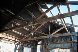
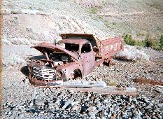
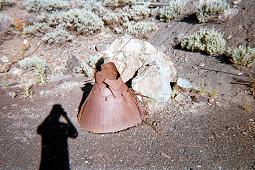
|
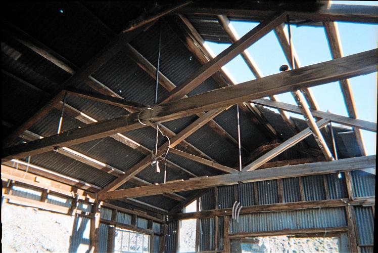
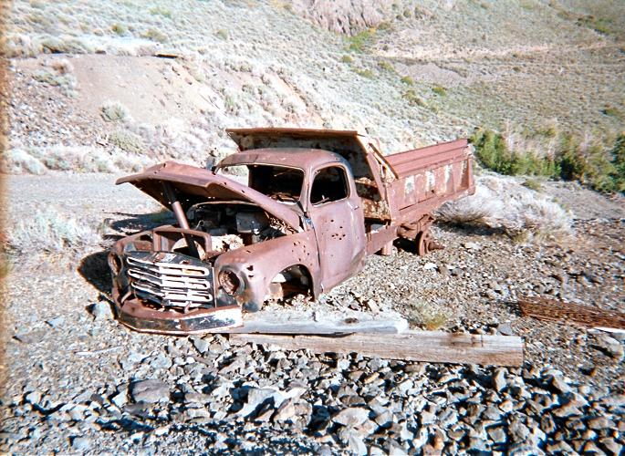
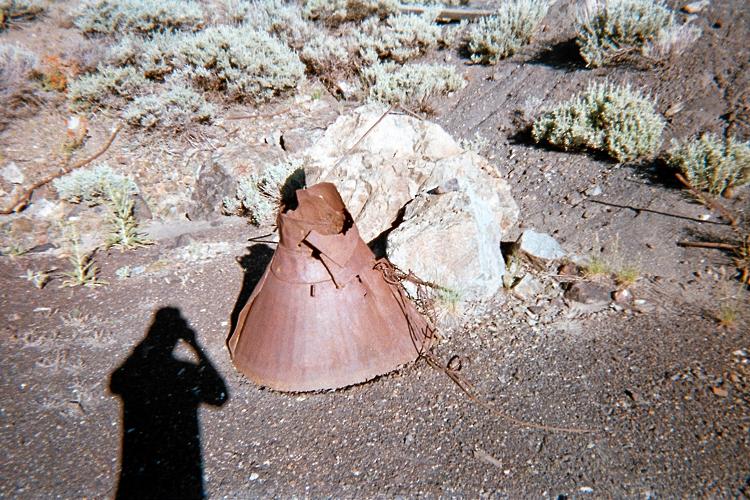
A trio of views at the abandoned mining complex.
(left) The roof supports of one metal building.
(center) An automobile well past its prime.
(right) What's THIS?
|
Options abound at this point. You may drive south, west, and then south again on a
very decent mining road, stopping around 8,000 feet near an old adit, having been blocked
by a boulder on the road. You may (as I did) walk this route, leaving the road grid to climb
the southwest ridge starting just northeast of point 8280T.
Finally, you may climb steeply straight uphill to the summit directly from the cited carpark.
When climbing the southwest ridge, the summit directly ahead is highest,
i.e. potentially higher ground to its right may be disregarded.
|
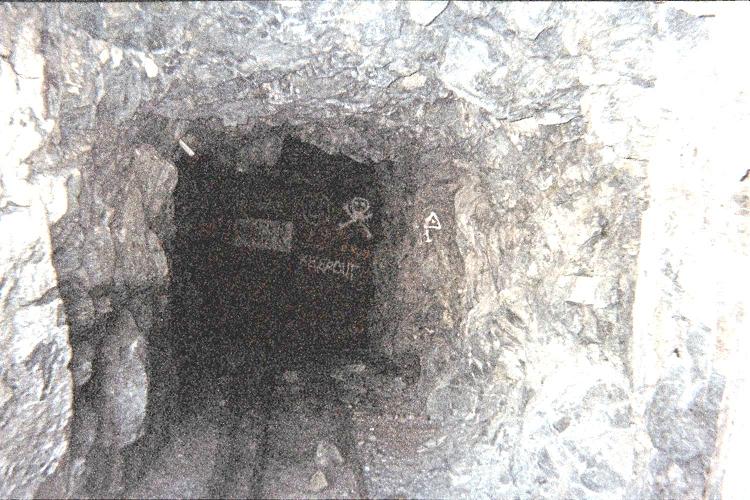
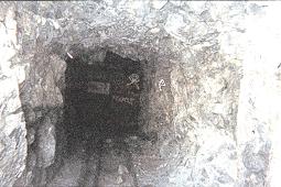
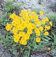
(left) An old adit (horizontal mine entrance) at 8,000 feet.
(center) Wildflowers along the climbing route.
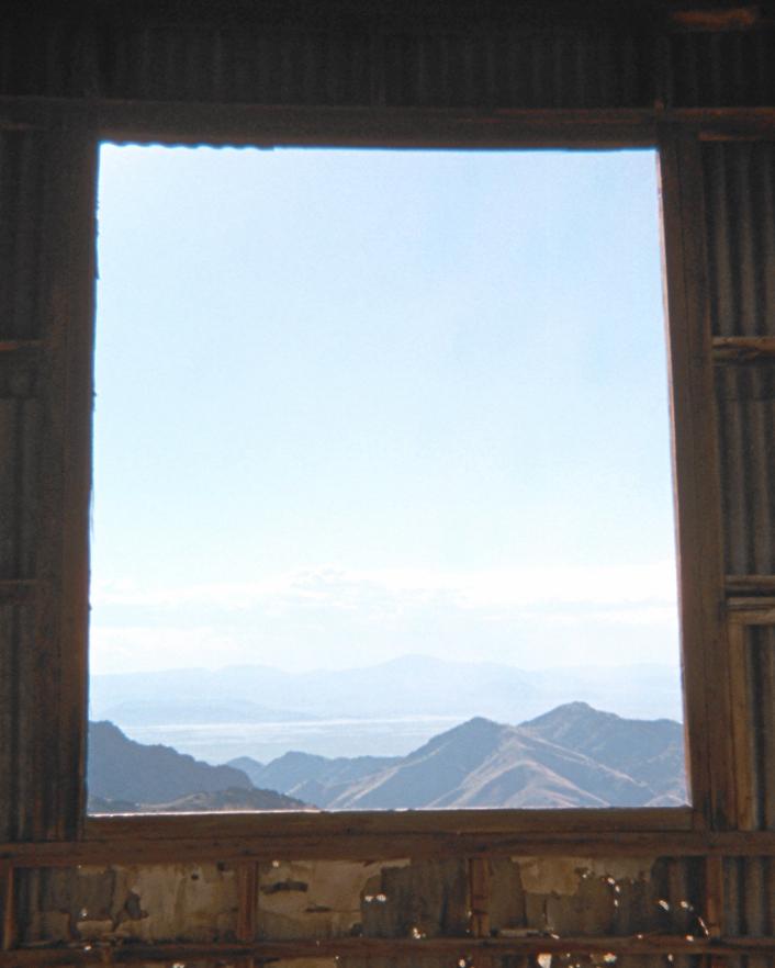
(right) An old window looks west from the Jackson trailhead.
|
Friday, July 9 - Mount Tobin
Yet another relatively simple affair. Walking the south ridge, it is a benign ascent -
one fully enjoyable ... until I see lightning at the summit many miles distant.
The cream cheese / blue cheese onion roll is half-finished as I descend rapidly -
some 800 feet in 15 minutes, holding it in my left hand uneaten.
I take a breather, and continue to the vehicle. Much later I have a room in Winnemucca.
Mount Tobin Route Information
note: Coordinates use the WGS84 datum.
From Winnemucca Blvd. in downtown Winnemucca (the main, east-west street with businesses)
find Hansen Road and take it south, over a bridge, to the first traffic light and thus
Grass Valley Road. From this intersection it is 45.6 miles south, on Grass Valley Road, to the
junction
with Golconda Canyon Road at (40.32640° N, 117.63608° W). Pavement ends at 12.3 miles,
followed by graded gravel for the balance.

|
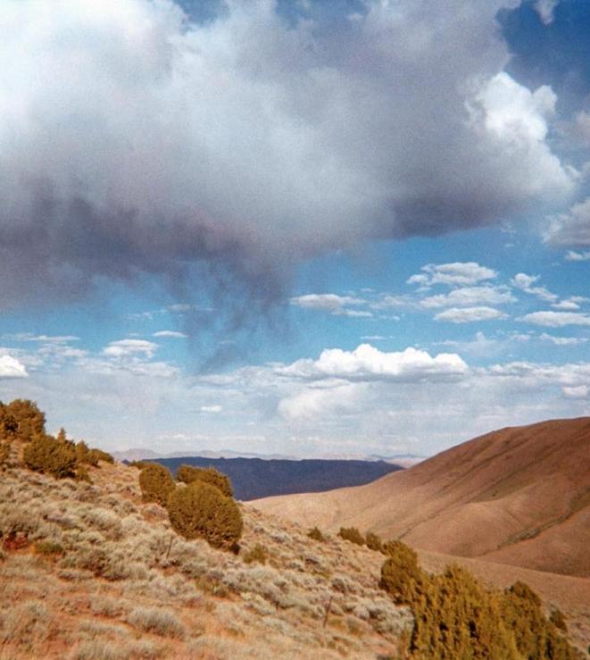
Virga (aborted rainfall)
at the Tobin "trailhead".
|
Zero the odometer and drive 4.6 miles east to a
second junction
at (40.30984° N, 117.56090° W). You will have passed through at least two locked gates,
in close proximity, at roughly the 4 mile mark, one on each side of the Etchegoyhen Ranch.
The first gate has an unusual locking mechanism based on green-painted interconnecting metal bars.
I did not enjoy trying to open it as its construction was completely foreign to myself.
Turn left at the cited junction at 4.6 miles. Continue to 5.2 miles (an additional 0.6 mile)
and then turn right at a
third junction
with coordinates (40.31556° N, 117.55221° W).
Drive an additional 1.6 miles (6.8 miles total) to this
fourth junction
at (40.31818° N, 117.52384° W), elevation 6,340 feet. To your left is a steep track
that you must take. Underpowered vehicles might be stopped here, which is a shame since there
is a lot of reasonably level, decent road ahead.
Two additional gates have been passed, and all of them require opening followed by closure after driving past -
a total of four gates. This burns time and is an undesirable part of getting close.
|
The dashboard's white paper reads,
"USE REVERSE GEAR!" to avoid
driving-off a cliff on exit.
Note the chocked front wheels.
|
Take the steep track, which very shortly mellows-out, and drive 0.4 more mile (7.2 miles total) to the
south ridge
at (40.32194° N, 117.51938° W), elevation 6,660 feet. You will have disregarded a left turn
0.1 mile from the last cited junction.
Drive the ridgeline as far north as desired. I recommend halting at the
base of a hill
with coordinates (40.35518° N, 117.51247° W), elevation 7,980 feet. The hill is too steep for most vehicles -
although an ATV should have no problem with it.
Walk the road as it ascends the hill and then continues north. There is some 150 feet of elevation lost
as the road nears Mount Tobin's final, southeast ridge. The road, now a mere grassy track,
continues slightly farther around Tobin's eastern flank, eventually reaching an estimated 9,100 feet.
I took this track to roughly 8,900 feet, and then ascended the east face in-between the southeast
and east ridges - both of which lead to the summit. This route appears to have less brush but is steeper
than either ridge.
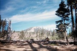
Saturday, July 10 - day off
It's been getting progressively hotter each day. With the next peak's trailhead considerably lower
than other efforts I am concerned about this issue. When arriving at 1 p.m. I seek shelter from
the sun's direct rays, sitting under a tree and reading a chemistry journal. Later I hide under the
truck's growing shadow, listening before supper to the shortwave radio. I pull-in Brazil, China,
Germany, and Cuba - among others.
I set the alarm for 3:55 a.m.: this allows for a five minute "snooze" (if needed), and a 4:45 a.m.
departure - timed so that I head cross-country just as a headlamp is no longer required.
My concern is not for the ascent. Rather, it's the descent by early afternoon.
I pack four quarts of water in addition to a food supply appropriate for the eight hour affair.
|
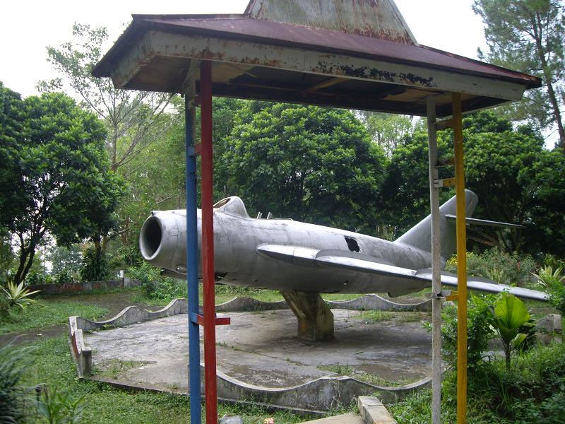
Korean War rivals in two parks half a world apart.
(left) A Soviet Mig-15 in Bambangan, Indonesia
as seen in 2007 the day before climbing Gunung Slamet.
(right) An F-86 Sabre in Winnemucca, Nevada along Route 95.
|
Sunday, July 11 - Mount Augusta
Most goes well in this summit bid - and I "nail" the navigation using a route described by Edward Earl.
However I did not enjoy the traverse (see below) across hill 8,130 feet to reach a saddle to its southwest.
And I did not relish nasty brush (see below) on the north slope of hill 9253 feet.
On reaching the summit it is wonderfully cool and crisp, with a stiff breeze that finds me
seeking shelter on the lee side of a new communications facility.
Four wild horses see me, only 200 feet below, and immediately
run off for lower ground. Then too a prancing member of the deer family also darts off
down the opposite face.
The summit register is falling apart, the paper too brittle to last much longer.
I did read an entry from some man who, in his words, "...took the elevator, AKA helicopter",
to erect a spanking new summit communications system located just 50 feet north.
Annoyed by his entry, I take my own pen (there is no writing implement provided) and write,
"YOU CHEATED - climb, don't fly". Then I take my own paper (with my home glob radius map),
and on the backside write,
"Hello Bob Bolton and Duane Gilliland!"
as I know they will shortly, and independently, be standing here later in the season.
Below 8,000 feet my performance suffers with the day's growing heat. I drink and drink
to keep moving efficiently. Finally I return at 12:51 p.m., 8 hour 7 minutes after leaving.
As with Denio Junction, Middlegate Junction on US Route 50 is just a bar with some gasoline pumps.
I watch as the Spaniards celebrate their victory in the World Cup final match against the Netherlands;
and recall that my brother Dale is there in South Africa taking-in the spectacle firsthand.
After some ice cream and soda I drive south on Nevada Route 361, eventually pass by Boundary Peak,
and take a room in Bishop, California. It is 100° F.
|
Mount Augusta is hidden behind green peak 9253
in this trailhead view up Florence Canyon.
Snowfields lie on the main summit ridge.
|
To Climb Mount Augusta
note: Coordinates use the WGS84 datum.
Zero the odometer 3 miles east of Middlegate Junction at the confluence of US Route 50
and Nevada Route 722.
Travel east and north on US Route 50. At 14.1 miles turn left (west),
signed 3 miles to Alpine. Re-zero the odometer upon leaving the highway.
At 0.8 mile encounter a junction with the Old Overland Road. Turn right (north), and continue
through the Alpine Ranch, driving an additional 1.8 miles (2.6 miles total from the highway) to the
junction
at (39.49735° N, 117.82948° W), elevation 5,380 feet, with a road heading west on your left.
Take the westbound road, driving 1.6 rough miles to a good
parking spot
at (39.50306° N, 117.85769° W), elevation 5,975 feet. From here the net elevation gain
is 4,000 feet. There is a road leading left (south); and a decent parking location is immediately
southwest of where this latter road branches off the taken road.
You are next to a wire fence and 68 road miles from the US Route 95 / Route 50
junction in Fallon, Nevada. Contemplate your isolation at night when the only evidence
of humanity is the rare white or red automotive light along Route 50 many miles northeast.
Now on foot, and perhaps still before sunrise, enter Florence Canyon by hiking the road northwest.
In about seven minutes encounter a
side road
at (39.50554° N, 117.86316° W), elevation 6,068 feet. Turn right (northeast), and hike the road to
here
at (39.50617° N, 117.86316° W), elevation 6,146 feet, where it ends just west of a
6,160+ foot hill.
The real work begins. Your task is to climb northwest on the obvious ridge for over 3,000 vertical feet
until gaining the main, north-south ridge just 500 feet beneath the summit. You will pass over
hills of elevation 6,560+, 7,562, 8,130, 8,200+, 8,522, roughly 8,700, and 9,253 feet.
However one may avoid climbing hill 8,130 feet by traversing on its south aspect. To this end I
left the ridge
at (39.52575° N, 117.88387° W), elevation 7,920 feet; and aimed for this
saddle
at (39.52841° N, 117.88838° W), elevation 7,960 feet.
There is an 8,680 foot
saddle
at (39.53195° N, 117.90308° W). Once there it is tempting to bypass hill 9,253 by contouring around
its northern slopes. I found the brush quite annoying, and, on the descent, simply climbed about
100 feet, went over the top of hill 9253, and then descended northeast to the indicated saddle.
"Hill 8700" has some 20 feet of prominence immediately east of this saddle - so allowing one to
zero-in on where to head on the descent.
One reaches the
summit ridge
at (39.53294° N, 117.91532° W) with approximately 9,500 feet of elevation.
Rather than continue to the very ridgeline, one can save some vertical gain by heading directly north,
paralleling the actual ridge just to its east.
A use-trail meanders north to the summit area. On nearing the top, stay to the left (west)
of the actual ridgeline: the latter is very pinnacled and guaranteed to slow your progress.
I obtain for the summit (39.53997° N, 117.91950° W) at 9,968 feet.
The necessary additional elevation gain is 300 feet, and arises mainly from the reascents
of hills 8700, 8522, and 7562T. Thus the total elevation gain is 4,300 feet - to which one may add
200 feet if going over hill 9253 in both directions, and 300 additional feet if failing to make the
recommended traverse of hill 8130T.
I accidentally went 100 feet above the desired saddle on the latter traverse, on the ascent;
and climbed (intentionally) hill 9253 on the descent alone. Hence my total gain was 4,500 feet.
Andy Martin: Please take note of the recommended traverses to avoid elevation gain.
Monday, July 12 - Fiftieth Birthday and Drive Home
I begin with a birthday breakfast featuring Eggs Benedict at the locally recommended eatery.
A slice of pecan pie is enjoyed with coffee; and on learning it's my half century mark,
the waitress and much of the staff presents me with a cupcake enrobed in icing and with
a single birthday candle atop. I have ice cream, and wash everything down with either
three or four mugs of coffee. I am stuffed.
I'm home by around 2:30 p.m. After checking mail and the home's "intactness",
I buy a 1.5 liter carton of coffee fudge brownie ice cream (half gallons are no longer sold),
a pan of brownies, and a bottle of macadamia nut liqueur.
Such are the interdependent components of my evening celebration.
Summary
Did I accomplish my intended goals? NO. Was the trip a success? Maybe.
All I know is that I did my best to transform a disaster into something with the
semblance of a positive outcome.
My pickup truck's odometer read "115,866" on trip commencement;
and "120,238" on conclusion - a total of 4,372 "Adam truck miles"
which appear to be roughly one-hundredth larger than normal, statute miles.
An interesting coincidence of camping / trailhead elevations exists for the Nevada-based efforts.
All of them except for Mount Augusta are roughly 7,000 feet: Matterhorn 6,700;
Hole-in-the-Mountain 7,150; McAfee 7,450; Duffer 7,200; Jackson 7,250; Tobin 7,250 and 7,400 feet.
I cannot rationalize this other than noting that a 2,000 foot elevation would not be an
appropriate summer venue in the first place; and that a 10,000 foot start would
result in little effort (except for Wheeler Peak which has such a high trailhead).
I intend that the next county highpointing trip, set for August, be considerably
more successful - and as I attempt to complete the Montana county highpoint list.