Nevada Prominences Spring 2013 Trip Report
© May 2013 Adam Helman

Note 1: All coordinates use the WGS84 datum.
Note 2: Photographs are by the author except where indicated.
Note 3: Mouse-click nearly all images for detail.
Dynamic Trip Map

Background

Historically my off-season prominence trips have included 4 or 5 mountain climbs. With ever-rising gasoline prices I include more peaks - and pursue a single rather than multiple outings. The orginal concept was to bag 8 2,000+ foot prominence summits with Bob Packard a month later in the season than last year's efforts.

Somehow that idea grew into a dozen peaks on Bob's immediate wishlist. I then see an opportunity - if I forego Pilot Peak and Lone Mountain, which he's already done, I can save a lot of money by flying to Las Vegas and driving as his passenger. This is the final plan, and yet modified by inviting other peakbaggers with their unique set of constraints and peaks-yet-unvisited.

Thus Richard Carey joins us for two-thirds of the journey, Andy Martin and wife Sarah for the final third, and John Hamann for just one effort - Kawich Peak with its roughly 40 miles of isolation distance to higher ground.

Denali is coming in June. To provide some physical training I carry the majority of Bob's pack weight (his food and water) in a new overnight backpack in addition to my own items. This action also lowers our round trip times by a minor yet significant amount. I also "pretend" to be in a tent every morning, rather than Bob's camper, performing the majority of actions required while on the Kahiltna glacier upon arising. This includes dressing while still in my sleeping bag, taking anti-virus pills to avoid a herpes labialis outbreak (due to sun exposure on snow at high elevation) and applying plenty of suncreen.

The exact trip dates are refined such that Andy's portion comes right upon conclusion of contract work. Thereby I fly April 22 and return May 7. Richard Carey, invited later, will simply have to abide by these preset constraints; while John Hamann, flying to Nevada, severely constrains the itinerary by forcing Kawich Peak to be climbed on specifically Saturday, May 4.

Trip Details

Monday, April 22 - to Nevada; Highland and Wilson

I take the earliest of several Southwest Airlines flights to Las Vegas to maximize our chances of doing both Highland Peak and Mount Wilson today - a feasible proposition as they are both drive-ups. This plan works perfectly, with Bob getting a pair of new 2,000+ foot prominences. Only Wilson is new to me, having hiked the final 1,400 feet of Highland on my birthday last summer.

Highland summit
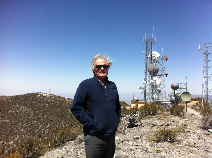
Bob atop Highland Peak.

The Highland Peak approach barely allows vehicular passage, with snowbanks having just recently disappeared from certain bends in the road. It's a satisfying indication of good strategic planning - late enough in the season to avoid snow while early enough to avoid growing heat.

The Mount Wilson approach is nearly as remarkable a drive. We visit both the main 9,315 foot summit and the 9,306 foot southeastern summit.

As per an Email message Richard Carey is to meet us around 3 p.m. along the approach road's junction with U.S. Route 93. We left a cardboard sign alerting him to our presence, and return after driving Wilson around 3:30 p.m.

Where is Richard?

With a signal I leave multiple voicemail messages. By 5:30 p.m. it's clear Richard is not going to appear, and we camp in-place since there's only a 30 or 40 mile drive to next day's trailhead - leaving plenty of time for that effort and reaching the next trailhead by afternoon.

Wilson summit VOR
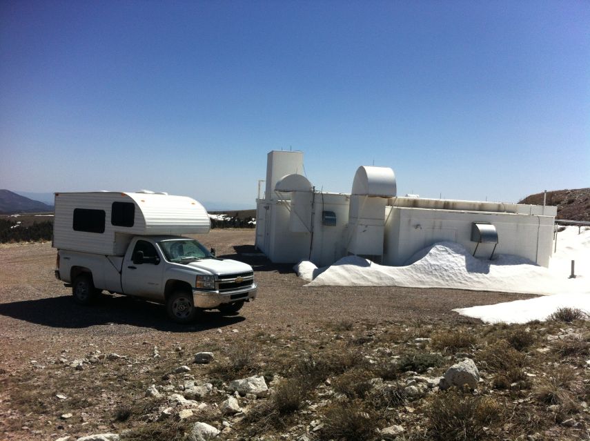
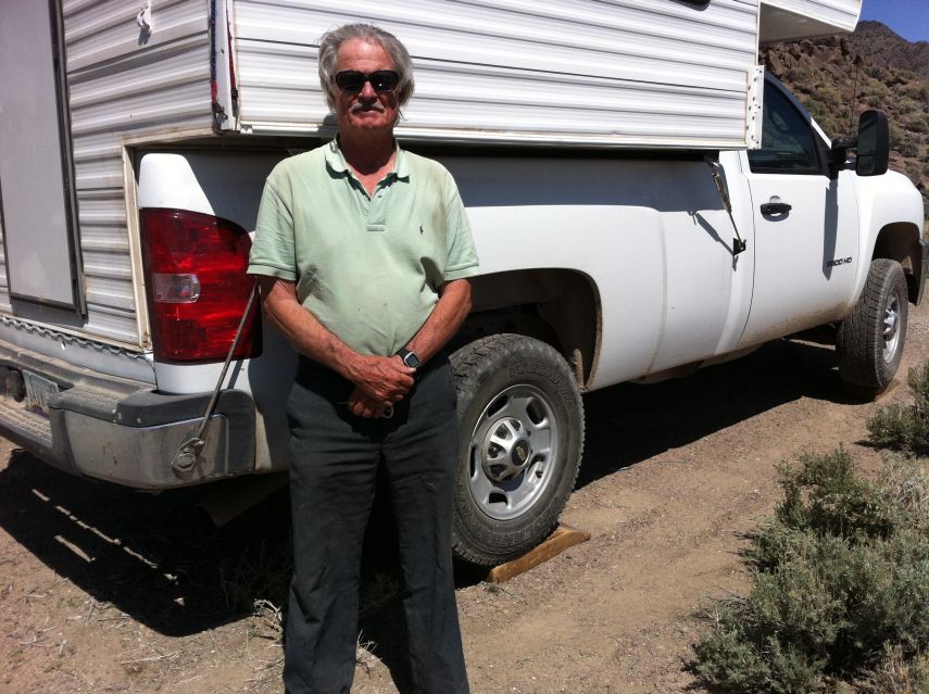
Bob's vehicle near
Mount Wilson's main summit.
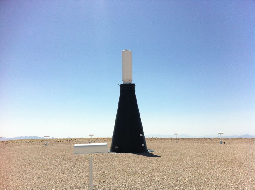
Mount Wilson navigational beacon

Tuesday, April 23 - Dutch John Mountain

We drive early, Bob agreeing to eat breakfast after reaching our trailhead. Here I feel it prudent to consume carbohydrates just before hiking uphill rather than before sitting on one's behind and riding. Thereby the meal's main function, providing energy, is optimally applied. Bob feels that leaving an hour to digest the food is better - and I agree provided the meal is sufficiently large and/or laden with protein and fat. Neither considerations apply to my steaming pot of fruit-and-cream oatmeal.

Richard is at our "trailhead"!

Dutch John
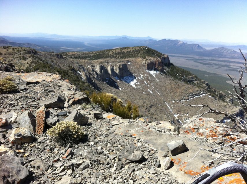
Looking back at our route
from Dutch John's summit.

Evidently he failed to read the entirety of my (typically verbose) Email wherein I specifically write of meeting at the Mount Wilson road / Route 93 junction. He waited for us at the junction of Route 93 and the Dutch John Mountain approach road.

It's surprisingly nippy even an hour after sunrise. Indeed, Richard's camper thermometer read 32° F. this morning.

We get going soon enough - and select a route based largely on Dennis Poulin's GPS track posted at peakbagger.com . Progress is followed by a set of waypoints uploaded into my GPS device. I call out elevations and distances to them as a form of encouragement.

By mid-day we return to our vehicles. Grassy Mountain is highly convenient. However as an "error range" prominence with an interpolated value under 2,000 feet I have little interest in it, and would protest bagging it only to sacrifice a true P2K summit later on for lack of time. Then too Richard just climbed Grassy. So Bob agrees to bypass this opportunity.

By all of 3 p.m. we arrive at the last reasonable place to camp for tomorrow's effort. As with many of our days a lengthy, lazy late afternoon follows prior to supper and an early bedtime just after sundown - about 8 p.m.

Wednesday, April 24 - Silver benchmark; illness

Upon reaching the obvious saddle we locate an ATV track heading due east. It then curves to the north (counterclockwise), heading ideally to near the base of a ridge we take to the summit. It's a significant time-saver.

Bob, food
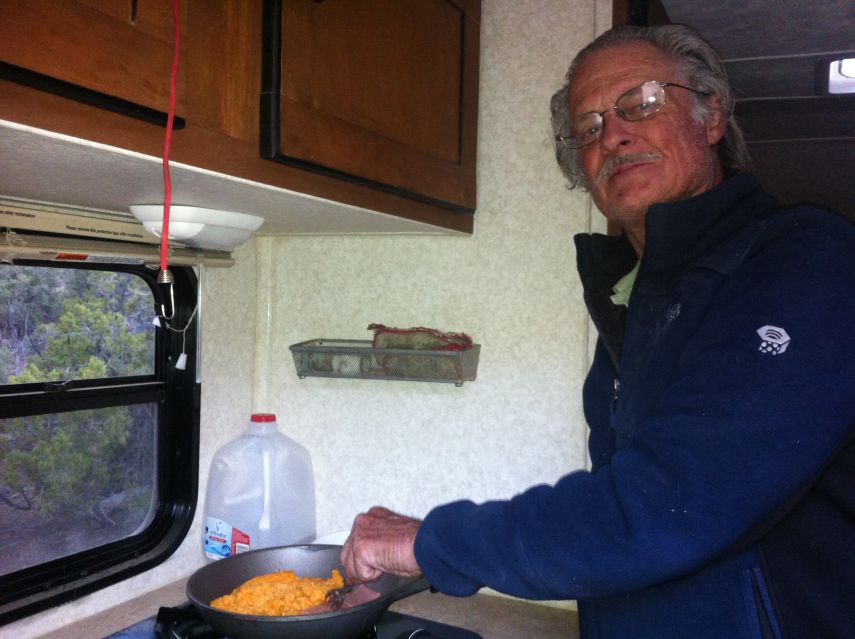
Bob prepares SPAM and eggs.

I've brought an assortment of Pepperidge Farm cookies - including oatmeal raisin, milk chocolate toffee almond, dark chocolate pecan, fudge brownie and more. It's vastly more tasty having them with a pint of milk, rather than water, as prepared the previous afternoon in Bob's camper. Along with raisins and cashews they are my snack food for the entire trip.

In addition I have 6 bagels for summits, enjoyed with kosher beef salami, smoked turkey, Stilton (a variety of blue cheese) and triple creme Brie.

We head out in early afternoon, and drive south on Nevada Route 318 to a "trailhead" for the next day's venue. Suddenly I feel lethargic and decide to sleep for 2 hours across the front seats. Then at suppertime I force myself to eat the pasta - and have little appetite for dessert. I sleep immediately on lying down. Something is wrong.

Thursday, April 25 - Seaman Range highpoint

At 5:30 a.m. I sit erect and consider whether it's reasonable to climb for several hours given how I feel. Slumping back into my bag I decide to forego today's peak. My pulse is unusually high and I feel very groggy despite 9 or 10 hours of sleep. Bob and Richard go without me.

paperwork
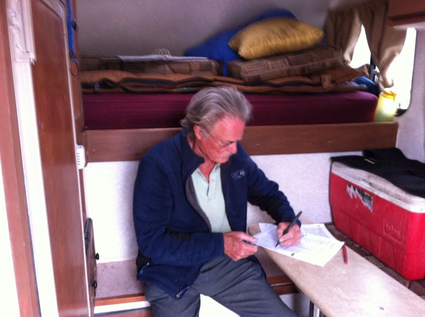
Bob does paperwork to
document his efforts.

I sleep until 10 a.m., some 14 1/2 hours! Finally I feel decent enough to get out of bed and eat some breakfast. I open a book loaned by Richard, "Top Secret America", about all the government facilities that are off-limits to the public. It's a fascinating read, and I eventually finish the book on this trip to fill-in downtime.

Bob and Richard return, citing 6.9 hours round-trip and difficult route conditions.

The original plan was to take an entire day-off for driving to the western set of peaks. However Rawhide Mountain lies along our route, and if done tomorrow will "save" a day while synchronizing our efforts with Andy Martin who has already been there. Thereby we drive up Crystal Canyon, along a marginal quality road, and park at an obvious 7,800 foot saddle - positioning us perfectly for a short effort the next morning.

I either had contracted an illness from Bob (who cited stomach problems immediately before meeting me as "given" to him by grandchildren); or suffered from a severe case of caffeine withdrawal as I have abstained from coffee since the trip started. I will never know the truth.

Friday, April 26 - Rawhide Mountain; Pilot Peak

bizarre geology
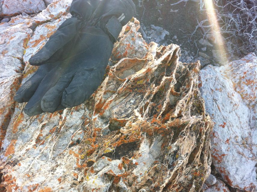
Unusual rock texture at Rawhide
Mountain; orange lichens.

We have just 1,300 feet of elevation gain. A continuation of our road takes us to the northwest ridge, whence an obvious route allows summiting soon after 8 a.m. An old, abandoned miner's camp is passed about 400 feet below the top, including a rusted bed frame!

There's plenty of time - and after passing through Tonopah realize my concept of driving up Pilot Peak in Richard's vehicle while Bob waits below. We climb 4,700 feet over 9.8 road miles and 48 minutes. Although Richard cannot recall if he's done this peak, all doubts are laid to rest after I hold high his signature double red can register! Examination reveals he placed it 15 years ago - and he now signs-in for yet a second time. Richard gets twenty dollars

Back on the highway we pass through the small Mina community and negotiate the long approach for our next day's venue, parking at the same 7,600 foot saddle described in Dennis Poulin's peakbagger.com trip report.

Saturday, April 27 - Garfield Hills highpoint

Bob at Garfield
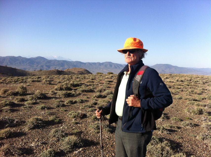
Bob atop a Garfield Range subpeak
with Boundary-Montgomery
massif in the distance.

This is yet another short affair. Passing over three hills heading southeast, I get a strong cell phone signal on the second bump! Here I talk to mother and photograph Bob and Richard with Boundary Peak, Nevada's highpoint, as background.

Back down around 9:30 a.m. we caravan to Mina where Richard goes his own way for two days, having done both Mount Ferguson and Miller Mountain. He will keep busy with a set of 5 peaks planned using his laptop computer.

Bob and I drive north, and park along the east-west riverbed where the route becomes too narrow for vehicular passage. Remarkably there is a passenger car parked here, and, with a DeLorme Atlas on the front seats we surmise a peakbagger is on the mountain and will return soon enough.

True to expectation, Bill Peters appears, having driven from California for a jam-packed weekend of prominence bagging. After sharing some fresh pineapple with Bill we re-park in his vacated space and settle-in for yet another long afternoon followed by supper. The entire pineapple was part of my checked luggage, sitting double-plastic-wrapped in my overnight pack's top compartment.

Sunday, April 28 - Mount Ferguson

lunch
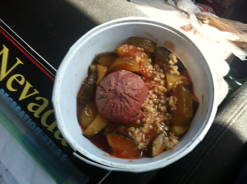
Lunch food as car passenger -
zucchini with tomato, garlic, salami.

Another 5 hour-ish effort. No problems, and especially as the weather continues to cooperate. We return to pavement and head south for Miller Mountain by early afternoon. It's approach drive is thankfully short at just 2.4 miles off-pavement. The Boundary-Montgomery Peak massif is quite near, and we also have views of the Sierra Nevada.

Around 4 p.m. a vehicle approaches - it's Bill again! He's intent on climbing Miller in the 4 hours before sunset, and sets off up the gully soon enough. I loan him a printed map - he is only using files uploaded to his smartphone for navigation. I feel that's a disaster just waiting to happen: what if the phone should fail for any of multiple reasons? Hard copy should always be available.

Important Mount Ferguson Information

If your driving approach is from the south, the final section is a sandy, dirt track taken west along a riverbed until it's no longer feasible. We parked at (38.62993° N, 118.15955° W), 1.26 air miles prior (east) of the trailhead cited by Dennis Poulin. Beyond this point the "road" remains broad enough for an ATV.

Monday, April 29 - Miller Mountain

Bob and wood blocks
Sometimes Bob places wood blocks
for completely level camping.

We take Dennis Poulin's route from the southwest as described in his peakbagger.com report. Navigation is easy apart from this caveat - one leaves the gully (whence heading north for the peak), at a most specific location (see below for details).

Bob and I drive east some 60 miles to Tonopah where Bob spends some two hours in a casino's bar, using his laptop computer, researching possible P300 foot summits to hike while Richard and I climb Lone Mountain. Meanwhile I enjoy a pint of Haagen-Dazs black cherry amaretto gelato with a shot of amaretto liqueur from the bar - and an almond chocolate bar. In truth it's only 14 fluid ounces, rather than the 16 ounces of a pint, presumably some cost-cutting measure on the manufacturer's part which I protest.

By 4 p.m. we return west 13 miles to meet Richard at a highway rest stop. From there we caravan east 3 miles and then leave pavement for the Lone Mountain approach drive, parking nearly at the desired location as a compromise between our goal's needs and Bob who has already climbed it.

Important Miller Mountain Information

Montgomery
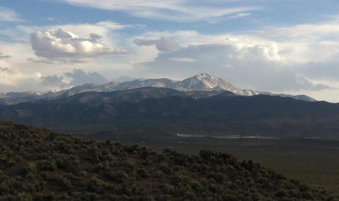
Montgomery with Boundary Peak
accented with cloud and shadow.

The route described by Dennis Poulin eventually leaves a gully at roughly 7,600 feet. I recommend exiting the gully at (38.05451° N, 118.19886° W) and elevation 7,700 feet, thence heading almost due north up and over an 8,160+ foot subpeak on the 1:24,000 scale chart. This exit point is immediately (100 or 200 yards) north of a sharp turn in the gully from west to east as it ascends. The subpeak, of minimal prominence, is represented only by a change in contour spacing 500 feet southeast of the red "4" identifying a one-mile square section.

Tuesday, April 30 - Lone Mountain

Adam
Adam at Lone Mountain
(Richard Carey photo).

Richard and I finish the drive and start before 7 a.m. upcanyon. The going is reasonable, yet we somehow have taken the wrong side-canyon as demonstrated by GPS units compared with the desired track. We are 1,000 feet east of an 8,000 foot elevation waypoint in my device - and to get there we steeply climb the intervening ridge and sidehill into the proper drainage.

Back on-track we ascend to roughly 8,500 feet and exit the gully to its upper left bound directly for the top. It's windy there, and we huddle outside the windbreak's leeward perimeter. With some 3,800 feet of prominence views are spectacular. A question regarding Richard's total P2000 count is settled by reaching peakbagger.com with my smartphone and consulting the relevant Front Runner List. Our proximity to Tonopah likely explains the non-negligible cellular phone network signal.

On the descent we find our error - at 7,400 feet the canyon branches, and we took, understandably, the broader left fork as viewed looking uphill. The correct choice is to take the narrower, right fork.

We drive to the camping road junction where Bob has already returned from his P300 effort, having walked directly from there. Now we drive back to a key road junction where I spend a lazy afternoon while Bob and Richard drive in Richard's vehicle for yet another P300 summit.

Finally we caravan to pavement - only to leave it again and camp underneath a pair of P300 summits that both Bob and Richard will hike by morning.

A tall solar energy collecting tower has been constructed several miles northwest of Tonopah. It is very conspicuous from the highway, Lone Mountain's summit, and, to its southwest, from atop the San Antonio Mountains highpoint. Based on its apparent (angular) size and estimated distance the tower might be 400 or 500 feet tall.

Important Lone Mountain Information

The route described by Dennis Poulin ascends Springdale Canyon as it heads west and then southwest. This canyon forks at approximately (38.03141° N, 117.48548° W) with 7,400 feet elevation. Take the right, narrower fork as you ascend.

Wednesday, May 1 - Meeting Andy; Prominence-Lovers Rendevous

Bob and Richard take 3 hours for the pair of nearby summits, returning around 10 a.m. We then caravan into Tonopah where Bob performs more peak research in the casino's bar. Richard finds the loud television and smoke from bar patrons highly offensive and does Email in the embedded restaurant.

I have no research to perform and decide to relax as we await Andy's 4 p.m. arrival from Tucson. Soon I find myself purchasing from Scolani's supermarket a 4-pack of Zinfandel wine bottles (6 ounces each), and pour the contents of 2 bottles into an unlabeled plastic water bottle. I then join Richard at his booth and enjoy them with a fudge brownie cookie over the span of nearly 1 1/2 hours.

With plenty of time and a decent menu we eat lunch here around 12:30 p.m. I have the fried chicken dinner, substituting the bread in favor of a salad ("ranch" dressing). As we conclude eating a large group of tourists arrive, swamping the staff. I forego the chocolate brownie sundae dessert, figuring that it will now take way too long for it to arrive while Bob and Richard wait.

Andy and Sarah arrive early around 3:20 p.m. We caravan in three vehicles to the desired trailhead, yet are stopped short, annoyingly I must admit, by the relative inadequacy of Andy's low clearance Honda Accord. It upsets me because we have the time, now, to drive farther - while completing the drive next morning forces me to eat breakfast before driving rather than before exercising. I decide to eat my oatmeal cold at the trailhead rather than suffer that fate.

Suddenly two pickup trucks descend into our riverbed, coming from the peak's direction. Lo-and-behold Dean Molen and Dennis Poulin arrive - two prominencians high in the P2000 foot rankings! We have an extended conversation lasting quite some some. They decide to camp here rather than drive onwards, and so after people eat their suppers the dialogue continues clear until sunset. (I have cream of mushroom soup with a reserved piece of fried chicken.) Between the six of us (all but Sarah) we have some 3,600 P2000 foot prominence efforts to our credit - a remarkable 600 peak average.

convention
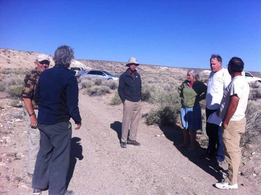
From viewer's left - Dean Molen (facing camera), Bob Packard, Richard Carey (center),
Sarah Martin, Andy Martin and Dennis Poulin (facing away).

Thursday, May 2 - San Antonio Mountains highpoint

It is surprisingly cold and windy at our chosen parking location, in fact, very uncomfortable. As I hurriedly eat cold, uncooked oatmeal with added dry milk powder and water the group begins walking.

It's a relatively short effort. I arrive first, discovering that the highest ground is 200 feet west of the benchmark's location - a significant fact for full peak credit.

By 10 a.m. we're back at the two vehicles (the Accord remains at camp). Bob hikes a P300 summit as I change, setting to dry my innermost clothes which have typically become full of sweat. Soon we are in Tonopah for topping-off our tanks since the next portion of our journey has no services whatsoever.

We drive east on Route 6 and then south on Nevada Route 375 - the "Extraterrestrial Highway". Satellite imagery reveals a faint track that can be hiked in the morning from a car camp 3 miles from our goal's base. However we investigate a perfectly driveable road that even Andy's vehicle can negotiate. Thereby we find ourselves at road's end, having eliminated 1,300 feet of elevation gain and over 6 miles of distance for tomorrow's effort. It's a windfall that pleases everybody.

Important San Antonio Mountains highpoint Information

Highest ground is some 200 feet west northwest of a tiny, 8,520+ foot contour on the 1:24,000 chart.

Friday, May 3 - Reveille Peak

There is no published route to assist. However visual inspection suggests we head essentially due east. After traversing a few gullies we pass between a pair of obvious rock pinnacles after 200 vertical feet. Now we are in a basin, and aim, eventually, directly for the summit rather than head southeast to the ridgeline. Although there are some differing opinions how to proceed, Richard and I serendipitously meet Bob 500 feet below the top - and then Andy with Sarah. We summit after two hours and spend a good time at the peak, some 45 minutes.

air mattress
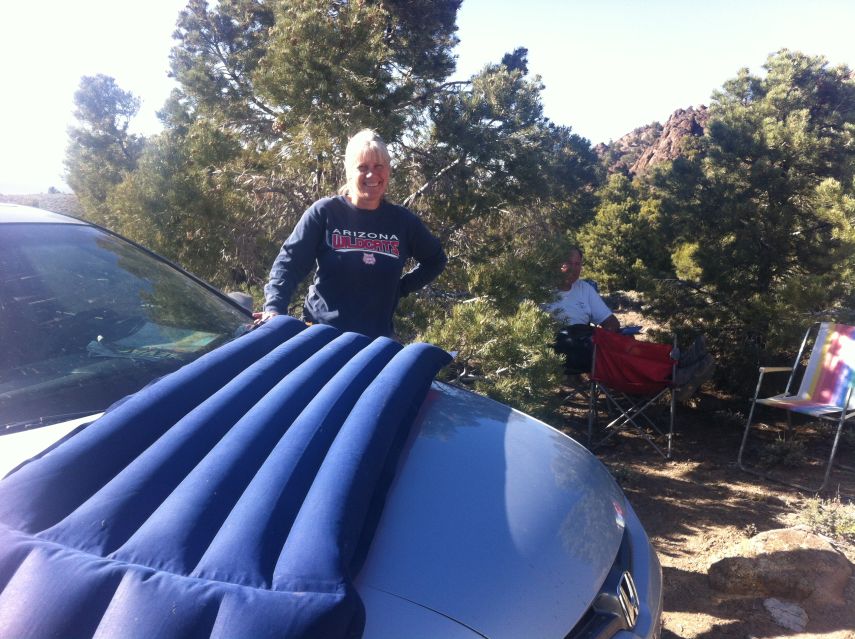
Sarah inflates a mattress
for tent camping while Andy
reads in the shade.

On the descent Bob and I take a different route than the others. Everybody returns by around 11 a.m. Now we have a huge amount of time - and the only necessity is getting to the next mountain's starting point a mere 15 or 20 miles away.

After caravaning to the "main" dirt road Richard drives home, citing a need for being there by Saturday evening. Andy wants to try specifically a western approach for Kawich Peak while I am convinced there is little advantage to such a route. Worse, it adds dozens of driving miles when we already have to be careful with limited gasoline. Thereby Bob and I drive to a pre-agreed junction to meet John Hamann who presumably has flown to Las Vegas yesterday.

cactus patch
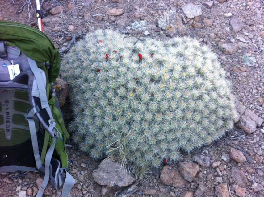
A round cactus patch along
the Reveille Peak route.

Although we agreed to 5 p.m. John arrives around 1:30 p.m. - and after a brief conversation (I am finishing lunch) we caravan to a reasonable parking location for his rental car. From there we all drive in Bob's cab, using a route involving a steep 300 feet of elevation loss - and some low-lying branches that were sawed-off so Bob's camper could pass underneath.

For the return drive, late tomorrow, we agree to use the alternative road which is downhill the entire distance.

We park at a 7,600 foot junction, prepared to hike west by morning up a shallow drainage. A deteriorated road continues west yet is unsuitable for Bob's vehicle. An extended conversation ensues, occupying the entire afternoon until supper around 6 p.m., the topic being all manner of peak lists - including lists that John was unaware of.

summit vista
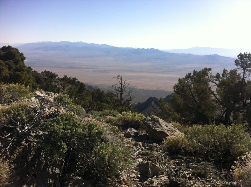
Reveille Peak summit
looking east.

I share plenty of food with John seeing as he only has honey-flavored almonds for tomorrow's effort - including two of those nice cookies and a handful of raisins. I also prepare a pot of "Buffalo chicken" macaroni and cheese for everybody at suppertime - and it's considered quite delicious! Bob's desire for his own entrée is thusly marginalized, and he consumes a series of sweets instead - including apple pie, a chocolate doughnut and "Sunny Delight" orange drink.

To Climb Reveille Peak

Reveille route
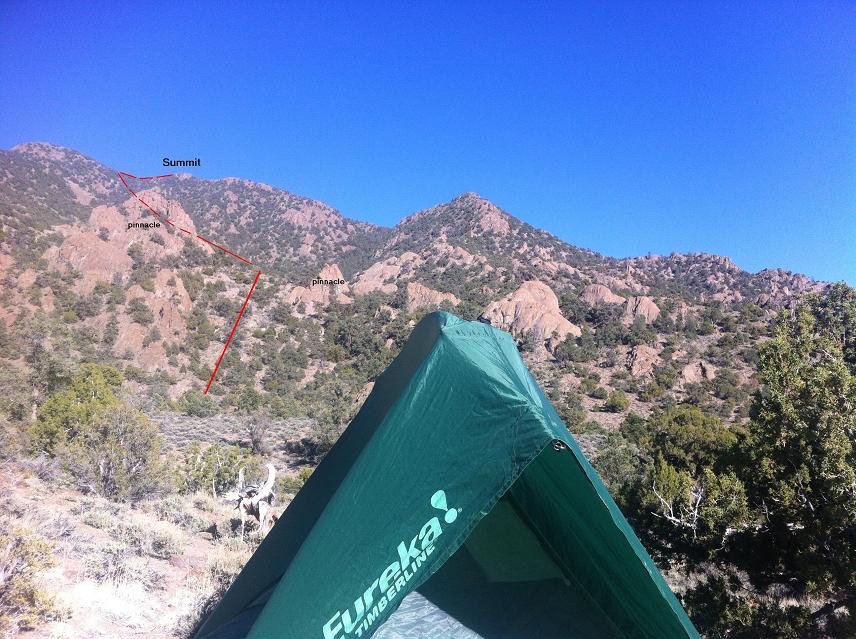
Reveille Peak route - click to
view clearly. Note the two red
pinnacles one passes between.

Leave Nevada Route 375 at this junction and drive west on pavement to this junction. Continue northwest on excellent dirt to Willow Witch Well at (37.84075° N, 116.21095° W) and note the two-track beginning just north of a cattle pen and heading east. Drive this track for some 3.2 miles and park near its end at (37.85444° N, 116.15324° W), elevation 7,100 feet.

Hike east through a series of minor drainages, aiming for a pair of visually striking red pinnacles, passing in-between them after 200 vertical feet.1 The terrain is now nearly level as you continue into the basin. Eventually aim for roughly the 8,300-8,500 foot level of the obvious summit ridge to your northeast by turning left. You want to reach this, the west summit ridge, rather than the southeast summit ridge (the latter with spot elevation 8,241 feet).

Once on the ridge travel less steeply to the summit, eventually veering to right of the ridge's centerline about 150 feet below the top followed by brief sidehilling. Return the ascent route.

1In the photograph at left a red dashed line goes behind the left pinnacle - not atop it.

Saturday, May 4 - Kawich Peak

We know all about unpublished stories of bad brush on this mountain as told by Bob Sumner and John Vitz. This is why, presumably, Andy decides to try a different route even though it means starting at a lower elevation than coming from the east. There are no published trip reports.

The going is not bad until after a 9,020 foot saddle (coordinates below). Here, just 0.77 air mile from our goal, we mistakenly traverse the west side of an intervening subpeak - and encounter a horrendous combination of brush and huge boulders. It's terrible. Relief comes on reaching the saddle immediately southeast of Kawich Peak, whence the going, albeit still unpleasant, is not overwhelmingly such.

About 150 feet below the top I hear Andy's voice!!

They are already descending, and I negotiate a revised meeting arrangement - rather than 4 p.m. at a specific road junction (impossible to satisfy given our slowness caused by brush) we delay Worthington Peak one day while meeting somewhere along its driving approach. Tomorrow will be a rest day.

Kawich top
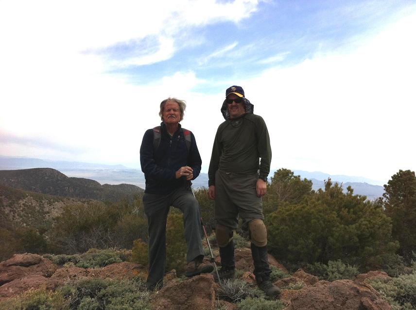
Bob and John Hamann
atop Kawich Peak.

It takes 4 1/2 hours to summit. After a well-earned break we return, yet go over the subpeak rather than traverse to its west. This alternative is vastly preferible and is recommended to all future peakbaggers climbing from the east (description below). The entire effort consumes 8 1/2 hours, and is aided somewhat by a deer path on the west side (east-facing slope) of the drainage leading northwest to the 9,020 foot saddle noted.

The skies are largely overcast. This is quite timely as I would have run out of water had the sun beaten down on me the entire effort. I had brought 2 1/2 quarts - yet perhaps 4 quarts would have been required for this longest duration effort of our trip.

By 4 p.m. we caravan south on the "good" dirt road and say goodbye to John at its intersection with pavement. He refuses to eat anything until reaching Las Vegas, saving his appetite to consume 4 cheeseburgers at In-and-Out for dinner.2 Bob and I camp at a gravel area along Route 375.

2John's love of cheeseburgers was previously demonstrated on a boat ride to Santa Cruz Island in November 2011.

To Climb Kawich Peak

Leave Nevada Route 375 at this junction and drive west on pavement to this junction. Continue northwest and then north on excellent dirt, past the Reveille Peak trailhead turnoff (see above) to this junction at (38.00144° N, 116.36517° W). This is where we met John Hamann.

If coming from the north leave Route 375 just one kilometer east of its junction with Route 6 at Warm Springs, and drive south on "40 m.p.h. dirt" to the aforementioned meeting point.

Drive southwest on good dirt perhaps 2 1/2 miles, passing an abandoned house on the left (east). Immediately south the road bends southwest and comes to a junction at (37.96860° N, 116.38412° W). Turn right (west) onto the lesser road, so taking one along our exit path which we found preferable (see above).

Drive generally west, and then south, as the road ascends over 1,000 feet. In-time you encounter the junction at (37.95194° N, 116.41610° W) with our (not recommended) entry road coming from the left (east). Continue south and then southwest to park at (37.94579° N, 116.42276° W) with 7,600 feet of elevation.

Hike west along a deteriorated road, one which finally ends here at (37.94484° N, 116.43455° W) with roughly 7,900 feet elevation. The drainage bottom is very brush-choked and must be avoided. Hike west on the north-facing slope to your left (south), remaining nearly in the drainage yet high enough to avoid the worst brush.

Continue to this point at (37.94464° N, 116.44474° W) and elevation 8,200 feet; thence head northwest up-canyon, passing to the left (west) of spot elevation 8645T. At around 8,400 feet transition from the gully itself to the east-facing slope at your left, taking a deer path when feasible. The route becomes more westerly around 8,800 feet as it ascends nicely to a 9,000+ foot saddle at (37.95134° N, 116.45662° W). Kawich Peak is visible for the first time as the obvious entity to your northwest. The serious bushwhacking begins.

Hike northeast to roughly the bottom of "W" in "K A W I C H" on the 24,000:1 chart. Go over the top of a 9,380 foot subpeak, follow its ridge northwest to this 9,100 foot saddle and climb 300 feet to your summit. Return the ascent route.

cherry amaretto black walnut
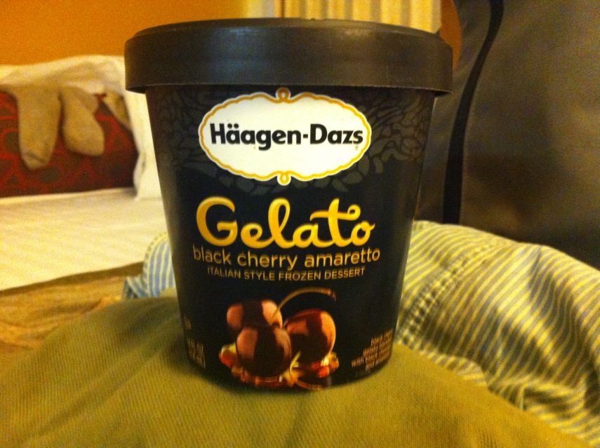
The 14 ounces of black cherry amaretto
ice cream enjoyed in Tonopah April 29.
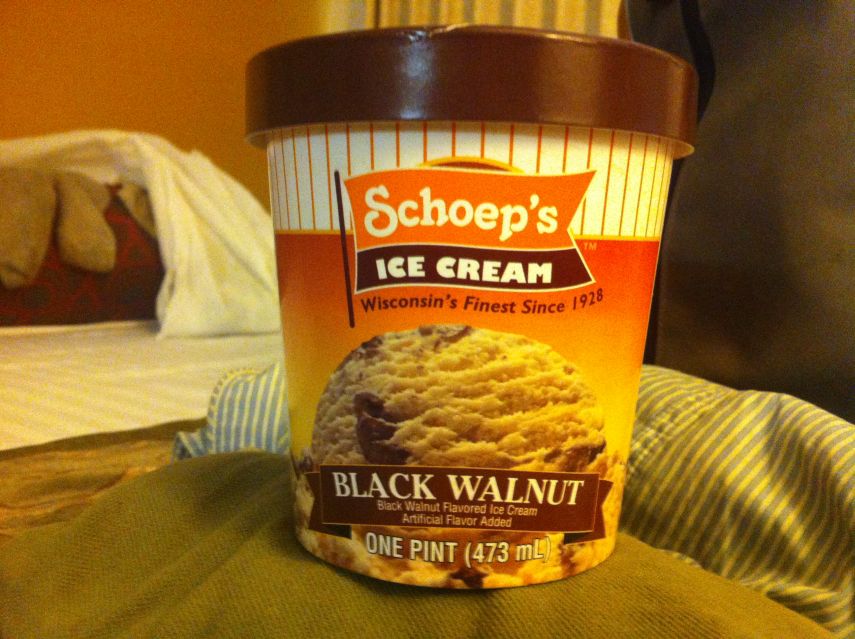
The pint of black walnut ice cream
consumed returning to Las Vegas May 6.

Sunday, May 5 - Day Off

I remain in my bag as Bob drives south, first through Rachel and then a bit farther for a trio of P300 summits this morning. The first is completely trivial with just 306 feet of gain. Of the remaining two peaks one of them is actually P1K - having at least 1,000 feet of prominence; while the other peak is "Chocolate Drop", named after the color of its rock and general shape.

Finished with these by 12:30 p.m. we eat lunch and then drive the Worthington Peak approach. Andy Martin's car is plainly seen, again, short of the desired "trailhead" - yet this time because he could not find a good parking space to sleep there rather than undriveability. We agree to camping here provided that we eat breakfast farther up the approach where Andy's vehicle has already driven.

The sky remains overcast - even threatening to rain.

Monday, May 6 - Worthington Peak

From Andy's parking location all four of us ride in Bob's vehicle, Sarah inside the camper. Branches are sawed by Andy to allow passage; and we park, as desired, 0.6 mile west where there's a road leading north to a radio facility.

atop Worthington
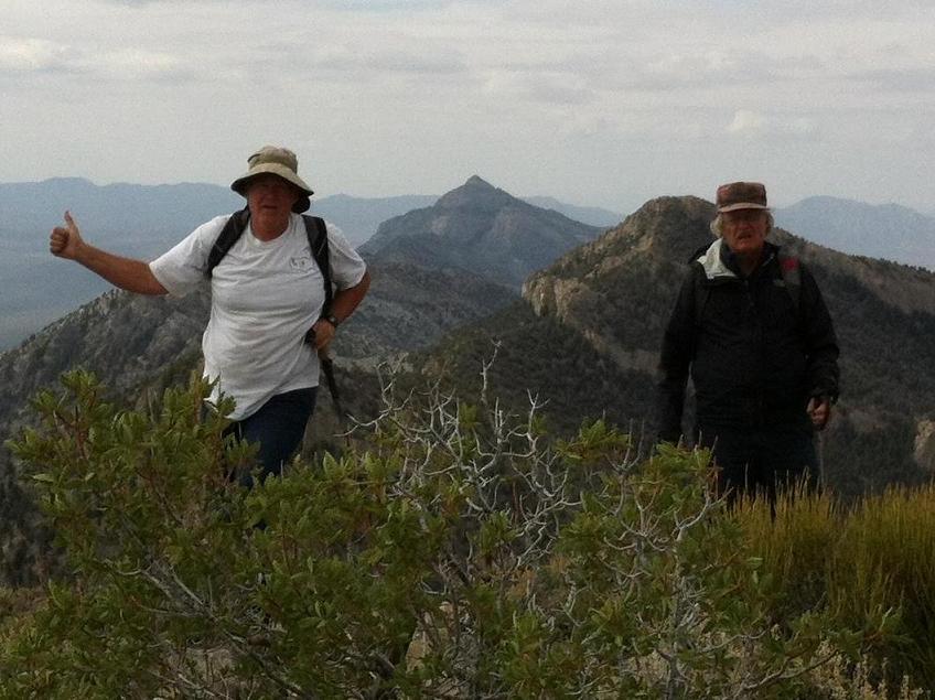
Andy (viewer left) and Bob
reach Worthington's summit.
Meeker Peak at the range's southern
end appears between them.

We start at 7 a.m. up the remaining road to its western end where Sarah decides to turn around. Bob manages to squeeze out a decent 1,000 vertical feet an hour, such that we summit at 9:20 a.m. Our route includes a ridge heading south-southwest to 8,200 feet and as described by Eric Kassan at peakbagger.com. Several ridgeline rock outcrops are avoidable by going immediately left or right. Once at the saddle we go west, climbing 600 feet. The final 200 vertical feet are on a more northerly heading.

The descent is uneventful apart from rain after reaching the road. We rush back to Bob's camper and expeditiously drive out. Andy leads south once on the "good" dirt road, and we reach pavement at Route 318 around 12:30 p.m. He speeds home, while Bob and I take a long 50 minute break at Ash Springs for gasoline, changing clothes and lunch.

After a cheesy bratwurst dog I sit down as passenger and thoroughly enjoy a pint of black walnut ice cream as Bob takes us to Las Vegas. There I rent a cheap motel room near the airport at Howard Johnson and as used by John Hamann a few days ago. This action, although not in the original itinerary, allows Bob to drive home nearly a day earlier so he can get ready for his next journey with time to spare.

I detest everything Las Vegas represents, and intentionally remain in my room even though I am mere blocks from the "Strip" with all its sights and sounds. Without a microwave oven I am relegated to cold cream of asparagus soup for supper - with jalapeño Cheetos as garnish.

Tuesday, May 7 - Homebound

jet
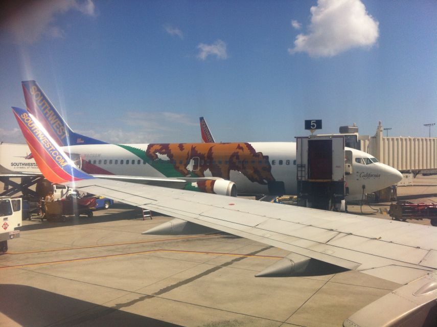
Southwest Airlines' "California One"
parked at San Diego's Lindbergh Field.

I pack and request a taxi ride with the front desk. After repeated phone calls nobody comes after a full hour. I then walk to a nearby hotel with waiting taxi cabs, returning with the driver to retrieve my luggage, behind the desk, followed by my ride to the airport terminal. I suspect that no driver comes to Howard Johnson because they expect a meager tip from people staying at such a cheap hotel.

With two hours before boarding I survey available airport food for sale, and settle on a giant, hot jalapeño and cheese soft pretzel ($3.99 plus tax) as best value for the money. Rather than pay for some overpriced beverage at Starbuck's I prepare milk from dry powder using fountain water, enjoying another 3-inch cookie with it.

The flight home is quick, and I retrieve my vehicle from Richard's home in exchange for loaned reading materials.

Summary

This was a very fun trip. Despite illness precluding a climb of the Seaman Range highpoint I nonetheless secure one peak more than originally planned for a total of 13 P2K summits.

Bob earned 21 P300 summits, of which 13 have at least 2,000 feet of prominence. Then too Richard got 10 new P2Ks, and a bunch of other peaks as well - including at least one P1000.

Andy has 4 more P2000 summits to his credit, just as planned - while John Hamann climbed Kawich Peak as desired.

My next mountain will not be quite so easy. 8-)