Rockies July and August 2007 Trip Report
© August 2007 Adam Helman
(Click on any image for enlargement.)

Background

Plans to complete the Colorado county highpoint list on Mount Lincoln at state's center were foiled by acts of Nature. On concluding the summer 2006 season, Vermilion Peak of San Juan County was snowed-out in an early storm September 9. I then planned a winter assault, the January effort doubling as cold-weather training for Mount McKinley. That would have left Mount Lincoln as the remaining highpoint.

Colorado received several feet of fresh snow - and the implied postholing effectively cancelled that venture without leaving home. The winter camping was (partly) recouped in late February with a CMC (Colorado Mountain Club) outing hosted by Dave Covill. However both Park County's Mount Lincoln and Vermilion Peak remained for the summer.

With today's gasoline prices it is not efficient to travel from San Diego to the Rocky Mountains for climbing just two mountains. Wyoming comes to mind - and, to fill-in the itinerary, I added six county highpoints in southeastern Idaho. Two of the venues have fixed dates as constrained by others: Cloud Peak, highpoint of Big Horn and Johnson Counties, Wyoming on August 1-3; and Washakie Needles, the APEX ("toughest twenty") highpoint of Hot Springs County, Wyoming. Then, Coloradans Kevin Baker and Patrick Thornley plan a co-completion of their state at Vermilion Peak August 12.

Teton Range
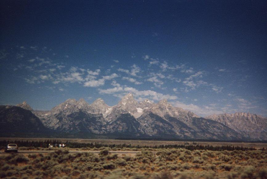
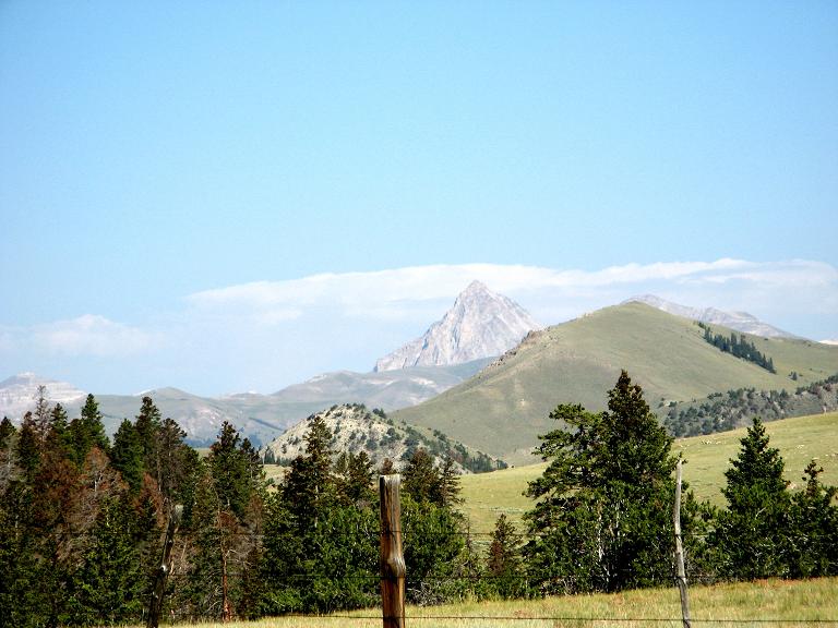
The Teton Range from Jackson Hole.
Taken collectively, these dates and locations suggest a large, clockwise driving loop wherein I visit, in-turn, southeast Idaho, northern Wyoming, and finally Colorado. Mount Lincoln of Park County would precede Vermilion Peak unless I wish to backtrack some 250 road miles (NOT!) - and so, owing to practicalities (and the desire for a TRIPLE Colorado completion), fashion my itinerary with San Juan County's Vermilion Peak as the final venue.

This plan, although extinguishing my long-term goal of completing at Mount Lincoln, did have the advantages of a simultaneous triple completion; while raising my home glob radius to first-place status (680 statute miles), and all at the county (San Juan, Colorado) with the highest mean elevation of any in the nation (11,240 feet). Further, Vermilion Peak is a far more "interesting" effort from a climbing aspect than Mount Lincoln, entailing some scrambling amidst cliffs on the summit ridge, while topping-out under confined conditions with surreal views of major San Juan Range peaks in every direction.

I get ahead of the picure. Looking earlier in the itinerary one notes a major highlight as the ascent of Washakie Needles - a technical rock climb in Wyoming's Hot Springs County. Another significant venue is Cloud Peak, the highest mountain of eastern Wyoming and an ultra prominence summit that competes with Gannett Peak for the title of "Wyoming prom point." Finally there is Sheridan County, Wyoming's "Split Rock" - an overhanging boulder rendered climbable by a narrow cavity within.

The three-week journey entails eleven hikes or climbs for reaching thirteen county highpoints.

Trip Details

Tuesday, July 24 - San Diego to central Utah

Having just finished a five week journey to southeast Asia, I really did not want another climbing trip so soon after. I still have a diarrhoea issue, and must take doxycycline daily as an antimalarial medication, through August 12 - a full 30 days after leaving the "problem area".

Nonetheless summer calls, and, after some 550 road miles find myself in a motel room at Beaver, Utah. The summer monsoon is in full-swing, and brings an overnight downpour with much thunder.

inside camper
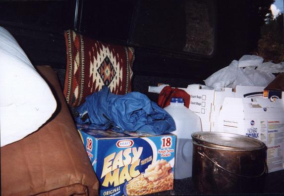
The view from my recumbent position
inside the camper shell.
Wednesday, July 25 - Power County, Idaho (Deep Creek Peak)

I complete the drive into Idaho, and, as the weather is barely holding, climb Deep Creek Peak of Power County this afternoon. The Tacoma truck sits at an electric power relay station for the night - and, until it gets entirely dark, I lie warily in the camper shell lest some police officer approaches with a complaint from some local resident. Nothing happens.

Thursday, July 26- Bannock County, Idaho (Bonneville Peak)

It rains just after leaving the summit ridge. Damp and in the clouds, it is miserable indeed as I descend the slope, bushwacking, to find the top of the ski lift and hence a service road that will mitigate this misery.

The forecast is for drying weather over the next several days - a most welcome forecast to just myself as the farmers and ranchers desperately need the rain.

Friday, July 27 - Oneida County, Idaho (Oxford Peak)

From Clifton, Idaho it is 6.4 miles to the "trailhead". I drive back 0.4 mile to a saddle, camping there, because an overhanging tree branch might fall and block egress were I to drive under it after my ascent: not having to worry about this is worth the additional 0.8 mile of hiking.

Sheep Mountain
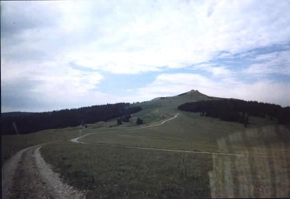
Sheep Mountain along FH11 enroute to
the Big Horn County, Montana highpoint.
The hike itself, a long one, is north along the south ridge - and, despite approaching weather on the descent, was enjoyable.

Saturday, July 28 - Franklin County, Idaho (unnamed 9,484 feet)

I camped last night at Danish Pass, having come from the west. If one zeroes the odometer at pavement's end, the campground is at mile 13.9. Danish Pass is at 20.2 miles - while the very worst road conditions are encountered from roughly 15.5 to 17.0 miles. I do not recommend this approach except for high-clearance vehicles.

The climb is trivial, consuming one hour for the ascent with about 1,000 feet of elevation gain. First I headed north on a jeep trail; reach a saddle; and then travel 80° true for the remaining 600 feet of elevation.

Sunday, July 29 - Bear Lake and Caribou Counties, Idaho (Meade Peak)

The previous afternoon I encountered a very muddy section of road 2.4 miles from the junction with the main gravel approach road. Backtracking, I camp near a road bend 2.2 miles from gravel. With the "trailhead" at 3.6 miles, the extra 2.8 miles of walking consumes an hour. Regardless, Meade Peak is climbed in about three hours with roughly 3,000 feet of gain.

The jeep track is narrow, and a branch is snapped under the tires ...

tundra
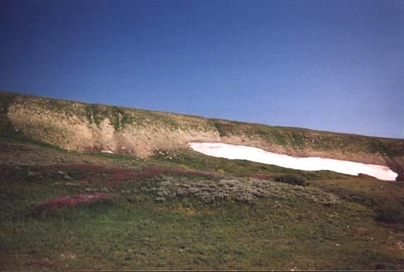
Tundra and wildflowers along
US Alt 14 in northern Wyoming.
On entering Jackson, Wyoming a whining sound occurs upon turning the steering wheel. Concerned, I take the cheapest room possible there - a Motel 6 for $100 (!) - and wait the night for a Subaru dealer to open Monday morning that also handles Toyota models.

Monday, July 30 - Jackson and northern Wyoming

I am as polite as possible when discussing my problem with the chief mechanic, having come one-half hour earlier than their 7:30 open. My efforts are rewarded when the vehicle is examined without delay. The whine is due to a one-inch twig that lodges in the steering mechanism - nothing more serious and quite a relief.

Furthermore, the truck receives a sixteeen-point inspection .... and it does not appear on the bill! Clearly I am in a state where courtesy matters as much as finances - and, grateful that all is well with my truck, continue by 10 a.m. through both National Parks enroute to the Big Horn National Forest just south of the Montana line.

This inspection replaces that planned for later on - and, as my truck has 59,330 miles in Jackson, effectively allows me to "hold-off" on the major, 60,000 mile service until I return home.

stream crossing
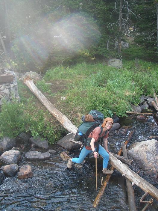
Adam at a stream crossing
on the Cloud Peak approach.
Tuesday, July 31 - Big Horn County, Montana on the State Line

I visit the Big Horn County, Montana highpoint this morning via the Wyoming approach. Details are provided in this trip report. It is mainly a ridgeline drive followed by a short hike west along the (fenced) state line. The Wyoming side is public land while the Montana side is Crow Indian Reservation. One remains on the former side until the last moment.

In the afternoon I head for the Cloud Peak trailhead, meeting John Stolk of Washington state around 4 p.m. After an extended dialogue and dinner we turn-in well after dark.

Wednesday, August 1 - Cloud Peak Approach Hike

John and I backpack just over three hours to a high camp near Mystymoon Lake at 10,300 feet. John has fresh milk, cherries, and yogurt - and, after finishing the milk with breakfast, carry the latter items to camp lest they be spoiled by our return.

The afternoon, a lazy one, features a storm front that sits over the range without budging. Rain and lightning, however, are absent.

glacier and tarn
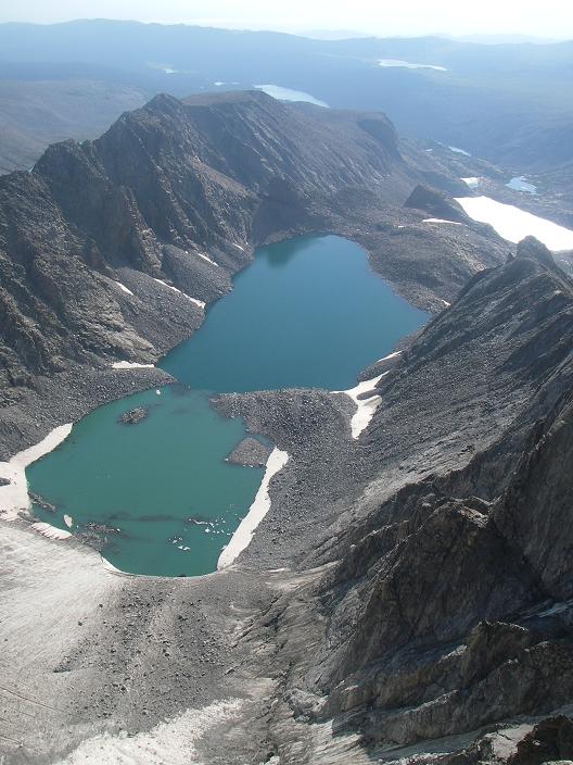
View east from Cloud Peak's summit
to a glacier and a pair of tarns.
Thursday, August 2 - Cloud Peak Summit Day

John loans me a lightweight daypack that I am pleased with - considerably lighter than my large, red daypack and yet with ample capacity for the present effort. We consume 3 hours 6 minutes on ascent under flawless skies, and touch all potential highest boulders to claim Cloud Peak's major prominence.

The refrigerator-sized boulders of previous reports only appear in short sections. For the vast majority of the distance one hops over smaller boulders and rocks. Further, the route is quite obvious and it is difficult to get lost.

After returning to camp around 12:30 p.m. the overwhelming issue is whether to pack out that afternoon. John favors this, largely, I believe, because we are somewhat exposed to the elements at camp - and he has vivid memories of a near fatal lightning encounter at Mount Elbert.

I object to this concept as it buys me nothing: for I cannot get to the next trailhead the following morning anyway. Thus I save no time in rushing. In contrast, leaving early allows John to reach his next venue, in Montana, with enough spare time to consider hiking the following afternoon.

wildflowers
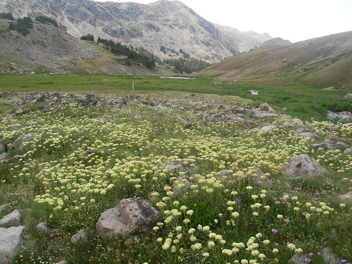
Wildflowers in a 10,100 foot meadow
on returning from Cloud Peak.
With energy from a wonderful cinnamon Babka coffee cake I aver to John, dismantle camp, and head down the trail to our cars. Back at 6:30 p.m. we enjoy another evening of conversation before slumber sets in. I am definitely "in the market" for a new, lighter weight daypack.

Friday, August 3 - Drive to Sheridan County, Wyoming

John prepares his customary excellent pot of fresh-brewed coffee. It is the best I've had in quite a while - and this, regardless of the venue be it Starbuck's or elsewhere. I let him prepare my portion in the way he enjoys - with six cubes of sugar and lots of instant creamer.

I'd say that we are generally compatible apart from the observation that John is cleaner than I in the backcountry. I've hiked with people at all levels of cleanliness - and John is definitely on the fastidious side while I am on the slovenly side. This matters because there are times, as on Mount McKinley, when hygiene is of considerable importance to the group's overall health and, by implication, success.

Split Rock
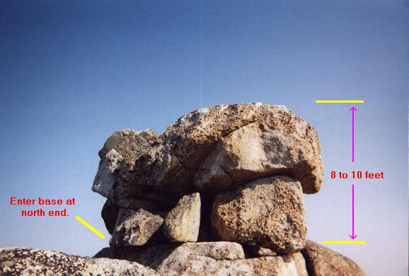
The Sheridan County, Wyoming highpoint
is this overhanging boulder.
I arrive at the new Coney Lake trailhead by 2 p.m. and spend the remaining hours reading National Geographic and having supper.

Saturday, August 4 - Sheridan County, Wyoming ("Split Rock")

Today I climb to the Sheridan County highpoint - an overhanging boulder dubbed "Split Rock" by some in our highpointing group. Details are provided in this trip report.

My lower back is a serious issue. The next climb is scheduled for August 7. It is way too hot to camp in the Big Horn Basin. Taken together, I elect to stay at a motel - and I find one in Greybull, Wyoming at some $40 plus tax as the Lilac Motel. I honestly think the hot bath helps the back - at least making it "feel" better.

Sunday, August 5 - Drive to Worland and Thermopolis

With only some eighty road miles between myself and Thermopolis, our rendevous point for Washakie Needles, I find myself with considerable extra time. In Worland, just forty miles south, I wash clothing at a laundromat, and then enjoy a pint of Starbuck's coffee fudge brownie ice cream to celebrate my efforts (at the highpoint - not the cleaners).

Washakie Needles
Washakie Needles viewed from
the BLM1310 approach road.
Still only 11 a.m., I drive west to Thermopolis all of forty-or-so miles, and, by 1 p.m. have crashed in the Coachman's Inn, room 112, the same establishment where all with meet the next evening. I honestly had nothing I WANTED to do - and, this together with my ailing back suggest that I simply rest. Besides, it is terribly hot outside anyway at this lower elevation. Coincidentally, "112" is also the motel's street address along Highway 20.

I read a lot and enjoy fresh food from the local supermarket.

Monday, August 6 - Another Lazy Day in Thermopolis

I take huge advantage of the free continental breakfast with raisin muffins and butter, bread and jam, fresh fruit, and an assortment of artificially flavored creamers for coffee - amaretto, chocolate, creme brulee, hazelnut, etc.... Later, I return to "confiscate" several Pop Tarts packages with as many packets of cream cheese as future snack food - brown sugar, blueberry, cherry, and strawberry milkshake.

At lunch the stuffed shell pasta salad in olive oil is wonderful - especially with the ricotta cheese hiding in each with an assortment of marinated vegetables. So too the fresh watermelon - and I buy another eighth melon in anticipation of the other Washakie Needle climbers.

knife-edge ridge
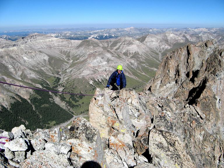
I climb the knife-edge ridge
of Washakie Needles.
Tim Worth arrives about 5 p.m. - just as a tornado warning is cancelled for Hot Springs County! He moves into the room and, later, we visit the supermarket to eat supper in the room as there is a microwave oven and 'fridge. That's a darn sight more enjoyable than eating out since one consumes at convenience rather than being forced to wolf down the food, tableside, without the means to reheat it.

Charlie Winger and George Vandersluis arrive around 6 p.m. We agree to an 8 a.m. departure from town - every other item related to our inpending climb being decidable later.

Tuesday, August 7 - Washakie Needles Drive and Approach Hike

While Charlie and George acquire ice, I stock up on those nonperishable Kraft cheese bottles that are simply unavailable in southern California. In all I purchase eight five ounce jars, with a concentration on the Roka Blue Cheese flavor.

At roughly 8 a.m., as planned, we depart Thermopolis in three vehicles bound for the trailhead near Washakie Needles.

A detailed account of the Washakie Needles effort is provided in this trip report.

Wednesday, August 8 - Washakie Needles Summit Day

This trip report more than suffices to describe our climbing efforts and the post-climb celebratory meal.

I sleep this evening in the backlot of an IGA supermarket on the east side of Thermopolis near the railroad tracks. Tim drives home to Colorado, while Charlie and George, unable to secure a room in town, drive to Meeteetse, Wyoming for the night.

on-rappel
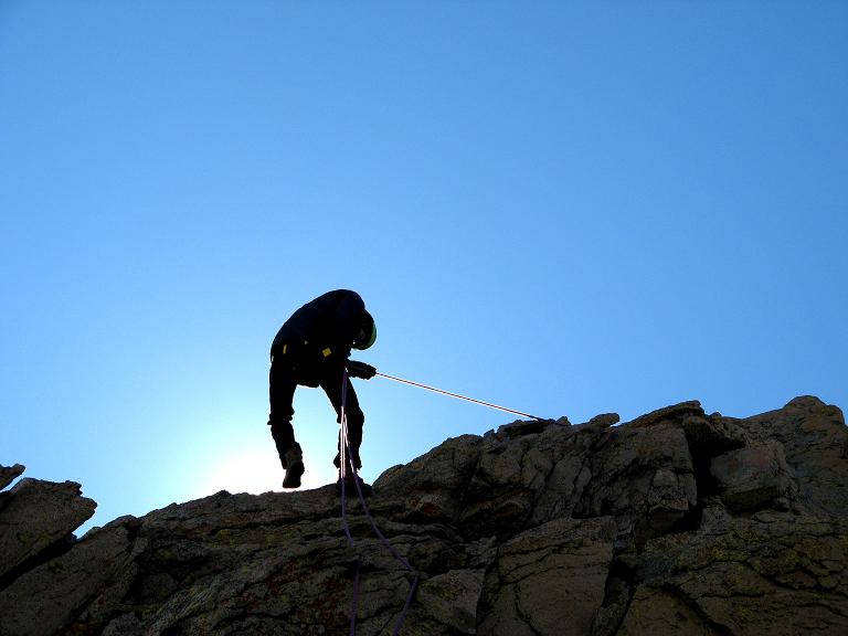
Rappelling the first pitch high on Washakie Needles.
Thursday, August 9 - Drive to Colorado

The original plan was a single driving day from Washakie Needles to the Mount Lincoln trailhead. However Tim Worth wants a day at home to take care of personal matters, check E-mail, and everthing else that accumulates after being away for over a week.

I drive to Berthoud, just south of Loveland, Colorado, and call his humble apartment home for the night. We enjoy a sumptuous Italian meal down the street, one that sets me back $78 as I treat Tim and myself for our successes at Washakie Needles and my imminent completion of the Colorado counties. Our meals are amply described in the Washakie Needles trip report in the section, "Après Climb Festivities".

Friday, August 10 - Drive To Park County, Colorado

I awaken around 7 (late by this journey's standards), and, with the Kite Lake Trailhead only 3-4 hours distant, first visit the REI store in Boulder to purchase a new, lighter weight daypack. Then I visit the AAC (American Alpine Club) Library in Golden to ascertain where my prominence book, The Finest Peaks, had been shelved. It is located in the geology section - classification QE, as agreed to the previous year by the staff and myself.

By 4 p.m. I am at the 12,000 foot trailhead, one that soons crowds with more and more Colorado fourteener enthusiasts on this - a summer weekend with excellent weather. Tim Worth is supposed to arrive after dark. It puzzles me why he sould elect to drive in the dark given better options.

descending slab
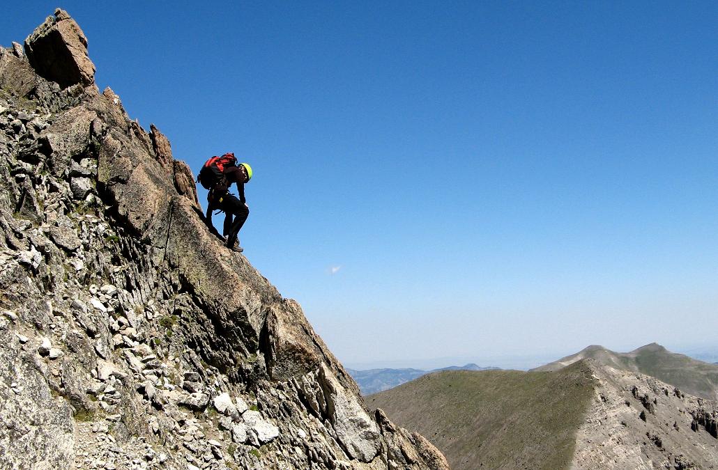
Descending a rock slab at Washakie Needles,
to avoid nasty talus and scree.
Alas, Tim never arrives this evening, and I will climb Mount Lincoln and its neighboring fourteeners alone.

Saturday, August 11 - Park County, Colorado (Mount Lincoln)

Tim noted that were he to not appear yesterday evening, he would be at the trailhead 6 a.m. Thus I wait until about 6:10 and then head, unconventionally, east to Mount Bross rather than north to the Mount Democrat / Lincoln saddle. I had calculated that a counterclockise loop route, hitting, in order, the summits of Bross, Lincoln, and Cameron, features 200 feet less elevation gain. Further, the loop route is more interesting than backtracking the entire Cameron-Bross ridge as required in the absence of using the Kite Lake to Mount Bross trail at some time.

Hiking uphill at roughly 1,500 feet / hour, I summit Bross around 7:37 a.m. and wander about its broad plateau.

I descend to the Bross / Cameron saddle, contour around the latter's south slope, and ascend Mount Lincoln by around 8:30 a.m. Several fourteener chasers are present, and all are amused to learn that Lincoln is, at once -

I also enjoy pointing out distant fourteeners: Mount Elbert, Mount Massive, Pikes Peak, others as well. The irony of a Californian doing this for Coloradans in their native state did not pass me by.

Suddenly who appears but Tim Worth!

Having arrived at Kite Lake 6:30, Tim really hustled to climb Mount Democrat before meeting me atop Lincoln. We trivially hiked Mount Cameron (folks, with some 150 feet of prominence it is a hill - not a mountain). Tim heads south for Mount Bross and I descend to the Lincoln / Democrat saddle and then back to the trailhead. I elect to nix Mount Democrat because it would result in arriving at the Vermilion Peak area at sundown. In turn, after eating and organizing items, I would not get eight hours of sleep.

I might someday get interested in fourteeners for their own sake. Should that transpire, climbing Mount Democrat will be far more appealing than as a mere "afterthought" to the county highpoint - Mount Lincoln.

Tim Worth claims to have a sick belly, and heads home rather than join me for the final climb. I will now do Vermilion Peak alone.

True to calculation I require six hours from Kite Lake to the FR585 approach road for Vermilion Peak. I camp at a pullout 0.4 mile shy of the trailhead and eventually sleep with watchful anticipation.

Sunday, August 12 - San Juan County, Colorado (Vermilion Peak)

I arise at 4:30 a.m., drive to the trailhead, eat some breakfast, and depart at 5:30 uptrail. Sunrise is predicted to be 6:25 a.m., and it is completely dark as August 12 features a new moon.

Whereas I use the new, lighter daypack for Mount Lincoln, I carry my standard, large, red daypack for this effort. Here, I travel alone without, in principle, anybody else around. Thus I take my parka - and its bulk precludes use of the new, smaller pack.

The hike turns sour by failing to locate the trail's continuation on the opposite bank of a stream perhaps two or three hundred feet higher. Still dark, my headlamp the only illumination, I could not for the life of me figure out what "went wrong". I waste maybe 20 minutes in this mode, following faint paths leading nowhere, and eventually scream "SHIT!!" multiple times at the top of my lungs: this is my completion climb and time wasted now means dealing with lightning on the summit ridge by late morning.

I DO NOT WANT TO FAIL AT VERMILION AGAIN.

At first light I locate the trail's continuation, cross, and let out an indecipherable and extremely loud "AEHHHHHHH!!", twice in fact, to vent my emotions. It feels good to do that - and I bet folks in the campground can easily hear me. Big deal - people with RVs who think they're "roughing it" with satellite dishes, barbecue grills, and other outdoor luxuries. Guess that's all they can (or desire) to do insofar as their summer fun - how absolutely PITIFUL.

I reach the lower Ice Lake basin just after 7 a.m., and Ice Lake itself about 7:50 a.m. That, of course, is too late for meeting Kevin Baker who had camped at Ice Lake and likely started at dawn for the summit.

I reach the base of the talus slope leading to the Fuller Peak / Vermilion Peak ridge, and carefully follow a rough-hewn path, skirting melting snow patches, to the ridge at 13,500 feet. It is now about 9 a.m. and the sky remains clear save the tiniest hints of daytime heating as small cumulus clouds: the race is now "on" to summit and get off the ridge before weather is a serious, life-threatening issue.

A few minutes after starting up the ridge I meet Kevin Baker heading down from the summit. We recognize each other, and, after I congratulate him as the 24th Colorado completer, Kevin "pre-congratulates" me in advance of my own success.

Then, almost immediately, I meet the CMC group also descending. During the conversation, a lone climber appears from behind me - and, yes, he too wishes to climb Vermilion Peak - and knows the route from having done it three years ago.

We two decide on the "low" route, which entails turning left at a conspicuous pair of boulders along the left edge of the trail, onto a smaller yet obvious path that heads slightly downhill to the infamous Vermilion Dollar Couloir. At the couloir, which is very loose indeed, climb perhaps thirty vertical feet to a saddle. Turning left, climb maybe fifty final feet to an airy ridge. Turn right on the ridge for all of ten horizontal feet to the true summit.

I summit at 9:34 a.m. MDST as Colorado state completer.

We talk about, well, what else: mountains. He shares a savory snack; I give him a chocolate chip granola bar for later; and at 10 a.m. we descend to the Fuller / Vermilion saddle under rapidly clouding skies while I ground him in the basics of prominence theory. He appears to be very receptive, and I recommend that he investigate both peaklist.org for prominence lists, and, of course, cohp.org for county highpointing.

I am at Ice Lake 11 a.m., and, upon arrival, a teenage boy and girl inquire about what I've done, and the possibility of their own climb that day. I recommend they hold-off until a time when they can start at dawn - for it was quite obviously about to rain and thunder. Both are, again, interested in prominence. They are exceedingly thin (as skinny as myself); but I suppose, given their intentions that's a lot better than being overweight.

I enjoy my summit food - sourdough bread turned blue/green in parts (!); and enjoyed with some fascinating green, sage-infused English Derby cheese. Then, some dried fruit and nuts. I depart no sooner than 11:40 a.m. - a full forty minutes at Ice Lake - and worthy of every second seeing as I did not know when I would return to the Colorado high country.

I reach the truck in 1 hour 10 minutes - and, in a stroke of luck, it only then rains earnestly with thunder and lightning.

I can start the drive home - it is only midday. Emotionally overwhelmed by the realization that my Colorado dreams are finally realized, I am too lazy for that. Rather, I change clothes and footwear, then drive into nearby Silverton for a filling meal.

At the Pickle Barrel I find the salmon steak, on last summer's menu, is no longer. I settle for the red chili wrap with chicken, rice, black beans, and cream cheese - served with cole slaw. However I start with a lime margarita - which, peculiarly and fortunately lacked any "punch" whatsoever (so that my driving remains unimpaired). I finish with hot blueberry pie and two scoops of vanilla ice cream as garnish. Fact is that both Bob Packard and I craved this very dessert whilst traveling in southeast Asia the previous month - and now I consummate that desire at a most appropriate event and location.

I return to FR585 and take the soonest pullout available, just 0.3 mile from US Highway 550, and thus within cell phone range for the sake of my mother and anybody else I wish to call. Tim Worth rings and congratulates me.

Not hungry, as the hours pass I munch on jelly beans and listen to my shortwave radio. I do not want to do anything - not even read a magazine. Sleep comes early and easily.

Monday, August 13 - Drive to Gila Bend, Arizona

After one hour along US 550 I reach Durango and treat myself to a Starbuck's java chip frappuccino, venta ("large") size, and enjoyed with a chocolate chip Pop Tart. This wonderfully non-nutritious breakfast keeps hunger at-bay for much of the drive today - at least until Flagstaff, Arizona where a severe thunderstorm cell makes driving hazardous as I enter the city. The power is out at my chosen gasoline station, and a huge traffic jam ensues because the city traffic lights are disabled.

I continue to Gila Bend where at 5 p.m. it is still 110° F. - so forming (intentionally, I admit) a huge contrast with the cool, alpine temperatures I have so recently enjoyed. The flora is similarly different, with sagebrush and cacti standing-in for timberline trees and shrubs. The Yucca Motel room eventually cools to the point of tolerability, and I have a fine evening with simple meal and a television movie.

Tuesday, August 14 - Drive Home

The drive home today, some 297 Adam truck miles, was uneventful. I always fill the tank completely in Yuma, Arizona, before returning to high California gasoline prices.

Summary

Here is my completion map resulting from this journey. The Colorado state completion is evident; the "doughnut hole" of north Wyoming and Big Horn County, Montana is "plugged"; and Wyoming has but one remaining county - albeit a significent one - Teton County with the eponymous mountain.

I initiated the Colorado project years ago, with the first trip collecting its counties in earnest being April 2004. So, when I phone mother after Vermilion Peak the dialogue ran,

(Mother) "Hello.".

(Adam) "Paint Colorado GREEN.".

(Mother pretends to sob) "Oh, I'm so HAPPY for you. It's been ten years that you wanted to do this.".

(Adam) "I think the first trip was in 2000.".

  etc....

Not done on a lark, the southeastern Idaho counties incrementally raise my home glob radius from 666 miles (the value attainable upon climbing Vermilion Peak) to 680 miles. Indeed, I have but three Idaho counties to visit for a 700+ mile radius - Elmore, Jerome, and Minidoka.

I drive 3,834 "Adam truck miles" on this journey. One Adam truck mile is about one-sixtieth part greater than a statute mile, and is defined as 1.0 miles indicated on the trip odometer.

The resulting thirteen additional counties raise my western county count to 347. However I measure progress relative to 414 - the number of western counties in the eleven western states of the 48 contiguous states. I have 345 of these highpoints. That leaves 69 counties, exactly one-sixth of the 414 county total. Many of these are arduous or difficult, be they in Montana or Washington - and, to a lesser degree, Idaho. Perhaps next year I can make a "serious dent" in the latter state.