
|
Nevada County Trip Reports | |
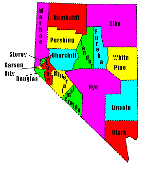
| USA Map / Home Page | Click on any county for highpoint information |
|
The 17 Nevada county highpoints have been
completed by Andy Martin with Guy Cloutier (1998); Bob Packard, Barbara Lilley, Gordon MacLeod, John Vitz, Bob Martin, Mike Coltrin, Bill Hartman, Rex Reed, Bill Schuler, Adam Helman, Jobe Wymore, Edward Earl, Tyson Reed, Richard Carey, Gail Hanna, Dennis Sanders, Dennis Poulin, Scott Casterlin, Scott Surgent, Charlie Winger, Dean Molen, and Greg Juhl. |
First Ascent List | Disclaimer |
topo chart / aerial image photos
Clark County - Charleston Peak (11,918 feet)topo chart / aerial image photos
Douglas County - East Peak (9,591 feet)topo chart / aerial image photos
Elko County - Ruby Dome (11,387 feet)topo chart / aerial image photos
Eureka County - Diamond Peak (10,614 feet)topo chart / aerial image photos
Humboldt County - Granite Peak (9,732 feet)topo chart / aerial image photos
Lander County - Bunker Hill (11,474 feet)topo chart / aerial image photos
Lincoln County - 10,640 foot point on summit ridge of Mount Graftontopo chart / aerial image photos
Lyon County - Middle Sister (10,570+ feet)topo chart / aerial image photos
Nye County - Mount Jefferson (11,941 feet)topo chart / aerial image photos
Pershing County - Star Peak (9,836 feet)topo chart / aerial image photos
Storey County - Mount Davidson (7,864 feet)topo chart / aerial image photos
Washoe County - Mount Rose (10,776 feet)topo chart / aerial image photos
White Pine County - Wheeler Peak (13,063 feet)topo chart / aerial image photos
Disclaimer
Attempting to reach some of the points listed in this web site can be dangerous, and could lead to accidents resulting in injury or death. Some of the summits lie in rugged and isolated regions, where even minor mishaps can escalate into a life threatening crisis. Other locations lie on private property, military bases, and other areas where access is restricted. Trespassing in these areas can result in being arrested, shot at, or worse. Right of access to these areas is constantly changing, and access in the past does not guarantee present access. By use of this web page, the reader hereby releases the trip report authors, trip report compiler, and webmaster from liability for any injury, including but not limited to monetary loss, death, and other damages that might in any way be connected with this web site. FAIR WARNING: These are "armchair mountaineer" articles, an offering for amusement, not action. Many of these peaks are potentially life threatening, or are on private property. Adequate mountaineer training and/or owner's permission are required if you choose to pursue this list. The authors cited on this page accept no responsibility for injury, or any liability related to these route descriptions.| State Hyperlinks / Text-only Home Page | Introduction | Highpoint Superlatives |
| Highpoint Maps | Topographic Prominence | Highpointer Celebrities | Disclaimer |