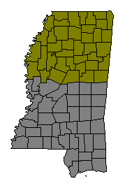
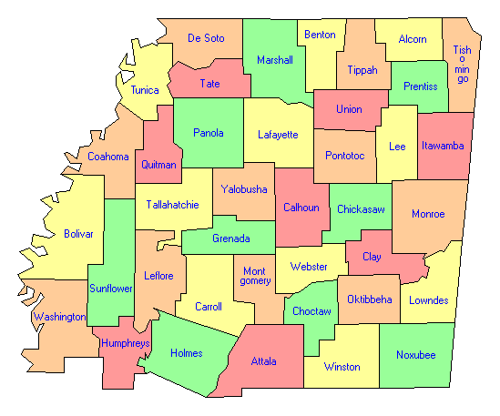
Small Mississippi State Map North Mississippi County Trip Reports North Mississippi County Map

Click on either region from the map above
to access the corresponding reports.
Click on any county for highpoint information.

Mississippi main page First Ascent List Disclaimer


    topographic chart (Acme)     aerial photograph (Flash Earth)                     Explanation

topo chart / aerial image scale:     normal     regional overview

(coordinates are not yet available)


Alcorn County - Crum Mountain (725 feet) and one area (720+ feet)

Attala County - McCool lookout tower (720+ feet)

Benton County - Malone benchmark (771 feet) and one area (760+ feet)

Bolivar County - one area (175+ feet)

Calhoun County - one area (615 feet)

        No trip reports have been posted.

Carroll County - one area (540+ feet)

Chickasaw County - two areas (580+ feet)

Choctaw County - one area (720+ feet)

Clay County - Barr benchmark (530 feet) and one area (520+ feet)

Coahoma County - one area (190+ feet)

      -   UNVISITED (virgin high points)

De Soto County - nine areas (420+ feet)

      -   UNVISITED (virgin high points)

        No trip reports have been posted.

Grenada County - one area (540+ feet)

        No trip reports have been posted.

Holmes County - one area (520+ feet)

Humphreys County - three areas (120+ feet)

      -   UNVISITED (virgin high points)

        No trip reports have been posted.

Itawamba County - eight areas (660+ feet)

Lafayette County - Thacker Mountain (623 feet) and three areas (620+ feet)

Lee County - seven areas (520+ feet)

Leflore County - one area (150+ feet)

      -   UNVISITED (virgin high points)

        No trip reports have been posted.

Lowndes County - four areas (450+ feet)

Marshall County - Scales lookout tower (700+ feet)

Monroe County - three areas (580+ feet)

Montgomery County - one area (600+ feet)

Noxubee County - six areas (640+ feet)

Oktibbeha County - three areas (600+ feet)

Panola County - three areas on Terrapin Mountain (600+ feet)

Pontotoc County - one area (580+ feet)

Prentiss County - Lebanon Mountain and one area (780+ feet)

Quitman County - three areas (185+ feet)

Sunflower County - multiple areas (150+ feet)

      -   UNVISITED (virgin high points)

        No trip reports have been posted.

Tallahatchie County - nine areas (400+ feet)

      -   UNVISITED (virgin high points)

        No trip reports have been posted.

Tate County - five areas (560+ feet)

Tippah County - five areas (780+ feet)

Tishomingo County - Woodall Mountain (806 feet and State Highpoint)

Tunica County - one area (300+ feet)

Union County - one area (760+ feet)

Washington County - nine areas (150+ feet)

        No trip reports have been posted.

Webster County - Sand Mountain (670+ feet)

Winston County - one area (722 feet)

Yalobusha County - ten areas (520+ feet)

      -   UNVISITED (virgin high points)

        No trip reports have been posted.


Disclaimer

Attempting to reach some of the points listed in this web site can be dangerous, and could lead to accidents resulting in injury or death. Some of the summits lie in rugged and isolated regions, where even minor mishaps can escalate into a life threatening crisis. Other locations lie on private property, military bases, and other areas where access is restricted. Trespassing in these areas can result in being arrested, shot at, or worse. Right of access to these areas is constantly changing, and access in the past does not guarantee present access. By use of this web page, the reader hereby releases the trip report authors, trip report compiler, and webmaster from liability for any injury, including but not limited to monetary loss, death, and other damages that might in any way be connected with this web site.

FAIR WARNING: These are "armchair mountaineer" articles, an offering for amusement, not action. Many of these peaks are potentially life threatening, or are on private property. Adequate mountaineer training and/or owner's permission are required if you choose to pursue this list. The authors cited on this page accept no responsibility for injury, or any liability related to these route descriptions.


State Hyperlinks / Text-only Home Page Introduction Highpoint Superlatives
Highpoint Maps Topographic Prominence Highpointer Celebrities Disclaimer